Posts Tagged ‘VHF’
 More Power For VHF SOTA
 For years now, I’ve been doing Summits On The Air (SOTA) activations using VHF and higher frequencies. The GO TO band/mode for VHF SOTA is 2-meter FM because of its overall popularity. Just about everyone has a 2m FM radio (well, almost everyone). Still, if you are on a remote peak you may not find anyone within range to work. Because of this, it really helps to optimize the performance of your portable VHF station.
Antennas
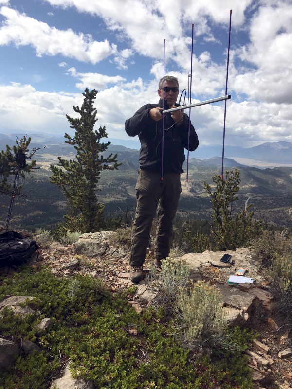
I’ve already written that the first step is to upgrade the rubber duck antenna to something that actually radiates. My measurements indicate that a half-wave antenna performs 8 to 10 dB better than your typical rubber duck. That’s a big difference. I tend to favor the collapsible half-wave antennas because they are compact and don’t require any support. Another option is the J-pole or Slim Jim antennas, typically build out of twin lead or ladder line.
The next step up is to use a small yagi antenna, such as the 3-element Arrow antenna. Although Arrow does not specific the gain of this antenna, it has been measured at the Central States VHF Society conference as having ~6 dBd of gain. I’ve been on the lookout for a higher gain antenna but I have not found one that has significantly more gain while still being backpack portable.
Modulation
Frequency Modulation performs very badly when signals are weak. The well-known threshold effect means as the signal level decreases at the receiver it simply crashes into the noise. Linear modes such as CW and SSB work much better when signals are weak, which is why they are popular with the serious VHF crowd. I’ve used my Yaesu FT-817 to make SOTA contacts on both 2m and 70cm SSB and CW. My all time best distance on 2m during a SOTA activation was 229 miles, a QSO with N7KA from Capulin Mountain using CW. However, the problem with SSB/CW is that there are much fewer radio amateurs that operate that mode. I estimate that on a typical day, there are 10 to 100 times more hams on 2m FM than are on 2m SSB/CW.
More Power on FM
I’ve noticed that I sometimes hear stations on 2m FM but they cannot hear me. Further investigation revealed that they were typically running more power than me. I had my little HT putting out 5W and they were running a 50W mobile. That got me thinking about whether I could increase my power while still having a backpack-compatible station. SOTA operation is typically QRP, around 5 or 10 W of power. However, SOTA does not specifically state a required power level…it’s really driven by the need to operate backpack portable. Hence, there are very few 1 KW amplifiers in use on SOTA summits.
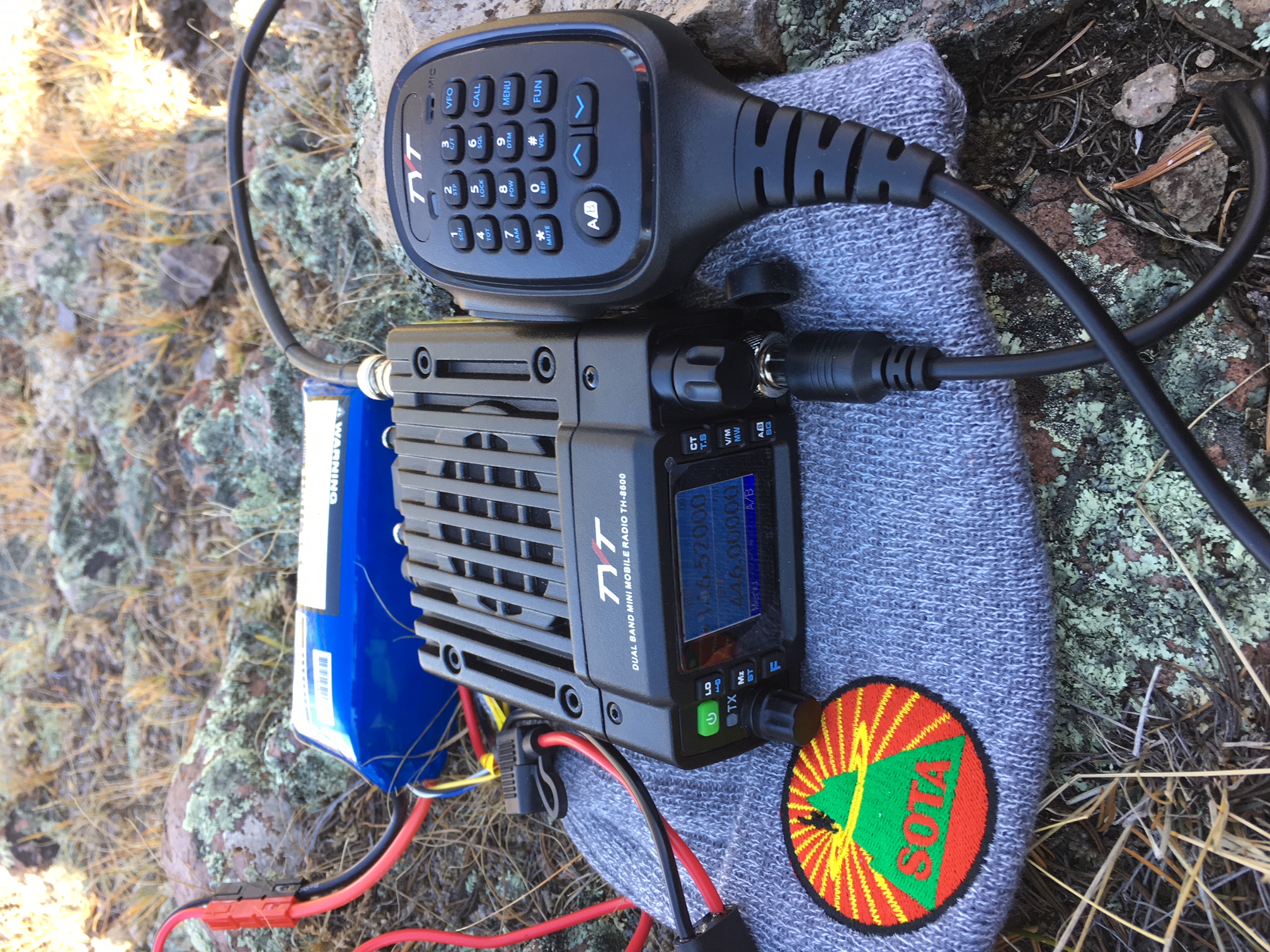
Some of the Chinese manufacturers now offer compact dualband (and even quadband) VHF/UHF transceivers that output 10 to 30 watts of RF power. I purchased the Tytera MD-8600 based on my experience with other Tytera products. The radio’s specified output power is 25 watts on 2 meters. The DC power current is rated as 0.2 A on receiver and 4A on transmit, not too bad for battery operation. I paired it with a 13.2V LiFe battery rated at 4300 mAH. In theory, that would provide over an hour of transmit time or 21 hours of receive. That should be plenty for the typical SOTA activation. The size is a slightly larger than 4″ W x 1.5″ H x 5″ D and it weighs about 2 pounds. All in all, this setup is very compatible with the typical backpack portable operation.
Let’s do a little math to understand the difference in transmit signal. The TH-8600 puts out 25W compared to the 5W from FT-60. The difference in dB is 10 log (25/5) = 7 dB. Someone said to me “hey, that’s only a little more than one S unit, which is normally defined as 6 dB. Is that really enough to make a difference?” To which I responded, “yes, 7 dB can make the difference between making the radio contact or not…when signals are near the noise floor of the receiver.” For strong signals, it just doesn’t matter.
I’ve used this configuration on three SOTA activations and I like the results. On two of the activations, I compared the TH-8600 (25W) to the Yaesu FT-60 (5W) that my hiking partner (Joyce/K0JJW) was using. Both radios were connected to 1/2-wave vertical antennas, operating on 2m FM. The radios performed the same on receive, as expected. But the weaker stations we were working had trouble hearing the FT-60. Again: if signals were strong, it didn’t matter but the extra power made the difference when near the noise floor.
I checked out the basic performance of the radio on my test bench and found it to be adequate. The transmit frequency was spot on, the harmonics and spurious on 2m were about 60 dB below the carrier. The receiver sensitivity was about 0.2 microvolts. The RF output power was low, 22.4 W on 2m and 17.7W on 70cm (compared to the specs at 25W and 20W).
I was hoping the receiver performance would be better with regards to rejecting adjacent channel signals and intermodulation. I don’t have a good test bench for that but I can tell you that I noticed some unwanted interference from transmitters that were not close to my location.
How Many dB’s Is That?
So let’s summarize the dB situation.
5W HT with standard rubber duck antenna       0 dB
5W HT with 1/2-wave antenna                  +8 dB
3-element Yagi antenna (Arrow or similar)    +6 dB
25W transceiver (vs 5W output)               +7 dB

Total improvement (25W with yagi vs HT)     +21 dB
Wow, I can improve my signal strength by over 20 dB be making these improvements! I should point out that the antenna improvements help on both transmit and receive, while the increased transmit power only improves your stations transmitted signal.
73, Bob K0NR
The post More Power For VHF SOTA appeared first on The KØNR Radio Site.
TyMD380tools for Tytera MD-380
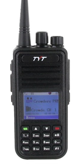 The Tytera MD-380 is an low cost radio for analog FM and DMR on the 70cm band (see video here). One of the limitations with the radio is that it only holds 1000 contacts…which seems like a lot of contacts but it fills up quickly. With DMR, each radio or user has a unique 7-digit radio ID number. For ham radio use, the DMR-MARC organization maintains a database that maps radio ID number to user name and callsign. If a user is in your contact list, the user’s name and callsign pops up in your radio’s display. Otherwise, you just see the radio ID which is not very helpful. There are over 63,000 users in the database with more being added on a daily basis.
There are a number of firmware updates to the MD380 and I have not checked them all out. I heard some guys talking about the TyMD380Tools on one of the DMR talkgroups, so I decided to give it a try. This software was developed by KG5RKI (go here) and is easily installed from Windows without a lot of messing around. This firmware upgrade loads the entire DMR-MARC database into the radio.
Now that I have the worldwide database of DMR users loaded onto the radio, its like having caller ID on my HT (see photo below). Actually, its better than that, it pulls up the other ham’s full name, callsign and location information.
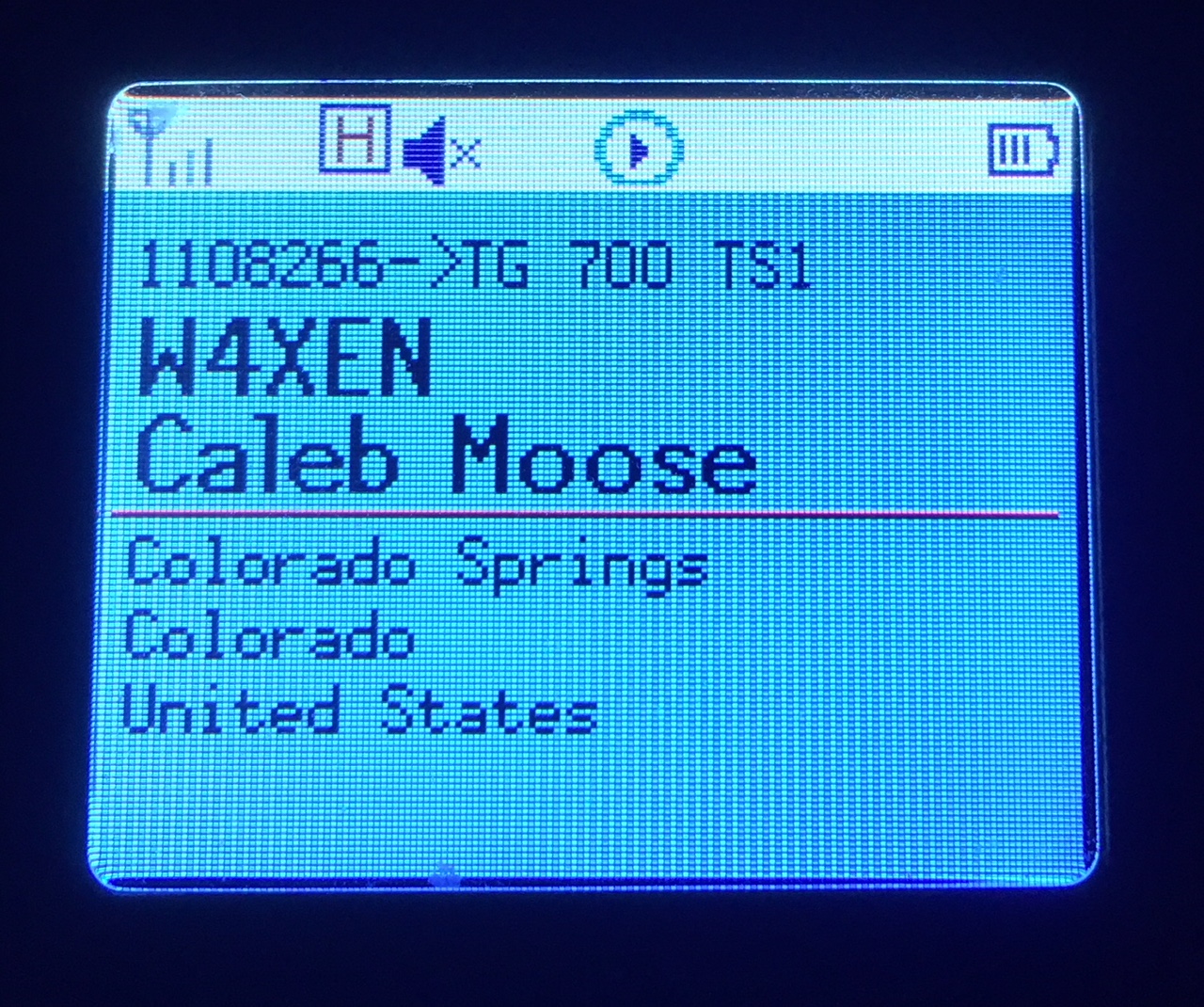 This may not seem like a big deal but I’ve found it to be surprisingly useful. I am often scanning a few channels or talkgroups with my radio and just listening casually. I may not be tracking who’s talking but I can just look at the radio to see who’s on the air. It’s one of those convenience features that makes me think “why don’t all of my radios do this?”
The TyMD380Tools implements a bunch of other features but increasing the number of contacts has been the most important one for me. This is a great example of radio amateurs adapting (“hacking”) commercial gear with improvements for ham radio use. KK4VCZ, DL4YHF and others contributed to this code. Check out the software…seems to work great.
73, Bob K0NR
The post TyMD380tools for Tytera MD-380 appeared first on The KØNR Radio Site.
This Spewed Out of the Internet #35
 I noticed that I’ve been blogging mostly about SOTA activations, so here’s something completely different: a bunch of exciting stuff flowing forth from the interwebz.
From the Why Do They Do That Department, Jeff/VA2SS shared this article on the origin of the radio term “Roger That.” See The story of why pilots say “Roger that”
This reminds me of the classic scene from the movie Airplane, with the flight crew named Roger, Victor and Clarence.
I recently came across the Wikipedia web page on Etymology of Ham Radio, which explains the origin of the term “ham radio.” Etymology: the origin of a word and the historical development of its meaning. About the same time, Dan/KB6NU wrote about the use of the term “ham radio”: HAM? HAM radio? ham radio? Amateur Radio? amateur radio! I have to admit that I do get annoyed by people that write “HAM” in all caps. What the heck is that?
The ARRL recently published a series of six posters promoting the value of amateur radio. I’m not quite sure where to deploy these but I do like them.
I was checking on electrical voltages and plugs in various countries and came across this site: Power Plugs and Sockets of the World Very handy and easy to use.
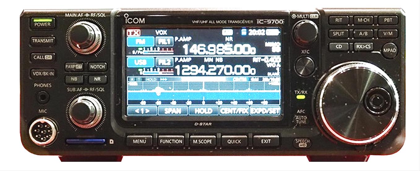
Twitter was abuzz with news about a new VHF/UHF transceiver from ICOM: the IC-9700. This is the first new radio aimed at VHF and up enthusiasts in a long while. I try to not get excited about these early product teasers and wait until the product is shipping in quantity. But I have to admit that this radio has my attention. I don’t have a lot of Icom gear in the shack but this radio may change that.
The DX Engineering web site shows these key features for this unreleased product:
Direct-Sampling SDR design
Three bands: 144 and 432 MHz (50 Watts), 1.2 GHz (10 Watts)
High definition Real-Time TFT display
Main and Sub RX
Dual Real-Time Spectrum and Waterfall displays
Dual Watch (with Spectrum/Waterfall displays)
Touchscreen interface (LCD touch-screen control)
That’s some good stuff spewing from the internet. What did I miss?
73, Bob K0NR
The post This Spewed Out of the Internet #35 appeared first on The KØNR Radio Site.
SOTA Activation: North Kaufman Ridge (W0C/SP-085)
Kaufman Ridge is a ridge line that runs along the border of Park and Chaffee Counties in Colorado, near Trout Creek Pass. There are two Summits On The Air (SOTA) summits on this ridge: Kaufman Ridge (W0C/SP-081), formerly Kaufman Ridge HP, and North Kaufman Ridge (W0C/SP-085), formerly Kaufman Ridge North. I have activated these summits before including a winter activation of North Kaufman Ridge. These summits have turned out to be popular SOTA activations because they are easy to access, easy to hike and have outstanding views of the surrounding area.
Joyce/K0JJW and I decided to do a SOTA activation on a pleasant September day. On previous trips, we approached the summit from the east without much thought to the route. This time we approached from the north, based on a tip from other SOTA activators. This route is a little bit longer than coming from the east but it turned out to have fewer steep spots and less downed timber to navigate.
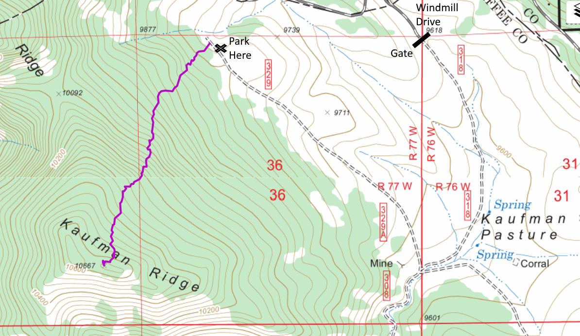
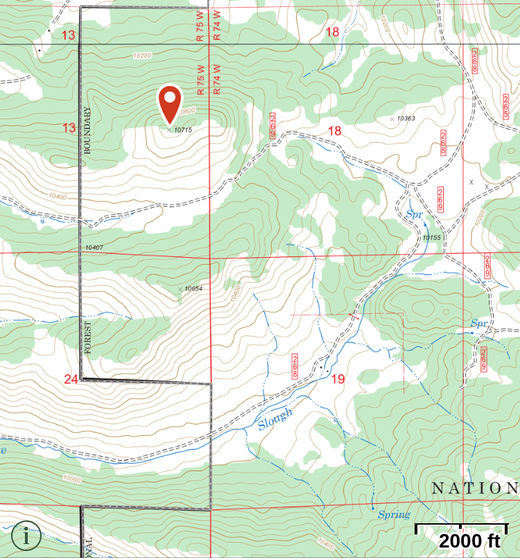
To get to the start of the hike, we went south on Windmill Drive to FS 318, entering the San Isabel National Forest. There is a gate at the entrance to the forest that is closed from December to April. We turned right onto FS329, which may not be marked but is an obvious 4WD road heading to the north. We drove to the end of the road and parked near the National Forest boundary. These are really easy 4WD roads such that a high-clearance 2WD vehicle should have no problem.
At this point, we aimed straight at the summit and started hiking. We found only bits and pieces of a trail here and there. Someone has attempted to mark the trail in places but it was difficult to follow. No worries though as the route was relatively smooth without many obstacles such as rock formations and difficult downed timber. We had to do some minor route finding but just looking ahead for obstacles was sufficient. The one-way distance was 1.1 miles with a vertical gain of 800 feet.
On top, we both snagged plenty of radio contacts on VHF/UHF and enjoyed the excellent views in all directions. This made for a nice SOTA activation on a sunny fall day!
73, Bob K0NR
The post SOTA Activation: North Kaufman Ridge (W0C/SP-085) appeared first on The KØNR Radio Site.
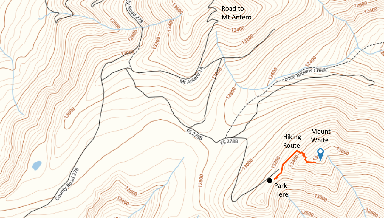
Mount White: Easy SOTA With A Jeep
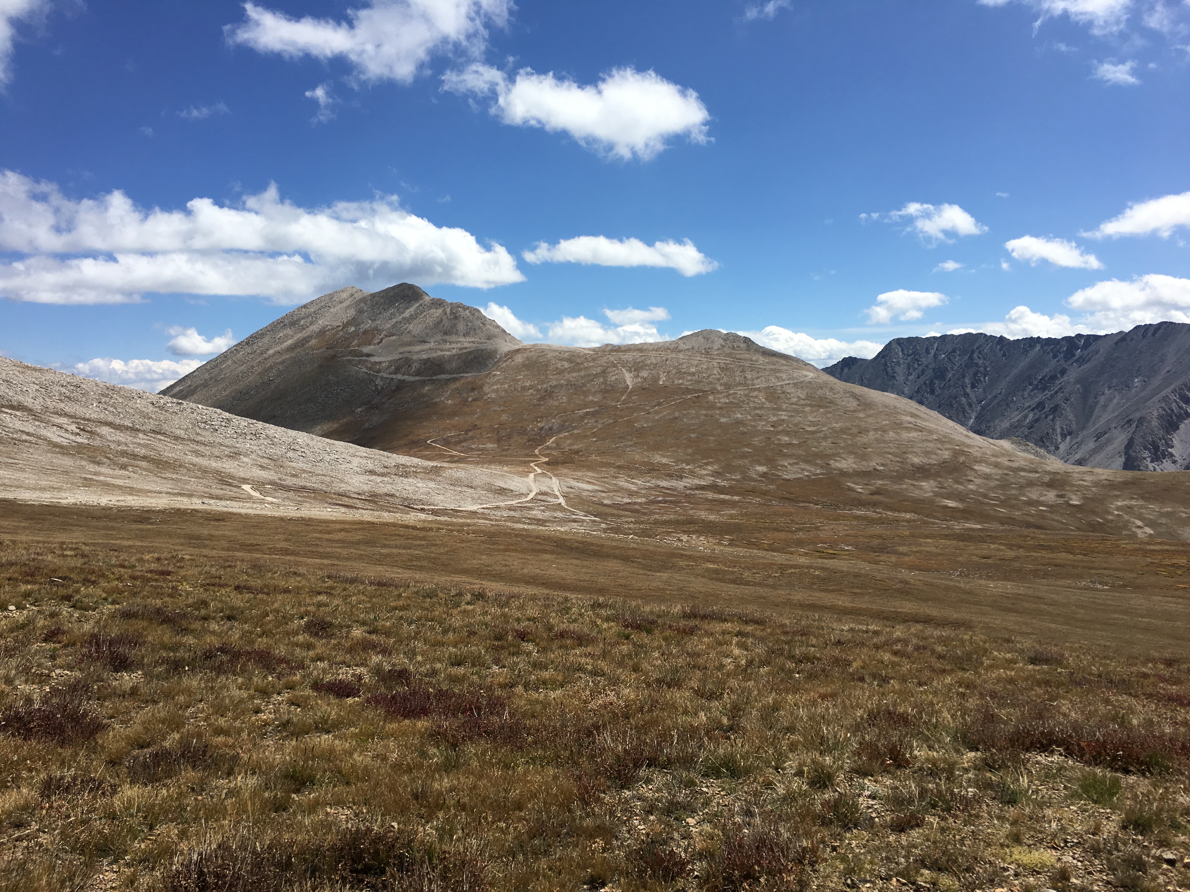
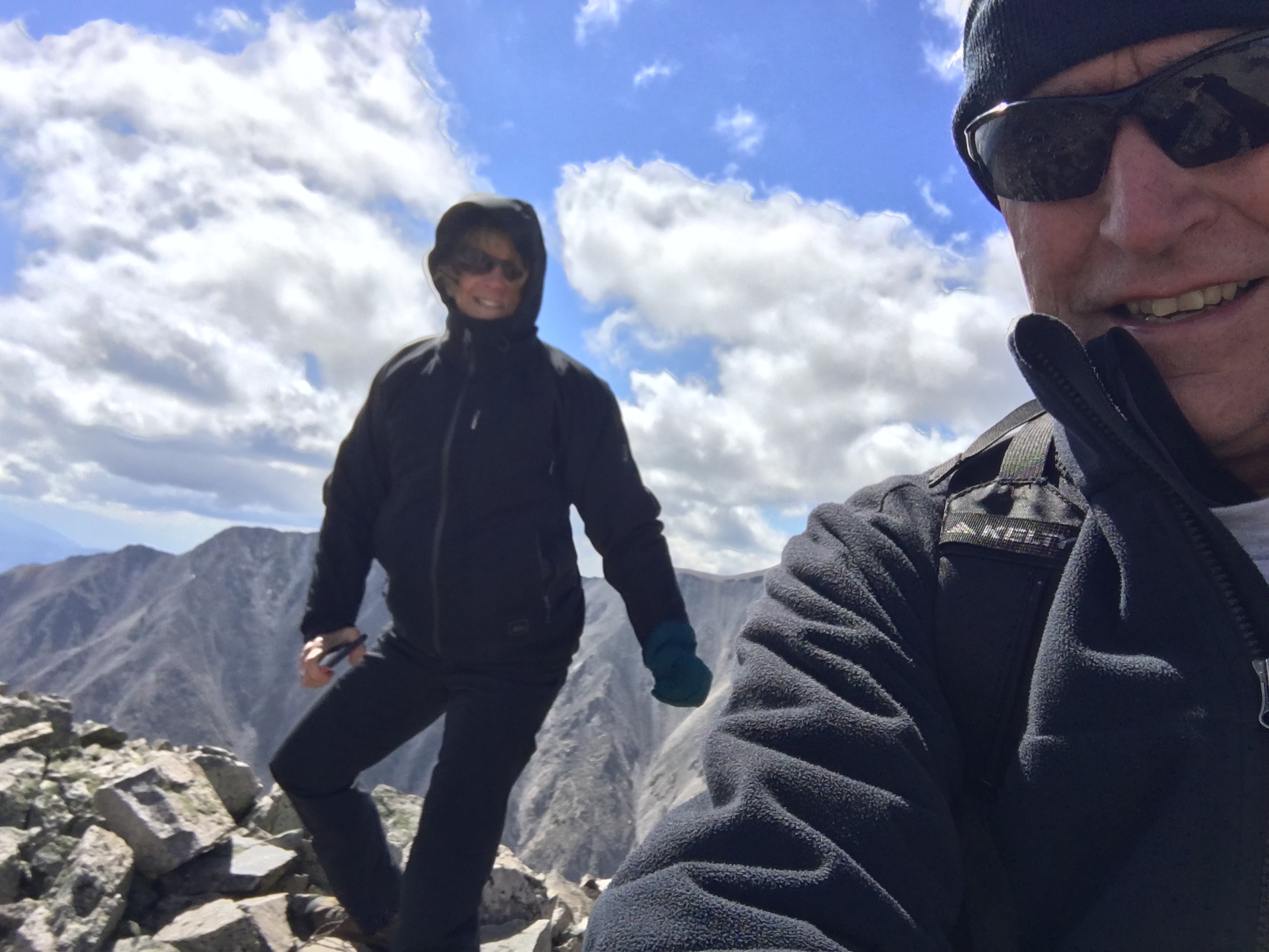
Mount White (W0C/SR-021) is 13,667 feet in elevation, just south of its big brother Mount Antero (W0C/SR-003) at 14,269 feet. Joyce/K0JJW and I activated this summit on SOTA using VHF/UHF. There had only been 4 activations of Mount White, which is a bit surprising. It is not that difficult to get to…if you have a decent 4WD vehicle. We have a stock Jeep Wrangler that handled the road just fine, but I would suspect that a AWD crossover (e.g., Subaru) or similar would not be adequate. We saw a number of hikers on the road (probably headed to Antero), so that is always another option.
The Mount White / Mount Antero area is covered with mining claims and old mining roads. This may degrade the hiking experience but does provide some decent 4WD roads to access the area. The Summitpost.org posting on Mount White has some interesting geological information about Mount White and Mount Antero. There are two summits on Mount White and Summitpost says the actual summit of Mount White is the eastern one. However, the SOTA database indicates the western one. Some other maps also indicate Mount White as the summit to the east but I believe the SOTA information is correct. I guess for SOTA purposes, it is correct, by definition.
A San Isabel National Forest map is very helpful for figuring out access to this summit. Basically, you head west on County Road 162 towards Mount Princeton Hot Springs. Eventually, you’ll get to FS 277 which is a moderate 4WD road marked as the road to Mount Antero. Take a left turn onto FS 278 and follow that uphill to eventually take a left turn onto FS 278A. Stay on 278A for a very short time, then take a right onto FS 278B which takes you to the saddle below Mount White. (See map below.) This route does require good vehicle ground clearance. There are two stream crossings and many tight switchbacks. All in all, it was an easy-peasy fun trip with our stock Jeep Wrangler.
The hiking route is not difficult: 0.35 Miles one way and 450 feet vertical. But you are above 13k feet, so expect the oxygen to be thin. We started out by following a road along the north side of the peak, then scrambled up the talus to the summit. There are bits of pieces of “trail” but we did not find an established hiking route. The day we were there in September it was extremely windy so we did not stay long.
Mount Antero is close by so you could do both summits on the same trip, assuming the weather cooperates.
73, Bob K0NR
The post Mount White: Easy SOTA With A Jeep appeared first on The KØNR Radio Site.
Smoky Mountain Summits On The Air
Joyce/K0JJW and I were getting prepared for a trip to Gatlinburg, TN in August with some of her family. Gatlinburg is the gateway town to the Great Smoky Mountains National Park and the surrounding area. I had hiked and camped in the Smokies years ago and this was a great opportunity to visit that area again. Of course, we needed to get in a little Summits On The Air (SOTA) action during this trip.
We decided to pick out some easy-to-access summits in the area so we could weave them into the trip without too much disruption. My first step was to consult the SOTA database for potential summits in Tennessee and North Carolina, looking at the summits with the most activations. This is usually a good indication of easy access and not too difficult of a climb. I did pick out two iconic summits to activate: Clingmans Dome (this highest summit in the national park) and Mount Mitchell (the highest summit east of the Mississippi river in the US). After checking the various trip reports logged on the SOTA web site, I created a list of potential target summits. Clingmans Dome and Mount Mitchell were Must Do but any other summits would be more opportunistic based on available time and location.
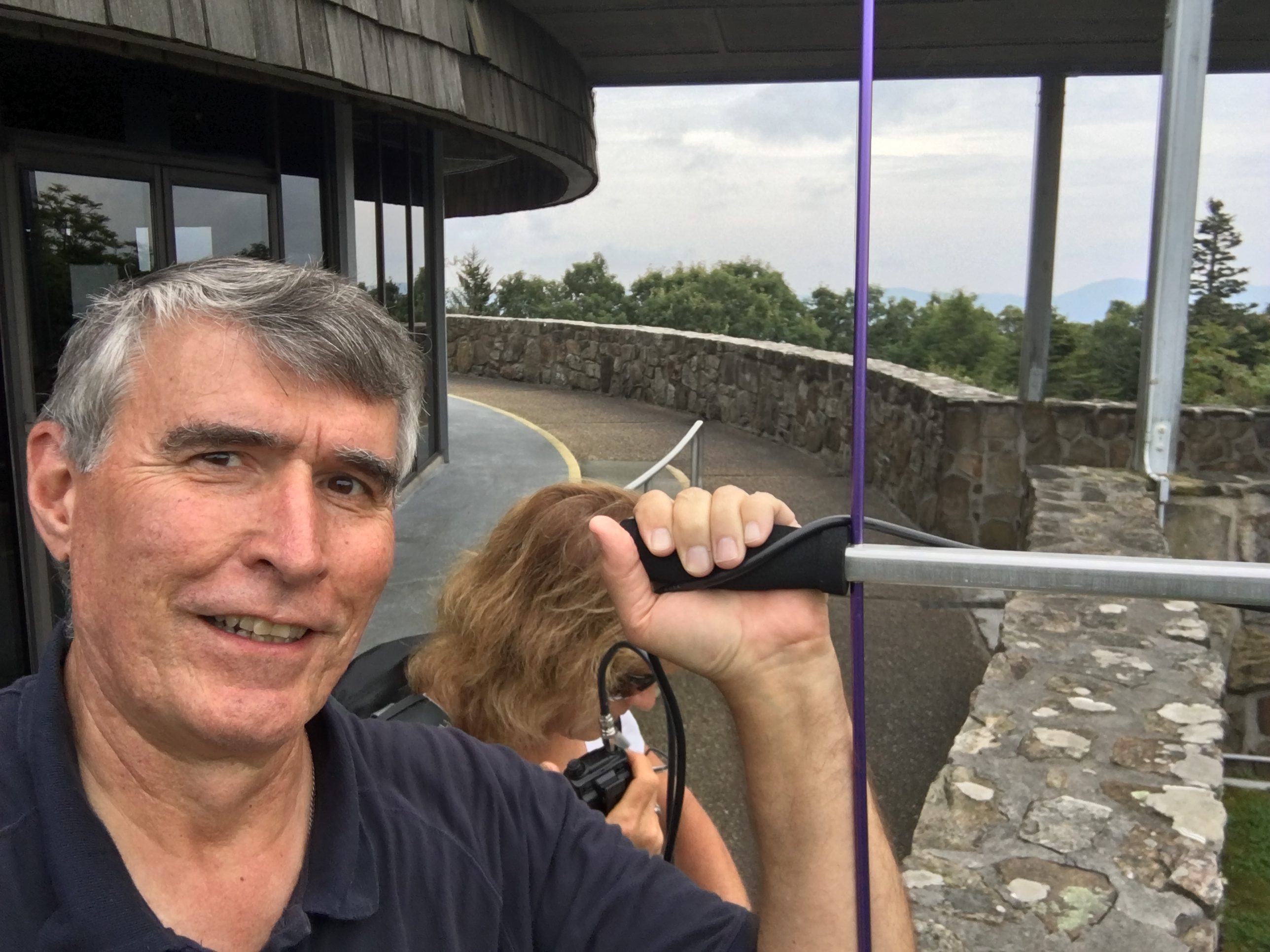
We are using VHF/UHF for SOTA activations and opted for a basic FM station for this trip: a pair of Yaesu FT-1D handhelds, a couple of vertical antennas and a 3-element Arrow yagi antenna for 2 meters. I debated about whether to bring along the yagi but the split-boom design fits into my luggage without any problem. In the end, I am glad we had the yagi as several of the contacts would have been missed without it.
Greentop
Greentop (W4T/SU-076) was our first summit…basically a driveup mountain with radio towers and a lookout tower on top. I noticed quite a bit of interference on the 2 meter band, something I’ve encountered in previous activations near transmitter sites. It turns out that putting a more effective antenna on an HT (such as a half-wave vertical) couples more of the interference into the receiver and degrades its performance. On the other hand, the standard rubber duck antenna picks up less of the interference and performs better then the “good” antenna. After I realized this was happening, I tried using two HTs with reasonable results: one radio with a rubber duck was used for receive on 146.52 MHz while another radio with a half-wave antenna was used for transmitting. The net result was reasonable performance that allowed us to make contacts on 2m fm.
Clingmans Dome
Clingmans Dome (W4C/WM-001) is a popular tourist spot in the Great Smoky Mountain National Park. Parking is a challenge and there are quite a few people on the short trail to the summit.
Although it sits right on the border of Tennessee and North Carolina, it is in the W4C (Carolinas) Association for SOTA purposes. As I approached the summit, I saw a fishing pole sticking up in the air. I thought “huh, I wonder what the rangers are demonstrating today.” Followed by “Hey, wait a minute, that looks like a SOTA activation.” Sure enough, I met W2SE and WI2W setting up on 20m CW. Joyce and I headed to the observation tower and worked 2m from up there. There were quite a few people on the observation tower so I considered just operating from down below. I decided to leave the yagi in the backpack and just use the half-wave vertical. We fit right in with the chaos of tourists on the tower.

Mount Mitchell
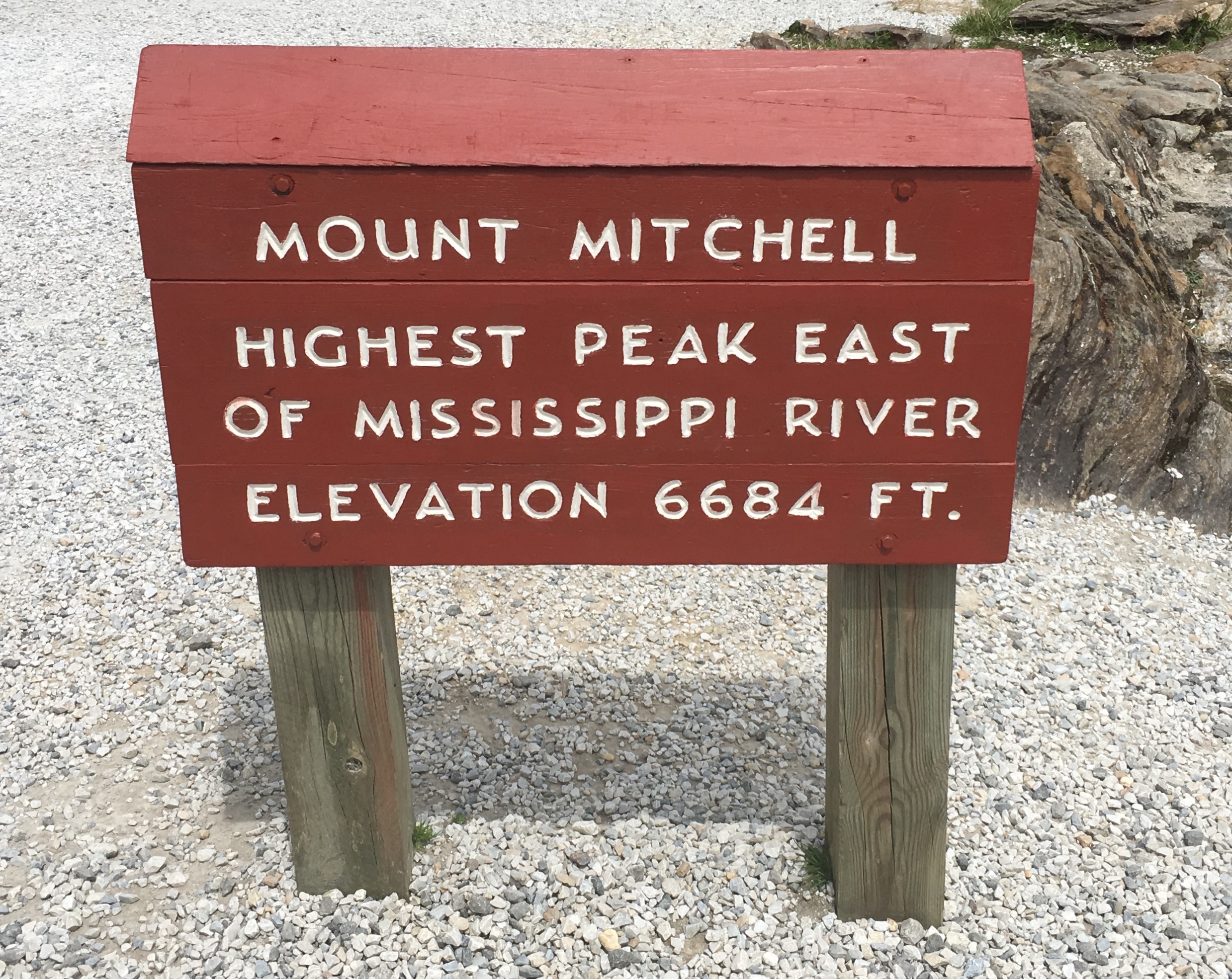
At 6684 feet in elevation, Mount Mitchell (W4C/CM-001) is the highest point in the USA east of Mississippi River. (Interesting perspective: our house in Colorado is 800 feet higher than this summit.) We started with just the 2m vertical but switched to using the yagi when we had trouble copying a few stations. It definitely made a difference…probably 6 dB or so. When signals are near the FM threshold, this can pull them out of the noise.
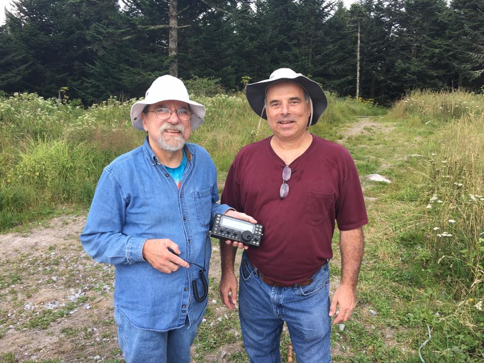
One of the highlights on Mitchell was working Kevin/K4KPK on Walnut Mountain, summit to summit. Kevin is very active in SOTA and has contributed many SOTA summit guides in the area. I made good use of these reports when planning our trip.
Richland Balsam and Waterrock Knob
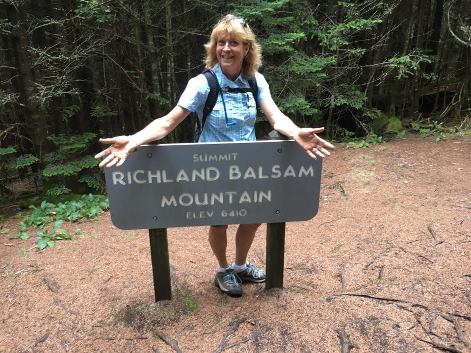
We discovered a number of summits right along the Blue Ridge Parkway and we ended up working these two: Richland Balsam (W4C/WM-003) and Waterrock Knob (W4C/WM-004). Another flashback for us was driving sections of the parkway, which is a lovely drive (typically 45 MPH speed limit) that winds through the mountains. It has been years since we’ve been on that road. This route is something I’d like to explore further on a future trip as you could spend a week wandering along the parkway and knocking out summits.
We worked Pat/KI4SVM on 2m fm from Watterock. I recognized his callsign from the trip reports he has submitted to the SOTA web site. Later, I looked up his SOTA score and found that he is a double Mountain Goat (> 2000 activation points) and the highest scoring activator in the W4C association.
Brasstown Bald
The Mountain Explorer Award is a SOTA award for activating in different SOTA Associations (regions). Activating in Tennessee (W4T association) and North Carolina (W4C association) got my total to 6. Joyce pointed out that we might be able to also hit Georgia on the trip, so we added Brasstown Bald (W4G/NG-001) to the list. This is the highest summit in Georgia, so it rounded out our collection of state high spots for TN, NC and GA.
Brasstown Bald is an easy hike up summit with a significant observation tower on top, including a visitors center. This is another location where we experienced interference from radio gear on the summit, so we chose our position carefully and used the 2m yagi to point away from the interference sources.
This trip worked out really well. We managed to activate 6 summits for a total of 58 points, operate from three new SOTA associations (W4T, W4C and W4G), enjoy some really nice hikes and see some great scenery. I was a little concerned whether we would find enough random activity on 2m fm for our SOTA activations but it all worked out. Actually, there were a few times that 146.52 MHz was busy and we had to standby to make a call. Some of our contacts were less than 25 miles but many covered 100 miles or more. Yes, the 3-element yagi made a difference.
If you are in the Gatlinburg area, it certainly makes sense to try a few SOTA activations. I am also thinking about a return trip to enjoy the area more fully including some longer hikes. We really liked hiking the trails and summits there. The elevation is lower than Colorado (read: you have oxygen to breath), the forests have lots of deciduous trees (not just evergreens) and the trails are less rocky. I am sure we will be back.
73, Bob K0NR
The post Smoky Mountain Summits On The Air appeared first on The KØNR Radio Site.
Another Black Mountain SOTA (W0C/FR-031)
There are (at least) 20 different summits named “Black Mountain” just in the state of Colorado. I’m sure there are many more nationwide. It seems to be a popular, if unimaginative, name. This is why we have a numbering system for Summits On The Air, else we would forever be talking about “which Black Mountain was that anyway?” Or Deer Peak or Sheep Mountain or …
On Thursday, Joyce K0JJW and I activated another Black Mountain, this one with Summits On The Air (SOTA) designator: W0C/FR-031. I’m not sure why it has an FR or Front Range designation, as the summit is actually in the South Park region of the state. I can tell you that it is an awesome summit with great views.
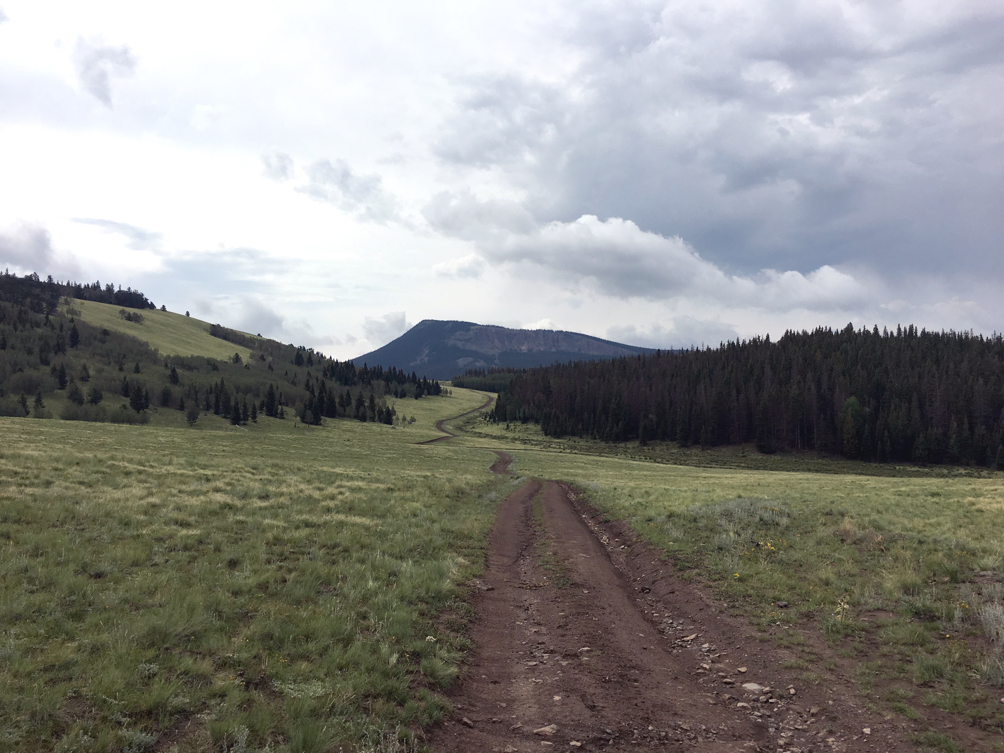
To get to Black Mountain, take Highway 9 south out of Hartsel, CO (or come north on Highway 9 from the south). The Pike National Forest map is very helpful with getting into the vicinity of the mountain. Turn west on FS 108. (This is the same road that leads to Dicks Peak W0C/FR-041.) This road has a sign that indicated “Dicks Peak” and “Black Mountain”. Follow FS 108 S/SW and then take FS 107 to the south (right turn). Follow FS 107 to FS 268, then follow FS 268. About this time, you should have an excellent view of Black Mountain to the south. The roads were muddy and rutted, definitely 4WD. Our Jeep Wrangler had no problem but a AWD crossover/Subaru may be challenged to get through.
Black Mountain has a steep vertical rock face to the north, which is very visible. At this point, we wondered if we signed up for a difficult climb…but not so. FS 268 turns west, kind of parallel to Black Mountain, then heads away from it. At this point, we wondered if we were on the wrong road. Not so. At this point, the Pike National Forest map failed us…it seems to be incomplete in this area. Instead we used the gaiagps.com app on my smartphone which had a representation of the terrain and roads. As we headed west on FS 268 we saw a road heading off to the south. (I don’t recall if it is marked, but see map below.) Take this road south for about one and a half miles…looking for an unmarked road heading off to the east. The intersection with this road is easy to miss as it is not that distinct. But the road is very visible heading off to the east, so you’ll probably spot it later if you miss the turn and can circle back.
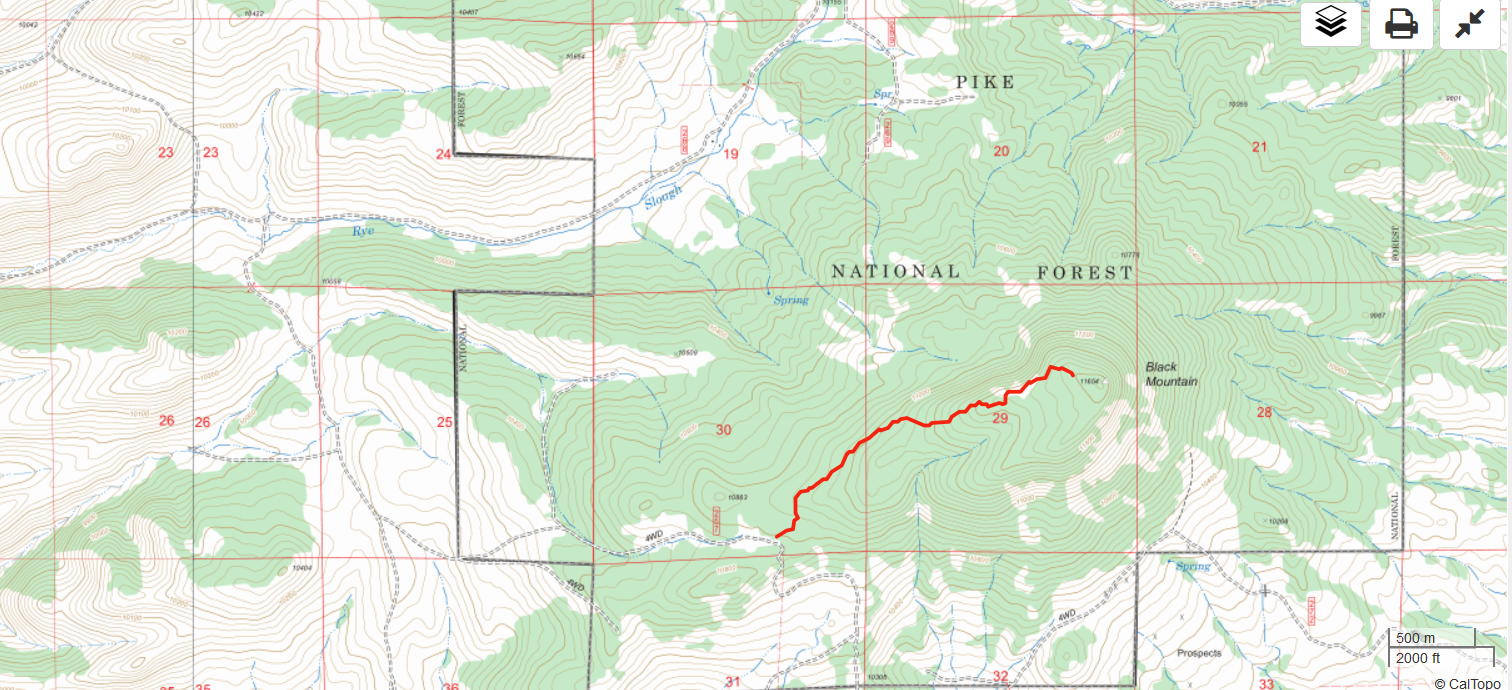
We took the unmarked road east until it deadended at a camping spot. We parked there and started the climb up to the summit. There are only random bits of a trail here and there, so we mostly just followed the GPS towards the summit. The route is forested with some downed timber but not difficult to navigate. The steep north side of Black Mountain provided some nice views. The hike is about 1.5 miles and 1000 feet vertical.
On top, we worked stations on 2m and 70cm fm without much trouble. It is an excellent VHF/UHF site and we found a number of locals hanging out on 146.52 MHz. We reversed our route on the way down and drove the Jeep out.
W0C/FR-222
Steve WG0AT suggested that we could do an nearby unnamed peak (W0C/FR-222) on the same day. This is an excellent idea and we did just that. We headed back north and took FS 269 west, parking just south of FR-222. FR-222 is not shown on the Pike National Forest map but the Gaiagps.com app and other maps show it. The summit is easily seen from the road and a short hike gets you to the top (about 1/3 mile and 500 vertical feet).
73, Bob K0NR
The post Another Black Mountain SOTA (W0C/FR-031) appeared first on The KØNR Radio Site.


