Posts Tagged ‘Mountains’
 Rescue on Uncompahgre Peak (1992)
I came across this story in my archives, written by me way back in August 1992. This was before mobile phones were commonly available, so ham radio turned out to be critical in this incident. Even today, there are many places in the Colorado backcountry where mobile phones don’t work but amateur radio can communicate. My callsign at the time was KBØCY
Something happened on the way to Uncompahgre Peak on August 8, 1992.
Around noon, my brother, my two nephews and I made it to the summit and had just signed the log. I called on 146.52 and contacted Chris, NQ5V, who was somewhere to the east of me (Creede, I think). This must be his summer location, since his callbook address is Texas. We talked about the trail up Uncompahgre, since he was interested in hiking it.
After I signed clear with NQ5V and was about to start down the mountain, a teenage boy came up to me and said he had been sent to “find the guy with the radio” because a girl had been hit by a rock down below and was hurt. I am not sure how they knew I had a radio, other than I used it once on the way up the trail. The story seemed rather sketchy and I was skeptical but asked NQ5V to standby on frequency because we may have a medical emergency. At that time, Arnold, W7JRC, from Cedaredge, CO, came on frequency and said he had a phone nearby. (NQ5V did not have a phone available.) A second, older teenager came up the the trail with more information. He said he was a pre-med student and had search and rescue experience. He had more detailed info which made the story more clear. At this time, I concluded that we had a real emergency and asked W7JRC to call the authorities. I handed my HT to the older teenager and had him describe the victim’s condition to W7JRC. W7JRC had some trouble contacting the police, but eventually got through to the Ouray County Sheriff’s Office. (It turned out we were in Hinsdale County, but we did not know that at the time.)
Jim, NR5Y (also close to Creede, I think) came on frequency and said that he was close to a telephone. I was not always able to communicate with NR5Y, so NQ5V relayed to NR5Y. Since W7JRC was having trouble with getting the telephone call through, I asked NR5Y to also try to place a call. He called the Mineral County Sheriff, who relayed to Hinsdale County. All this time, I was moving down the mountain to try to get closer to the victim without losing my radio contact. About this time, my HT battery went dead, so I switched to my spare (Good thing I had one!) As I moved onto the saddle below Uncompaghre, I lost contact with W7JRC and contact with NQ5V got much worse, but usable. About this time, Doug, NØLAY, came on the air and his signal was very strong at my location which allowed me to stay on low power and conserve my HT batteries. N0LAY apparently came on the air in response to a call from the Hinsdale County Sheriff. N0LAY also had a radio which was on the sheriff’s frequency and relayed information from me to the sheriff’s dispatch.
I had not proceeded down any further because I was certain that I would lose radio contact with NØLAY. The victim had several people with her that had First Aid training and was about 1000 feet below me at the bottom of a cirque. I sent the older teenager back down to the victim with instructions to signal me as to her condition. We both had signal whistles – two whistles meant her condition was the same (stable), three whistles meant her condition had deteriorated. After I got the two whistles back, I felt like things were going to be OK.
About that time, NØLAY relayed that an ambulance had been dispatched to the trailhead and a search and rescue person was on the way up the trail with a trail bike. Also, a helicopter had been dispatched from Montrose. It took us a little while to communicate to the sheriff where the victim was, but we had a pretty good topo map, so we eventually gave them an accurate fix on the location. As I was listening to NØLAY relay, I realized that my Kenwood TH-77A could receive most police frequencies. NØLAY provided me with the frequency and I programmed it into the HT, scanning between 146.52 and the sheriff’s frequency. This allowed us to listen in on what was going on. In fact, many times I was clearly hearing the various parties while they were having trouble communicating.
The S&R guy on the trail bike made it to the accident scene without us noticing him. He had parked his bike about half a mile away from us and had scrambled down to the victim. The first time I was aware of his position was when he transmitted from the accident site. He confirmed that the girl was pretty bashed up, but stable, and needed a helicopter ride out. About this time, the sheriff’s dispatch reported that the helicopter was about 5 minutes out (I think it turned out to be more like 15 minutes away). Soon the helicopter came up on the sheriff’s frequency and I could hear the S&R guy coordinating with the helicopter pilot The two-seater helicopter landed and they put the girl in the second seat. Apparently, she was stable enough to walk to the helicopter with some assistance. The alternative was to put her outside the chopper in a litter. The helicopter lifted off and set back down a few minutes later near the ambulance which was near the trailhead. The two-seater chopper was not a medical evacuation helicopter and the plan was that Flight-For-Life from Grand Junction would pick up the victim at the ambulance location. It turned out that Flight-For-Life was unavailable so they took the victim to a hospital by ambulance (to a local clinic, then Gunnison, I think).
We stayed on the ridge until the chopper headed for home, then we did the same. On the way down, the S&R guy on the trail bike caught up with us and we talked about the accident. He said the girl lost some teeth, had facial cuts, internal bleeding and swelling in the face, but was in stable condition. He said that without the radio report that they would be just getting the initial call at the time he was heading home. That is, we saved about 5 hours on the response time with amateur radio.
I have carried my HT on every 14er hike I have ever done and had considered the possibility of using of using it for emergency communications. I guess I never gave it too much thought because people venturing into the backcountry need to have a self-sufficient attitude. That means being prepared and preventing or handling any emergency situation on your own. But the unexpected happens, and here I was in the middle of a medical emergency. It certainly has caused me to take this emergency communications thing more seriously.
Things I learned that day:
- Always carry an extra HT battery (or two)
- Always carry a decent portable antenna (more than a rubber duck)
- Always carry a good topo map, even if you don’t need it to follow the trail.
- Make note of what county you are hiking in when in unfamiliar parts of the state. This aids in getting to the right Sheriff’s office. (This is important because the person you contact via radio is likely to be two or three counties away.)
- My signal whistle (which has caused considerable abuse from a few hiking companions) is actually useful.
- Extended coverage receive is very useful in emergencies. (I am still thinking about extended transmit — I clearly could have used it in this case.)
I was very pleased that everyone reacted quickly but in a professional manner. The radio amateurs all helped out when they could be stayed out of the way when appropriate. I am sure we can find some things that could have been done better, but I felt like things went well overall.
– Bob KØNR
The post Rescue on Uncompahgre Peak (1992) appeared first on The KØNR Radio Site.
Pikes Peak SOTA (W0C/FR-004) Winter Activation
Joyce/K0JJW and I had intended to hike Pikes Peak this year for a Summits On The Air (SOTA) activation but somehow the plan never came together. I still had my eye on it as a drive-up activation before the end of 2017. The road to the summit is open year round now but closes frequently due to snowstorms passing through. Saturday morning the road was open to 13 miles (out of 19 miles) with the promise that it would be open to the summit later in the morning. (Call 719 385-7325 for a recorded message on road conditions.) By the time we got to the toll gate around 10 am, the road was open to the summit.
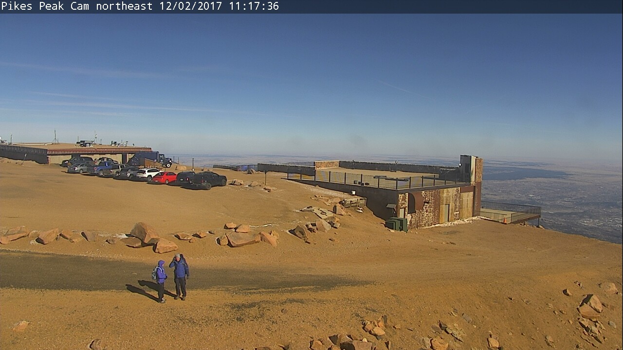
When we reached the summit, the weather conditions were 20 deg F with 20 mph winds, creating a windchill of 4 deg F. We were prepared for that having loaded up on the winter clothing. Still, it was freaking cold up there. As you can see in the webcam picture, there was only traces of snow on the summit.
To be SOTA-compliant, we had all of our gear loaded into our packs and walked some distance away from our vehicle to set up. Because of the wind, we chose the observation platform, tucked in behind one of the walls. Normally, that platform is to be avoided because its overrun with tourists but with the cold weather we only had a few people to contend with.
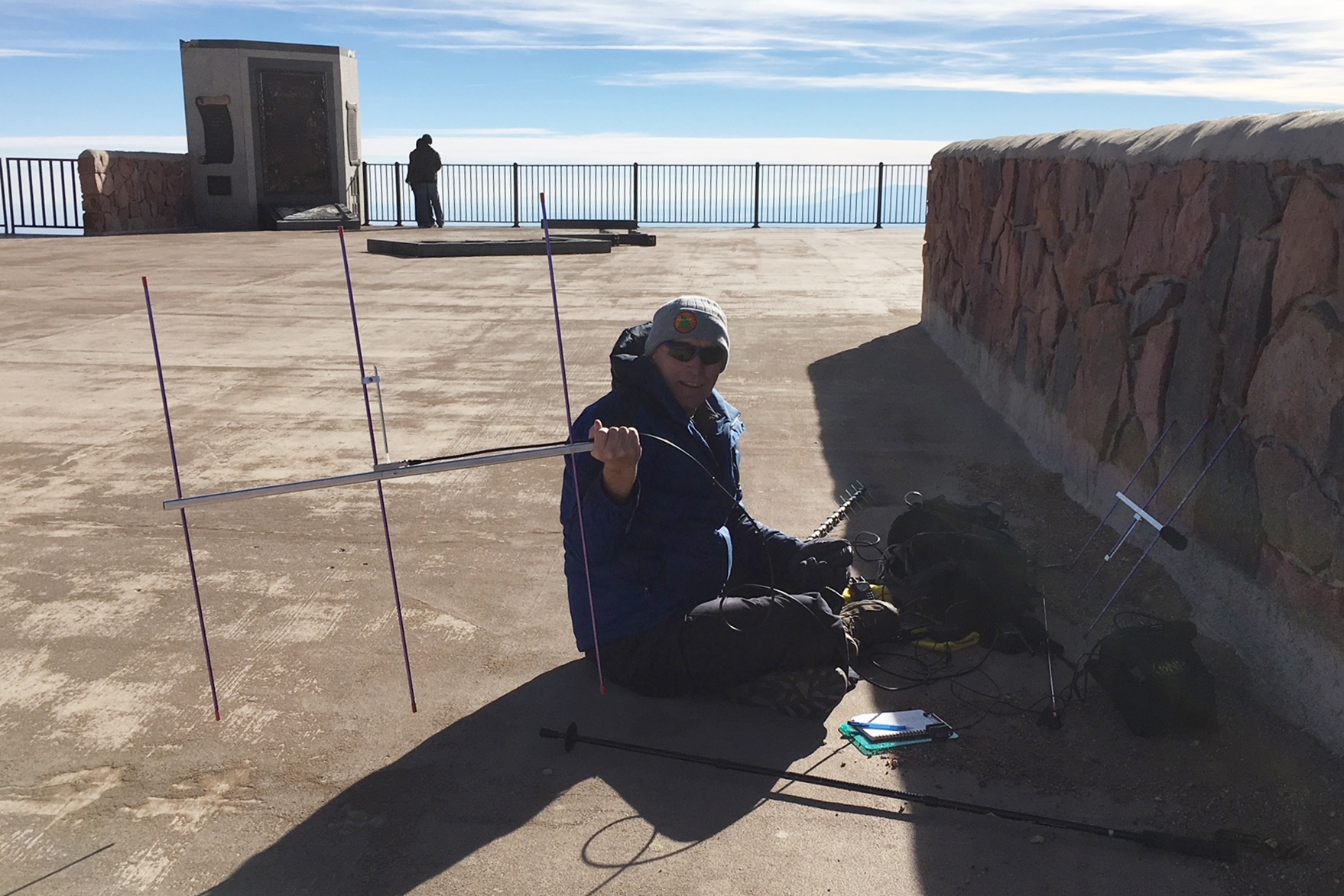
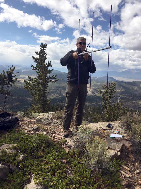
Joyce set up on 2m fm (146.52) using a handheld transceiver (HT) with a vertical antenna. Even with her headset (foam protection on the microphone), the wind noise on her signal was significant. I started out on 2m fm but quickly moved up to 223.5 MHz and worked a few stations there, then on to 446.0 MHz. I had HTs and small yagi’s on both of those bands. Then I fired up 1.2 GHz with an Alinco HT (just 1W on that band) and a 16-element yagi. I worked Paul/W0RW, Gary/WB5PJB and Wayne/N0POH on that band. My QSO with N0POH in Aurora was a new personal best for distance on 23cm/1.2 GHz, at about 90 km.
I tried 2m SSB using my FT-817 but made only one contact: Jim/WB0GMR. Shortly thereafter, I switched back to 2m fm using the 25W mini-mobile rig with a 3-element yagi to work many more stations. Again, just running a bit of power and having a decent antenna on 2m fm was very effective at making radio contacts. I expected the Tytera radio to be overloaded with signals on the summit of Pikes but it actually held up well with just occasional bursts of interference.
Overall, we made 54 QSOs (not too shabby): 43 QSOs on 2m, 5 QSOs on 70cm and 3 QSOs on both 1.25m and 23cm. Our best DX was Jeff/N0XLF near Akron, CO for a distance of about 130 miles (on 2m and 70cm).
73, Bob K0NR
The post Pikes Peak SOTA (W0C/FR-004) Winter Activation appeared first on The KØNR Radio Site.
Hidden Gem: W0C/SP-076 Unnamed SOTA Summit
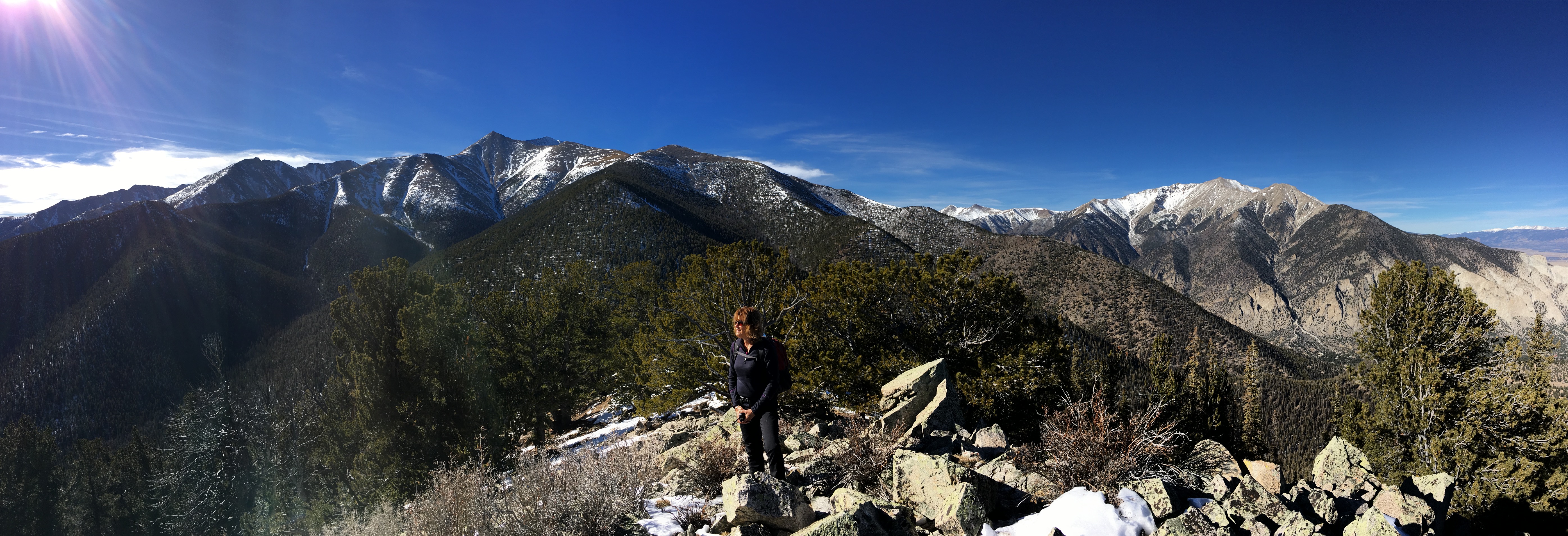
Walt/W0CP had recommended this Summits On The Air (SOTA) summit (W0C/SP-076) to me a while ago. Somehow it had escaped my attention, probably because it’s an unnamed peak and not that well known. Joyce/K0JJW and I decided to give it a try today and it turned out great.
We followed Walt’s directions on the SOTA website, using the southern route. We were pleasantly surprised to find a pretty good trail most of the way to the summit. There were a few spots with downed timber, where people have diverted around the logs, but generally the trail was easy to follow. The trail is not shown on many maps, including the USFS San Isabel Forest map. Thus, I was expecting considerable bushwacking to get to the summit.
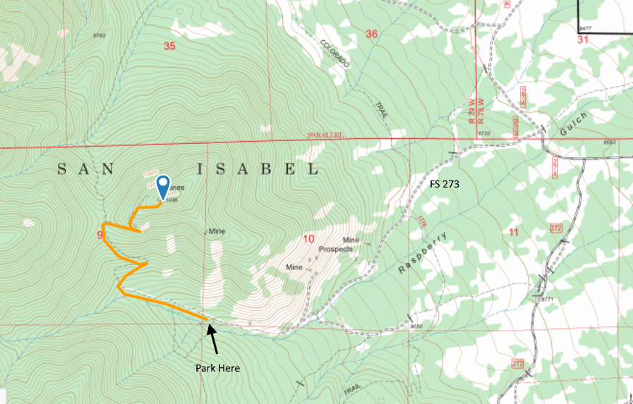
The route to the trailhead is via FS Road 273, easily accessible from Highway 285 south of Buena Vista and north of Salida. See the San Isabel National Forest map for orientation. The road is narrow in spots. Our Jeep Wrangler fit OK but a wider vehicle would get to deal with the brush on both sides of the road. The road is easy 4WD and should be passable with a high-clearance 2WD vehicle. The road had some snow on it (Nov 25, 2017) and with a few more snowstorms may not be passable.
The road continues a little further than indicated on our topo map but it is obvious when it ends. After that, the road turns into a nice trail (our route shown on the map above). The trail has a few broad switchbacks that made for easy hiking. When we got near the summit, the trail was covered by many small snow drifts, so we opted to go off trail and just head for the summit. So our last quarter mile or so is probably not optimal for summer hiking. There are several mines at or near the top of the mountain.
We had quite a variety of radios with us, for 2m, 1.25m, 70 cm and 23 cm, FM only. We started on the workhorse band (2m FM) with the 25W Tytera radio and a vertical half-wave antenna. It seems that someone (me) left the 3-element 2m yagi antenna at home. We quickly made contacts with KD0MRC, W0BV, KD0VHD, KE0DMT and KL7GLK on 2m and/or 70 cm. I used my Alinco 222 MHz handheld to work KD0MRC on 223.5 MHz, which is apparently the first 222 MHz SOTA contact in Colorado. (Yeah, not a popular band.)
For the most part, it was pleasant on the summit, about 40 degrees F, but it got cold whenever the wind picked up. Without the wind, it was great. With the wind, kind of cold.
This is a great hike and a great summit. Only a few people have activated it for SOTA, so I wanted to write it up for others to consider. We will definitely return to this one due to it’s excellent combination of easy accessibility, good trail and wonderful views.
73, Bob K0NR
The post Hidden Gem: W0C/SP-076 Unnamed SOTA Summit appeared first on The KØNR Radio Site.
Colorado (W0C) SOTA Activators
Here’s the SOTA activator scores for Colorado (W0C). I have to admit that I like checking this to see how everyone is doing. Some of it is friendly competition but mostly its enjoying the accomplishments of my fellow SOTA enthusiasts.
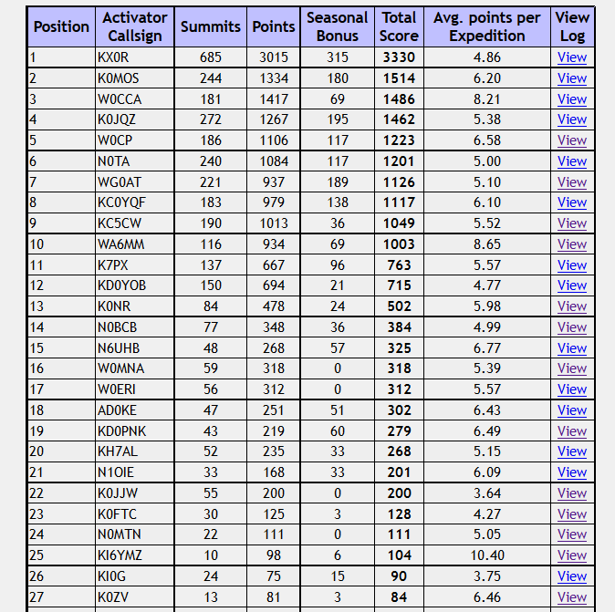 We’ve got 10 “Mountain Goats” in Colorado now, with 1000 or more points. Carey, KX0R just never stops activating. It seems like he is out there on a summit every day. My friend Brad WA6MM just made “Mountain Goat,” by activating only Colorado summits, never repeating any, with many difficult climbs. Note that his average points per expedition is 8.65, higher than any of the other MGs. (W0CCA comes close at 8.21) Congratulations, Brad!
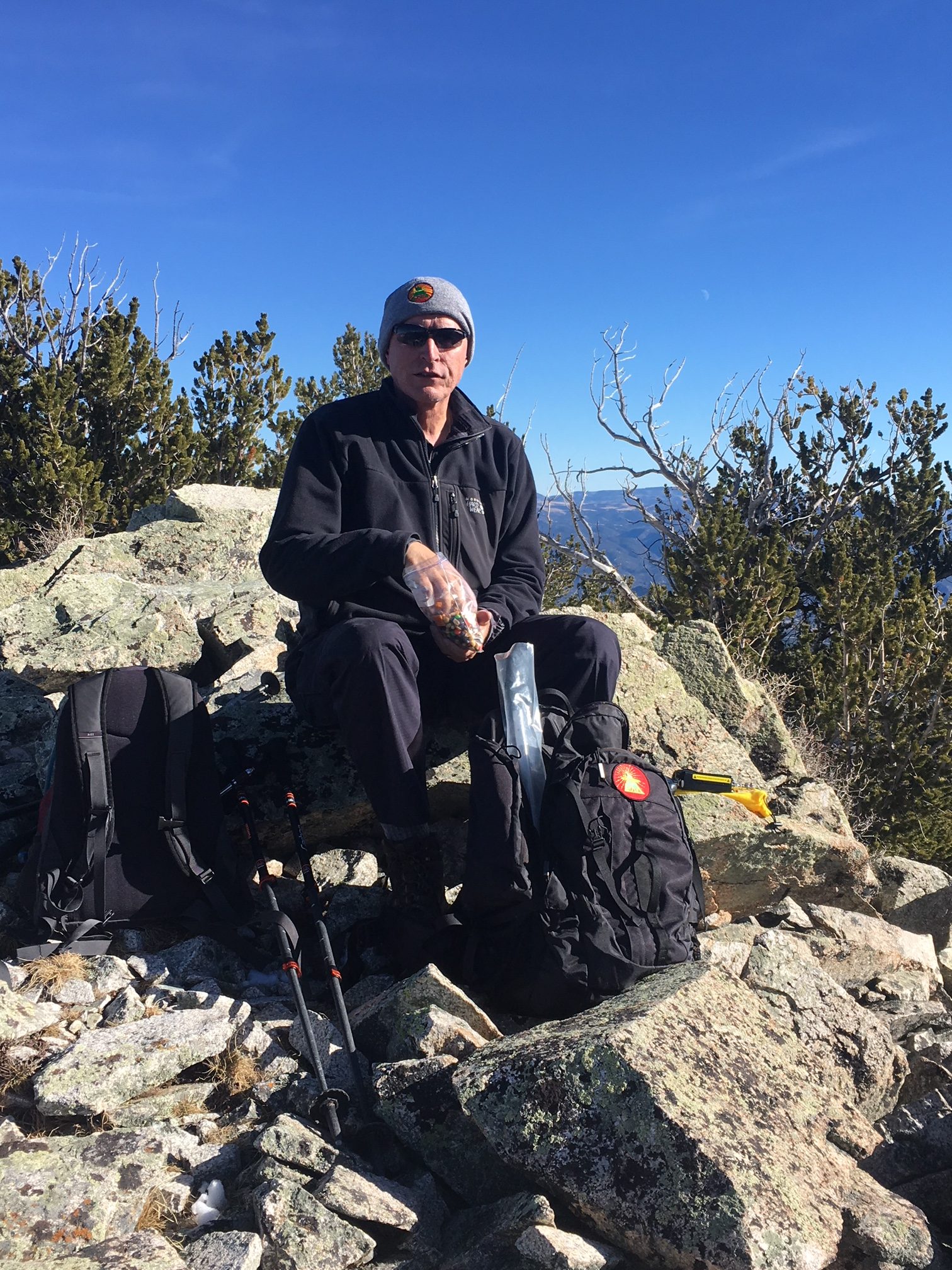
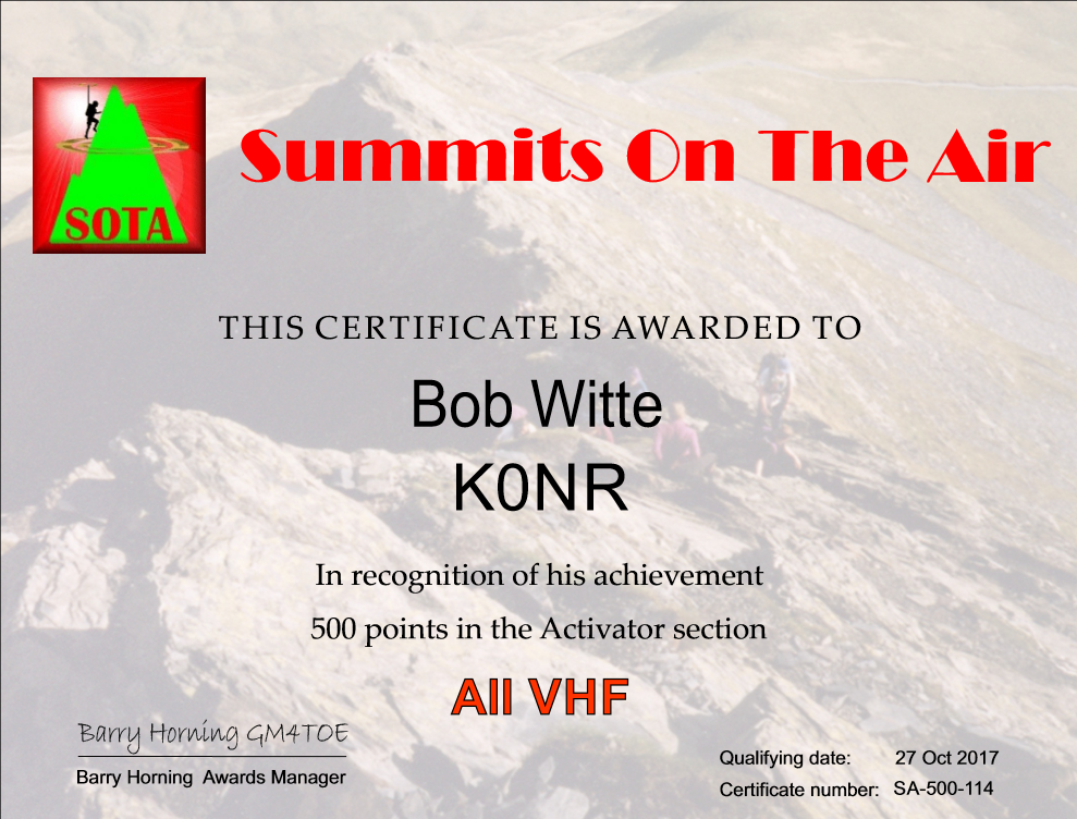 It looks like K7PX and KD0YOB are next in line for Mountain Goat, while I am still a ways back. My hiking partner Joyce/K0JJW is coming on strong, having accumulated 200 points. I just cleared “half a Mountain Goat” at 500 points, so I requested a certificate for that accomplishment. At my current rate of progress, I am about 2 years away from Mountain Goat. I keep telling myself to be patient, keep at it and (most of all) enjoy the journey.
73, Bob K0NR
The post Colorado (W0C) SOTA Activators appeared first on The KØNR Radio Site.
Twenty Six SOTA Summits
 I’ve written before about how operating goals can be a good motivator for getting on the air and making ham radio contacts. It is fun to have a goal to work towards and keep checking items off on the list. A few years ago, I decided to apply this approach to Summits On The Air (SOTA). SOTA is ripe for this kind of thing, given its extensive database and tracking of QSOs.
Our family has a cabin in the mountains that we use to hike, jeep, ski, snowshore, explore, escape … So I decided to make a list of the SOTA summits in the general vicinity of the cabin. I did not use a precise criteria, just listing the summits that seemed close by. I used the Lists Of John web site as a tracking tool. That site is used by hikers/climbers to track their ascents, often working on their own list of summits based on whatever criteria that interests them.
 This list turned out to have 26 summits on it and I completed the last one a few months back, which was an unnamed peak (W0C/SP-055). Fifteen of these were the first activations of those summits. Some of these have still not been activated by anyone else (except for Joyce K0JJW, who usually hikes with me).
Now that I have completed that list, I obviously need to create a new one. With all of the SOTA summits available in Colorado, I won’t run out of options any time soon.
73, Bob K0NR
The post Twenty Six SOTA Summits appeared first on The KØNR Radio Site.
SOTA Activation: North Kaufman Ridge (W0C/SP-085)
Kaufman Ridge is a ridge line that runs along the border of Park and Chaffee Counties in Colorado, near Trout Creek Pass. There are two Summits On The Air (SOTA) summits on this ridge: Kaufman Ridge (W0C/SP-081), formerly Kaufman Ridge HP, and North Kaufman Ridge (W0C/SP-085), formerly Kaufman Ridge North. I have activated these summits before including a winter activation of North Kaufman Ridge. These summits have turned out to be popular SOTA activations because they are easy to access, easy to hike and have outstanding views of the surrounding area.
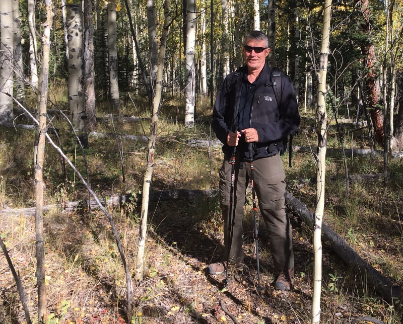
Joyce/K0JJW and I decided to do a SOTA activation on a pleasant September day. On previous trips, we approached the summit from the east without much thought to the route. This time we approached from the north, based on a tip from other SOTA activators. This route is a little bit longer than coming from the east but it turned out to have fewer steep spots and less downed timber to navigate.
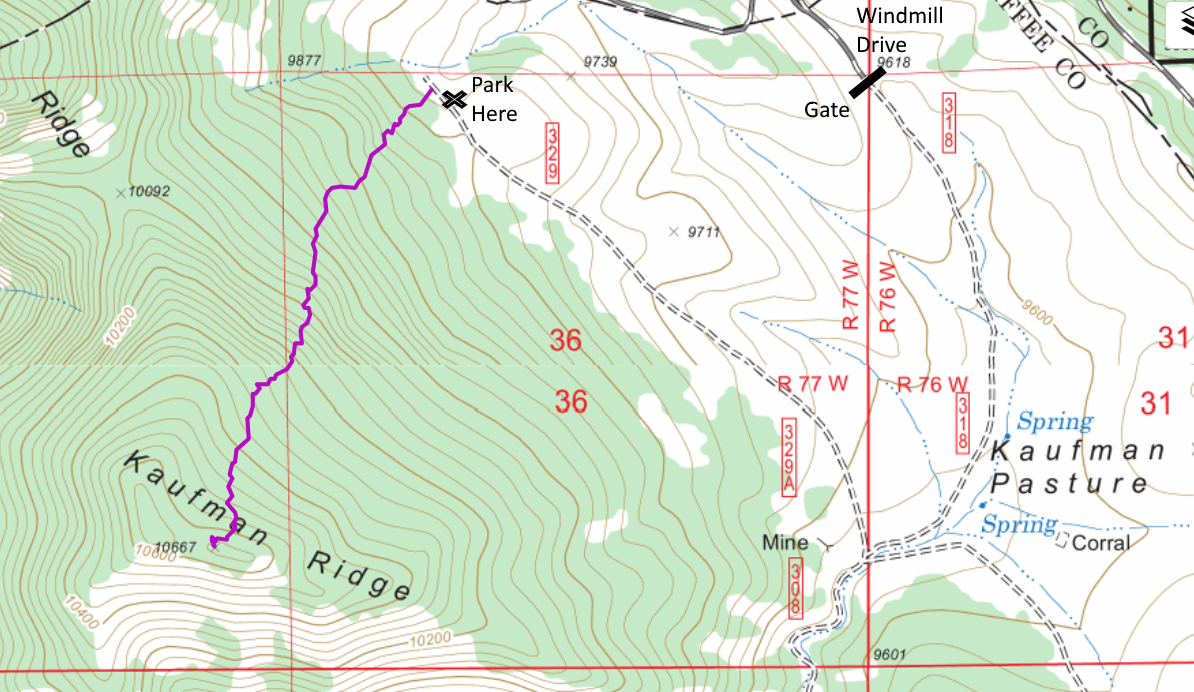
To get to the start of the hike, we went south on Windmill Drive to FS 318, entering the San Isabel National Forest. There is a gate at the entrance to the forest that is closed from December to April. We turned right onto FS329, which may not be marked but is an obvious 4WD road heading to the north. We drove to the end of the road and parked near the National Forest boundary. These are really easy 4WD roads such that a high-clearance 2WD vehicle should have no problem.
At this point, we aimed straight at the summit and started hiking. We found only bits and pieces of a trail here and there. Someone has attempted to mark the trail in places but it was difficult to follow. No worries though as the route was relatively smooth without many obstacles such as rock formations and difficult downed timber. We had to do some minor route finding but just looking ahead for obstacles was sufficient. The one-way distance was 1.1 miles with a vertical gain of 800 feet.
On top, we both snagged plenty of radio contacts on VHF/UHF and enjoyed the excellent views in all directions. This made for a nice SOTA activation on a sunny fall day!
73, Bob K0NR
The post SOTA Activation: North Kaufman Ridge (W0C/SP-085) appeared first on The KØNR Radio Site.
Mount White: Easy SOTA With A Jeep
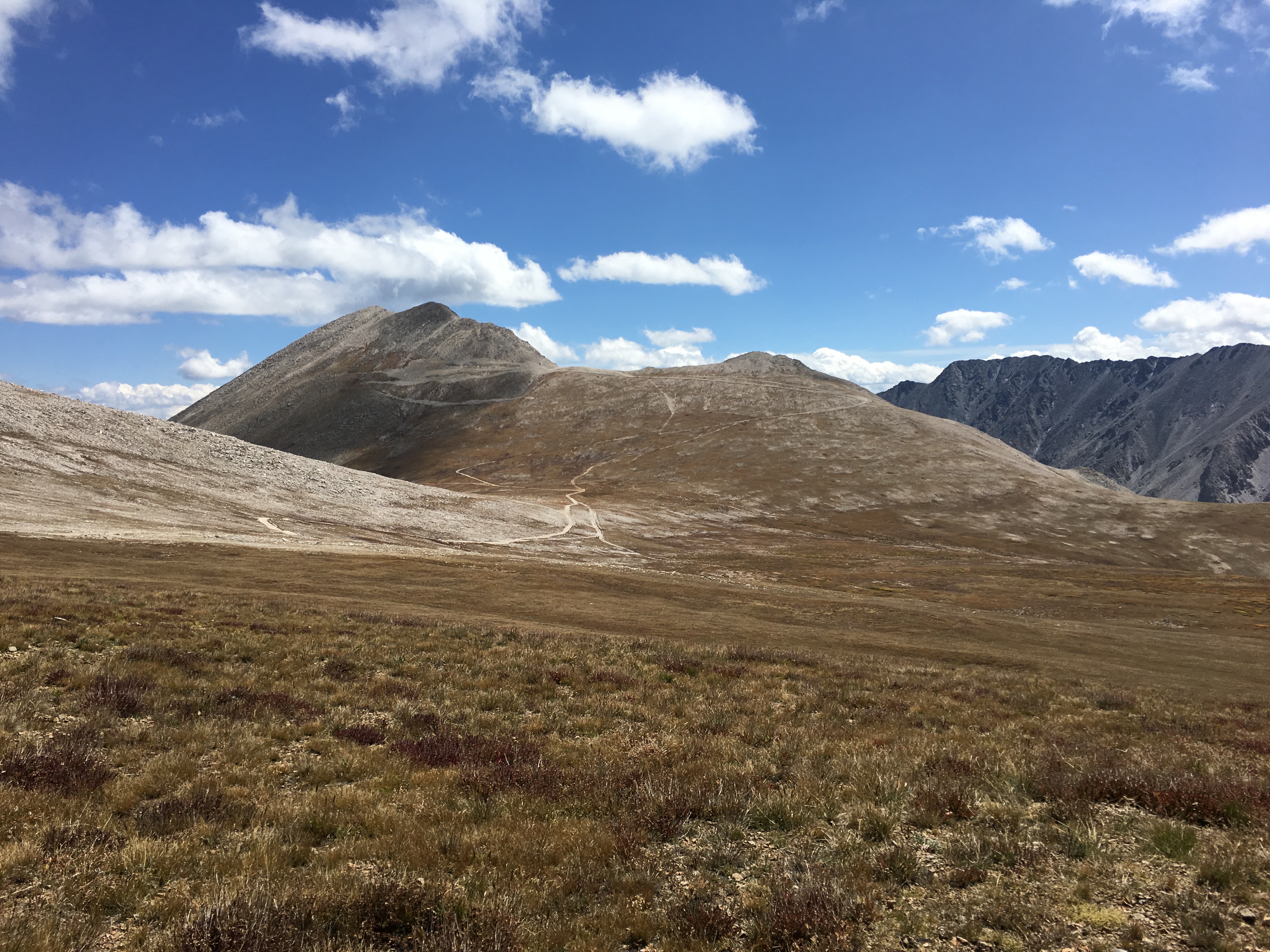
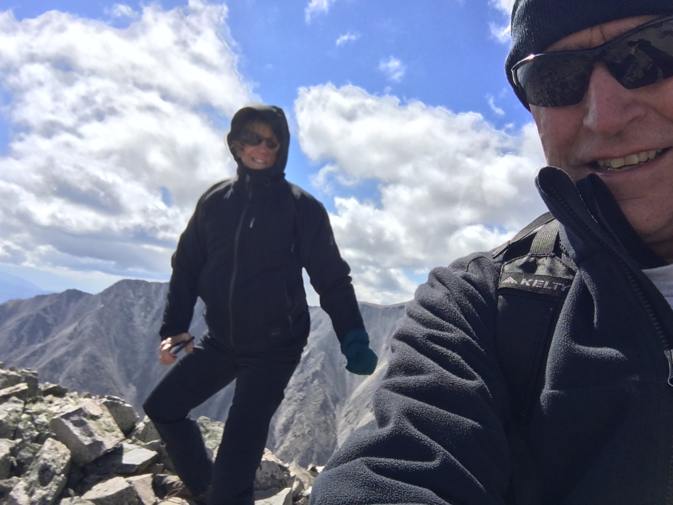
Mount White (W0C/SR-021) is 13,667 feet in elevation, just south of its big brother Mount Antero (W0C/SR-003) at 14,269 feet. Joyce/K0JJW and I activated this summit on SOTA using VHF/UHF. There had only been 4 activations of Mount White, which is a bit surprising. It is not that difficult to get to…if you have a decent 4WD vehicle. We have a stock Jeep Wrangler that handled the road just fine, but I would suspect that a AWD crossover (e.g., Subaru) or similar would not be adequate. We saw a number of hikers on the road (probably headed to Antero), so that is always another option.
The Mount White / Mount Antero area is covered with mining claims and old mining roads. This may degrade the hiking experience but does provide some decent 4WD roads to access the area. The Summitpost.org posting on Mount White has some interesting geological information about Mount White and Mount Antero. There are two summits on Mount White and Summitpost says the actual summit of Mount White is the eastern one. However, the SOTA database indicates the western one. Some other maps also indicate Mount White as the summit to the east but I believe the SOTA information is correct. I guess for SOTA purposes, it is correct, by definition.
A San Isabel National Forest map is very helpful for figuring out access to this summit. Basically, you head west on County Road 162 towards Mount Princeton Hot Springs. Eventually, you’ll get to FS 277 which is a moderate 4WD road marked as the road to Mount Antero. Take a left turn onto FS 278 and follow that uphill to eventually take a left turn onto FS 278A. Stay on 278A for a very short time, then take a right onto FS 278B which takes you to the saddle below Mount White. (See map below.) This route does require good vehicle ground clearance. There are two stream crossings and many tight switchbacks. All in all, it was an easy-peasy fun trip with our stock Jeep Wrangler.
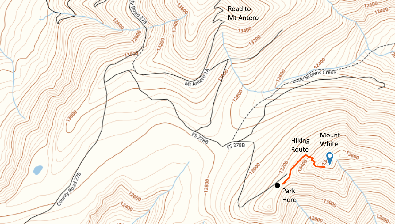
The hiking route is not difficult: 0.35 Miles one way and 450 feet vertical. But you are above 13k feet, so expect the oxygen to be thin. We started out by following a road along the north side of the peak, then scrambled up the talus to the summit. There are bits of pieces of “trail” but we did not find an established hiking route. The day we were there in September it was extremely windy so we did not stay long.
Mount Antero is close by so you could do both summits on the same trip, assuming the weather cooperates.
73, Bob K0NR
The post Mount White: Easy SOTA With A Jeep appeared first on The KØNR Radio Site.


