Posts Tagged ‘SOTA’
 Easy SOTA: Blue Mountain (W0C/SP-123)
Joyce K0JJW and I were preparing to drive back home from the mountains and began to consider what Summits On The Air (SOTA) peaks might be on the way and easy to access. I consulted with Steve WG0AT, who had a number of good suggestions but we ultimately decided on Blue Mountain (W0C/SP-123). This is an easy summit to get to and an easy summit to hike.
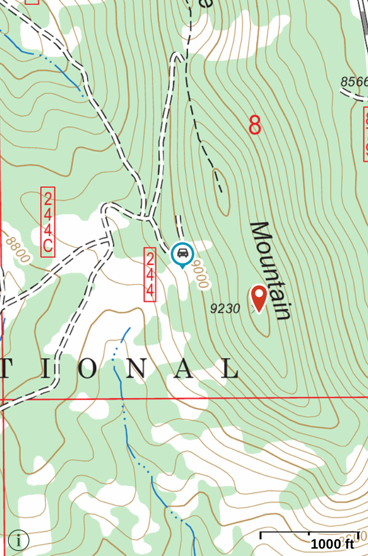 I found Carey’s (KX0R) trip report to be helpful, so I suggest reading that information. To get to Blue Mountain, just get on Blue Mountain Road (CR 61) heading south out of Lake George. Looking at your Pike National Forest map (you do have a National Forest map, right?), you’ll see that this road passes by Blue Mountain on the east side and then turns west. Take forest service road FS 244 to the right (north), which takes you up to the west side of Blue Mountain.This road turns into easy 4WD (challenging 2WD with high clearance). We just kept going on FS 244 (ignoring the side roads) and parked at the very last turn, as shown on the map (38.93108N, 105.35597W). At this point, you can just take aim at the summit (40.33530N, 105.28100W) and hike your way up. Approaching the slope at an angle makes it not quite so steep.
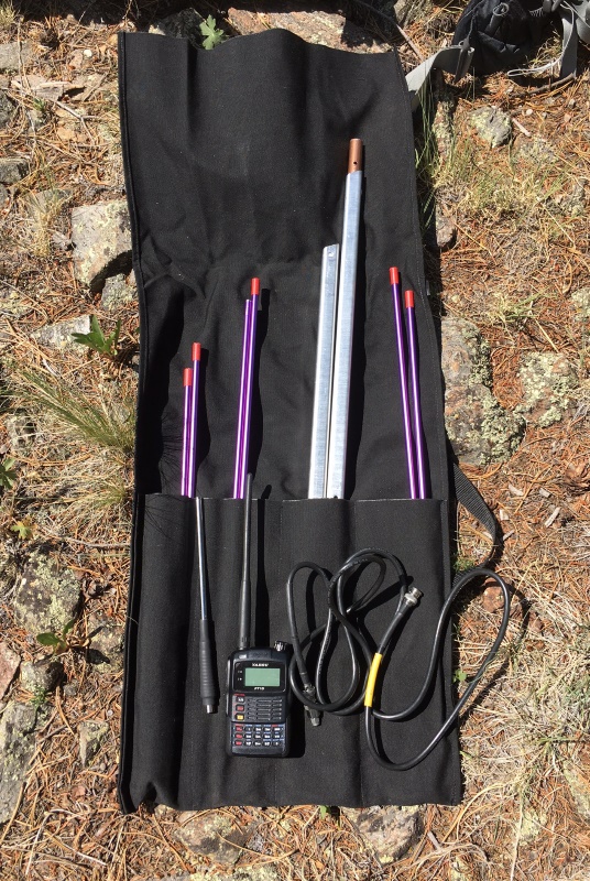 For this activation, we took along gear for 2m, 70cm and 23cm, FM only. Basically, this amounts to a pile of HTs and a few compact antennas. All of our contacts were on 2m FM except I did work Paul W0RW on Wilkerson Pass using 1.2 GHz (23 cm). At an elevation of 9230 feet, this location does pretty well on VHF and higher, so we easily worked stations in Buena Vista (W0BV), Woodland Park (WA6TTY) and Como (KD0VHD). We also worked a hiker (Jim, KD0MRC) on the side of Mount Yale, about 50 miles away.
The photo on the left shows my portable 2m FM station: Yaesu FT-1DR handheld transceiver, 1/2-wave Flex antenna (Smiley Antenna), and the dismantled 3-element Yagi (Arrow Antenna). I recently started using the Smiley halfwave antenna because it flexes on the connector end, making it more resilient to on trail use.
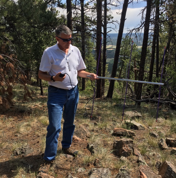 In the photo to the left, I’ve got the yagi antenna assembled and I’m using it to make contacts. With a little practice, the Arrow antenna screws together quickly and provides some nice gain over the halfwave vertical (about 6 dB).
We had excellent weather today so that helped make for a fun day. If you are in the Lake George, CO area consider Blue Mountain for an easy and fun activation.
73, Bob K0NR
The post Easy SOTA: Blue Mountain (W0C/SP-123) appeared first on The KØNR Radio Site.
There’s summat on the air now..but be quick
Recently I attempted a SOTA activation of Skiddaw G/LD-004. It is an easily accessible summit and a really good MTB route (called Back ‘o’ Skiddaw – although I’m not sure there is a link between the lake district and pirates but we’ll run with it). I’ve ridden it before but it has been a few years and the 17.5m route is straightforward and involves 2 out of the 4 lakeland MTB activities, these are of course:
- Riding – Sounds trivial but read on
- Pushing – Right its too steep / rocky / muddy. Get off and push the thing (generally up).
- Humping – Stage 3 is extreme. You have to carry your bike. It is very heavy after a few meters
- Throwing – This is the last resort and usually used in the summer when vegetation is everywhere. Pick up your bike and throw it on the bracken. Step into the flattened area. Pick up and repeat.
As I said the route is straightforward. The kit is standard….
- FT817nd
- LiPo – 3S 11.1v 2200mAh
- SOTAbeams SB270 (no longer available but a great antenna)
- VX-8GR APRS handheld
- Fishing pole
- End fed half wave antenna and ilertuner
- Palm paddle key
- 7m fishing pole
So imagine the scene. Dropped son off at cub camp and parked up. the sun is shining and the breeze is gentle. A good spring day. No need to check the high level weather forecast as you can see the summit. Assume its a bit colder and windier up top so pack a lightweight fleece.
Ride off. Enjoy the view. Here are a few photo’s


Nobody this way

Or that way…excellent

Windy, cold and rocky. makes riding fun (ish)

I kept my helmet on to keep the heat in
Whilst on stage 2 (pushing) up seat how (a lower summit and not a SOTA one) a fell runner was coming down with full kit on. To the untrained eye this might sound reasonable but as this is Cumbria it is rare to see a fell runner (because they are very quick generally, blink and they’ve gone…into the mist) and its even rarer to see one wearing a jacket. I was concerned. Sure enough the wind got stronger and stronger. Even though I was on the windward face I was shielded or in some kind of wind flow niceness. It didn’t last. Over the top of the ridge and it was howling and cold. Quick up the top and find a windless spot on the leeward side of the summit.
Skiddaw is a loose rocky summit that is old, as are all the lakeland summits and valleys for that matter but thats a whole new post. The summit might have been in a wind tunnel. 40+mph and around 3c. Not good when you’re in shorts. So on with the spare clothes and set up. No chance of HF today and VHF was going to be a quick one. I tried 2m USB but couldn’t keep the antenna straight so switched to FM and added more rocks to the support. No joy. I had to drop it to ground level and made do with the few contacts I made. Not what I planned at all.
There will be many morals to take from this experience. I like to focus on the positives and ignore the negatives, it helps block out the cold in this instance. So the main points…..
2 hours up……..10 minutes down…….great down hill section weaving around the many walkers who on the whole were much better behaved than they have been in the past. Just don’t touch the brake rotors for a while and keep them spinning. 
Next summit will be…….TBC
Pursue Radio Operating Goals
 Operating goals or awards are a fun way to keep focused on accomplishing something via ham radio. Really, it’s a specific reason to get on the air and make radio contacts. I am not big on idle chit chat via the radio (“the weather here is 65 deg and raining”) so having a reason to make contacts helps me get on the air. I’ve tended to pursue awards in a serial manner…once I hit some level of accomplishment, I usually declare victory and move on to something else.
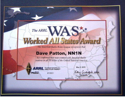
Way back in the wayback machine, the first award I pursued was Worked All States (WAS). It does take some effort but I was pretty active on the HF bands at the time, so many of the states just showed up in my log. But to really drive it home, I kept track of which states I still needed and actively looked for opportunities to work them.
Next up was Worked All Continents (WAC), which obviously requires working some DX. But then I decided that if I was going to have any DX cred at all, I needed to get DX Century Club (DXCC). This turned out to be a bit of a challenge with my modest station (100 watts and a dipole) but I found that working DX contests to be very helpful. The big hassle was collecting the QSL cards and getting them checked by the ARRL (back before the Logbook of the World days). Once I checked the box on DXCC at just over 100 countries, I was satisfied and went on to other things. Serious DXers chase all available countries/entities to get Honor Roll and other bragging rights.
The VHF and higher bands have always been a passion for me, so I pursued the VHF/UHF Century Club (VUCC) awards. First, it was 6 meter VUCC, the easiest one to get. A really good run during the ARRL June VHF contest can produce the 100 grids you need for the award in one weekend. For me, it took a few more contests than that after factoring in the fallout that occurs when trying to get confirmation QSLs. The 10 GHz VUCC only requires 5 grids which turned out to be not too difficult. My VHF collaborator at the time, Doug W0AH (now W4LY) and I took turns operating from Pikes Peak while the other guy went out and activated the required 5 grids. It helps to have a big honkin’ mountain nearby to use for 10 GHz operating. About this time, I got into working the LEO satellites and worked the required 100 grids for satellite VUCC. I don’t have very many grids confirmed on 2 meters, so that one is still calling to me.
Recently, I spent some effort going for the CQ WPX Award (worked prefixes award). This is an intriguing award structure because every new callsign prefix counts as a new one. For the basic mixed-mode award, you need to work at least 400 different callsign prefixes. I found this format to be a lot of fun because “everyone is DX” so to speak, but DX prefixes are also very valuable. The same approach is used for the WPX contests, which naturally brings out stations with less common callsign prefixes. A big motivator for me was when the ARRL announced Logbook of the World (LoTW) support for the CQ WPX awards. I mean, there was no way I was going to collect 400 QSL cards to submit for this award, but using LoTW made this very efficient. More on that story here: CQ WPX, LoTW and the End of QSL Cards.
Summits On The Air
Lately, I’ve been active in the Summits On The Air (SOTA) program, both activating and chasing summits. This is a natural fit for me as I’ve enjoyed mountaintop operating in various forms, mostly on VHF and UHF. (See my SOTA blog postings.) The SOTA program has a wide variety of awards, supported by a very powerful database used to record SOTA radio contacts and keep track of the scores. It is not really a competition but there is friendly rivalry between SOTA enthusiasts as they monitor each other’s posted scores.
I’ve been using VHF (and UHF) exclusively for SOTA and managed to qualify for the Shack Sloth Award using just those bands. (Shack Sloth is achieved with 1000 chaser points.) Shack Sloth is a bit of a misnomer for me as many of my SOTA chasing contacts were done while hiking, mobile or portable (not sitting at home in a shack). The Mountain Goat Award is taking a bit longer because I have to drag myself up enough summits to reach 1000 points as a summit activator.
Here’s the current scores for the Colorado (W0C) SOTA activators:
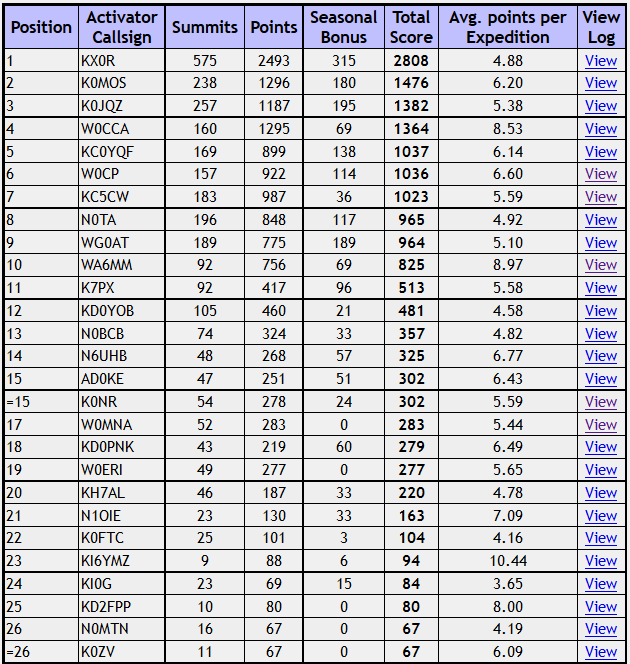 At the top of the list, we find Carey KX0R totally killing it with 2808 points. These folks have all reached the coveted Mountain Goat status: KX0R, K0MOS, K0JQZ, W0CCA, KC0YQF, W0CP, KC5CW. I am further down the list, tied with AD0KE at 302 points. Now, remember this is not a competition
  Honestly, I wish I were further along the path to Mountain Goat but I’ve decided to keep at it and enjoy the journey. Walt W0CP recently gave me some excellent advice: just keep making progress.
Other Goals
You may not find the awards and goals I’ve mentioned to be very interesting, but there are many other options. In 2016, the ARRL sponsored the National Parks On The Air (NPOTA) program, which created a lot of interest and activity. I did just three activations for NPOTA but many people really got into it.
You might also set your own personal goal, not associated with any award. I know one ham that decided his goal was to make a ham radio contact every day of the entire year. This sounds simple but if you have a full-time job and other responsibilities, it takes some persistence to make this happen. Perhaps you are public service oriented; you might set a goal for the number of ARES events you support this year. I challenge you to think about what it is you are trying to do with ham radio and set a goal that is consistent with that.
Those are my thoughts, what do you think?
73, Bob K0NR
The post Pursue Radio Operating Goals appeared first on The KØNR Radio Site.
First SOTA Activation: H-44 Benchmark (W0C/SP-130)
With the most recent release of the W0C ARM, there were 61 summits added to the Colorado SOTA list. I noticed that one of the new summits, H-44 Benchmark (W0C/SP-130) was easy to access, easy to climb and was in the vicinity of our mountain cabin. Surely, we needed to check it out and perhaps be the first ones to activate it.
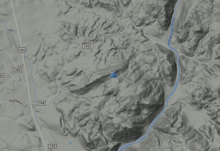 To get there, take Highway 285 south out of Buena Vista (or north from Salida), exiting at County Road 194 clearly marked as Hecla Junction. As you travel east, the road climbs then tops out. Soon after the road started to descend, Joyce K0JJW and I stopped and parked at lat/lon: N38.64998 deg, W106.06747. I don’t think where you park is critical but be aware that this road can get busy during the summer with the many rafting outfitters taking out at Hecla Junction (on the Arkansas River). There are two driveways heading south near where the road crests…we opted to stay to the east of these. One of them appears to be a campsite and the other leads to a house/cabin.
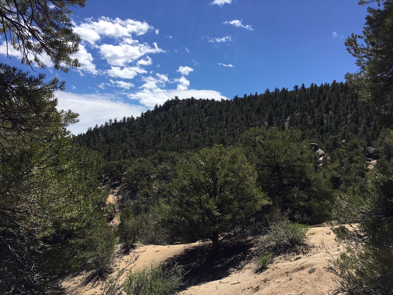
We proceeded south towards the visible summit, looking ahead to find a route that did not have too many ups and downs. There are many options and there was not much downed timber to deal with. We found a nice route that hit the main ridge about 0.2 miles west of the actual summit. We did cross a old logging road which had some recent dirt bike tracks on it, so that may be another option.
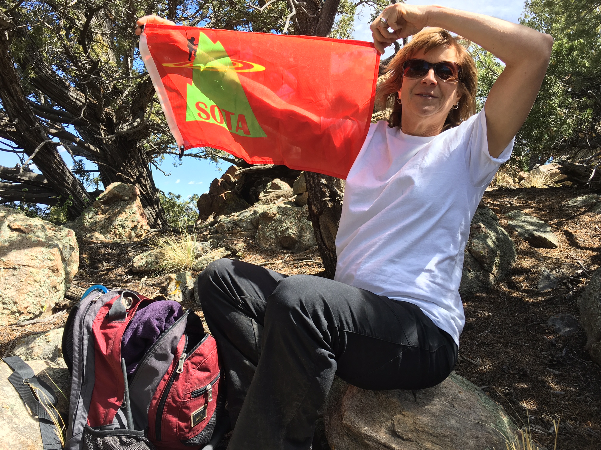
Joyce K0JJW had the honor of activating this SOTA summit for the very first time. As usual, we were working VHF//UHF, mostly 2m FM, but we also made some contacts on 440 MHz and 1.2 GHz. I managed to work Jay W9RM near Olathe, CO on the west side of the state using 2m CW. (We couldn’t quite make the contact on SSB, so we switched to CW to get the job done.)
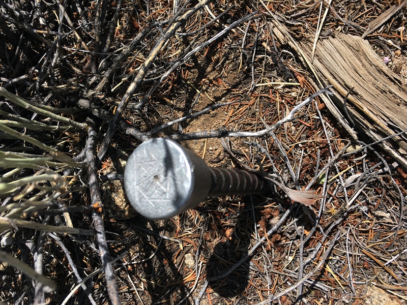
I’ve noticed a few other SOTA peaks are named “something benchmark.” I think that’s essentially an unnamed peak that happens to have a survey benchmark on it. So I looked around for the benchmark and found this marker at the summit:
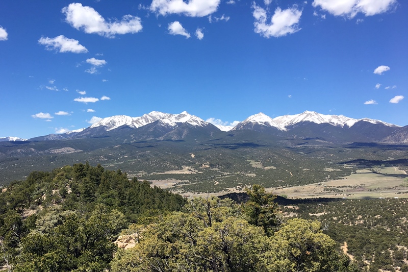
Of course, like many of the lower summits in the Arkansas Valley, this one has a great view of the Collegiate Peaks to the west.
I expect this summit to be a popular SOTA activation because its easy to get to and has a great view. I estimate our total distance traveled as 1.2 miles with an elevation gain of 500 to 600 feet. Sorry, it’s only 2 points.
73, Bob K0NR
The post First SOTA Activation: H-44 Benchmark (W0C/SP-130) appeared first on The KØNR Radio Site.
2017 Colorado 14er Event with SOTA
![]() Amateur Radio operators from around Colorado will be climbing many of Colorado’s 14,000-foot mountains and Summits On The Air (SOTA) peaks to set up amateur radio stations in an effort to communicate with other radio amateurs across the state and around the world. Well, last year we celebrated the 25th annual event so this year it must be the 26th. We are continuing the all weekend approach on August 5 and 6. However, many mountaintop activators will hit the trail early in the morning with the goal of being off the summits by noon due to lightning safety concerns.
Amateur Radio operators from around Colorado will be climbing many of Colorado’s 14,000-foot mountains and Summits On The Air (SOTA) peaks to set up amateur radio stations in an effort to communicate with other radio amateurs across the state and around the world. Well, last year we celebrated the 25th annual event so this year it must be the 26th. We are continuing the all weekend approach on August 5 and 6. However, many mountaintop activators will hit the trail early in the morning with the goal of being off the summits by noon due to lightning safety concerns.
We still have the very cool 25 Year Anniversary t-shirts (and other great stuff) available at http://www.cafepress.com/wg0at
The 14er event includes Summits On the Air (SOTA) peaks, which add over 1700 now 1805 potential summits! If you aren’t up to climbing a 14er, there are many other summits to choose from (with a wide range of difficulty). See the W0C SOTA web page at w0c-sota.org
Radio operators who plan to activate a summit should post their intent on the ham14er Yahoo Group. To subscribe to the “ham14er” email list, visit the Yahoo groups site at http://groups.yahoo.com/group/ham14er/ . Also, be sure to check out the event information at http://www.ham14er.org It is also a great idea to post an ALERT on the SOTAwatch.org website.
Frequencies used during the event
Activity can occur on any amateur band including HF, VHF and UHF. The 2m fm band plan uses a “primary frequency and move up” approach. The 2m fm primary frequency is 147.42 MHz. At the beginning of the event, operators should try calling on 147.42 MHz. As activity increases on that frequency, move on up the band using the 30 kHz steps. Don’t just hang out on 147.42 MHz…move up! The next standard simplex frequency up from 147.42 MHz is 147.45 MHz, followed by 147.48 and 147.51 MHz. We try to stay off 146.52 MHz, the National Simplex Calling Frequency to avoid overload, but if you need to make a call there, go for it…and be brief.
| Frequency (MHz) | Comments | Frequency (MHz) | Comments |
| 147.42 | Primary 2m FM Frequency, then up in 30 kHz steps | 7.032 | 40m CW Frequency |
| 147.45 | Alternate 2m FM frequency | 7.185 | 40m SSB Frequency |
| 147.48 | Alternate 2m FM frequency | 10.110 | 30m CW Frequency |
| 147.51 | Alternate 2m FM frequency | 14.060 | 20m CW Frequency |
| 446.000 | Primary 70 cm FM frequency | 14.345 | 20m SSB Frequency |
| 446.025 | Alternate 70 cm FM frequency | 18.092 | 17m CW Frequency |
| 144.200 | 2m SSB calling frequency | 18.158 | 17m SSB Frequency |
| 50.125 | 6m SSB calling frequency | 21.060 | 15m CW Frequency |
| 1294.50 | 23 cm FM calling frequency | 21.330 | 15m SSB Frequency |
| Other Bands/Modes | Standard calling frequencies and/or band plans apply. | 28.060 | 10m CW Frequency |
| 28.350 | 10m SSB Frequency |
Warning: Climbing mountains is inherently a dangerous activity.
Do not attempt this without proper training, equipment and preparation.
Sponsored by The Colorado 14er Event Task Force
The post 2017 Colorado 14er Event with SOTA appeared first on The KØNR Radio Site.
First SOTA activation – Normanby Top G/TW-005

After last weekends disappointment I had purchased a new Baofeng UV-82L dual band for the princely sum of £27 from eBay to replace the suspect UV-5R. It certainly seems more sensitive when receiving and the transmit audio is loud and clear.
With the 'flower-pot' antenna in the rucksack I spent the walk monitoring the local repeaters (and could hear the regular idents) as well as the calling channels. I was putting out the odd call (with little success) when we stopped to allow the wife to search for the geocaches.
 |
| One man and his dogs |
I had been spurned on to have a go at an activation after watching a video of Michael Sansom's (G0POT) presentation on the SOTA scheme for the Chertsey Radio Club. The video is available online here and Michael has written an excellent companion introduction to SOTA on his website http://peanutpower.co.uk/sota
 |
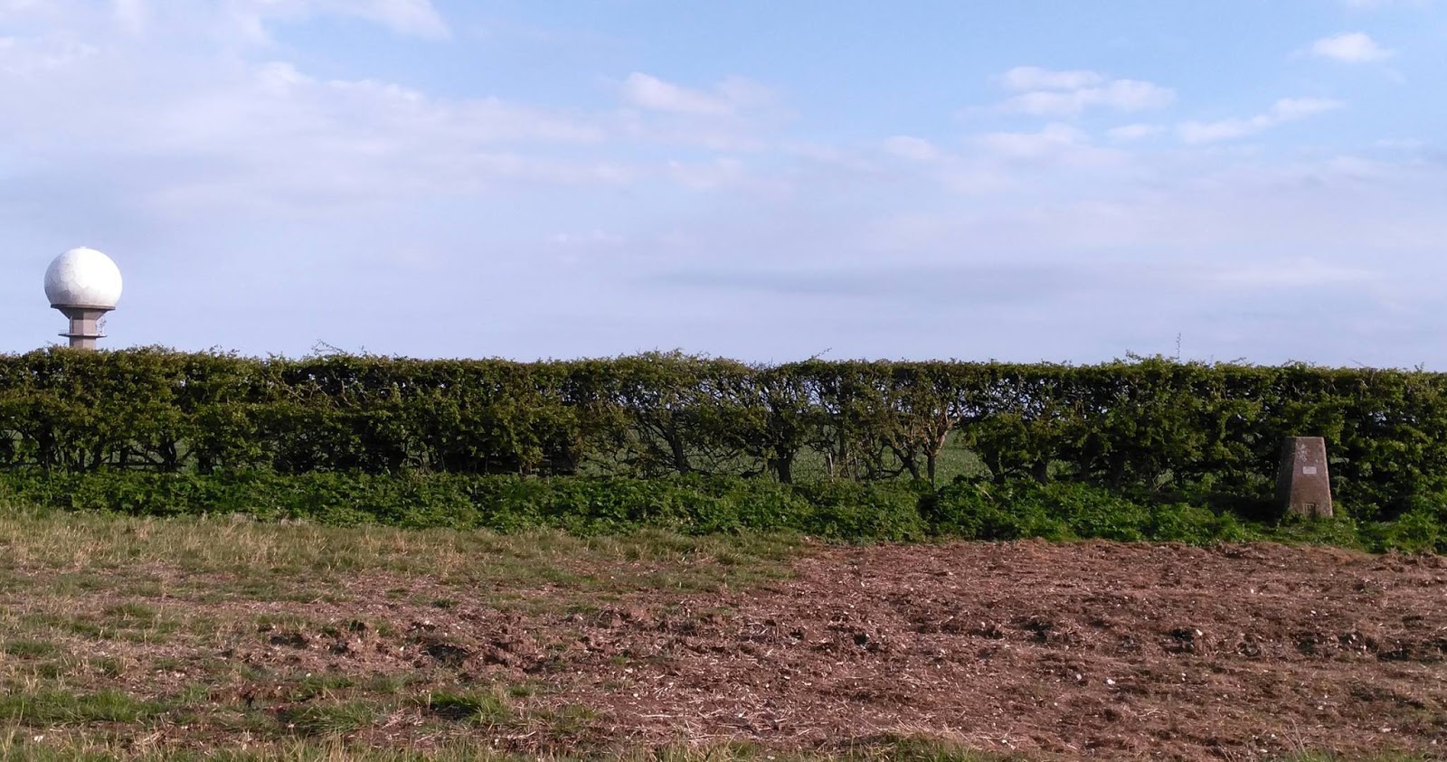
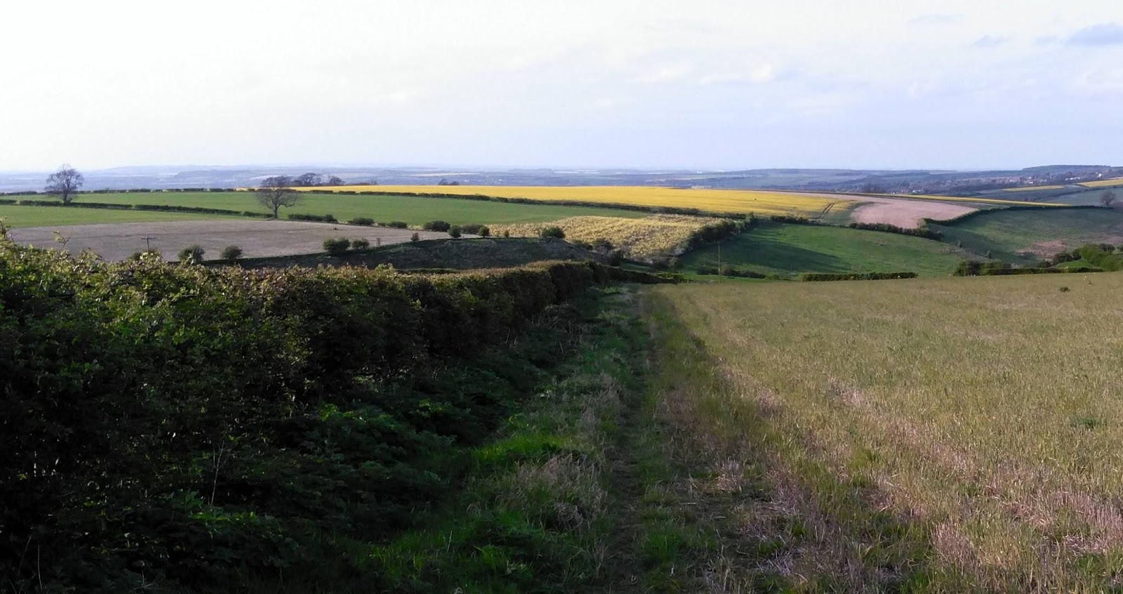
| View across to radar station on Normanby Top |
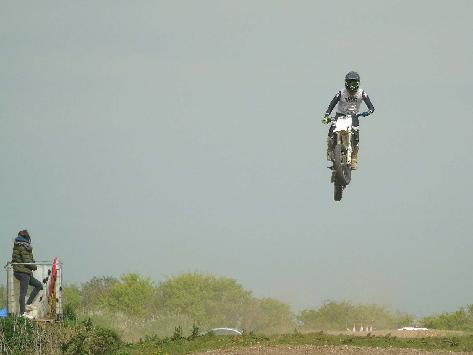 |
| Saw some spectacular jumping skills |
 |
| Section of the 1:25000 Ordnance Survey Map |
To the South of the summit is a road with an air-traffic control radar station. We parked up near this impressive structure to have some very late lunch (time had flown by)
 |
| Radar Station on Normanby Top |
I had a friendly chat with him and he was fully aware of what I was doing and had no issues having met other activators in the past. He also gave me permission to walk across his land up to the trig-point if I wanted to. As I've mentioned it isn't on a public right of way but said he is more than happy for people to go to the trig-point providing they ask at the farm before hand and take home all their rubbish, unfortunately he has some recent problems with inconsiderate litterers.
I decided to decamped and following his instructions to a gap in the fence and set off to the trig-point which was a little bit further away and a little steeper than I thought, but it didn't help I was carrying a half made up antenna, poles and a bag full of kit and my not inconsiderate bulk! Anyway I got there but due to us running already behind schedule and my change of location it was getting late in the day and was nearly 5pm.
 |
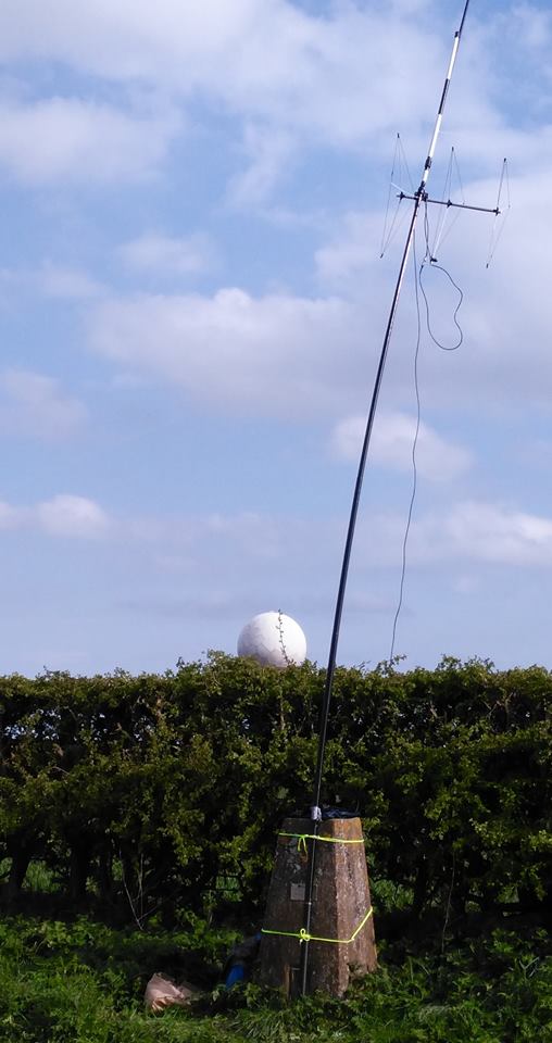
| Trig-point and radar station behind |
I had taken my Yaesu FT-857D, two 7Ahr SLA batteries, fibreglass pole, antennas for 20m/40m HF, 2m SSB and 2m/70cm FM. Yes I'd travelled light! Having some lovely clear views all around I decided to try some 2m 'line of sight' contacts.
I put up the Sandpiper Delta Beam for SSB (horizontal) and my 'flower-pot' dual band for FM (vertical) on a fishing pole. The wind had started to pick up and I'd not got any proper bungee cords (doh!) so I lashed it up using guy ropes around the pillar.
 | |
| It was straighter than this before I went to take photo |
 |
| View North (Humber to the top left) |
I really enjoyed myself but wished I'd allowed myself more time, this was in part because it was a late decision in the week to tack the 'summit' on the end of a day out walking and changing my mind to actually go to the summit given the chance but it was nice to do that for my first SOTA but I really need to get the hang of travelling light.
 |
| Back down and met by the wife who wanted her shopping bag back |
"Geocaching is like a high tech Easter egg hunt. People hide caches – waterproof containers containing a logbook and maybe some little trinkets – and then post the GPS coordinates to a Web site like geocaching.com. Others will search the site for caches in an area of interest, then use their own GPS (and intuition and woodcraft skills) to try to find them. Anyone who finds a cache signs the logbook, may take one of the trinkets and/or leave a new one, then goes back to the Web site and reports that they found that cache. There’s quite a community of geocachers, and it’s been going on for over a decade."
First SOTA activation – Normanby Top G/TW-005
After last weekends disappointment I had purchased a new Baofeng UV-82L dual band for the princely sum of £27 from eBay to replace the suspect UV-5R. It certainly seems more sensitive when receiving and the transmit audio is loud and clear.
With the 'flower-pot' antenna in the rucksack I spent the walk monitoring the local repeaters (and could hear the regular idents) as well as the calling channels. I was putting out the odd call (with little success) when we stopped to allow the wife to search for the geocaches.
|
| One man and his dogs |
I had been spurned on to have a go at an activation after watching a video of Michael Sansom's (G0POT) presentation on the SOTA scheme for the Chertsey Radio Club. The video is available online here and Michael has written an excellent companion introduction to SOTA on his website http://peanutpower.co.uk/sota
|
| View across to radar station on Normanby Top |
|
| Saw some spectacular jumping skills |
|
| Section of the 1:25000 Ordnance Survey Map |
To the South of the summit is a road with an air-traffic control radar station. We parked up near this impressive structure to have some very late lunch (time had flown by)
|
| Radar Station on Normanby Top |
I had a friendly chat with him and he was fully aware of what I was doing and had no issues having met other activators in the past. He also gave me permission to walk across his land up to the trig-point if I wanted to. As I've mentioned it isn't on a public right of way but said he is more than happy for people to go to the trig-point providing they ask at the farm before hand and take home all their rubbish, unfortunately he has some recent problems with inconsiderate litterers.
I decided to decamped and following his instructions to a gap in the fence and set off to the trig-point which was a little bit further away and a little steeper than I thought, but it didn't help I was carrying a half made up antenna, poles and a bag full of kit and my not inconsiderate bulk! Anyway I got there but due to us running already behind schedule and my change of location it was getting late in the day and was nearly 5pm.
|
| Trig-point and radar station behind |
I had taken my Yaesu FT-857D, two 7Ahr SLA batteries, fibreglass pole, antennas for 20m/40m HF, 2m SSB and 2m/70cm FM. Yes I'd travelled light! Having some lovely clear views all around I decided to try some 2m 'line of sight' contacts.
I put up the Sandpiper Delta Beam for SSB (horizontal) and my 'flower-pot' dual band for FM (vertical) on a fishing pole. The wind had started to pick up and I'd not got any proper bungee cords (doh!) so I lashed it up using guy ropes around the pillar.
| |
| It was straighter than this before I went to take photo |
|
| View North (Humber to the top left) |
I really enjoyed myself but wished I'd allowed myself more time, this was in part because it was a late decision in the week to tack the 'summit' on the end of a day out walking and changing my mind to actually go to the summit given the chance but it was nice to do that for my first SOTA but I really need to get the hang of travelling light.
|
| Back down and met by the wife who wanted her shopping bag back |
"Geocaching is like a high tech Easter egg hunt. People hide caches – waterproof containers containing a logbook and maybe some little trinkets – and then post the GPS coordinates to a Web site like geocaching.com. Others will search the site for caches in an area of interest, then use their own GPS (and intuition and woodcraft skills) to try to find them. Anyone who finds a cache signs the logbook, may take one of the trinkets and/or leave a new one, then goes back to the Web site and reports that they found that cache. There’s quite a community of geocachers, and it’s been going on for over a decade."


