Posts Tagged ‘SOTA’
 Capulin Mountain (W5N/SG-009) VHF SOTA
Joyce (K0JJW) and I were driving back to Colorado from Texas on Highway 87 that goes right past Capulin Mountain in the Capulin Volcano National Monument. Capulin is a dormant volcano with a large crater on top, a great place to visit if you ever in the area. Oh, and it’s a Summits On The Air (SOTA) peak, too (W5N/SG-009). Obviously, I thought it was a great opportunity to activate it for SOTA. There’s only one problem: this summit is out in the middle of nowhere so making some contacts on 2 meters was not going to be easy. (Yeah, I have been doing SOTA activations only on VHF.) In many locations, I just put out a call (or many calls) on 146.52 MHz and I eventually get my 4 QSOs to qualify for SOTA activation points. This works near populated areas and places where there is significant tourist traffic.
Capulin Mountain is in NE New Mexico, about 150 miles from Colorado Springs, 200 miles from Denver and about 190 miles to Albuquerque. These distances are all workable with a decent weak-signal station on 2 meters. But I was going to be operating at QRP power levels and a small 3-element yagi antenna. I concluded that this activation was still possible but it depended on getting some of the weak-signal VHF guys on the air so I had someone to work. So I put the word out to some of the VHF enthusiasts in the Rocky Mountain area asking for help. I received a good response which was encouraging so I published a schedule for Tuesday afternoon, starting at 19:30 UTC, 1:30 pm local.
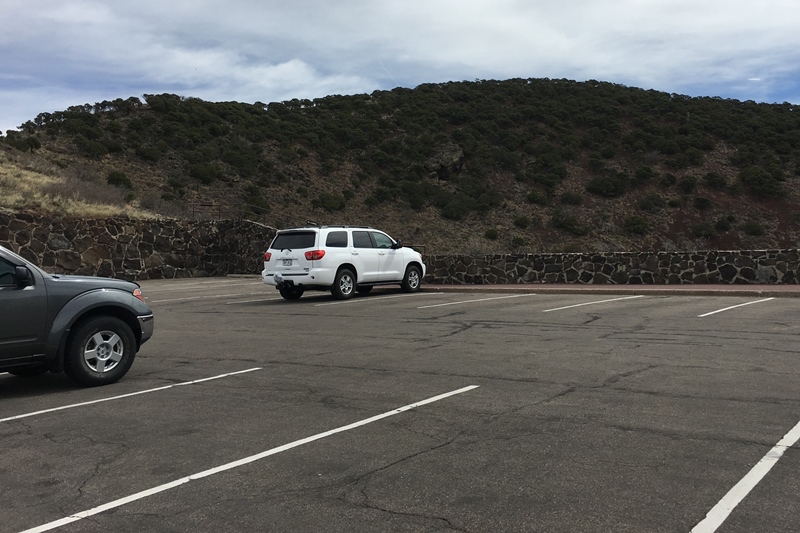
The national monument is easy to access, just a few miles from the highway. I have an annual national parks pass, so we did not have to pay an entrance fee. This satellite photo of the monument, shows the crater and the access road that winds around it. The parking area is visible on the west side of the crater (zoom in).
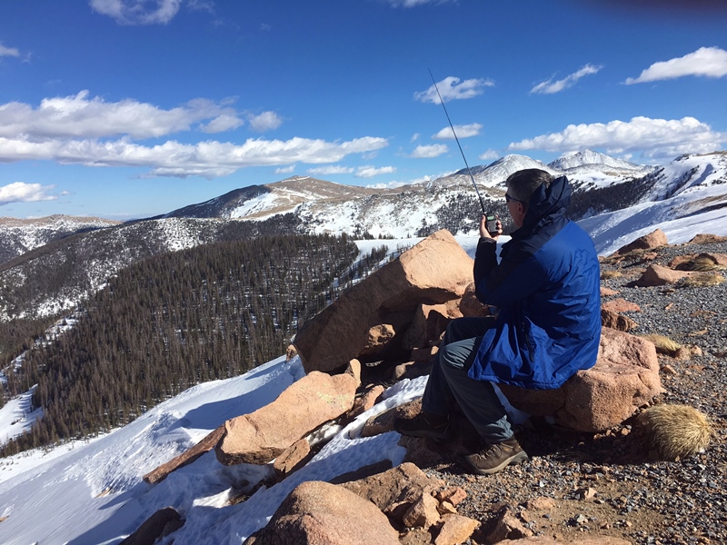
The parking lot is not within the SOTA activation zone, but an easy hike up the ridge got us to the summit. For VHF, I wanted to be as high as possible anyway with a 360-degree view. There is a trail that goes completely around the crater rim, also crossing the summit. It is a short hike on a paved trail, a bit steep in spots but nothing difficult. We did encounter some extremely annoying gnats that swarmed around us the entire time.
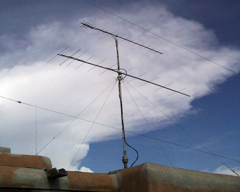
We got to the summit earlier than planned, around 17:30 UTC, started calling on 146.52 fm and 144.200 ssb without much luck. Finally, I caught WE7L in Elizabeth, CO (DM79) on 2m cw at 19:05 utc. He was weak but very readable. I think I was pointing the antenna a little too far east…later he came in stronger when I directed the antenna further west. After that I worked Arne N7KA (DM65) near Albuquerque and K9VSW (DM76) near Taos. Once I got my antenna zero’d in on K9VSW, I was able to work him on ssb. Some time later, I heard Lou K0RI calling from the Colorado Springs area. He was loud enough that I heard him off the side of the antenna, still pointed at Albuquerque. Lou was running 160w to a 17-element 2M5WL yagi at 75 feet.
| Time | Call | Band | Mode | Grid |
|---|---|---|---|---|
| 19:05z | WE7L | 144MHz | CW | DM79 |
| 19:10z | N7KA | 144MHz | CW | DM65 |
| 19:12z | K9VSW | 144MHz | CW | DM76 |
| 19:15z | K9VSW | 144MHz | SSB | DM76 |
| 19:53z | K0RI | 144MHz | SSB | DM78 |
I heard some other stations but was not able to work them. The challenge was quite clear: most VHF enthusiasts are running 150W or more of RF power, while I had the FT-817 max’d out at 5W. This is quite an imbalance, easier for me to hear them than they could hear me. Clearly, cw saved the day, punching through with minimal signal levels.
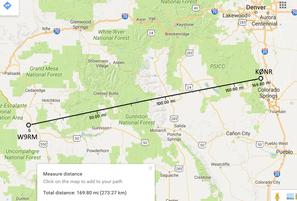
My best DX for the day was N7KA at 229 miles. Actually, this is an all time best distance for me on 2m while doing a SOTA activation. I recently worked W9RM from Mount Herman at 170 miles and was pretty happy with that. We had signal to spare that day, so I figured I could do better. Also, I had previously worked 160 miles using FM between two Colorado 14ers. See
Pikes Peak to Mt Sneffels – 160 Miles.
I really, really, really appreciate the hams that got on the air to try and work me on Capulin. I could not have activated the summit without those skilled radio operators and their capable VHF stations.
73, Bob K0NR
The post Capulin Mountain (W5N/SG-009) VHF SOTA appeared first on The KØNR Radio Site.
Winter SOTA on Monarch Ridge South
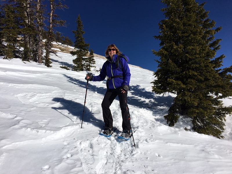
Joyce KØJJW and I were out for a little snowshoe activity near Monarch Pass in the San Isabel National Forest. Initially, we were headed to Old Monarch Pass when we noticed that the snow and weather conditions looked favorable on Monarch Ridge (also called Monarch Crest). Last winter, we tried snowshoeing Monarch Ridge twice, failing both times, once due to blizzard conditions that blew us off the summit.
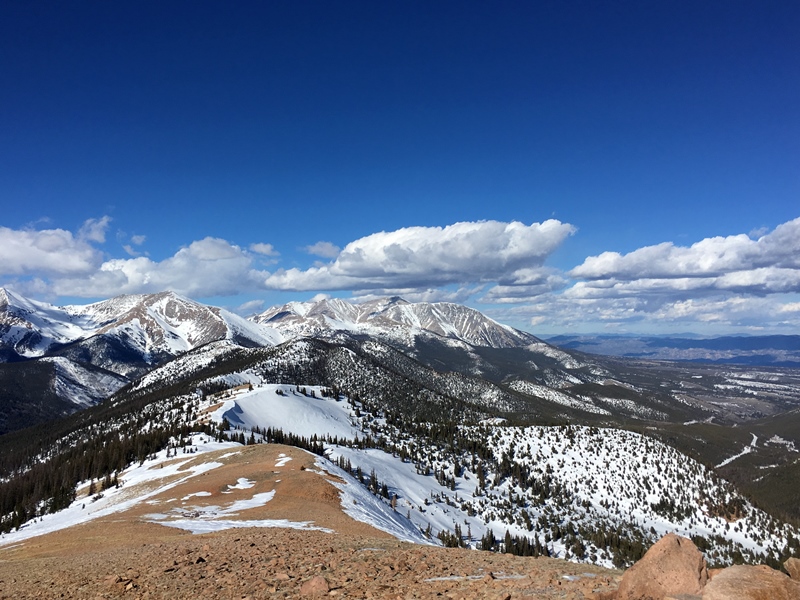
Monarch Ridge South (W0C/SP-058) is the high point and a Summits On The Air (SOTA) summit, so of course it was a great idea to showshoe up there. In August of 2016, we road to the top using the tram. Take a look at that posting for more information on the summit.
For SOTA, Monarch Crest South is a versatile and very accessible peak. The slacker method is to ride the tram up during the summer months. It also can be an easy summer hike. Monarch Pass is at 11,312 feet in elevation and Monarch Crest South rises to 11,898 so the vertical gain is about 600 feet. In winter, it is a reasonable snowshoe trip. However, watch the weather carefully: you might get blown off the summit.
We started from the Monarch Pass parking lot and snowshoed straight up to the summit, roughly following the tram line. This route is simple but steep. Near the top, the ground was bare, so we removed the snowshoes and hiked on bare ground and rocks. I did not have cellphone coverage at the parking lot but I did get “one bar” about halfway up the mountain. I used this to post a SOTAwatch alert and send an email notice to hams in the area.
Just like last time, I did have some minor interference on 2m fm from the radio site at the summit, which seemed to peak up right around 146.52 MHz. Lovely. But it did not keep me from making contacts.
As you can see from the photos, it was a gorgeous day. The temperature hung around 35 degrees F with some wind at the summit, so no problem with that. Another great day in the mountains, playing with ham radio.
73, Bob K0NR
The post Winter SOTA on Monarch Ridge South appeared first on The KØNR Radio Site.
2017 Mt Herman Winter Activation
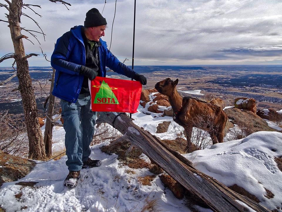
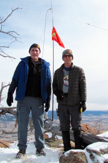
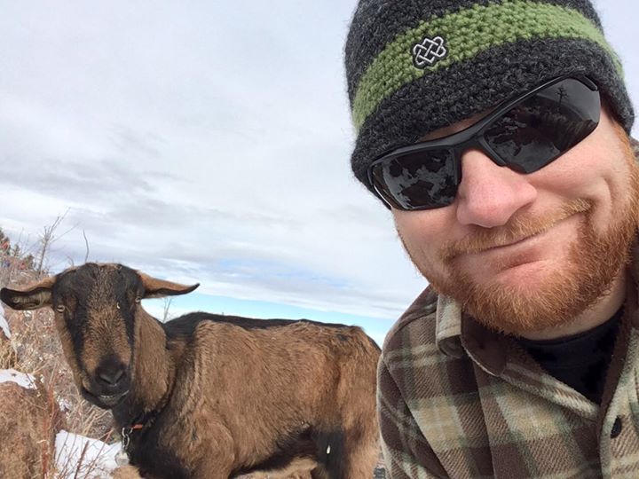
On Saturday, we returned to the Most Radio Active Mountain in Colorado, Mount Herman (W0C/FR-063), for a combination VHF contest, SOTA activation and winter hike. Our radio crew consisted of Steve/WGØAT, Caleb/W4XEN, Joyce/KØJJW and me. I’ve worked Steve forty times on various summits and often when he was activating Mount Herman, but this is the first time we did an activation together. What a treat be on the same summit as the Goathiker! Not only that, Peanut goat came along to supervise the entire operation.
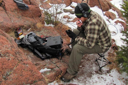
My objective for the day was to chalk up another VHF SOTA activation, while also making some Qs in the VHF contest. For most SOTA activations, I just focus on 2 meters. During a VHF contest, I bring more gear to cover the other bands. The main rig for SSB/CW was my FT-817 driving an Arrow II dualband yagi for 2m and 70 cm. For 6m, I used an inverted Vee dipole supported by a crappie pole. I also had two FT-1D handheld radios listening on 146.52 and 446.0 MHz.
I made 21 contacts on 6m, 2m and 70cm, with 7 grids/mults and a Single Operator Portable score of 164. Not that great of a contest score but it was only a few hours of operating. From a SOTA perspective, this is an attractive number of VHF QSOs in a relatively short time.
 Surprisingly, even during a VHF contest, most of the contacts were on FM with the usual SSB contest stations rather scarce. It was very handy to be able to use 146.52 MHz for the contest, finding a number of casual contesters on that frequency.
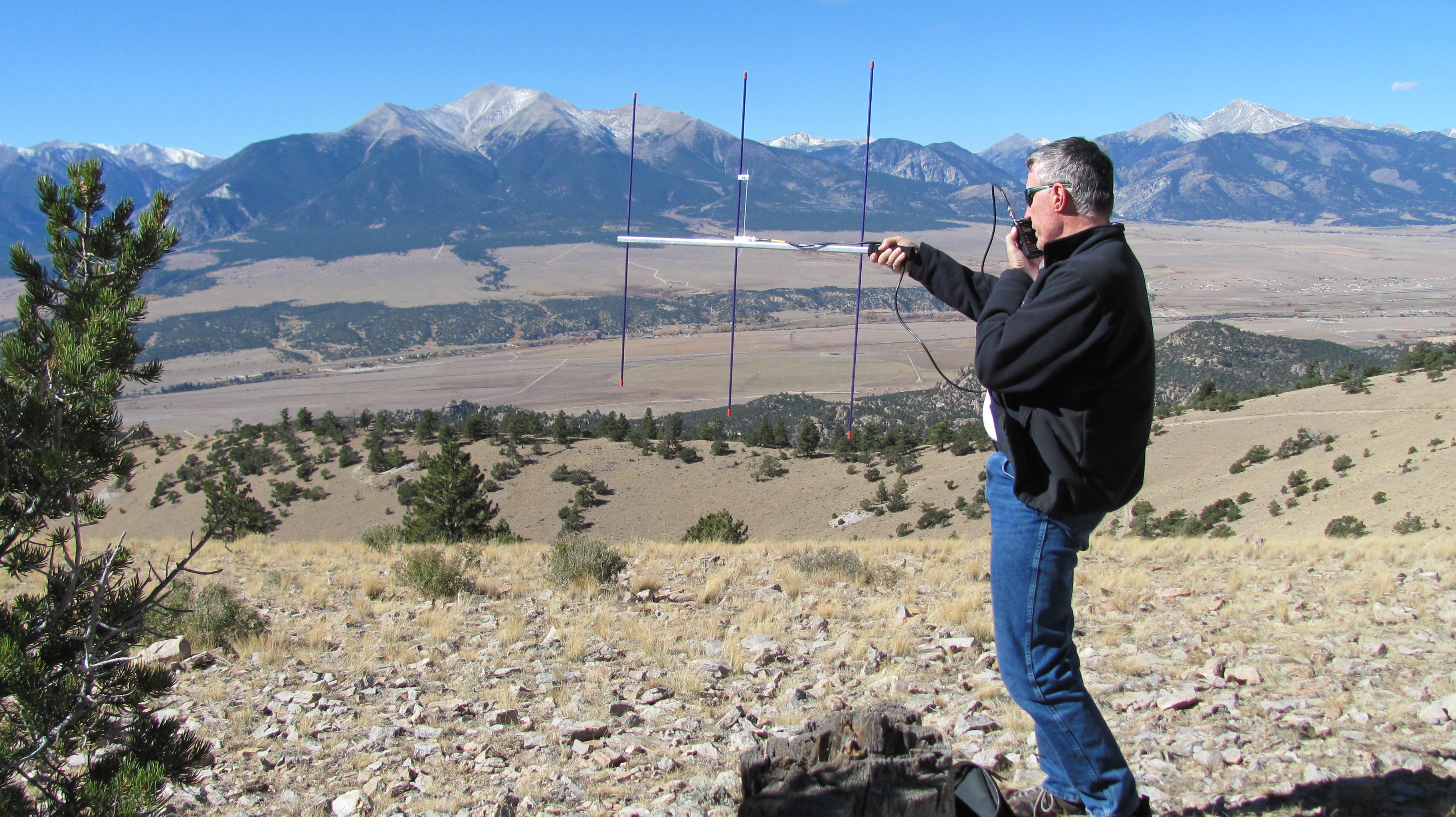
The high point of the day was working Jay W9RM on the other side of the state in DM58 using 2m CW on 144.210 MHz. The distance was about 170 miles on a path that went over or through several mountain ranges. Not too bad for QRP. (Oh, I guess it doesn’t hurt that W9RM has a serious weak-signal VHF station: 2M-5WL yagi at 50 feet.) This contact demonstrates the advantage of CW and SSB on 2 meters. Most VHF SOTA action is on FM due to the convenience of a 2m FM HT. But FM has poor weak-signal performance so much better range can be achieved with both CW and SSB. When is the last time you made a 170 mile QSO with an FM handheld?
This was the first SOTA activation for Caleb/W4XEN. Judging by the smile on his face, it won’t be his last one either. While I played on VHF, Steve did his usual thing on HF using CW, using a KX3 to drive an end-fed antenna. Caleb did a bit of both HF and VHF, managing to get a nice pile up going on 20m SSB. Joyce made a few contacts on 2m FM but mostly took pictures and occasionally tossed GORP in my direction.
On my last winter activation, my iPhone quit in the cold, so I did not want to rely on it for logging this time. I had a clipboard with my paper log on it, also holding the dual-paddle key. The key moved around a bit and my Morse code sending was sloppy. I don’t work a lot of CW for SOTA but it does come in handy at times, so I’ll be looking at improving my setup.
The 6m inverted Vee worked out OK but it was a little inconvenient to run the coaxial cable to the apex of the antenna. I’ll be looking to swap that antenna out for an end-fed half wave, which is so common on the HF bands for SOTA.
Steve brought along a large umbrella for use as an instant-up wind shelter. That looks like a practical way to block the wind.
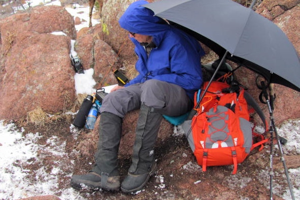
The weather was not great…we had a few patches of blue sky but it was mostly overcast and cold (probably 25 degrees F). We lasted about 2 hours before the cold started to take its toll, then we scooted on down the mountain.
Thanks to Joyce, Steve and Caleb for a great day playing radio in the mountains.
73, Bob KØNR
The post 2017 Mt Herman Winter Activation appeared first on The KØNR Radio Site.
2017 North America SOTA Events
 Here’s your handy list of North American Summits On The Air (SOTA) activities for 2017, as supplied by Guy N7UN:
- Jan 21-22rd: North America SOTA Winter Activity Weekend + ARRL Jan VHF Contest
- Apr 22-23: North America SOTA Spring Activity Weekend + QRPTTF Spring Event (Apr 22)
- Jun 10-11: North America SOTA Summer Activity Weekend + ARRL June VHF Contest
- Jul 15-16: SOTA optional date + CQ WW VHF Contest
- Aug 5-6: North America SOTA Rocky Mtn Rendezvous + Colorado 14er Event + W7 SOTA Activity Weekend + ARRL UHF (222MHz+) Contest
- Aug 21: SOTA and the Great American Total Solar Eclipse of 2017.
- Sept 9-10: North America SOTA Fall Activity Weekend + ARRL Sept VHF Contest
The post 2017 North America SOTA Events appeared first on The KØNR Radio Site.
SOTA Activation: Ormes Peak (W0C/FR-052)
I’ve been thinking about activating Ormes Peak (W0C/FR-052) for a while now. It is not too difficult to get to and is not a difficult climb. After the Waldo Canyon fire (2012), the area was closed for several years, so I needed to be patient. Then I noticed that Don KØDRJ put an alert on SOTAwatch indicating that he was going to activate the summit, so I gave a listen on 146.52 MHz. Sure enough, around mid-morning I heard Don on the frequency and worked him without any problem from my home location.
Then I got to thinking. Joyce KØJJW and I had talked about going for a walk this afternoon, so I did a little checking on Ormes Peak and concluded that it was an option. My fractured ankle is still on the mend so I am not back to 100% of my hiking ability. Ormes seemed like a good next step that would keep me progressing.
 We hopped in the Jeep and headed to Rampart Range. To get to Ormes Peak, take USFS road 300 from the north (which is what we did, via Mount Herman Road) or from the south via Garden of the Gods. You’ll want to have a Pike National Forest map for this trip.
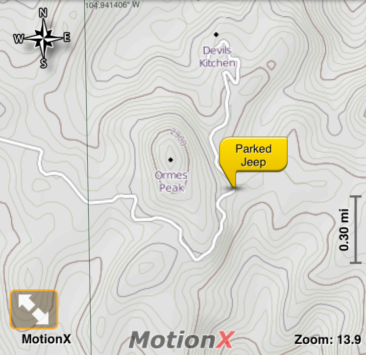 Turn East onto USFS road 303 and then follow USFS 302 (these roads are easy 4WD, probably OK for high clearance 2WD). These roads go through the Waldo burn area so you see what a burned forest looks like. Ormes Peak was not directly affected by the fire but we did see a few burned trees on the mountain. According to the Summit Post info, the best approach is from the south but we continued on around to the east and parked at the marked parking area here: 38.948680 deg N, 104.929677 deg W. From there, we bushwacked westward up the side of the hill without too much trouble (about half a mile and 600 feet vertical).
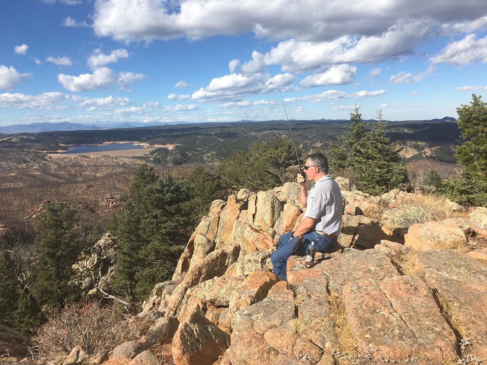
Once on top, I started calling on 146.52 MHz using the FT-1D handheld transceiver. I assembled my 2m yagi antenna hoping to work Brad WA6MM headed up Mt Antero but I found out later he did not summit. We had excellent visibility in all directions: great view of Pikes Peak to the south, Mt Yale and a sliver of Mt Princeton to the west and Mt Evans to the northwest. This really is a great spot to just sit and enjoy the view.
After making 7 contacts on 2m fm, we packed up the gear and headed down the mountain. Ormes Peak is a good “close in” summit accessible from Colorado Springs area.
73, Bob KØNR
The post SOTA Activation: Ormes Peak (W0C/FR-052) appeared first on The KØNR Radio Site.
SOTA Activation: Bald Mountain (W0C/SP-115)
On Saturday, I activated Bald Mountain (W0C/SP-115) for Summits On The Air. It was an awesome fall day here in the Rockies, so Joyce KØJJW and I were ready for some outdoor fun. When you say you are going to the summit of Bald Mountain, the usual response is “which Bald Mountain?” Fortunately, for SOTA purposes we can use the designator (W0C/SP-115) to drive out the ambiguity. Else, you have to deal with the fact there are 32 summits in Colorado known as Bald Mountain. And I am sure there are many more in other states.
SP-115 is a drive-up summit if you have a reasonable 4WD vehicle. For us, this meant taking the Jeep Wrangler to the top. (I am still recovering from a fractured ankle and just starting to hike a bit, so a drive-up opportunity sounded good to me.) Many maps do not show the road up Bald Mountain, so I included a portion of the latitude40smap.com map for the area (below). These recreational maps are excellent quality so I recommend you get one for exploring the area.
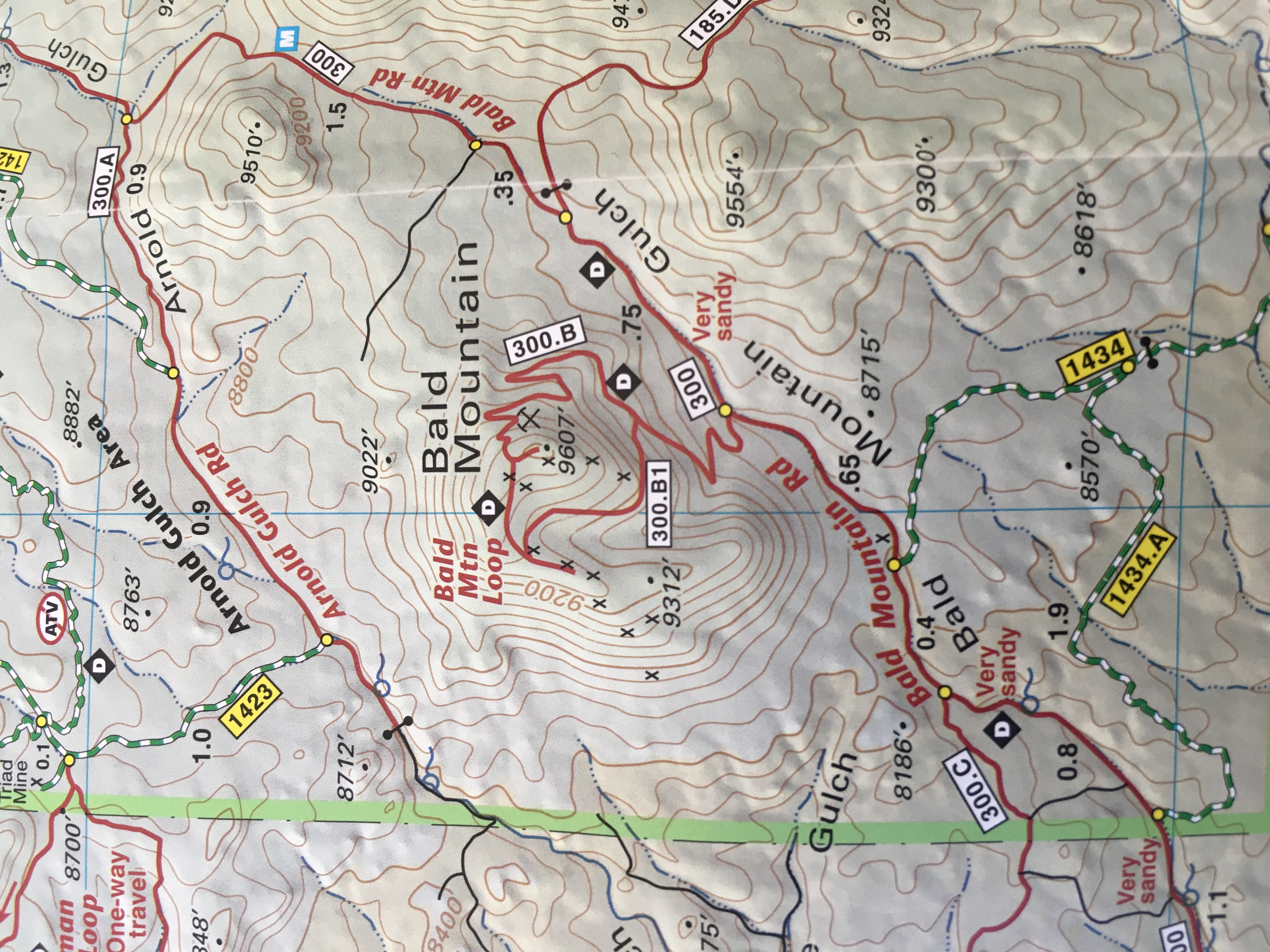
This summit is south of Buena Vista on Highway 285, which we exited at Fisherman’s Bridge, heading towards FS road 300. (Refer to the San Isabel National Forest or Latitude 40 map for details.) We followed FS 300 east which is easy 4WD. About 2 miles in, we took FS 300B (marked) to the north which winds its way up Bald Mountain.
At 0.6 miles from the intersection of 300 and 300B, an unmarked 4WD road leads off to the left and proceeds around the west side of the mountain. Taking this route provides a much easier path than the main route leading to the east side of the mountain. (We had taken the main route on our previous activation.) The preferred road does one big switchback out to the west and then returns east to the summit. This road is easy 4WD but is a bit narrow so a full size SUV or truck may have trouble. Of course, you can always hike to the summit…most likely just following the road.
 I got out my trusty Arrow 2m yagi antenna, connected it to the Yaesu FT-1D and started calling on 146.52 MHz. It took a while to get my four contacts but I kept at it. Actually, I worked five stations on 2m fm: KEØDMT, KDØMRC, K5UK, KAØABV and NØVXE. I was hoping to work WGØAT who was on the summit of Mount Herman, but I was unable to copy him. Thanks for the contacts! The summit has awesome views of the Collegiate Peaks to the west and it’s worth the trip just for the view.
73, Bob KØNR
The post SOTA Activation: Bald Mountain (W0C/SP-115) appeared first on The KØNR Radio Site.
NPOTA: Grand Teton, Yellowstone and Rocky Mountain
 To celebrate the 100th anniversary of the National Parks Service, the ARRL is sponsoring National Parks On The Air (NPOTA) during 2016. Joyce KØJJW and I happened to have a trip planned to visit several of the National Parks, so it was great opportunity to take along some radio gear and operate portable from the parks.
First stop was the Grand Teton National Park (NP23) in Wyoming. I operated from Signal Mountain, which is also a Summits On The Air (SOTA) peak. See my previous blog posting: SOTA plus NPOTA on Signal Mountain.
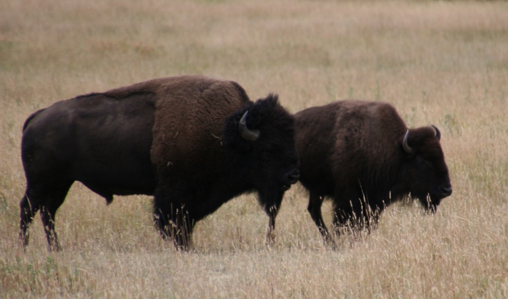
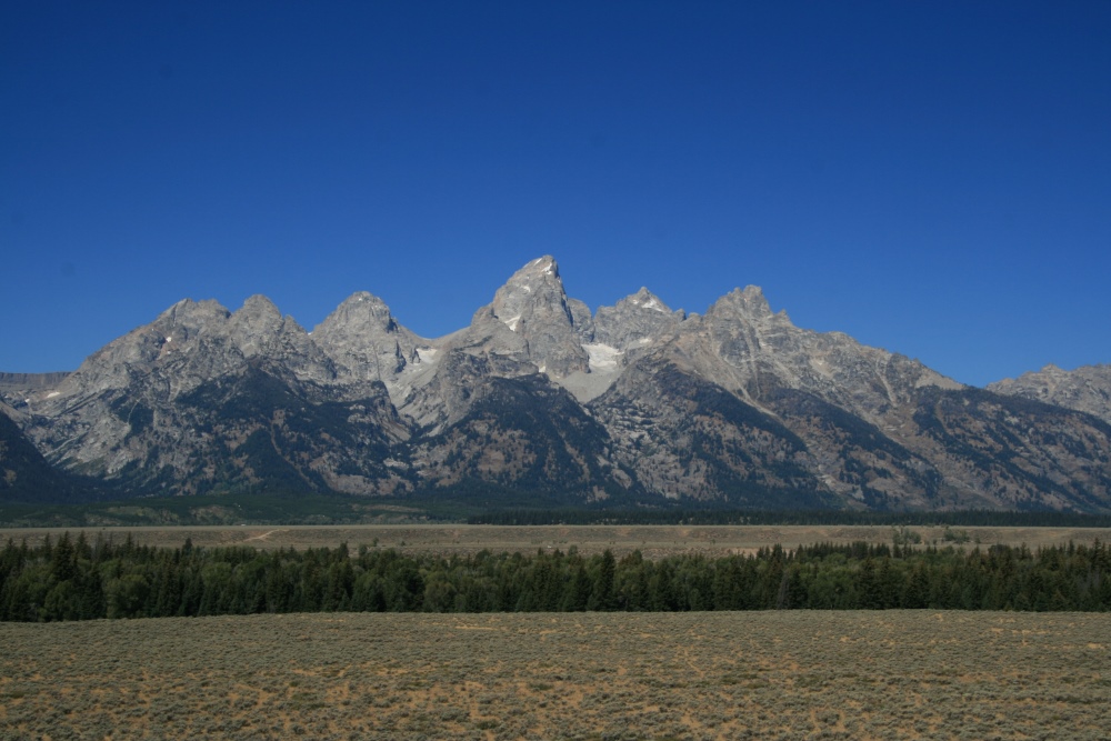
We continued on to Yellowstone NP (NP57), where we saw lots of wildlife: buffalo, elk, deer, bear and antelope. (Click on any of the photos to get a larger image.)
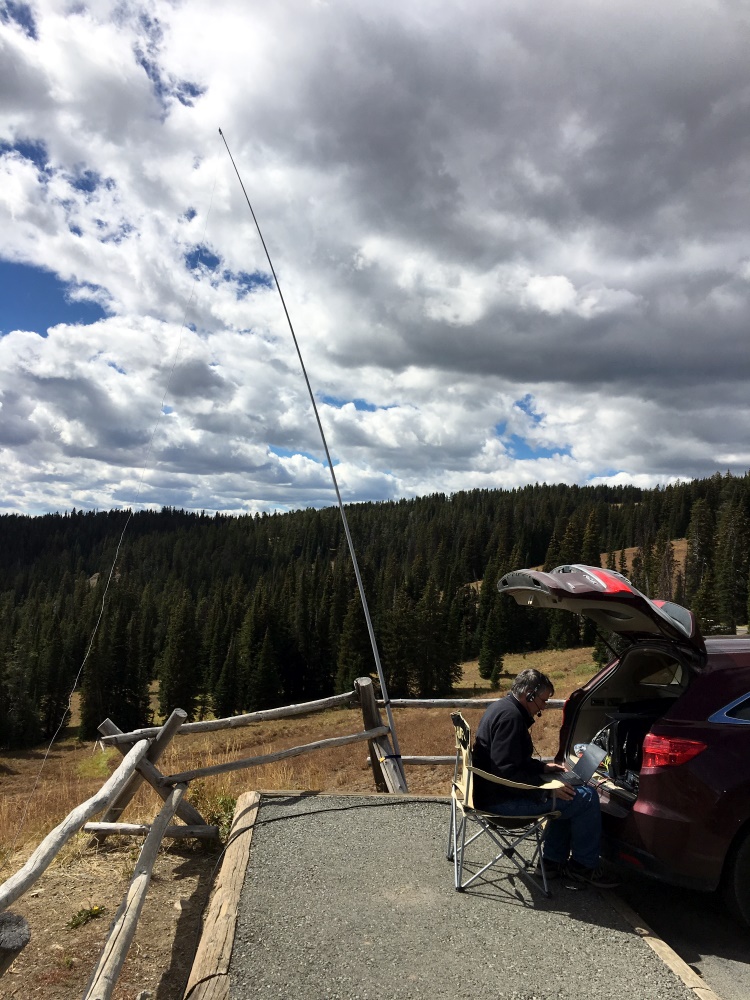
As described in the Signal Mountain post, my portable station was a Yaesu FT-991 driving an end-fed halfwave antenna on 20m. I used a SOTABEAMS pole to support the antenna, lashing the pole to whatever posts I found available. It was not too difficult to find a suitable parking spot close to mounting post. I was prepared to operate on other bands but 20m seemed to be the best choice based on current band conditions. I made 48 contacts on 20m ssb in about 30 minutes.
As we headed back home to Colorado, we visited Rocky Mountain National Park (NP48). We entered the park from the west side and crossed over to the east entrance via Trail Ridge Road. Love that drive! But first we stopped on the west side to do another NPOTA activation. Again, 20m phone was the operating mode and I made 33 contacts with stations across the US and Canada.
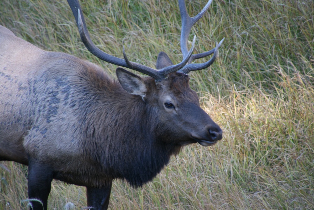
We took our time leaving the park around dusk so that we could spot some elk. The strategy paid off as we saw more than 20 elk in various locations.
Our top priority was enjoying the parks and viewing wildlife so we did not spend a huge amount of time doing NPOTA activations. Still, we activated three of our favorite National Parks, making 121 QSOs. We also worked in two SOTA activations on the trip as a bonus. All in all, it was a great trip with some fun ham radio activity included.
The SOTA and NPOTA logs have all been submitted (SOTA database and Logbook of The World, respectively.)
73, Bob K0NR
The post NPOTA: Grand Teton, Yellowstone and Rocky Mountain appeared first on The KØNR Radio Site.


