Posts Tagged ‘SOTA’
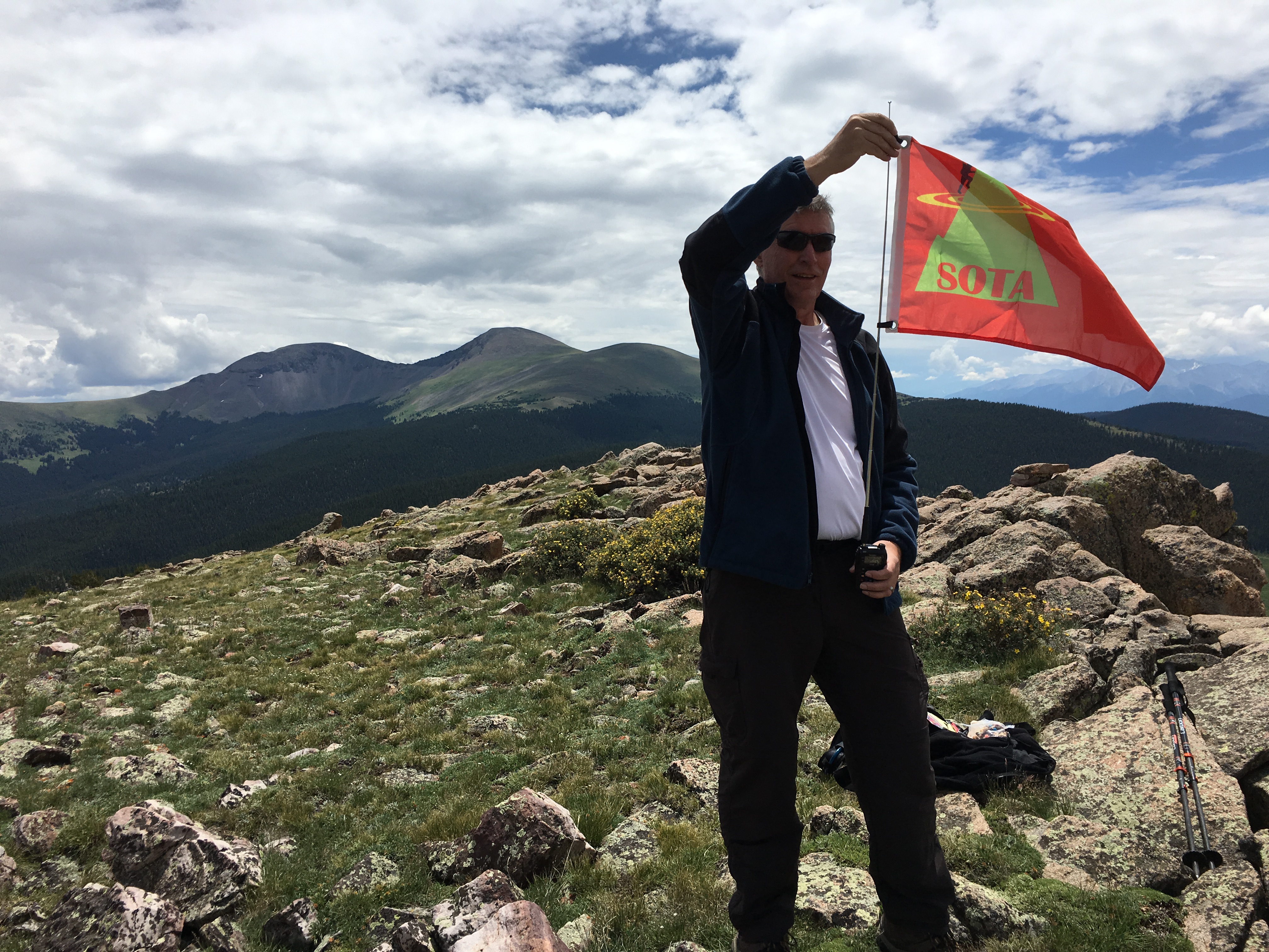
 SOTA Activation: North Kaufman Ridge (W0C/SP-085)
Kaufman Ridge is a ridge line that runs along the border of Park and Chaffee Counties in Colorado, near Trout Creek Pass. There are two Summits On The Air (SOTA) summits on this ridge: Kaufman Ridge (W0C/SP-081), formerly Kaufman Ridge HP, and North Kaufman Ridge (W0C/SP-085), formerly Kaufman Ridge North. I have activated these summits before including a winter activation of North Kaufman Ridge. These summits have turned out to be popular SOTA activations because they are easy to access, easy to hike and have outstanding views of the surrounding area.
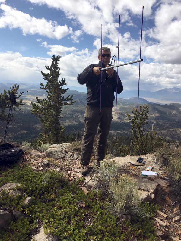
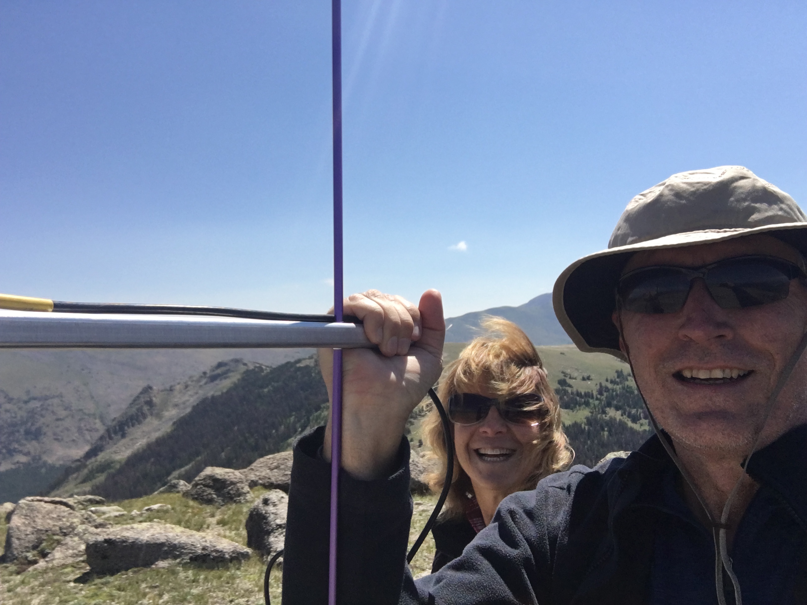
Joyce/K0JJW and I decided to do a SOTA activation on a pleasant September day. On previous trips, we approached the summit from the east without much thought to the route. This time we approached from the north, based on a tip from other SOTA activators. This route is a little bit longer than coming from the east but it turned out to have fewer steep spots and less downed timber to navigate.
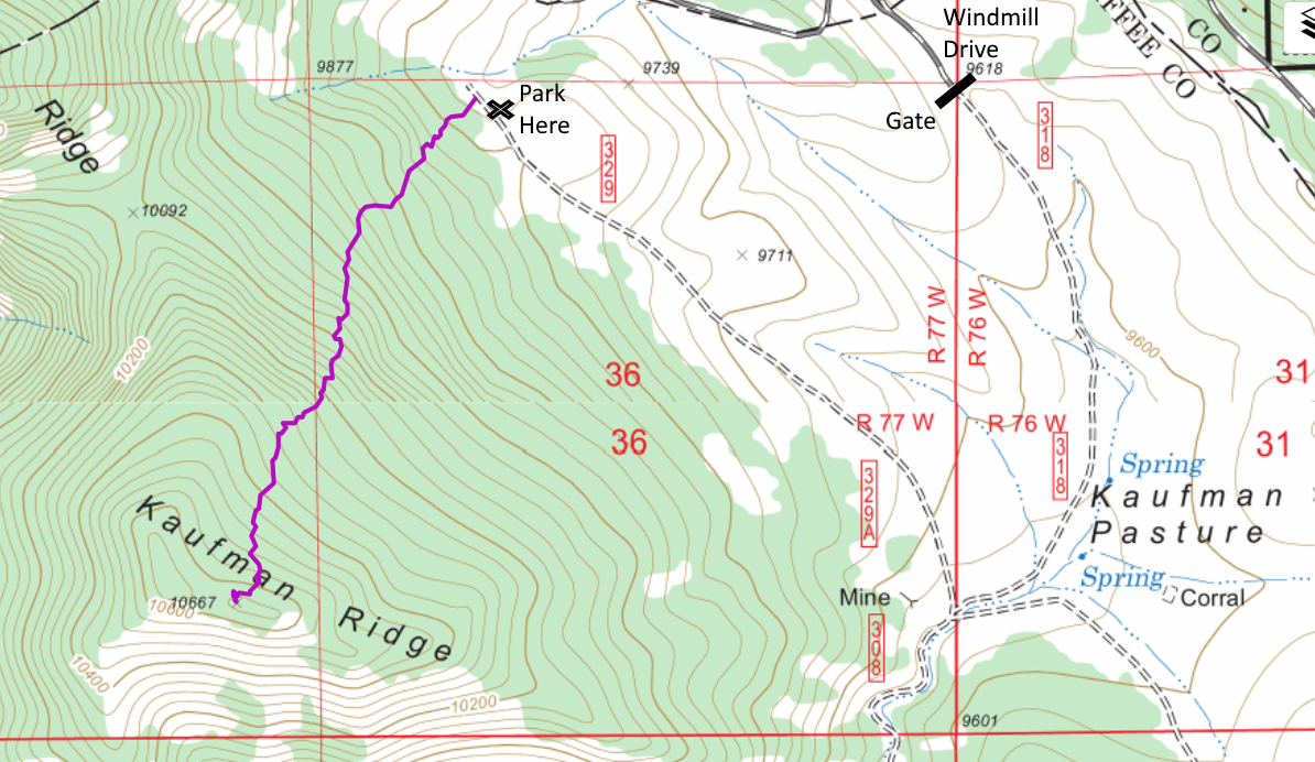
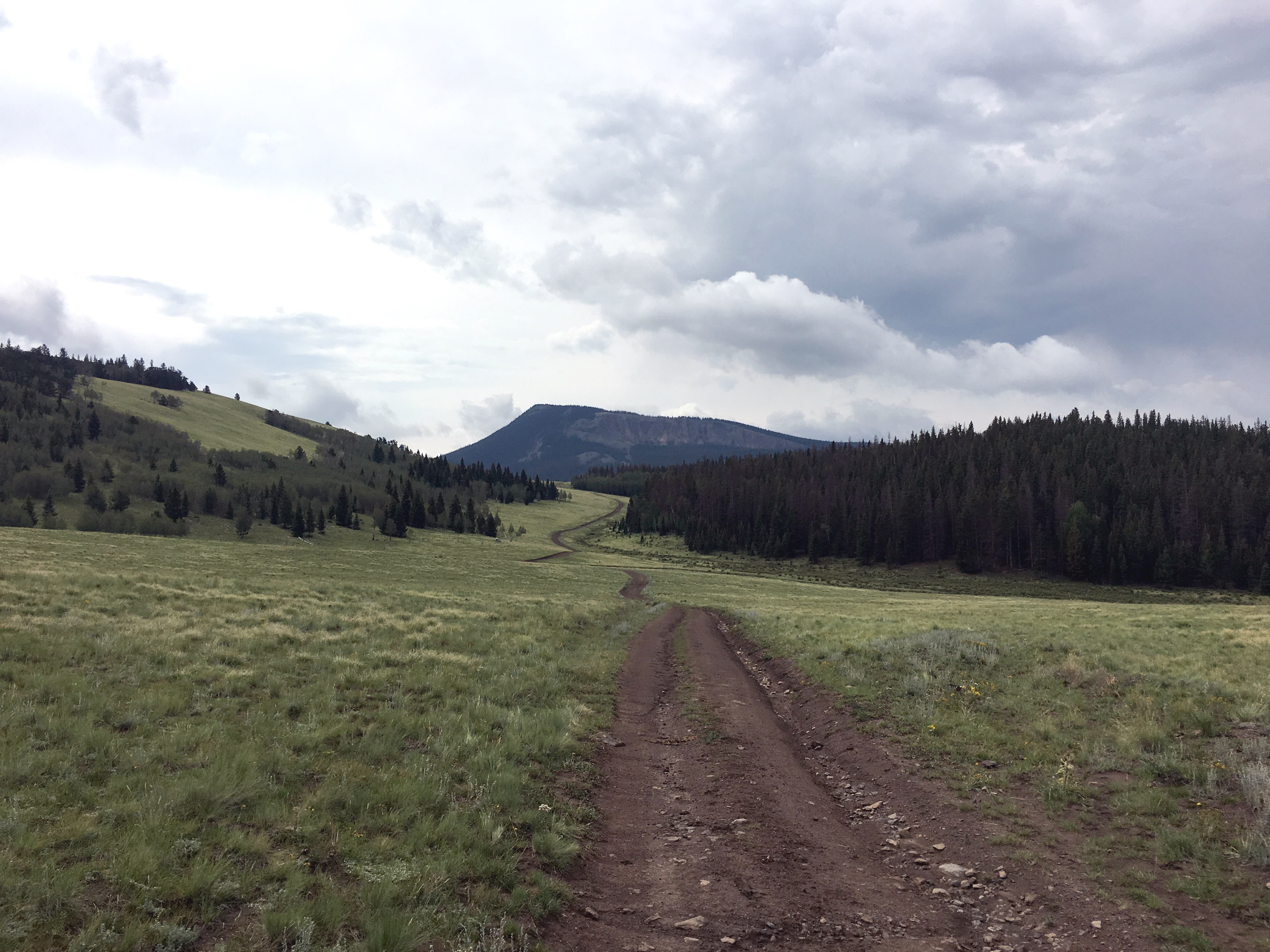
To get to the start of the hike, we went south on Windmill Drive to FS 318, entering the San Isabel National Forest. There is a gate at the entrance to the forest that is closed from December to April. We turned right onto FS329, which may not be marked but is an obvious 4WD road heading to the north. We drove to the end of the road and parked near the National Forest boundary. These are really easy 4WD roads such that a high-clearance 2WD vehicle should have no problem.
At this point, we aimed straight at the summit and started hiking. We found only bits and pieces of a trail here and there. Someone has attempted to mark the trail in places but it was difficult to follow. No worries though as the route was relatively smooth without many obstacles such as rock formations and difficult downed timber. We had to do some minor route finding but just looking ahead for obstacles was sufficient. The one-way distance was 1.1 miles with a vertical gain of 800 feet.
On top, we both snagged plenty of radio contacts on VHF/UHF and enjoyed the excellent views in all directions. This made for a nice SOTA activation on a sunny fall day!
73, Bob K0NR
The post SOTA Activation: North Kaufman Ridge (W0C/SP-085) appeared first on The KØNR Radio Site.
Mount White: Easy SOTA With A Jeep
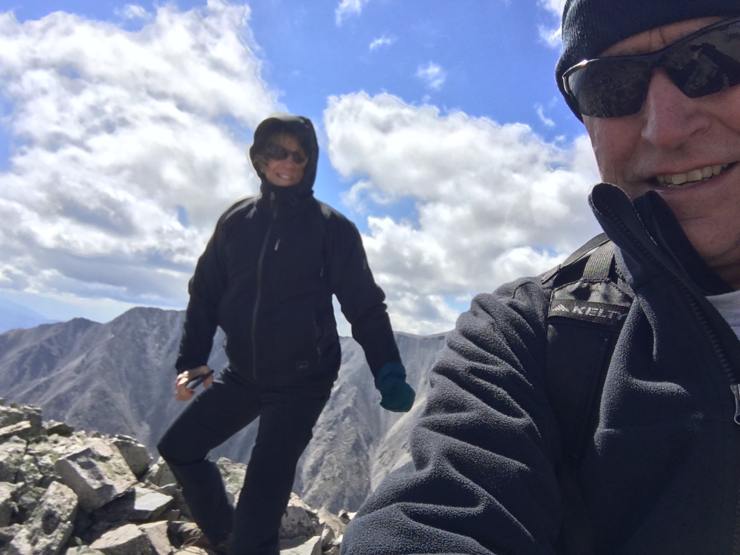
Mount White (W0C/SR-021) is 13,667 feet in elevation, just south of its big brother Mount Antero (W0C/SR-003) at 14,269 feet. Joyce/K0JJW and I activated this summit on SOTA using VHF/UHF. There had only been 4 activations of Mount White, which is a bit surprising. It is not that difficult to get to…if you have a decent 4WD vehicle. We have a stock Jeep Wrangler that handled the road just fine, but I would suspect that a AWD crossover (e.g., Subaru) or similar would not be adequate. We saw a number of hikers on the road (probably headed to Antero), so that is always another option.
The Mount White / Mount Antero area is covered with mining claims and old mining roads. This may degrade the hiking experience but does provide some decent 4WD roads to access the area. The Summitpost.org posting on Mount White has some interesting geological information about Mount White and Mount Antero. There are two summits on Mount White and Summitpost says the actual summit of Mount White is the eastern one. However, the SOTA database indicates the western one. Some other maps also indicate Mount White as the summit to the east but I believe the SOTA information is correct. I guess for SOTA purposes, it is correct, by definition.
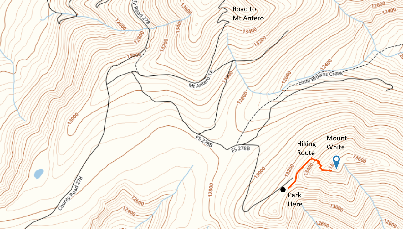
A San Isabel National Forest map is very helpful for figuring out access to this summit. Basically, you head west on County Road 162 towards Mount Princeton Hot Springs. Eventually, you’ll get to FS 277 which is a moderate 4WD road marked as the road to Mount Antero. Take a left turn onto FS 278 and follow that uphill to eventually take a left turn onto FS 278A. Stay on 278A for a very short time, then take a right onto FS 278B which takes you to the saddle below Mount White. (See map below.) This route does require good vehicle ground clearance. There are two stream crossings and many tight switchbacks. All in all, it was an easy-peasy fun trip with our stock Jeep Wrangler.
The hiking route is not difficult: 0.35 Miles one way and 450 feet vertical. But you are above 13k feet, so expect the oxygen to be thin. We started out by following a road along the north side of the peak, then scrambled up the talus to the summit. There are bits of pieces of “trail” but we did not find an established hiking route. The day we were there in September it was extremely windy so we did not stay long.
Mount Antero is close by so you could do both summits on the same trip, assuming the weather cooperates.
73, Bob K0NR
The post Mount White: Easy SOTA With A Jeep appeared first on The KØNR Radio Site.
A few SOTA’s
Over the last few weeks our domestic life has been a bit different to what it used to be. A change in how we work as a family has happened and it meant a hold on radio, or rather a less than active summer is the result.
I have one the other hand spent more time away from work than normal which meant that I didn’t have to chance the normally predictable weather in Cumbria at just the weekend if I was going /p. I am fortunate to live within 30 minutes of both the Ennerdale and Wasdale valley’s. If you know where they are you might also know that the meet between Pillar and Great Gable with Ennerdale being further inland to Wasdales long views out to sea. I’ve been to Ennerdale quite a bit so Wasdale it was for this couple of trips.
Operating in the he lakes gives up a few challenges. The harshest being the number of people that visit the 8+ point summits. One solution is to stay off the beaten track, the other is to go early. Combine the 2 on a sunny day and you’ve got English summer nirvana.
First up, Pillar and Kirk Fell – Wasdale head pub to Pillar via Mosedale and a short trot along to Kirk fell then down the front face of Kirk Fell. To get this view climb straight up the Mosedale scree slope (beware it is hard work). The view is worth it. Looking towards Scafell you can almost see the small tent I passed on the way up. Needless to say some geology buff will tell you different but it looks to me like a glacier made this shape.

The next shot is from Kirk Fell. Showing the sea off in the distance and Burnmoor tarn on the left, Wastwater (the chilly-est lake ever) with Illgill head in between the two. Kirk fell is a good summit to SOTA, its very accessible but if you go up the front be prepared for some heavy going.

Great Gable was attacked another day and the weather came in so it was a short activation. Another popular summit and at 8 points it is worth it. I like the route up to Styhead tarn the turn left. You get a good view of the unspoiled wilderness that is the route to Scafell Pike from Borrowdale. I’m sure the path would accept either 10 people abreast or a land rover. Its like a motorway.
The last trip was another early morning ascent, this time Scafell Pike. The quick route from Wasdale head car park during the summer is punctuated by knackered looking ‘3 peakers’. Some who look like they haven’t spent a lot of time preparing for what they were doing. Or, over-preparing in the pub. This was the first time I’ve been up and down without being in the cloud. This is not a quiet summit, even at 7:30am.

Whilst the blog may have been quiet over the summer I did manage to get 8 points for Pillar, 8 for Kirk Fell, 8 for Great Gable and 10 for Scafell Pike. If I carry this on for the next 25 years I could be part way to being a mountain goat.
Smoky Mountain Summits On The Air
Joyce/K0JJW and I were getting prepared for a trip to Gatlinburg, TN in August with some of her family. Gatlinburg is the gateway town to the Great Smoky Mountains National Park and the surrounding area. I had hiked and camped in the Smokies years ago and this was a great opportunity to visit that area again. Of course, we needed to get in a little Summits On The Air (SOTA) action during this trip.
We decided to pick out some easy-to-access summits in the area so we could weave them into the trip without too much disruption. My first step was to consult the SOTA database for potential summits in Tennessee and North Carolina, looking at the summits with the most activations. This is usually a good indication of easy access and not too difficult of a climb. I did pick out two iconic summits to activate: Clingmans Dome (this highest summit in the national park) and Mount Mitchell (the highest summit east of the Mississippi river in the US). After checking the various trip reports logged on the SOTA web site, I created a list of potential target summits. Clingmans Dome and Mount Mitchell were Must Do but any other summits would be more opportunistic based on available time and location.
We are using VHF/UHF for SOTA activations and opted for a basic FM station for this trip: a pair of Yaesu FT-1D handhelds, a couple of vertical antennas and a 3-element Arrow yagi antenna for 2 meters. I debated about whether to bring along the yagi but the split-boom design fits into my luggage without any problem. In the end, I am glad we had the yagi as several of the contacts would have been missed without it.
Greentop
Greentop (W4T/SU-076) was our first summit…basically a driveup mountain with radio towers and a lookout tower on top. I noticed quite a bit of interference on the 2 meter band, something I’ve encountered in previous activations near transmitter sites. It turns out that putting a more effective antenna on an HT (such as a half-wave vertical) couples more of the interference into the receiver and degrades its performance. On the other hand, the standard rubber duck antenna picks up less of the interference and performs better then the “good” antenna. After I realized this was happening, I tried using two HTs with reasonable results: one radio with a rubber duck was used for receive on 146.52 MHz while another radio with a half-wave antenna was used for transmitting. The net result was reasonable performance that allowed us to make contacts on 2m fm.
Clingmans Dome
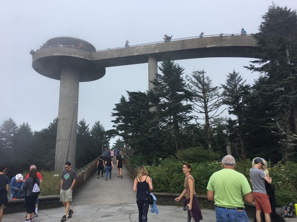
Clingmans Dome (W4C/WM-001) is a popular tourist spot in the Great Smoky Mountain National Park. Parking is a challenge and there are quite a few people on the short trail to the summit.
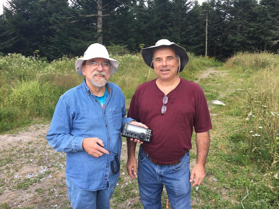
Although it sits right on the border of Tennessee and North Carolina, it is in the W4C (Carolinas) Association for SOTA purposes. As I approached the summit, I saw a fishing pole sticking up in the air. I thought “huh, I wonder what the rangers are demonstrating today.” Followed by “Hey, wait a minute, that looks like a SOTA activation.” Sure enough, I met W2SE and WI2W setting up on 20m CW. Joyce and I headed to the observation tower and worked 2m from up there. There were quite a few people on the observation tower so I considered just operating from down below. I decided to leave the yagi in the backpack and just use the half-wave vertical. We fit right in with the chaos of tourists on the tower.
Mount Mitchell
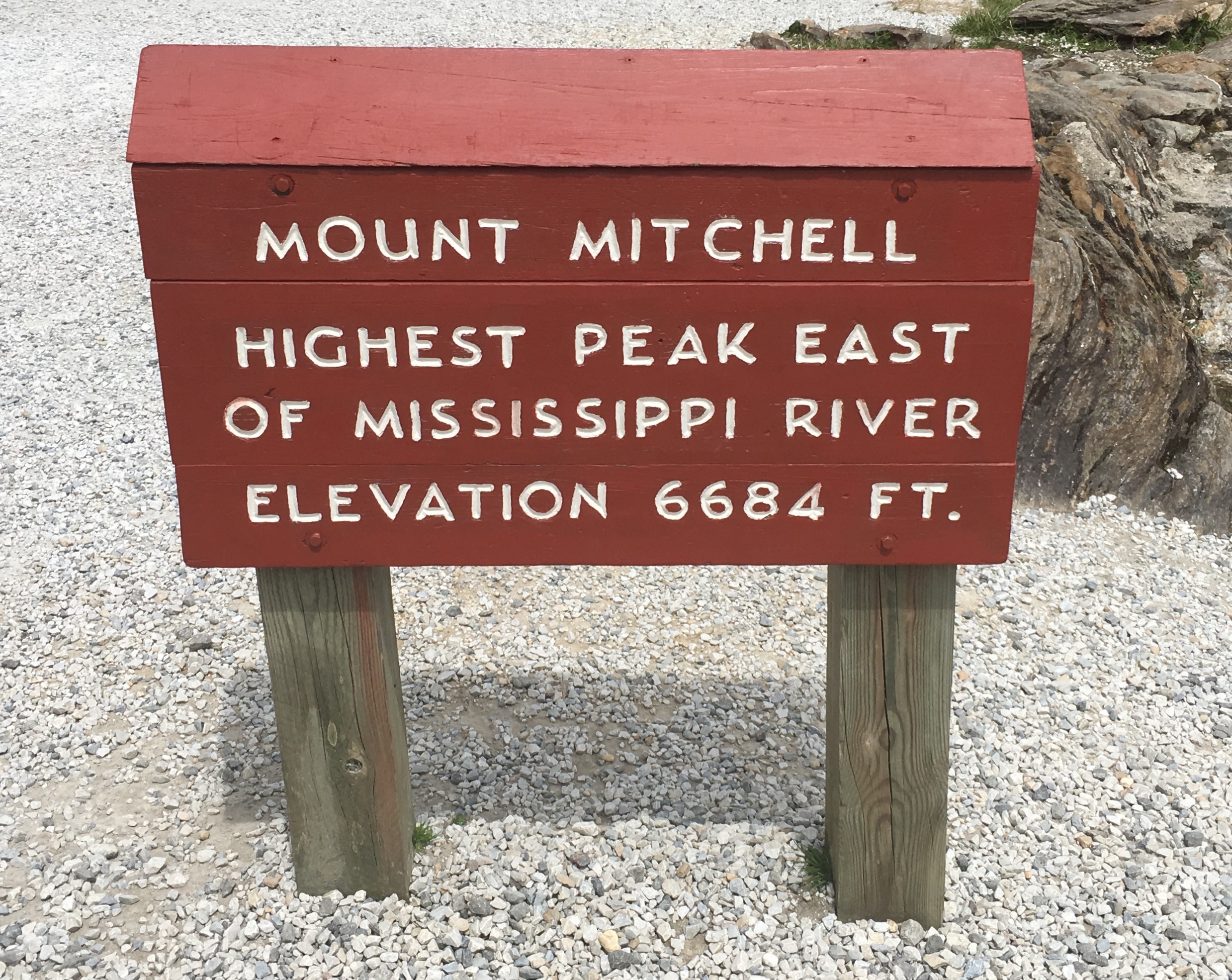
At 6684 feet in elevation, Mount Mitchell (W4C/CM-001) is the highest point in the USA east of Mississippi River. (Interesting perspective: our house in Colorado is 800 feet higher than this summit.) We started with just the 2m vertical but switched to using the yagi when we had trouble copying a few stations. It definitely made a difference…probably 6 dB or so. When signals are near the FM threshold, this can pull them out of the noise.
One of the highlights on Mitchell was working Kevin/K4KPK on Walnut Mountain, summit to summit. Kevin is very active in SOTA and has contributed many SOTA summit guides in the area. I made good use of these reports when planning our trip.
Richland Balsam and Waterrock Knob
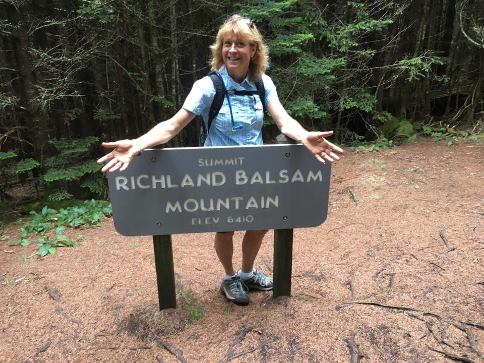
We discovered a number of summits right along the Blue Ridge Parkway and we ended up working these two: Richland Balsam (W4C/WM-003) and Waterrock Knob (W4C/WM-004). Another flashback for us was driving sections of the parkway, which is a lovely drive (typically 45 MPH speed limit) that winds through the mountains. It has been years since we’ve been on that road. This route is something I’d like to explore further on a future trip as you could spend a week wandering along the parkway and knocking out summits.
We worked Pat/KI4SVM on 2m fm from Watterock. I recognized his callsign from the trip reports he has submitted to the SOTA web site. Later, I looked up his SOTA score and found that he is a double Mountain Goat (> 2000 activation points) and the highest scoring activator in the W4C association.
Brasstown Bald
The Mountain Explorer Award is a SOTA award for activating in different SOTA Associations (regions). Activating in Tennessee (W4T association) and North Carolina (W4C association) got my total to 6. Joyce pointed out that we might be able to also hit Georgia on the trip, so we added Brasstown Bald (W4G/NG-001) to the list. This is the highest summit in Georgia, so it rounded out our collection of state high spots for TN, NC and GA.
Brasstown Bald is an easy hike up summit with a significant observation tower on top, including a visitors center. This is another location where we experienced interference from radio gear on the summit, so we chose our position carefully and used the 2m yagi to point away from the interference sources.
This trip worked out really well. We managed to activate 6 summits for a total of 58 points, operate from three new SOTA associations (W4T, W4C and W4G), enjoy some really nice hikes and see some great scenery. I was a little concerned whether we would find enough random activity on 2m fm for our SOTA activations but it all worked out. Actually, there were a few times that 146.52 MHz was busy and we had to standby to make a call. Some of our contacts were less than 25 miles but many covered 100 miles or more. Yes, the 3-element yagi made a difference.
If you are in the Gatlinburg area, it certainly makes sense to try a few SOTA activations. I am also thinking about a return trip to enjoy the area more fully including some longer hikes. We really liked hiking the trails and summits there. The elevation is lower than Colorado (read: you have oxygen to breath), the forests have lots of deciduous trees (not just evergreens) and the trails are less rocky. I am sure we will be back.
73, Bob K0NR
The post Smoky Mountain Summits On The Air appeared first on The KØNR Radio Site.
SOTA Activation: Mount Peck (W0C/SP-053)
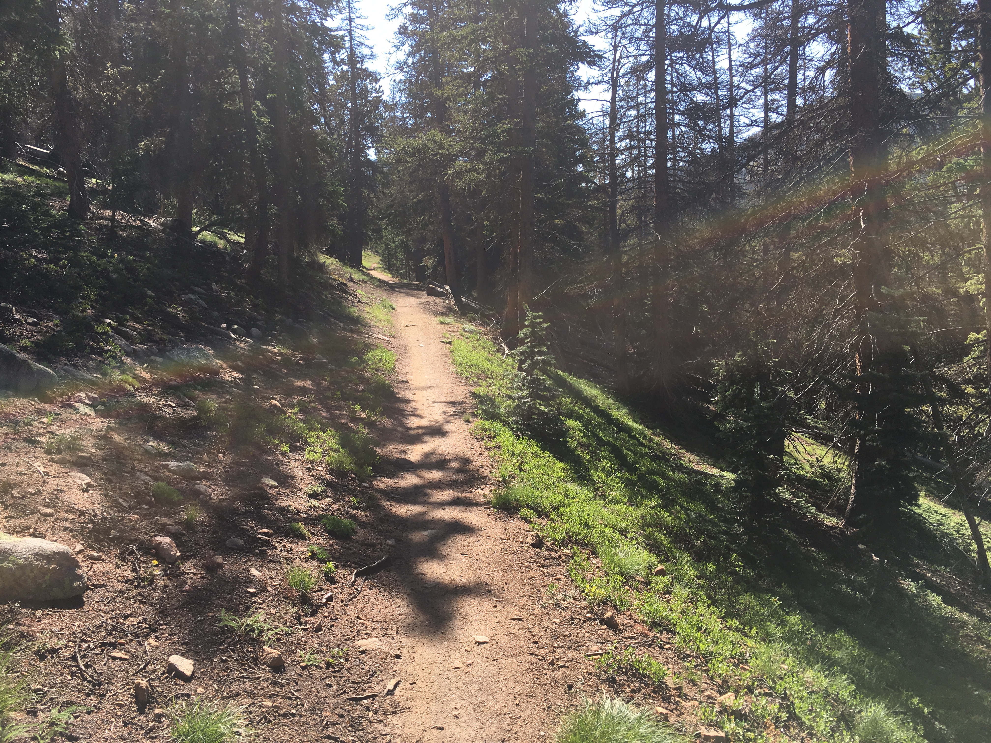
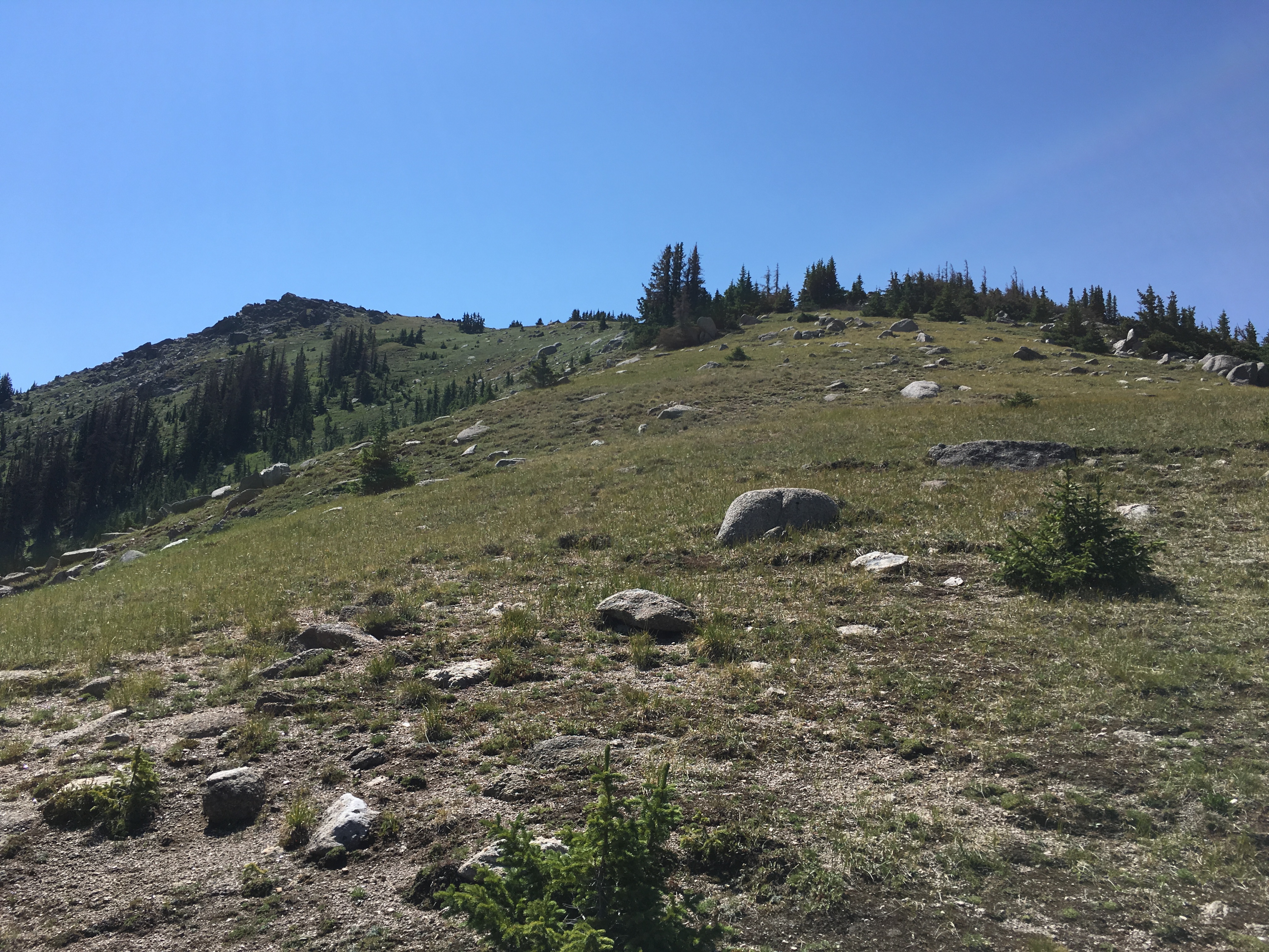
Mount Peck (W0C/SP-053) is a 12,208 foot summit near Monarch Pass, accessible via a 2.5 mile hike with ~900 feet of elevation gain. This is one of the most pleasant Summits On The Air (SOTA) peaks along the Continental Divide. For most of the route, you are hiking on the Continental Divide Trail (CDT), with outstanding views in all directions. It is always a treat to hike on the CDT, which is like walking on top of the world.
The hike starts at the parking lot at Monarch Pass. (I’ve adapted these directions from Walt W0CP’s notes on the SOTA website.) Take the marked trail that goes behind the building of the Monarch Crest Scenic Tram. Proceed on this trail (really a road at this point) until the CDT exits off to the right (follow it). This section of the CDT is a popular mountain bike trail, so you may encounter bikers on the route. In fact, dirt bikes are also allowed…we encountered a few of them, too.
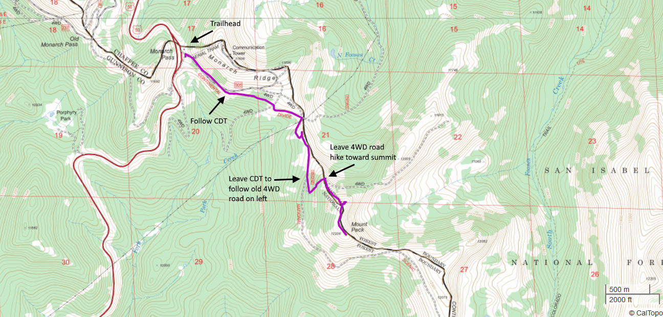
Stay on the CDT until you see an old 4WD road heading off to the left. Leave the CDT at this point and follow the road uphill. When the road crests and before it starts to go back downhill, leave the road and hike off-trail towards the summit. This is the steepest section of the hike where you gain the most elevation. Don’t forget to stop and enjoy the view. (My spouse started singing songs from The Sound of Music at this point.)

Often hiking on old 4WD roads can seem just like that: hiking on a road and not very enjoyable. This route is not that way…it is actually quite pleasant as the “road” is not rocky or rutted and just seems like an extra-wide trail.
We had great weather on the summit and managed to work a number of stations on 2m fm (Yaesu FT-1D driving a 3-element Arrow yagi antenna). This is a hike that we want to repeat in the future.
Another SOTA summit, South Monarch Ridge (W0C/SP-058) is nearby and it is possible to do both of these summits in the same day.
73, Bob K0NR
The post SOTA Activation: Mount Peck (W0C/SP-053) appeared first on The KØNR Radio Site.
Another Black Mountain SOTA (W0C/FR-031)
There are (at least) 20 different summits named “Black Mountain” just in the state of Colorado. I’m sure there are many more nationwide. It seems to be a popular, if unimaginative, name. This is why we have a numbering system for Summits On The Air, else we would forever be talking about “which Black Mountain was that anyway?” Or Deer Peak or Sheep Mountain or …
On Thursday, Joyce K0JJW and I activated another Black Mountain, this one with Summits On The Air (SOTA) designator: W0C/FR-031. I’m not sure why it has an FR or Front Range designation, as the summit is actually in the South Park region of the state. I can tell you that it is an awesome summit with great views.
To get to Black Mountain, take Highway 9 south out of Hartsel, CO (or come north on Highway 9 from the south). The Pike National Forest map is very helpful with getting into the vicinity of the mountain. Turn west on FS 108. (This is the same road that leads to Dicks Peak W0C/FR-041.) This road has a sign that indicated “Dicks Peak” and “Black Mountain”. Follow FS 108 S/SW and then take FS 107 to the south (right turn). Follow FS 107 to FS 268, then follow FS 268. About this time, you should have an excellent view of Black Mountain to the south. The roads were muddy and rutted, definitely 4WD. Our Jeep Wrangler had no problem but a AWD crossover/Subaru may be challenged to get through.
Black Mountain has a steep vertical rock face to the north, which is very visible. At this point, we wondered if we signed up for a difficult climb…but not so. FS 268 turns west, kind of parallel to Black Mountain, then heads away from it. At this point, we wondered if we were on the wrong road. Not so. At this point, the Pike National Forest map failed us…it seems to be incomplete in this area. Instead we used the gaiagps.com app on my smartphone which had a representation of the terrain and roads. As we headed west on FS 268 we saw a road heading off to the south. (I don’t recall if it is marked, but see map below.) Take this road south for about one and a half miles…looking for an unmarked road heading off to the east. The intersection with this road is easy to miss as it is not that distinct. But the road is very visible heading off to the east, so you’ll probably spot it later if you miss the turn and can circle back.
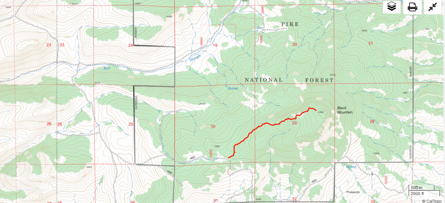
We took the unmarked road east until it deadended at a camping spot. We parked there and started the climb up to the summit. There are only random bits of a trail here and there, so we mostly just followed the GPS towards the summit. The route is forested with some downed timber but not difficult to navigate. The steep north side of Black Mountain provided some nice views. The hike is about 1.5 miles and 1000 feet vertical.
On top, we worked stations on 2m and 70cm fm without much trouble. It is an excellent VHF/UHF site and we found a number of locals hanging out on 146.52 MHz. We reversed our route on the way down and drove the Jeep out.
W0C/FR-222
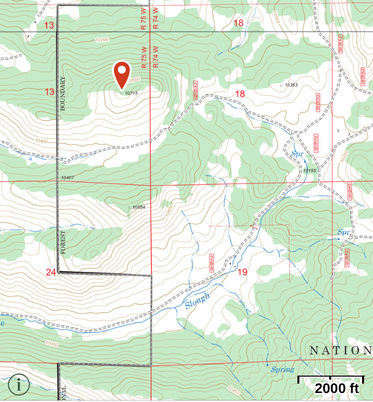
Steve WG0AT suggested that we could do an nearby unnamed peak (W0C/FR-222) on the same day. This is an excellent idea and we did just that. We headed back north and took FS 269 west, parking just south of FR-222. FR-222 is not shown on the Pike National Forest map but the Gaiagps.com app and other maps show it. The summit is easily seen from the road and a short hike gets you to the top (about 1/3 mile and 500 vertical feet).
73, Bob K0NR
The post Another Black Mountain SOTA (W0C/FR-031) appeared first on The KØNR Radio Site.
First SOTA Activation for W0C/SP-055
For several years, I’ve had my eye on an unnamed summit (12132) in the Buffalo Peaks Wilderness Area (W0C/SP-055). No one had activated it for Summits On The Air (SOTA) probably because the summit is somewhat remote. I originally thought I would have to do many miles of bushwhacking from the north to get to get to the top. After studying a few maps and trail descriptions, I eventually found a route from the east that is not too difficult.
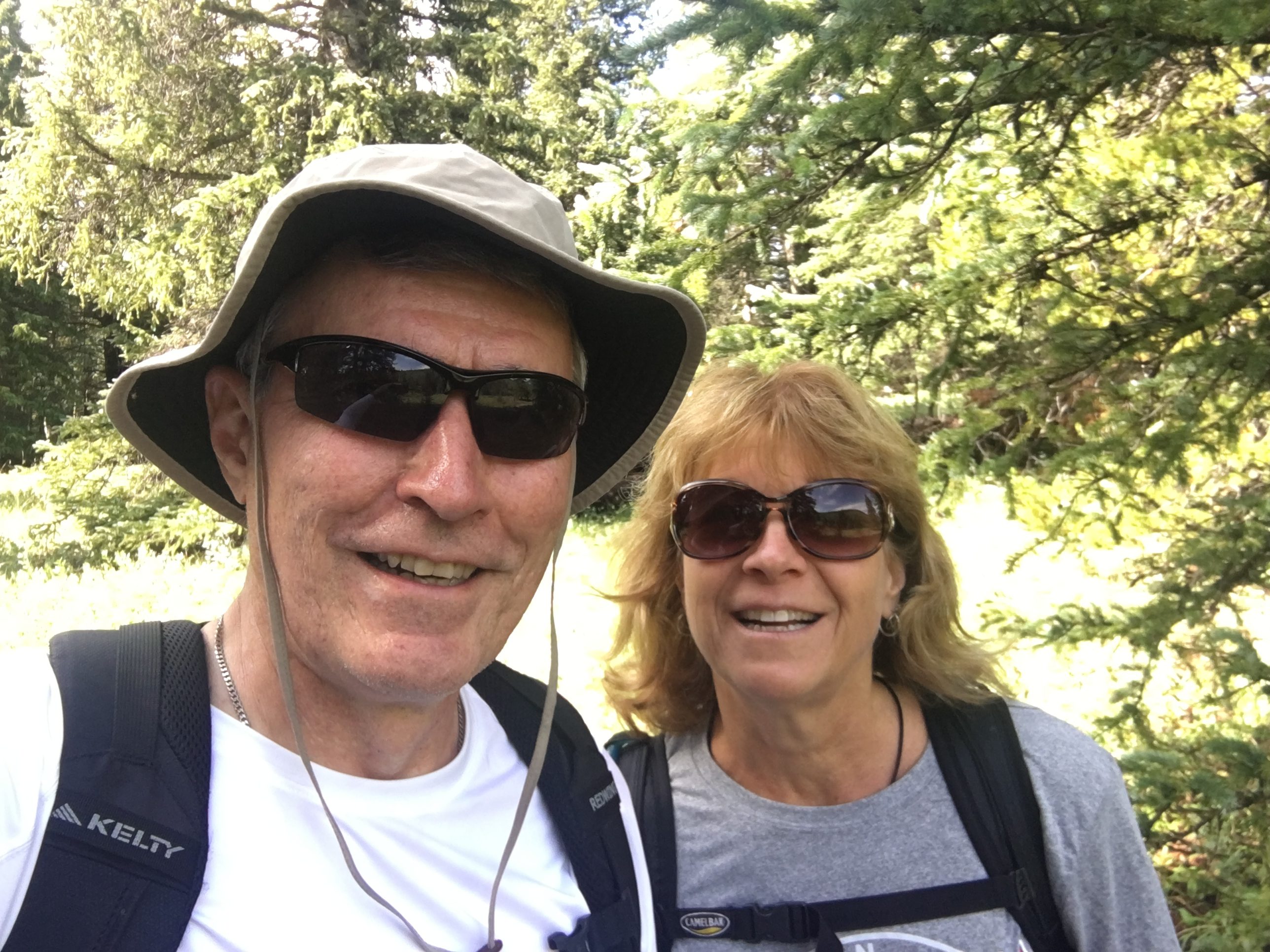
My hiking partner Joyce/K0JJW and I started at Lynch Creek Trailhead, which is about 9 miles west of Highway 285 on FS 431, also known as Buffalo Peaks Road. The USFS Pike National Forest map is a good reference for finding the trailhead. We followed Salt Creek Trail #618 for about 1 mile to connect to the Tumble Creek Trail #617. These are well-used and well-maintained trails and a joy to walk on. We had been doing too much off-trail hiking lately, so this was a very nice change. The trails are marked by signs at the junction and are easy to follow.
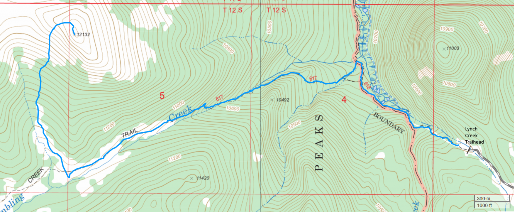
We considered ascending the east side of the mountain but concluded that we’d end up hiking through some dense forest, which usually means downed timber and slow progress. Instead, we approached the summit from the south, leaving Trail 617 about three miles in from the trailhead, and heading uphill through a grassy meadow. There is a large beaver pond to the south at the point where we left the trail, so that makes for a good landmark. You can’t completely avoid the trees on this path but they are sparse enough to easily walk through. Near the summit, the easiest path hooks around to approach the summit from the west, avoiding some steep rocks on the south side of the summit. (Actually, we went straight up the rocks on the ascent and decided to avoid them on the descent.)
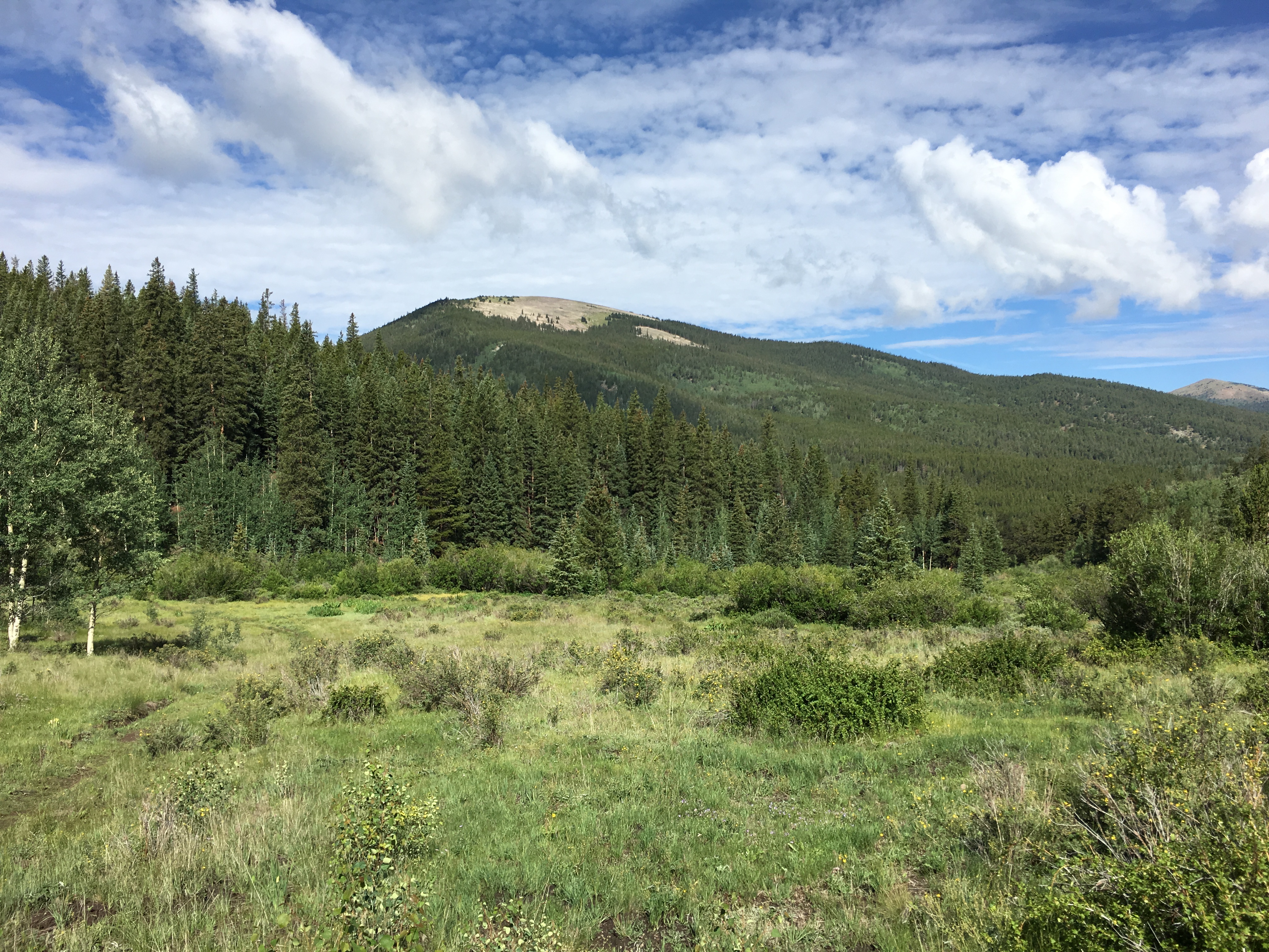
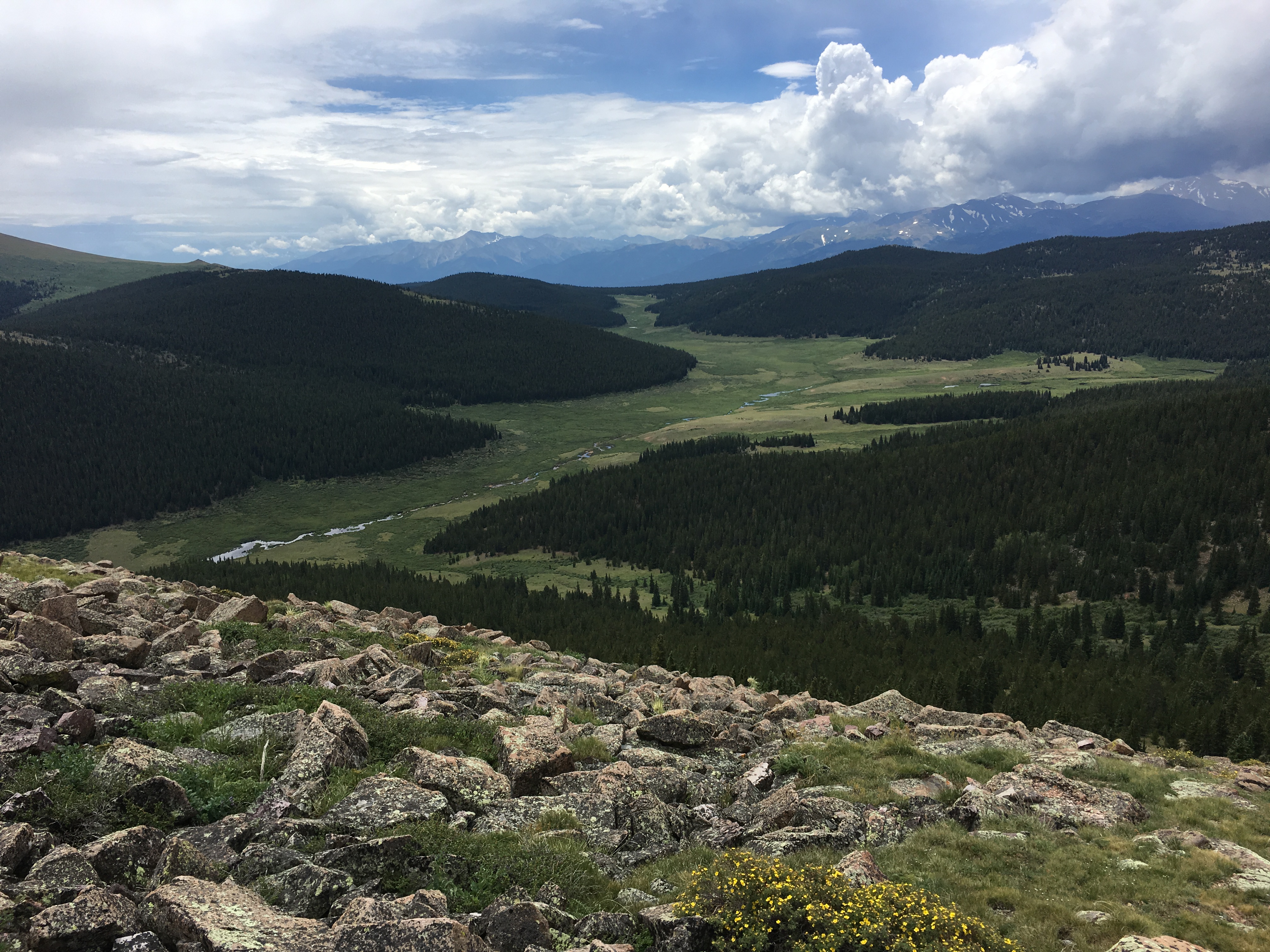
The summit is above treeline and relatively flat, offering excellent views in all directions.
Joyce and I both got on the air and made calls on 146.52 and 446.00 MHz using handheld VHF/UHF radios. We just used vertical antennas and didn’t bother to assemble the yagi antennas. Thanks to these stations that we worked that day: W0BV, W0DLE, N0VXE, K0RCW, K9LNH and KD0VHD.
The GPS app on my smartphone indicated the one-way distance at just under 4 miles, with an elevation gain of 2000 feet. The actual elevation gain may be slightly more than that due to some ups and downs on the trail. This is one of those hikes that we’ll probably do again in the future. It has an enjoyable mix of good trails, rolling streams, green meadows, great views and a pleasant summit.
73, Bob K0NR
The post First SOTA Activation for W0C/SP-055 appeared first on The KØNR Radio Site.


