Posts Tagged ‘Activations’
 Holiday SOTA Activations
So here we are, another year has past, and it seems, at warp speed. I hope each of you are enjoying the holiday season, however you celebrate it. Our family celebrates Christmas and I was able to spoil my grandchildren, so it has been fun indeed. Happy New Year as we approach 2015, and may you have health and happiness.
I am spending a few days at my Santa Fe, NM QTH for the holidays. There is snow on the ground and its only been above freezing about 3 hours since last Friday. However its a dry cold so its not too bad.
As always when I'm here I try to squeeze in some Summits on the Air (SOTA) activations. So far I've been able to do a couple as detailed below.
The Wagon Mound W5N/EL-016 6,930ft ASL 6 pts
The Wagon Mound gets its name from it's appearance. Without too much imagination you can see the outline of an old Conestoga Wagon on the summit outline. I chose this summit primarily because I've never done it, but also because, for the peaks in the area, it is at a relatively low elevation and the snow cover should be much less than higher peaks. When I departed Santa Fe, it was clear, sunny and 19F. I envisioned very thin snow cover, if any, on the mountain.
I was in for a little surprise, as you will see from the video below.
Wagon Mound, NM is 104 miles northeast of my QTH near Lamy, NM. About half way there we encountered fog. Visibility dropped, at times, to about 50 yards and the temperature dropped to 7F. I was beginning to have my doubts about making the climb. It was obvious that the snow accumulations were significantly more here, than back home. However I continued, postponing my decision until I could see the actual conditions at the base of the mountain..
Upon arrival, conditions had improved a little, visibility to 1 mile and the temperature was 13F at the base of the mountain. It wasn't a long climb, but it was steep. There was about 12 inches of snow on the ground. The problem with that is that this climb was a bushwhack over volcanic rocks and cactus. The snow cover completely disguised what might or might not be underneath. I decided to make the attempt. Cris, my XYL, was with me and she was willing to try as well. After all, we had just come over 100 miles.
The footing was treacherous. I had to plant my foot through the snow to discover what footing was below, whether solid ground or slippery rocks.We took our time and turned what should have been a 20 minute climb into about 40 minutes.
We set up about 30 feet below the summit, well into the activation zone. I used my KX3, 31 ft. piece of wire elevated with a 21 foot mast through a 9 to 1 balun, tuned by the KX3's tuner. Despite weather conditions, propagation was very good. I worked 31 stations on 20m CW in 18 minutes, a quick QSY to 40m yielded no results and since it was cold I didn't try any other bands. We packed up and retraced our steps down.
All in all a very satisfying activation given the challenges. We stopped on our way home in Las Vegas, NM and warmed ourselves up with some Mexican Food. A good day.
Summit 6860 W5N/SI-022 6,860ft ASL 6 pts
After my experience heading north, I decided to go south for my next activation. This summit is east of Albuquerque NM just south of I-40 and 67 miles from my QTH. This is a nice summit. Depending on where you start, the hike is 2. to 3 miles round trip. The elevation change is about 800 feet over that distance. There are numerous crisscrossing trails over the terrain, so there are multiple ways to get to summit. The trails are all nice trails, no bushwhacking required on this one.
The weather was near perfect for climbing, about 40 degrees, sunshine and little wind. Very enjoyable. You will see from the video below that the conditions were splendid and there was a little snow on the ground.
I used the same set-up here as described above. Conditions were good, 31 QSO's on 15, 20, and 30 meters.
So 12 more points in the log and some good exercise and, obviously, some stories to tell.
Happy New Year!!
Tromelin, Andamans and SOTA
It's been a while since I've sit down to write down a few thoughts. I've intended on several occasions to sit down and write down my thoughts, but it seems some other priority asserts itself and I can't get the time to write. But not today.
So what's happened since I last blogged.
Tromelin Expedition FT4TA: The expedition team did a great job, making nearly all bands available with good signals, at least in South Texas. I enjoyed both working the expedition, to fill some band slots, but also the event. The daily news, conditions, the complaining, etc.... I worked them on 10m, 15m, 20m, 30m and 80m. All new bands except 20m. My practice, as I have written about here, is to try to work the expeditions, during the last days, QRP. I was not able to do that on this expedition. The pile-ups never really slacked off, which brings me to my point.
Now that many expeditions use Club Log and other online tools to post how many QSO's each caller has logged, the information is leading to much debate. I am on a particular reflector where an individual copied and posted the band scorecard for multiple individuals and berated them for making multiple band/mode contacts when so many needed Tromelin for an all time new one.
My thoughts on this one: As long as an individual doesn't dupe band/mode slots, working the expedition is fair game. If a DXer builds a station that is capable and puts in the time operating to work Tromelin on 20 band slots, why not. Telling him not to is like telling a guy with a Ferrari that he can only drive the speed limit. If, for whatever reason, a dipole is all you have, you know that working rare DX is a tough proposition. Why should the capable stations be made to wait on those not so capable. In my early days of DXing, not working an expedition motivated me to improve my station, improve my operating skills, improve my understanding of propagation, etc... Failure is often life's greatest teacher.
DX-peditions can control this somewhat by limiting the number of bands they operate on, but those guys paid their money, why shouldn't they have all the fun they can.
Andamans VU4CB and VU4KV: This team also did a nice job activating a pretty rare place, that from my part of the world, is difficult to work. I was able to get QSO's on a few bands and was impressed with the operation. I was not able to work these guys on QRP either. VU4VB operated from a rare IOTA which I also chased. So, please all around on this one.
SOTA Activations: I did find time to get in four SOTA activations near my Santa Fe, NM QTH during November. I activated three peaks, along with Fred KT5X and John K1JD, southeast of Albuquerque, NM.
Summit 8455 W5N/EL-002
This was a full day of activating. The first peak was a 100 mile drive, but well worth it. All of the three peaks were in excess of 8,000 feet. The picture above is of the first summit we activated, about a mile hike to the top. You can see from the pictures that a wildfire some years ago delineates our path to the top.
View from 8455
The reward, besides activator points, from being involved in SOTA, are the views.
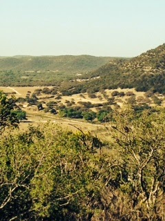
More Views
The additional points achieved from these activations moved me to a total of 719 points in my quest to get to a 1,000 and earn the esteemed title of "SOTA Goat"
I love this radio stuff.....Until next time...73
Music and Mountains
This past Monday was Memorial Day in the US. A day to remember those who paid the ultimate sacrifice in defense of Freedom and our Country. I am grateful for the dedication and patriotism of these Americans.
Memorial Day Weekend is therefore a Holiday weekend that finds many of us enjoying a three day weekend. The weekend was busy and memorable one for me. The weekend began with a 300 mile drive to play a show with my band, The No Refund Band, at a venue in Crystal Beach, TX. Crystal Beach is on the Bolivar Peninsula, east of Galveston Island on the Texas Coast. We had a great show there. (You can check out my band at norefundband.com )
The next morning (Sunday), my XYL Cris and I got in the Jeep and headed to the Ouachita Mountains in Oklahoma. This would be a 430 mile drive with the purpose of getting as many SOTA points as possible. The drive from Houston was very nice. North of Houston you take Hwy. 19 which goes through the piney woods of east Texas. Of course Texas is a big state and on this highway alone I went through Palestine, Athens, Canton and Paris. The road is nice and the speed limit is 70 - 75 mph and the traffic was light. As long drives go, this one wasn't bad.
The Ouachita Mountains cover southeastern Oklahoma and west central Arkansas. Along with the Ozark Mountains, the Ouachita Mountains form the U.S Interior Highlands, one of the major mountainous regions between the Rocky Mountains and the Appalachian Mountains. It is a beautiful area that is very green and lush with mountains and valleys that induce tranquility.
From a SOTA perspective I had done my research to find the most efficient route to accumulate the most points in relatively short amount of time. I had to be backon Tuesday for work, so I would have 24 hours get as many points as possible.
Sycamore Lookout W5O/OU-005 (8 pts)*
We arrived 20:15 UTC. The summit has easy access from the highway and I was QRV by 20:35. I set up next to the commercial antenna's with no RF issues. The bands were not in good shape and the WPX contest was in full swing. I made 10 QSO's in 25 minutes on 17 and 40 meters and decided to move on to the next one.
Peak 2210 W5O/OU-006 (8pts)*
This summit is just up the road a few miles and the highway is in the activation zone. I did ascend about 50 feet vertically to the summit. I set up just below the summit ridge. Unfortunately, the cell service was spotty and I wasn't able to spot myself. For some reason I wasn't picked up by the RBN network either. Consequently I called CQ for 10 minutes on 17m with no responses. I finally had cell service long enough to get a call off to Fred, KT5X, to ask him to spot me. It still took me 10 minutes after the spot to get my 4 QSO's. Conditions were not good.
Winding Stair Mountain W5O/OU-002 (10 pts)*
Winding Stair Mountain is a nice hike. The trail head is across the road from the Campground and the hike is about 3 miles roundtrip. We encountered a troop of Boy Scouts training for their upcoming 68 mile trek at the Philmont Scout Ranch in New Mexico. Conditions were only marginally better, I made 11 QSO's in 25 minutes.
After this summit we made out way to the Green Country Inn in Heavener, Oklahoma where we had a room. The hotel is a great place to stay if you find yourself in the area. The next morning began early to make sure we got to the summits we planned.
Lynn Mountain W5O/OU-001 (10 pts)*
Getting to this summit is best done with a 4WD vehicle. While a 2WD would make it most days, a 4WD is preferred. The road does enter the activation zone, but I took an ATV trail for the short walk to the summit. This summit is very green and overgrown so I operated from the trail. The weather was overcast and as I left the Jeep it started to rain. We were prepared with rain gear and umbrellas to provide a mini-shack on the summit. There was a light rain during the entire activation. Conditions were a little better and, since the WPX contest was over, 20m was available again. I was on the air at 1335 UTC, so I think I was a little early for propagation and some late rising operators. I made 12 QSO's on 20m and 40m.
Pigeon Benchmark W5O/OU-013 (10 pts)*
This summit is off the same road as Lynn Mountain. The hike to the activation zone is a 2 mile round trip. The trail to the summit is an overgrown ATV trail. The walking is easy with about a 220 foot elevation gain over the mile to the top. The grass on the trail is knee high and it was wet from the rain, so it was a very wet hike. Conditions were much better as I was QRV at 1510 and made 20 QSO's on 20 and 40 meters.
Rough Mountain W5O/OU-014 (8 pts) *
The road to this trail head requires a 4WD. The road crosses the Ouachita trail a about a mile in from Hwy. 259. This is nice 2.5 mile round trip hike with about 500 ft. elevation gain over the 1.25 miles to the summit. The trail is nice. I made 22 QSO's from here.
*Additional details on how to get to these summits can be found on the SotaWatch page for each summit
So there you have it, 54 SOTA points in 24 hours. We had a 500 mile drive home that we made in about 8 hours. So in total we traveled 1,200 plus miles to enjoy music and mountains to make memorable Memorial Day weekend.
A short highlight video can be found here:
https://www.youtube.com/watch?v=NZhGh-XATJ0
Texas SOTA Trip – The Law of Averages
The "Law of Averages" is a layman's term used to express a belief that outcomes of a random event will "even out" over time. While statistical experts may argue the validity of this thinking in the short term, what do they know anyway. So, you may ask, what does the law of averages have to do with SOTA?
As I have written here recently, the SOTA program recently added 40+ one point summits in South Texas. These summits are within a reasonable drive for me, so I was enthusiastic to activate them and after all, they are all one pointers, they should be easy enough. Just as a reminder for those who haven't caught the SOTA virus yet, point values range from 1 - 10. Oddly enough, 1 is the only odd number used in the valuation scale. Summits can be worth 1,2,4,6,8 or 10 points. Don't ask, I have no idea.
I've already activated Peak 2002, which was the first South Texas group summit activation. I ended up walking 8 miles for that point. Not to worry though, they can't all be that long. So in the spirit of adventure (and not point accumulation), I planned to activate two of these summits during the International SOTA day and the QRP to the field (QRPTTF) events. My two targets were Bullhead Mountain, W5T/ST-007, and Pikes Peak, W5T/ST-029. Yes there is a Pikes Peak in Texas. The one in Colorado is worth 10 points, the Texas version is worth, the aforementioned, one point.
I'd done my research and determined that there was a better than even chance these summits would be accessible. While on private land, these peaks are in sparsely populated areas that likely aren't posted. However you never know until you get there.
Bullhead Mountain, W5T/ST-007, is a limestone peak north of Vance (formerly Bullhead) and the intersection of Farm roads 335 and 2631 in far western Real County (at 29°49' N, 100°00' W). The summit, at an elevation of 2,042 feet above sea level, rises on the southern edge of the Edwards Plateau. Local vegetation includes open stands of live oak, Ashe juniper, and mesquite on the uplands and ridges and live oak and Ashe juniper woods on the hills and escarpments.
The best approach to this summit is from the Farm Road 335 side or the south side of the mountain. The fence is deteriorated and it is not posted. The approach on the Hwy 2631 side is posted. This one pointer is no bargain. You will climb 400 feet in about 1/4 mile. Translated, that is steep and the extra bonus is that there are no trails. The slopes are covered with all manner of hard to get through trees and underbrush combined with loose rock to make for an adventurous descent. This is Bushwhacking with a capital B. We did finally summit and had some nice views.
The bands were a little finicky. Only made QSO's on 20 meters. Nothing on 12m despite the RBN hearing me at PJ2T.
So after the descent of Bullhead Mountain, we made the short drive to Pikes Peak to discover what awaited us there. Pikes Peak, W5T/ST-029 is a mile north of Camp Wood in extreme southeast Edwards County (at 29°41' N, 100°02' W). It rises to a height of 1,904 feet, 470 feet above the nearby Nueces River. The summit was named for Zebulon Pike, whose exploring party passed near it on its return from the exploration of Colorado in 1807. The area's steep to gentle slopes are surfaced by variable soil that supports scrub brush and sparse grasses.
This summit was every bit as tough a Bullhead. There is a road that goes over the shoulder of the mountain which means you only have to climb 300 feet in about 1/3 of a mile. Again, that's steep and again no trails. I operated from the very top of the summit. A nice breeze cooled us down for the now 85F temperatures.
Propagation had warmed up a little by the time we summited, but not much. I doubled my QSO count on this summit, but still most of the business came from 20m. I was able to work five summit to summit contacts which is always rewarding. Portable QRP to portable QRP, from mountain to mountain. Pretty cool. The high bands, 12m and 10m were not really productive, only one QSO on 12m and none on 10m.
We had contemplated doing Wildcat Peak also. Another one pointer, not too far from Pikes Peak, however, we were tired. These ascents and descents were taxing because of the steepness and the full time bushwhacking through brush and the temperatures were warming up. My thermometer in my jeep read 90F when we got down. We had a nice Texas lunch in Camp Wood. A lunch buffet with Mexican food and Chicken Fried Steak. It doesn't get much better than that.:-)
So, what about this Law of Averages? Well, in the SOTA world there are some easy summits. Some you can even drive up to the summit or park near the top and take a nice trail a few yards to the summit. I have felt a little guilty about that in the past, getting so many points for so little effort, but no more. The Law of Averages does apply to SOTA. These one pointers were intense, difficult mountains to do. However, I suppose it all averages out. After doing these mountains, my guilt in doing an easy one has disappeared:-)
Photo credits to my XYL Cris, KC5HZQ
Excerpts above were taken from the Texas State Historical Association.
As I have written here recently, the SOTA program recently added 40+ one point summits in South Texas. These summits are within a reasonable drive for me, so I was enthusiastic to activate them and after all, they are all one pointers, they should be easy enough. Just as a reminder for those who haven't caught the SOTA virus yet, point values range from 1 - 10. Oddly enough, 1 is the only odd number used in the valuation scale. Summits can be worth 1,2,4,6,8 or 10 points. Don't ask, I have no idea.
I've already activated Peak 2002, which was the first South Texas group summit activation. I ended up walking 8 miles for that point. Not to worry though, they can't all be that long. So in the spirit of adventure (and not point accumulation), I planned to activate two of these summits during the International SOTA day and the QRP to the field (QRPTTF) events. My two targets were Bullhead Mountain, W5T/ST-007, and Pikes Peak, W5T/ST-029. Yes there is a Pikes Peak in Texas. The one in Colorado is worth 10 points, the Texas version is worth, the aforementioned, one point.
I'd done my research and determined that there was a better than even chance these summits would be accessible. While on private land, these peaks are in sparsely populated areas that likely aren't posted. However you never know until you get there.
Bullhead Mountain, W5T/ST-007, is a limestone peak north of Vance (formerly Bullhead) and the intersection of Farm roads 335 and 2631 in far western Real County (at 29°49' N, 100°00' W). The summit, at an elevation of 2,042 feet above sea level, rises on the southern edge of the Edwards Plateau. Local vegetation includes open stands of live oak, Ashe juniper, and mesquite on the uplands and ridges and live oak and Ashe juniper woods on the hills and escarpments.
 |
| The Trail up Bullhead, One of more open areas |
 |
| Operating from Bullhead Mountain |
 |
| View from Bullhead Mountain |
The bands were a little finicky. Only made QSO's on 20 meters. Nothing on 12m despite the RBN hearing me at PJ2T.
 |
| Cris and I. Our Jeep is the black speck on the road |
 |
| View from Pikes Peak |
This summit was every bit as tough a Bullhead. There is a road that goes over the shoulder of the mountain which means you only have to climb 300 feet in about 1/3 of a mile. Again, that's steep and again no trails. I operated from the very top of the summit. A nice breeze cooled us down for the now 85F temperatures.
 |
| Operating from the Summit of Pikes Peak, Texas |
We had contemplated doing Wildcat Peak also. Another one pointer, not too far from Pikes Peak, however, we were tired. These ascents and descents were taxing because of the steepness and the full time bushwhacking through brush and the temperatures were warming up. My thermometer in my jeep read 90F when we got down. We had a nice Texas lunch in Camp Wood. A lunch buffet with Mexican food and Chicken Fried Steak. It doesn't get much better than that.:-)
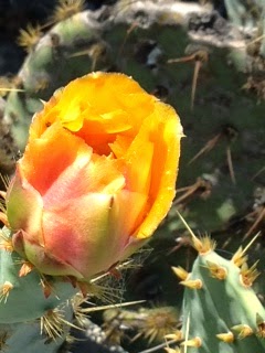
 |
| Cactus Flowers |
 |
| Texas Mountain Fauna |
So, what about this Law of Averages? Well, in the SOTA world there are some easy summits. Some you can even drive up to the summit or park near the top and take a nice trail a few yards to the summit. I have felt a little guilty about that in the past, getting so many points for so little effort, but no more. The Law of Averages does apply to SOTA. These one pointers were intense, difficult mountains to do. However, I suppose it all averages out. After doing these mountains, my guilt in doing an easy one has disappeared:-)
Photo credits to my XYL Cris, KC5HZQ
Excerpts above were taken from the Texas State Historical Association.
Nice SOTA Trip to New Mexico
I took a long weekend trip, Thursday - Monday over the Easter holidays, to travel to Santa Fe, NM to accomplish two things. The first, get a break from the day job and secondly to activate as many Summits as possible. It has been a while since I took a serious SOTA trip, way back in February to be exact and I was getting Summit fever. So I caught a plane on Wednesday night so I could hit the ground running, or climbing, on Thursday morning.
As the days passed, I activated 6 summits. Two each on Thursday and Friday and one each on Saturday and Sunday. Three of the peaks are mountains I had done before, Ortiz, Montoso and 7472 while the other three were new ones for me, Tetilla, Palomas and Escobas. Including the winter bonus I was able to collect 58 points to bring my total activator points to 349 or a little more than a third of the way to my goal of 1,000 points. On this trip I used the FT-817, pico paddle, Elecraft T-1 tuner and an LNR 40-20-10 EFHW mounted on my carbon fiber extendable 21' fishing pole. I operated 30 meters through 12 meters on most summits.
1. My activating process is much more efficient, i.e., pack weight, antenna configuration, set-up time.
2. I am much more confident in my previously rusty orientation skills. I don't need a trail to get to a summit and back.
3. I'm in much better shape than when I started. I've dropped pounds and added endurance.
4. I've explored much more of this country, getting to summits off the beaten path, than I would have ever done otherwise.
5. I've met a fantastic community of activators and chasers who share a common bond of a love a radio and the outdoors.
It is exciting when two of your hobbies converge into one activity and that is what SOTA is to me.
As the days passed, I activated 6 summits. Two each on Thursday and Friday and one each on Saturday and Sunday. Three of the peaks are mountains I had done before, Ortiz, Montoso and 7472 while the other three were new ones for me, Tetilla, Palomas and Escobas. Including the winter bonus I was able to collect 58 points to bring my total activator points to 349 or a little more than a third of the way to my goal of 1,000 points. On this trip I used the FT-817, pico paddle, Elecraft T-1 tuner and an LNR 40-20-10 EFHW mounted on my carbon fiber extendable 21' fishing pole. I operated 30 meters through 12 meters on most summits.
Operating on Palomas W5N/SI-010
Considering that I am a third of the way, what have I learned along the way. As I gave that notion some thought it brought to mind the following. 1. My activating process is much more efficient, i.e., pack weight, antenna configuration, set-up time.
2. I am much more confident in my previously rusty orientation skills. I don't need a trail to get to a summit and back.
3. I'm in much better shape than when I started. I've dropped pounds and added endurance.
4. I've explored much more of this country, getting to summits off the beaten path, than I would have ever done otherwise.
5. I've met a fantastic community of activators and chasers who share a common bond of a love a radio and the outdoors.
It is exciting when two of your hobbies converge into one activity and that is what SOTA is to me.
To add a star to this trip, my XYL Cris, KC5HZQ, was able to activate four of the summits on a combination of 2 meter and 10 meter QSO's. She now has 38 points. So she is off an running. I'm glad I got a 300 point headstart on her.
Ham Radio and Fitness
Unfortunately, to many, ham radio and fitness are mutually exclusive. We are all passionate about a hobby whose major milestones can be accomplished setting in a comfortable chair in front of our radios. Our major competitions include 24 - 48 hours of sitting. We've even developed software that eliminates the need to even operate a CW paddle or press the button on a microphone. Needless to say our hobby or at least many facets of it promote physical inactivity. You will never mistake a Hamfest for a Triathalete convention.
There are notable exceptions, within the hobby, that will get you out. Expeditioning, fox hunting (outside), Summits on the Air and I'm sure there are a few others. In fact, and I may be a little biased, I think that the SOTA Goat award is one of the toughest awards in amateur radio. The SOTA Goat is an activator award, you must earn 1,000 activator points with the highest value summit worth 10 points. There are some bonus points available during extreme weather conditions, but suffice it to say you will have to summit at least 100 peaks and operate to earn the award. Normally it takes several years to earn this award and you have to do it on your feet.
However, if you aren't into Summits or other outdoor forms of radio there is device that you can wear on your wrist to motivate you to get up and around. These devices count your steps in a day and depending on the device will nudge you to get up when you have been sitting too long. All of these devices have accompanying apps that will sync with the device to give you statistics on your day including steps and the quality of your sleep. I currently use a device made by Jawbone and although I have a somewhat regular exercise regimen, it reminds and motivates me to keep it up. An extra walk around the block or around the office, if done regularly can make a difference in your overall fitness.
I blogged here several months back about the backpacker mentality of saving ounces in our packs while we were carrying extra pounds on our bodies. Since that blog I have lost ten pounds and signficantly improved my stamina. The higher fitness level we can achieve improves our odds to live long enough to achieve some of our sedentary goals.
The First Activation of a South Texas SOTA Summit – Peak 2002
The SOTA Management Team recently authorized a group of qualifying summits in South Texas. These summits are located generally west of San Antonio in the Texas Hill Country. The elevation of these summits range from ~1700 - 2200 feet ASL. All of these new summits are only 1 point summits, however, they are new and have never been activated which begs for someone to do them for the first time. So today, I was the first to activate a South Texas Summit.
I have only done limited research and actually stopped looking when I found the first accessible summit. The summit, named "2002" for it's elevation because it is otherwise unnamed. The summit is an escarpment, which is defined as, "a long precipitous, cliff-like ridge of land, rock, or the like, commonly formed by faulting or fracturing of the earths crust". Peak 2002 is just that with a summit ridge that runs for nearly a mile. Accordingly it has a large activation zone. (In SOTA, the operator doesn't necessarily need to transmit from the actual summit, in Texas the activation zone is anywhere within 150 vertical feet of the summit). The majority of the summit ridge is on private land, however the eastern third of the summit lies within the boundries of the Texas Hill Country State Natural Area. So an easy, state park hike, should be easy.
Looking at the layout of the park, the ranger told me which trail would get me to the summit ridge, trail 4B. I downloaded the map and the trail was in the middle of the park, but I would be able to drive to the trail head right, wrong. The Ranger informed me that because this is a Natural Area I would have to walk. What I thought was, at most, a 2 mile round-trip was now a 6 mile round-trip. Wait a minute this is just a 1 point summit. But I was there, but I knew I didn't have enough water for 6 miles, so I bought a bottle of water at the Park Office, got directions and took off.
So what was a 2 mile round-trip which had now become a 6 mile round-trip, turned out to be nearly 8 miles. I missed a trail due to a poorly marked trail sign and was almost a mile down that trail when I realized my error. So I had to back track and get on the right trail. Finally 1 hour and 40 minutes after leaving the trail-head I reached the summit ridge.
From that point, it was a fairly normal activation. I used my MTR and a 20/40m EFHW and my Pico Paddle. I managed 22 QSO's with the first being AE4FZ and the last being KD5KC, Mike who did the bulk of the work to get the additional Texas Summits approved. Thanks Mike. I was also able to work a little DX with OK1CZ calling in on 20m.
So this was another SOTA first and I'm glad I was able to be the first to activate a South Texas Summit. I will have to say though, this was the toughest SOTA point I ever earned. Eight miles of hiking for 1 point, the miles per point is pretty high. If you extrapolated that ratio to a 10 point summit a person would have to walk 80 miles. Well as they say, everything is bigger in Texas.
Thanks to all the chasers and thanks again to Mike KD5KC who was a catalyst in getting these summits approved.
I have only done limited research and actually stopped looking when I found the first accessible summit. The summit, named "2002" for it's elevation because it is otherwise unnamed. The summit is an escarpment, which is defined as, "a long precipitous, cliff-like ridge of land, rock, or the like, commonly formed by faulting or fracturing of the earths crust". Peak 2002 is just that with a summit ridge that runs for nearly a mile. Accordingly it has a large activation zone. (In SOTA, the operator doesn't necessarily need to transmit from the actual summit, in Texas the activation zone is anywhere within 150 vertical feet of the summit). The majority of the summit ridge is on private land, however the eastern third of the summit lies within the boundries of the Texas Hill Country State Natural Area. So an easy, state park hike, should be easy.
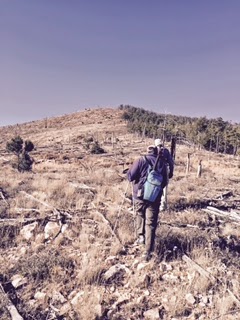
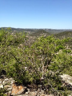
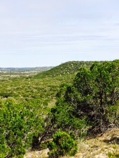
View from the Trail
Looking at the layout of the park, the ranger told me which trail would get me to the summit ridge, trail 4B. I downloaded the map and the trail was in the middle of the park, but I would be able to drive to the trail head right, wrong. The Ranger informed me that because this is a Natural Area I would have to walk. What I thought was, at most, a 2 mile round-trip was now a 6 mile round-trip. Wait a minute this is just a 1 point summit. But I was there, but I knew I didn't have enough water for 6 miles, so I bought a bottle of water at the Park Office, got directions and took off.
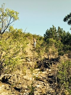
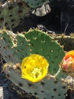
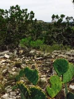
South Texas Fauna
So what was a 2 mile round-trip which had now become a 6 mile round-trip, turned out to be nearly 8 miles. I missed a trail due to a poorly marked trail sign and was almost a mile down that trail when I realized my error. So I had to back track and get on the right trail. Finally 1 hour and 40 minutes after leaving the trail-head I reached the summit ridge.
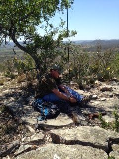
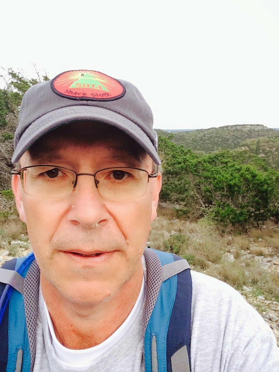
From that point, it was a fairly normal activation. I used my MTR and a 20/40m EFHW and my Pico Paddle. I managed 22 QSO's with the first being AE4FZ and the last being KD5KC, Mike who did the bulk of the work to get the additional Texas Summits approved. Thanks Mike. I was also able to work a little DX with OK1CZ calling in on 20m.
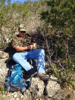
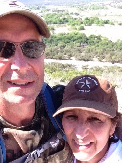
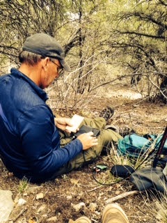
A Selfie from the Trail
So this was another SOTA first and I'm glad I was able to be the first to activate a South Texas Summit. I will have to say though, this was the toughest SOTA point I ever earned. Eight miles of hiking for 1 point, the miles per point is pretty high. If you extrapolated that ratio to a 10 point summit a person would have to walk 80 miles. Well as they say, everything is bigger in Texas.
Thanks to all the chasers and thanks again to Mike KD5KC who was a catalyst in getting these summits approved.


