 |
 Two SOTA Activations: W0/SP-099 and SP-115
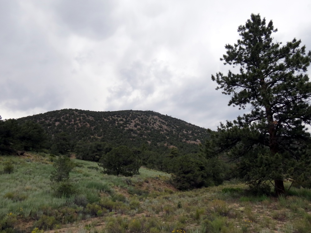
Bald Mountain (W0/SP-115)
Lately, I have been focusing on activating the SOTA (Summits On The Air) peaks near our cabin in the mountains. The basic idea is to identify a SOTA summit, hike to the top and make a few contacts on VHF. On Friday, my spousal unit (Joyce, K0JJW) and I decided to head out to an unnamed peak (W0/SP-099), southeast of Buena Vista, CO. By no coincidence, this summit had not been activated yet, so we’d get the esteemed honor and glory of being the first.
For lesser known summits, a bit of research is required to figure out the route. My first stop is to check the SOTA database for basic information on the summit. I’ll usually have to dig further using ListsOfJohn and SummitPost. ListsOfJohn is an incredible database of topographical information, listing every summit along with information such as elevation, lat/lon, rise, etc. (The Colorado SOTA information was gleaned from ListsOfJohn.) SummitPost will usually have more detailed information on a summit but only for the more popular ones. The SOTA Mapping Project is another excellent resource with very useful interactive topo maps. And, of course, I also dig out the US Forest Service map for the area, which often gives the best view of access roads.
We drove the Jeep to within a mile of the summit and started hiking up. I posted our route information on ListsOfJohn, so take a look there for that information. The summit is unnamed, so it is referred to by its elevation: 10123. I had my Yaesu VX-8GR burping out APRS packets which were plotted on aprs.fi when we reached the summit.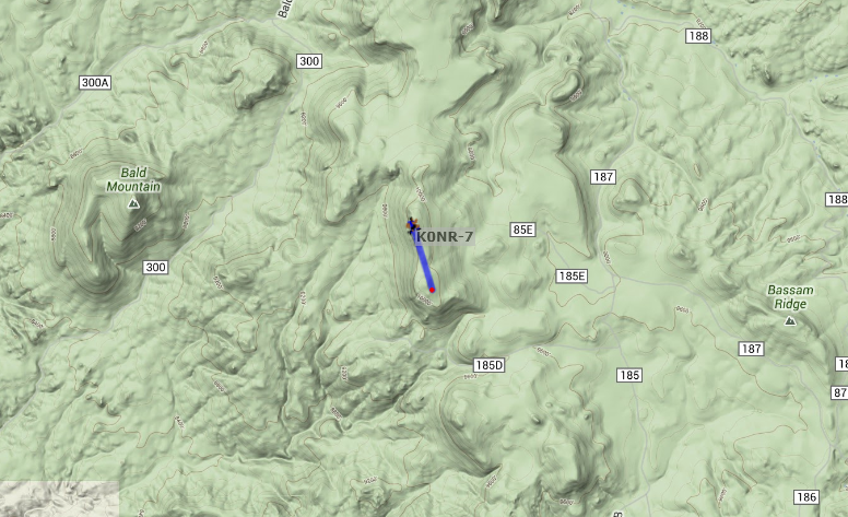
When we reached the summit, I spotted myself on the SOTAWatch web site using the SOTA Goat app on my smartphone. More importantly, the night before the hike, I sent an email to some of the radio amateurs that were likely to be within VHF range. That paid off and I worked Jim KD0MRC, Walt WZ0N and John K3NOQ on 146.52 MHz FM. Jim was hiking to Harvard Lakes above 10,000 feet, so it was special to be able to contact him on the trail. A little later, I caught KV4AL who was mobile near the top of Mount Evans. While only one contact is required to “activate” a summit, four contacts are needed to earn SOTA points, so I was happy to make these four QSOs. My gear was a Yaesu FT-60 driving a 3-element Arrow yagi antenna.
In addition, Joyce and I generally work each other on the SOTA the summit. The SOTA rules say that “QSOs with others within the same Activation Zone do not count towards the QSO total” which means that one of us needs to hike down a bit to get outside of the activation zone (75 feet vertical feet from the summit). We take turns doing this so that each of us activates the summit and makes a contact with the summit.
We took a round about path back to the Jeep and headed for Bald Mountain. At this point, we were both very tired and the thunderstorms were moving in. We decided to at least check out the access to Bald Mountain (Wo/SP-115) even if we didn’t climb it that day. It turns out that there is a 4WD road that goes to the top of the mountain, so we drove to the summit. The road is very rough in a few spots but the Jeep handled it nicely. At the top, we hiked back down a bit to meet the non-motorized ascent requirement for SOTA. We also did our “work each other” technique while on the mountain so that we each had a contact. I was not able to raise anyone on 146.52 MHz but I did catch Carl K5UK on the 146.745 MHz repeater and worked him on simplex. By this time, it was raining with lightning getting closer, so we abandoned the summit and headed back to the cabin.
Thanks to the guys that took the time to contact us on the two summits.
73, Bob K0NR
Bob Witte, KØNR, is a regular contributor to AmateurRadio.com and writes from Colorado, USA. Contact him at [email protected].
Series Six Episode Sixteen – Off Centre Fed Dipole
Series Six Episode Sixteen of the ICQ Amateur / Ham Radio Podcast has been released. The latest news, Listener Mailbag, Leslie Buttersfield, G0CIB reports in from the Essex Amateur Radio Camping event and Martin discusses Off Centre Fed Dipoles.
- Ham Radio Operators prepare to host ham radio 'Olympics'
- UHF and VHF spectrum planning - Call for inputs
- No more KW for VK LicenceMidland Amateur Radio Club Inc. Changes name
- Netherlands Special Event
- The 3rd World ATV QSO Party
- New 6 metre beacon
- One hundred years of licensed Amateur Radio in Queensland, Australia
- The sun's magnetic field is about to flip

Colin Butler, M6BOY, is the host of the ICQ Podcast, a weekly radio show about Amateur Radio. Contact him at [email protected].
DX from East Andover Bike Trail
This afternoon my wife and I took a quick bike ride along the old Northern Rail route in East Andover. I worked Spain, Paraguay, Italy, Poland, the Netherlands, and Luxembourg in 20 minutes of operating.

A mile or so down the trail is an old picnic table under a couple of pine trees… it’s a perfect spot for some quick operating. I heaved a line up about 40 feet and pulled up a wire. I set up the KX3 and opened the notebook. I started on 17 meters.

There were lots of strong stations and I logged three in a row. Then I switched to 20 meters where the WAE contest was going on. I worked three more and packed up to continue the ride. Here’s the log.
10 Aug-13 2053 18.070 EA8/DL7VOA CW 599 599 Spain
10 Aug-13 2058 18.075 ZP6CW CW 579 579 Paraguay
10 Aug-13 2105 18.079 I0JX CW 549 599 Italy
10 Aug-13 2111 14.019 SP9MZH CW 599 599 Poland
10 Aug-13 2114 14.010 PG2AA CW 599 599 Netherlands
10 Aug-13 2115 14.012 LX7I CW 599 599 Luxembourg
It was such a beautiful afternoon with warm sunshine filtering through the trees as we rode along. These glorious summer days are growing precious as August advances toward September. May this weather last…
Jim Cluett, W1PID, is a regular contributor to AmateurRadio.com and writes from New Hampshire, USA. Contact him at [email protected].
New and Improved 9:1 Un Un
My latest antenna uses a 9:1 Un Un. That’s a funny word isn’t it. It means Unbalanced to Unbalanced. It matches an unbalanced coax feed to an unbalanced antenna. The bonus here is that I can operate on 7 different bands using the same 35 foot wire antenna!
I had to change antennas every time I changed bands the old way. I guess this means I’ll have 7 single band antennas for sale soon!

Un Un Mounted on my porch rail
Note the bungee cord in the back. It allows for strain relief when this antenna is mounted over a tree limb.

Torroid on the left and PL 259 on the bottom.

Reinforcing block at the wire end of the Un Un. Note the hot glue holding the block.

Strain Relief for the wire lug.
I’ll use this antenna in the park, portable. Strain relief keeps the wire lug from separating from the antenna wire.
http://www.earchi.org/92011endfedfiles/Endfed6_40.pdf
I got the diagram and physical layout here. I added the bungee for strain relief and the reinforced ends. The Reinforced ends allow me to mount this antenna horizonatally, from my condo porch to the nearby Live Oak Tree.
Jim Cluett, W1PID mentioned this un un kit in a recent post. Thanks Jim. Thank you to the ‘Emergency Amateur Club in Honolulu for the PDF for this project.
73 de AA1IK
Ernest Gregoire
Ernest Gregoire, AA1IK, is a regular contributor to AmateurRadio.com and writes from Florida, USA. Contact him at [email protected].
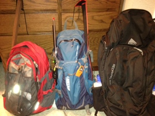
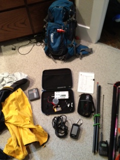
My Backpack Progression
As with any activity the more experience you get, the more refined your approach becomes and so it has been with me. My first activation was last March. I took my KX3 with an FT-817 as backup, an Alexloop, a Buddistick, several coax jumpers (BNC - PL-259, BNC - BNC and other combinations just in case), a pound of trail mix and several bottles of water. All this for a 3.5 mile round trip. I didn't even want to weigh it.
Mike Crownover, AD5A, is a regular contributor to AmateurRadio.com and writes from Texas, USA. Contact him at [email protected].
The dreaded “Conflict”
As you all know from my near constant and annoying yammering since last August, the 2013 NJQRP Skeeter Hunt is tomorrow. This is a huge event for me, and it gives me a lot of joy to not only operate in it, but to manage it as well. It is my sincere wish that all of you who have chosen to participate this year enjoy yourselves and have the best of times. You folks are the life blood of the QRP hobby, and without all of you, this niche of Amateur Radio would not be thriving like it is – and thriving it is!
Unfortunately, I will only be able to join with you all for a limited amount of time at the beginning and at the end of the contest. A few months ago, without paying attention to the date, I agreed to volunteer at the St. Mary’s Soup Kitchen in Plainfield from 2:00 to 4:00 PM (the middle two hours of the hunt) tomorrow afternoon. When I discovered the conflict, I have to admit that my first reaction was the human one, I thought of trying to find a substitute, or possibly make an excuse and just back out all together.
But as important as the Skeeter Hunt and Amateur Radio are to me (and they are VERY important!) some things are more important. The people that are served, who are down on their luck, depend on this facility for a decent meal. And even though my presence isn’t mandatory for the kitchen to open or run, it wouldn’t be right to blow off a commitment to people who are in need. Besides, the Amateur’s Code reminds us that the Radio Amateur must be “Balanced – Radio is an avocation, never interfering with duties owed to family, job, school or community.” In the end, I had to ask myself, “What’s more important, my fellow man or my hobby?” I think you’d all agree with me as to the answer.
Still, I can’t begin to tell you how much I want to be on the air for the entire event, but this year, that’s just not possible. So for as much as I can manage to squeeze in out of the first and final hours, Skeeter #13 will be in the basement shack, handing out as many contacts as possible. And believe me, I am going to squeeze in every possible last nano-second that I can, so keep your ears peeled for W2LJ.
Now, with all that said and done, I have a huge favor to ask of all of you who are participating. Along with your log summaries and soapbox comments (and photos … please, plenty of photos!) please let me know what changes if any, you would like to see for next year’s Skeeter Hunt. We added SSB this year – digital modes, next year perhaps? Would you like to see that? Different time of the day, i.e. a later start? Anything that you would like to see modified will be taken under thoughtful consideration.
For those of you who are not participating for one reason or another, but just might in the future, I’d be very happy to read your comments and suggestions, too. Just send an e-mail titled “Skeeter Hunt Suggestions” to either [email protected] or [email protected].
Once again, thanks for participating and for making the NJQRP Skeeter Hunt the success that it is – signups for Skeeter numbers exceeded last year’s requests! And a very special thanks to the NJQRP for sponsoring this event – with out them, this wouldn’t be possible.
72 de Larry W2LJ
QRP – When you care to send the very least!
Larry Makoski, W2LJ, is a regular contributor to AmateurRadio.com and writes from New Jersey, USA. Contact him at [email protected].
Toroid winding can be fun…..well almost.
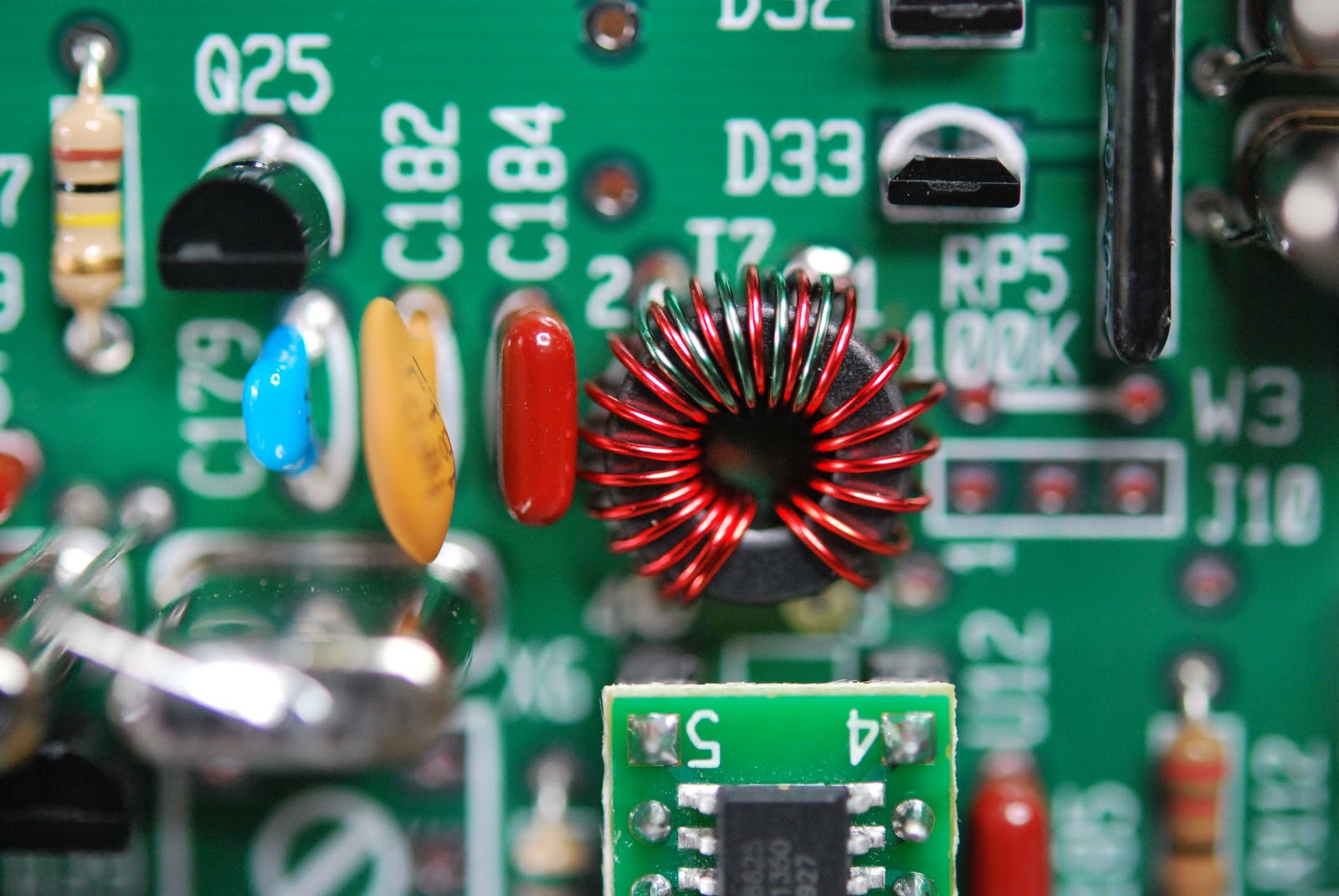 |
| The dreaded toroid... |
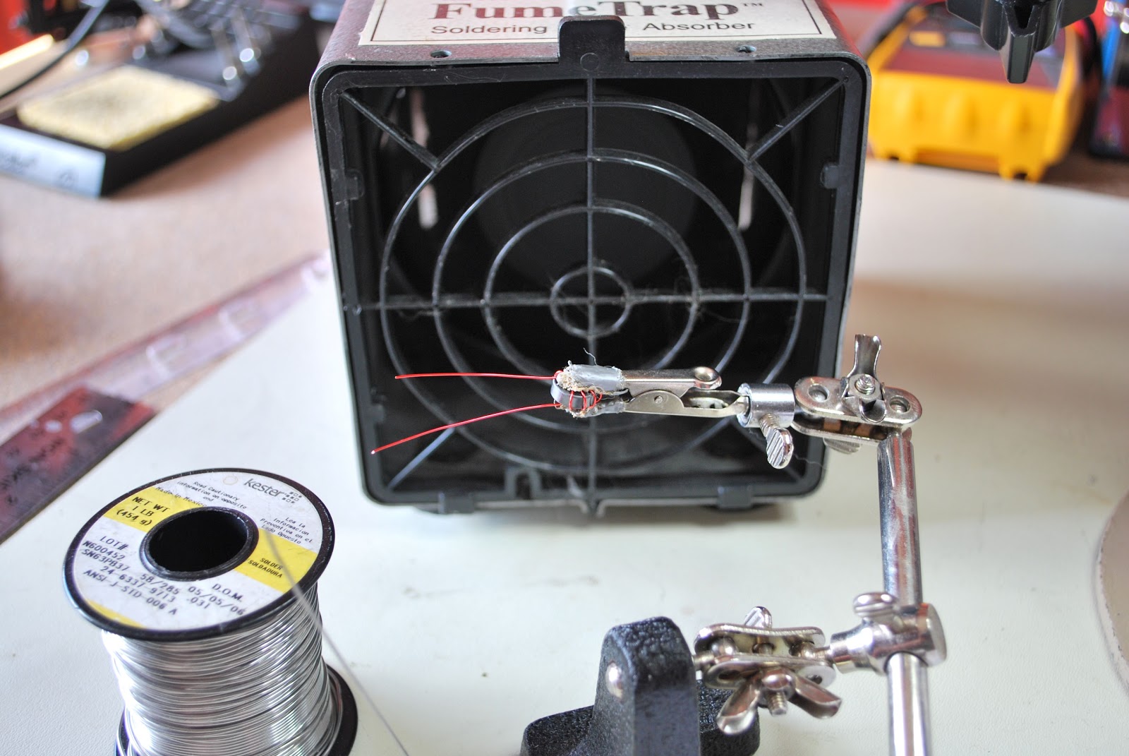 |
| Getting ready for solder blob |
B. Use sand paper.
C. The solder blob method.
D. Use a razor knife to scape the coating off.
E. I have heard some dipping the wire in var-sol....would not recommend it.
I use the solder blob method and I have tried the sandpaper (find it just to rough for the delicate work that is needed) I have tried the lighter method but found on the smaller toroids I am not able to control the heat and end up burning off to much insulation. The razor blade scraping I have not tried and really don't want a razor knife that close to my fingers. SO....it's the solder blob for me!! I find if I put the toroid in an alligator clip to hold it I can in a very controlled fashion remove the right amount of enamel from the toroid.
I change the tip on my Weller soldering iron to a larger tip and use a .030 diameter solder. Most of my board work is done with a .020 diameter solder.
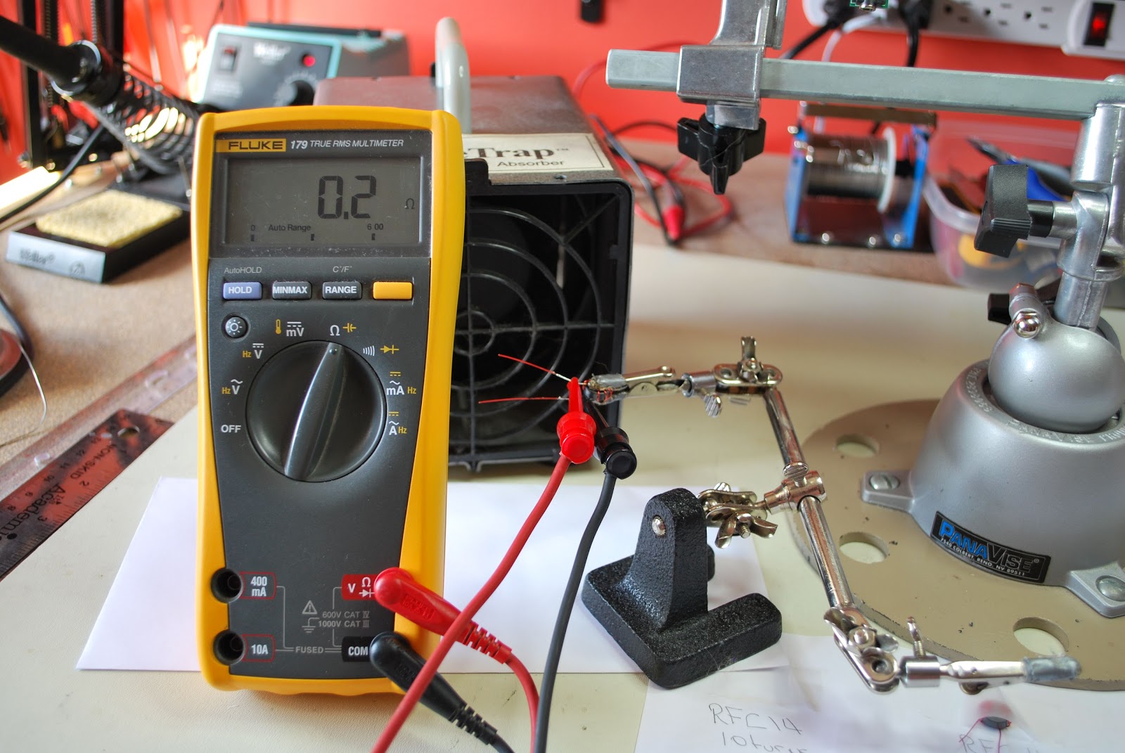
DO NOT SKIP STEP 7.....
7. Once the toroid wire has been stripped I use my DMM to check to make sure the coating has been removed and there is good continuity. Oh and for toroids that have more that one winding I check to make sure there is not shorts between the windings as well.
8. It's now time to solder the toroid in place and I find once the toroid is soldered in place before the leads are trimmed you can heat each solder blob up again and give each lead a LIGHT pull with a pair of pliers. This will allow the toroid to sit firmly on the board.
Some tips
1. Practice practice practice......it's like CW it's an art and over time you will get the idea and look forward to it.
2. Some toroids have nice rounded edges but be aware of those with sharp 90 degrees edges. These toroids can if your not careful remove the insulating coating from your wire and potentiality cause a short.
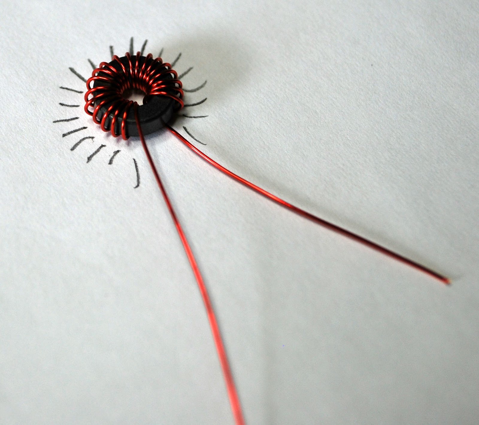 |
| Using a paper and pencil to count |
4. Use two sizes of soldering tip's one (I use the Weller ETC 1/8 tip) for the solder blob used to melt the insulation off the wire. Then a thinner tip (I use the Weller ETR 1/16 tip) for soldering the toroid to the board.
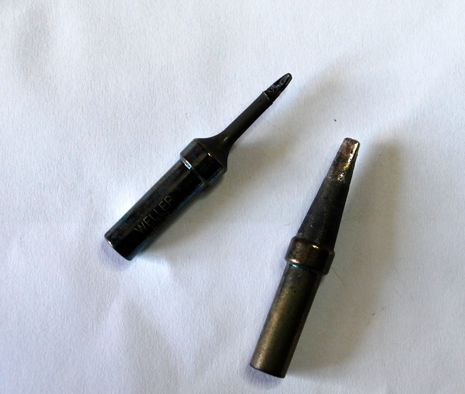 | |||
| ETR and ETC tips |
Coming soon how to wind the bi-filar toroid and transformer toroid.
Mike Weir, VE9KK, is a regular contributor to AmateurRadio.com and writes from New Brunswick, Canada. Contact him at [email protected].
 Ham Radio Deluxe |
 W5SWL Electronics |
 Ham Radio Prep |
 KB3IFH QSL Cards  Hip Ham Shirts  HamRadioAuctions HamRadioAuctions Reliance Antennas Reliance Antennas Enigma Shop Enigma Shop |  morseDX  Ni4L Antennas  R&L Electronics R&L Electronics antennas.us antennas.us QRV QRV |
- Matt W1MST, Managing Editor
