Posts Tagged ‘WOTA’
 WOTA day
What a day it has been for activity in the Lake District fells! Although the day isn’t over the light is beginning to fade as I write this and I’m guessing there won’t be any more activations today. But a quick count of the spots on the Wainwrights On The Air website shows there have been a total of 22 different fells activated by 6 different people which is probably a Wainwrights record.

At times the spots were coming so thick and fast that there was a danger of missing someone because you spent too long calling another station. And the fell-top stations had a hard job finding a clear frequency. Many had to QSY two or three times from their original chosen frequency because they landed on top of someone else’s contact. Perhaps we need to consider moving to 70cm for WOTA?
I myself made 16 contacts and added 7 new summits to my chaser total. I wish I could have been out on the fells myself to gain a bit of elevation and work some of the more distant ones. But this has still been my most productive day of WOTA chasing. Thanks to Phil G4OBK, Geoff GM4WHA, Phil M0AYB, Richard G1JTD and Colin G4UXH for the contacts. Visit Phil G4OBK’s Wainwrights blog where he will no doubt be posting an account of today’s activity with pictures shortly.
Autumn walk
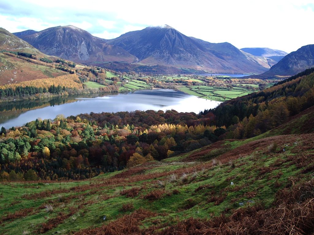
Sunday was a fine but cold autumn day and Olga and I went for a walk near Loweswater. In my rucksack I took the Motorola GP300 and the FoxTrak APRS tracker. This is a somewhat more bulky arrangement than using the VX-8GR, however this hobby has for me always been more about providing a reason to build and tinker about with stuff than using the latest, most efficient technology and using this home-built tracker with a radio I bought for £1 at a rally is just somehow more fun than using Yaesu’s latest gadget.
I had obtained a cable for the Motorola with the correct two-pin plug to make up an interface. I cut the tip off the 3.5mm jack so that inserting the plug did not cut off the speaker and I programmed a channel on the radio with 144.800 as the transmit frequency and 145.500 as the receive frequency. This meant that I could hear anyone calling CQ during the periods between transmitting position beacons. The downside is that the FoxTrak cannot tell if the APRS frequency is clear before transmitting. But many dumb trackers do that already because they don’t have a receiver. In any case, the APRS activity level here is so low that the chances of a collision occurring are about the same as winning the lottery.
Although the path we walked along was quite high, this was not a very good location for radio. Only one position beacon was received by a gateway and I made just one voice contact – with Phil M0AYB/P activating the summit of Blencathra for WOTA. (Phil later went on to activate Mungrisdale Common which completed activations of all of Wainwright’s Northern Fells. I’m doubly sorry to have missed contacting him there, but congratulations Phil on the achievement.)

Our walk took us down through the woods to the lake shore and then back to the car. The autumn colours were wonderful – my pictures don’t really do justice to them. I expect most of the leaves have now gone. Last night there was a gale and this morning through the overcast we could see wet snow on the mountains down to quite a low altitude. I doubt that there will be many more opportunities for a walk like this before the end of the year.
Rannerdale Knotts
On Sunday Olga and I went for a walk in the Lakes. As Olga doesn’t like climbing my Wainwright activation possibilities were limited so I decided to head for Rannerdale Knotts, LDW-209, the fifth from lowest Wainwright.
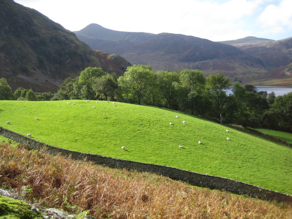
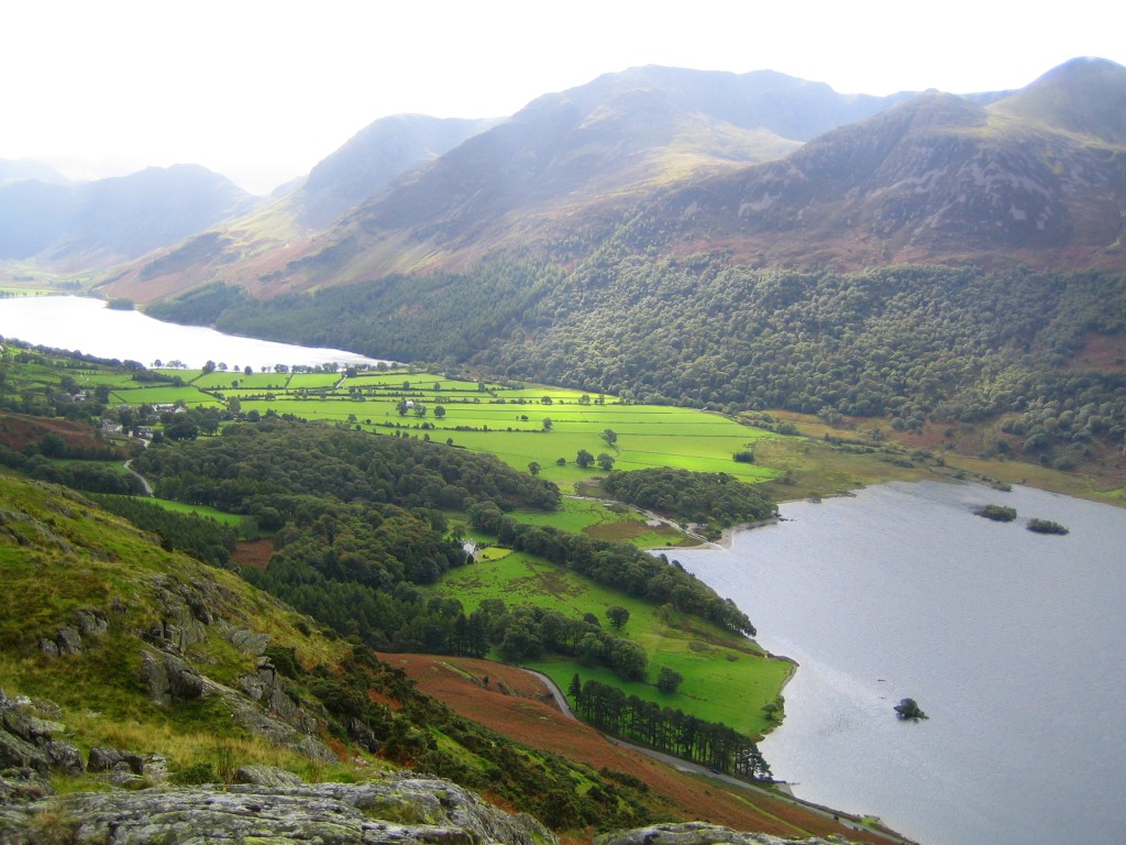
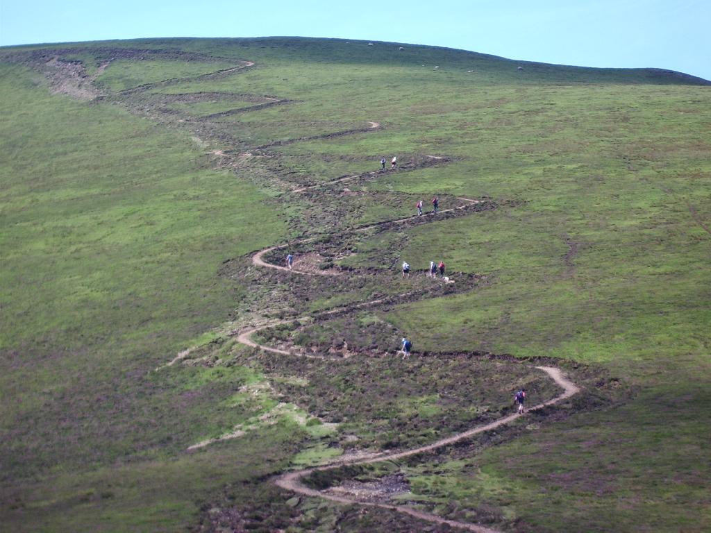
Despite its low height, Rannerdale Knotts looks quite forbidding. The most direct path is very steep. However the summit is also accessible by an easy walk up the valley named Rannerdale which brings you on to a ridge that leads directly to it. On the way there are great views back over Crummock Water and Loweswater out to the Solway estuary.
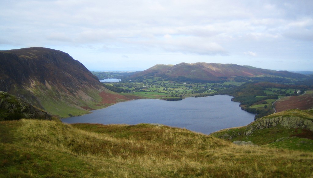
Just as we were about to climb on to the ridge I heard Phil G1OPV/P calling from the summit of Mellbreak (the hill on the left in the above picture.) Though only a couple of miles away I could only just hear him due to the steep ground between us. I hurried to the top to make contact and agree to work again when I reached the summit of Rannerdale Knott for a true summit-to-summit.
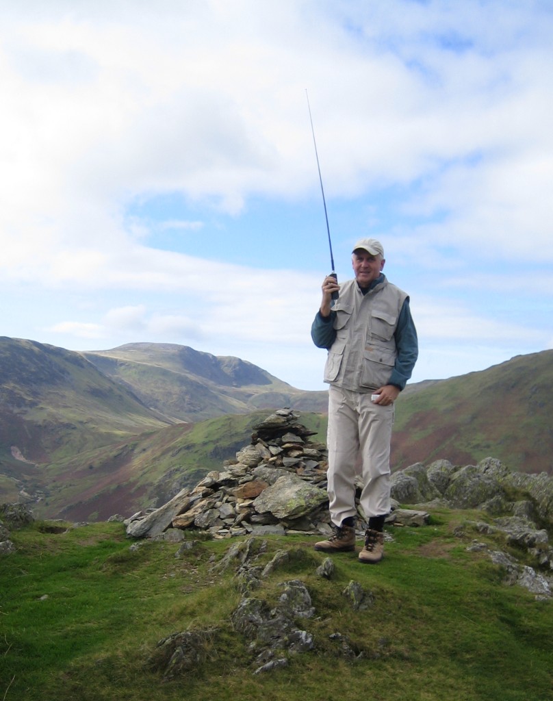
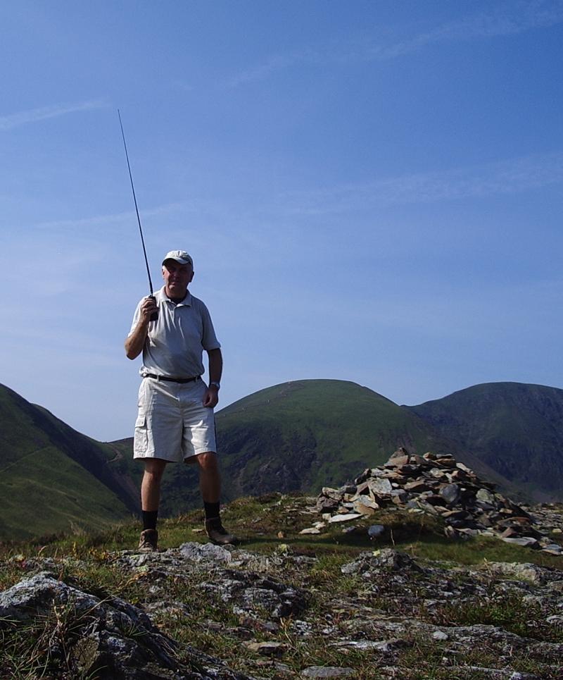
I had barely reached the summit and was still getting my breath back when I heard a “CQ WOTA” call and made contact with M0AYB/P (also Phil) who was on Dodd, another fairly low fell beside Bassenthwaite Lake. Anyone who knows the area was surprised that VHF signals could travel between two such low hills with a large mass of mountains in between. Olga captured me making the contact with Phil on her camera. I was using the Motorola GP300 on this occasion, with 4W out to a 5/8 wave telescopic “Black Whip” antenna. In my left hand you can see the Olympus personal voice recorder I use for logging.
After signing with Phil I was immediately called by Geoff, G4WHA/P who had arrived on the Causey Pike, the summit I climbed a few weeks earlier and failed to recognize or activate! Whilst I sneaked up on it the back way making it easy to reach, Geoff tackled it by the direct route which he informed me had turned out to be tougher than he anticipated. Accompanying Geoff on his first Wainwright outing – a baptism of fire – was Mark M1MPB/P so I made two contacts with the same summit. Then I contacted Phil G1OPV/P again to make the summit to summit with Mellbreak. I suspect we could have made the contact by shouting if the wind had been in the right direction, in fact I think I could just see Phil silhouetted against the skyline on the summit.
After that I was called by Robert M3XJV/P who was on Birkhouse Moor, on his way to Helvellyn. This was a nice addition to my chaser total as the Helvellyn hills seem to be out of range of my home station in Cockermouth. Finally I made two contacts with home based stations: Roger G0MWE in Dearham and Ron G0UQC in Keswick before I was able to sit down and join Olga having our picnic lunch and enjoying the view over Buttermere.
We returned to the car via the precipitous direct descent down to the lake. It was a short walk but a successful one. Seven contacts including five summit to summits from a low fell that on previous visits (before WOTA) you would never expect to make a contact from. I think Wainwrights On The Air is transforming VHF activity in the Lake District and the comment from one activator that it is getting hard to find a clear frequency is proof of it.
Barely making contact
I was reflecting on what I wrote yesterday about the EchoLink app for Android and why I find it and similar developments disturbing. I thought it was because it made me uneasy having to face the fact that the internet and a cellphone appears to make ham radio redundant by allowing us to make the same contacts so much more easily without using the ham bands at all. Then I had a blinding revelation. Ham radio is not about making contacts. It is about not making contacts, or making them only with luck and some difficulty.
I almost stumbled across this truth a few months ago after I sold my first VX-8R to do APRS on a smartphone using Lynn KJ4ERJ’s excellent APRSISCE software. It worked far better than the 2m radio, allowing me to be tracked and exchange messages in places where there was no 2m signal. But I went back to using RF for precisely that reason. The smartphone didn’t provide the interest of allowing me to see how VHF RF propagates around the local terrain. The disappointment of not being tracked as I slogged up the mountain was balanced by my surprise when a beacon was gated from a location I wouldn’t have thought possible and the interest created in working out how it happened. There is also the technical challenge of finding ways to improve coverage and get a radio signal out of difficult locations, for which buying a smartphone is simply a cop-out.
When you look at other ham activities that remain popular or are even gaining in popularity it’s obvious that the interest is not in how easy it is to make contacts, but how hard. DXing isn’t about pressing the PTT and ticking another entity off the list a minute later, it’s about what you have to do – buy equipment, improve your antennas, learn about propagation, develop operating skills, be patient – in order to achieve it. People boast about the DX they’ve worked, but what keeps them interested in DXing is the places they haven’t worked and how hard it will be to work them. Dialling up a contact using an internet application has nothing to do with it.
Contesting isn’t popular because it’s easy to amass a winning score but because you need the best equipment, the best antennas and lots of skill to get even close. It isn’t meant to be a level playing field. That’s why many people dislike developments like reverse beacons and skimmers that take away some of the skill required.
QRP pursuits like WSPR or MEPT beaconing aren’t about making contacts at all, but just about seeing how far a whiff of RF can go. The excitement isn’t in being received by someone for the nth time, it’s that first barely detectable trace on the screen of someone or somewhere new that makes you punch the air (if QRPers go in for such QRO expressions of emotion.)
The thing about VHF FM activity is that for the most part it isn’t about the achievement of the contact at all. It’s just about being able to converse with people. When I was first licensed, before mobile phones and inclusive call packages, chatting on 2m FM was actually the best and certainly the cheapest way of keeping in contact with my local ham friends. But things have changed over the last 35 years and I haven’t been paying attention. I’m the dinosaur who wouldn’t disclose his mobile number to the radio club database because I felt that if someone wanted to talk to me about radio they could wait until they can contact me on the radio. But I suspect that everyone else has moved on. If they want to speak with one of their ham buddies they pick up the phone. Which may partly explain why the VHF bands these days are almost dead. Or even the development of D-Star, which provides some of the convenience of calling someone on the phone without totally abandoning use of the ham bands.
In only a handful of pursuits like SOTA and WOTA where the point is to make a contact direct using radio is 2m FM still used in what I would call a traditional manner. People will struggle to hear their signal report even if the activator is right down in the noise and get a feeling of having accomplished something when they are successful.
So EchoLink on a smartphone really doesn’t change anything. It already changed. Whether hams call one another on the phone using their phone number or their EchoLink node number really makes no difference. It has just been blinkered thinking on my part to have felt that if people hold ham radio licenses they ought to talk to each other using ham radio even if it isn’t the most convenient way of doing so.
WOTA success
 I think it’s fair to say the Wainwrights On The Air (WOTA) scheme has become a big success. At the start it was probably true that the main participants were existing Summits On The Air (SOTA) enthusiasts who appreciated the opportunity to make more of their Lake District excursions by activating the hills they would otherwise have walked past on their way to a SOTA summit. But recently several local amateurs have got started specifically in WOTA chasing and activating. There has even been a request for a list of the easiest Wainwrights to climb! There isn’t an award for that, but it does suggest that WOTA is encouraging people to get out on the hills who were not previously enthusiastic fellwalkers and I think that is one of the best possible outcomes for the scheme.
It’s a pity, though, that no-one offered to design a nice award certificate for the scheme, which the Workington Radio Club was then going to get professionally printed. The ones I made using a free online certificate maker and print on our cheapo HP multifunction printer (with expensivo ink cartridges) look a poor reward for all the time and sweat that has been expended earning them. I always have a fight getting them to print correctly anyway, so having some professionally printed certificates would have saved me a lot of hassle.
Another great cockup
Another weekend of glorious weather. I decided to make an early start on Sunday and try a slightly more ambitious Wainwrights On The Air (WOTA) activation than normal. The plan was to walk over Barrow and Outerside and, if my legs still had enough energy left in them, Causey Pike. Though a much easier walk than those undertaken by Phil, G4OBK, I haven’t done much hill walking since getting married nearly 8 years ago and am not as fit as I used to be. This would be the longest walk I’d done for a long time.
I set off in the warm sunshine at about 9.30 and after about 15 minutes heard “CQ WOTA” from Phil who had arrived on the summit of Dodd, the other side of Bassenthwaite Lake. I was afraid I might have missed him while I was on the road. His expected arrival had been an hour earlier and I’d waited to try to catch him from the home station. But the day was warming up and he might have had a change of plan so I decided I couldn’t wait any longer. Dodd was a new summit worked for me so I was glad to have caught him. It also meant that Phil’s effort hadn’t been in vain because Dodd is a difficult hill to get contacts on.
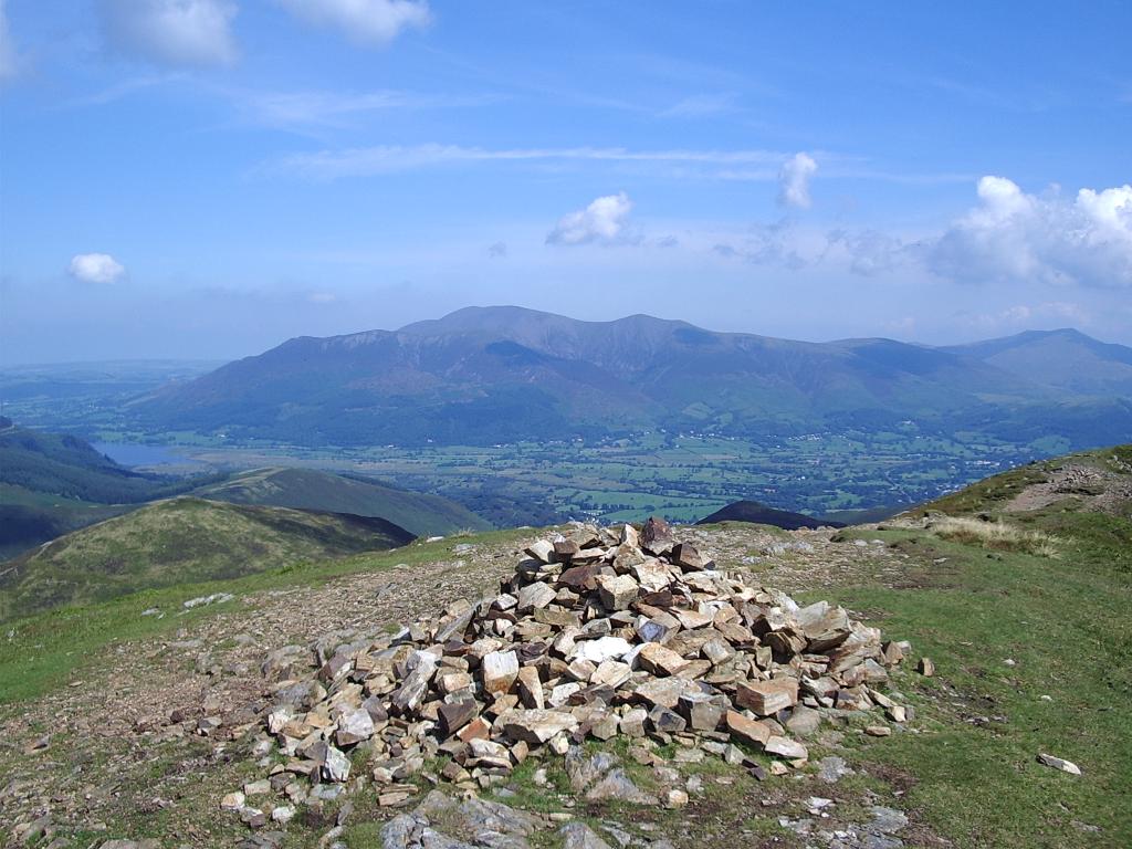
The path I was taking passed along the flank of Barrow. To reach the summit I would have to backtrack on a higher path. On the map it didn’t look far but in reality it looked quite a long walk so I decided to get Barrow on the way back and started the climb to Outerside. It was a pleasant and not difficult climb, but sweaty work in the growing heat. Eventually I reached the top (first picture) from where I made several contacts on 2m using the telescopic 5/8 wave antenna, including another with Phil G4OBK/P who had by now reached Carl Side.
I was not inclined to hang around on the summit which was plagued with flying ants – as were all the Lakeland summits judging by the comments of other hill-toppers. I descended the other side of the hill and made my way back to the main path from where I saw a track up the side of Causey Pike which looked like a shortcut. I crossed the path and made my way to the track, where I sat down and ate my packed lunch as there were no insects in that area.
Causey Pike is a narrow ridge with several undulations along its length. In fact I seem to remember one walkers guide I read a few years ago referring to it as Causey Pikes. My Ordnance Survey map shows it as a long, narrow island surrounded by the 2,000 foot contour (it’s an old map, made before they went metric.) I have walked along it several times over the years since I first came to the area but I had never given much thought to exactly which of the undulations was the actual summit was because at the time it didn’t matter.
The shortcut looked too short to reach 2,000 feet. I set off, and after about 15 minutes reached the crest. From there it didn’t look like 2,000 feet either. To my left, after a few more feet of climbing, was a small plateau which was followed by a sharp descent into the valley. To my right, the crest of the ridge rose steadily for what looked like another 400 or 500 feet. “The summit must be up that way” I thought, so I turned right and off I went. On the way I stopped to work Ian, 2E0EDX/P on Brim Fell, for another summit that I wouldn’t have worked from home.
Eventually I arrived at the highest point which was surmounted by a rough stone cairn. I started to call “CQ WOTA” and made several contacts from what I described as the summit of Causey Pike, including one with Colin, 2E0XSD whom I asked to check whether my position was showing on aprs.fi. He confirmed that it was, and the details tallied with what my VX-8GR GPS was showing.
I started to make my way off the fell on my way home by the main footpath when I was called by Phil, G4OBK, to pass on a message that Colin didn’t think I was on Causey Pike when I made the contacts. Since Colin sometimes has a bit of fun at my expense due to an error I made during an earlier activation the thought crossed my mind that he was having a wind-up. Shortly after that I received an APRS message from Colin which stated that I was on Scar Crags, not Causey Pike. I had never heard of Scar Crags but I knew that there was another hill nearby called something Crags (having checked it is Ard Crags) so I thought that perhaps the position of the labels on the map may have caused Colin to mistake my position and decided to carry on descending.
While all this was going on I was watching a couple of mountain bikers zooming down a zig-zag path that had been made on the side of the fell named Sail opposite where I was standing. This unsightly path has been made because the number of boots (and presumably tyres) ascending and descending the fell had destroyed the original path and made it dangerous. Britain is an overcrowded island and the number of visitors, particularly in recent years as more people take holidays at home, is literally causing the hills to wear out!
Further down the path back to the car the surface had been repaired by tipping truckloads of small rocks into the channel caused by thousands of boots, so that instead of a gentle walk down I had to pick my way from rock to rock like on a rocky beach. Not a particularly welcome activity for legs that were becoming tired. The battery of my VX-8GR finally expired during a contact with a SOTA summiteer in Northumberland whose call I heard on the walk down, so there being no point in taking the loop over Barrow I walked straight back to the car and came home.
Back home, examination of my position report on aprs.fi showed that Colin had been right. I had indeed been on Scar Crags when making my “Causey Pike” contacts.
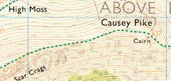
I had never heard of Scar Crags before and was completely unaware that it was the name of a Wainwright summit. However, had I stopped and looked at the map at the time it is unlikely that it would have convinced me that Colin was right. In this small grab from the online version of the map Scar Crags is shown at the bottom of the crags, which would suggest to me that it was the name of the cliffs and not of the actual summit. And the plateau that I now think may have been Causey Pike did not seem as prominent as the contours on the map make it look. Perhaps all the millions of boots have worn it flat, too. Only seeing my GPS position on the map and looking at Wainwright’s book made me realize that this was another great cockup (as distinct from Great Cockup.)
It’s rather embarrassing to make such a public mistake, as well as frustrating to have missed the opportunity to activate the real Causey Pike. I will just have to try again one day. And next time, perhaps I’ll also activate Barrow.
Pileup on the fells
The hills are alive with the sound of “CQ SOTA” and “CQ WOTA”. These two adventure radio programmes are becoming so popular that anyone trying to make contacts from a hilltop this last weekend on 2m FM had trouble finding a clear frequency. The sight of radio amateurs on mountain summits is becoming so commonplace that soon it will be the ones without radios getting the funny looks.
On Sunday morning Olga said to me “You should go for a walk”. Needing no further encouragement, I tossed the VX-8GR and a few bits and pieces into my rucksack and off I went. I parked at Thornthwaite near the old Swan Hotel and made my way up through the forestry roads to the minor summit of Barf. I didn’t go up by the direct path from opposite the Swan as it is very steep and slippery – I came down that way once a few years ago and it was enough for me.
On the way up I had a contact with top Wainwrights activator Phil, G4OBK/P on the summit of Brandreth. Phil is well on his way to completing the challenge of activating all 214 Wainwright summits in the English Lake District within two years and reached the half way mark this weekend. Visit Phil’s Wainwrights blog if you get a chance.
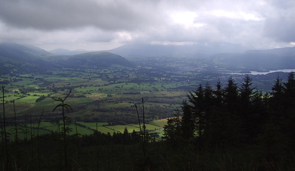
Shortly after contacting Phil I saw two ospreys circling over Bassenthwaite Lake and calling to each other with their high-pitched cry. I stopped and took the picture shown above of the view towards Keswick. About ten minutes later a small red deer came out of the forest about 100m ahead of me and trotted into the distance. Perfect!
It was cool but humid, but the misty weather creates a special atmosphere in the forest that is very pleasant. However once on the top of Barf a drying breeze was experienced. I made another contact with Phil, who was now en route for Great Gable, so he could tick Barf off on his “worked” list, and made another contact with Geoff GM4WHA. I also received an APRS message from Colin 2E0XSD, who unfortunately couldn’t hear me direct due to the amount of rock between us.
I then set off for the higher summit of Lords Seat, which I reached in about half an hour, where I stopped and had my lunch. By then Phil had reached Great Gable so we had a summit-to-summit contact. I made numerous other contacts, including Geoff and Colin and a couple people on SOTA summits outside the Lake District. I received a lot of comments about wind noise in the microphone, despite trying to shield the radio with both hands. The VX-8GR is the only one of my 2m hand-helds not to have a speaker mic, due to the fact that the only option is the expensive original Yaesu version. I should probably carry the VX-8GR just for the APRS and take the Motorola GP300 for voice contacts.
Simon, M3IWN/P called CQ from the top of Scafell Pike in the Lake District, which is England’s highest mountain. He was doing a SOTA activation and had a beam antenna with him. On a clear day I could probably see his summit from where I was, but he had so many callers that after 10 minutes of trying he still hadn’t heard me. I decided to move to another frequency and make some contacts of my own, checking back on Simon’s frequency now and again until eventually he got my call and we had a contact. At the time I worked him Simon had filled two and a half log pages with contacts including several summit to summits.
The QRM up there had to be heard to be believed. I was only using a 2m helical. The VX-8GR receiver tends to die in the presence of strong signals and I have heard strange things when using anything better than the stock antenna. Another reason for taking the Motorola, which has a better receiver. First, though, I will need to reprogram it to cover 145.300MHz, the frequency Phil likes to use on his activations.
Over the weekend I think something like 20 Wainwright summits were activated by around half a dozen different operators. Scafell Pike was actually activated twice on Sunday! Later in the afternoon after Simon had left I saw a spot had been posted for another station on the same summit.
I returned to the car via the forestry roads for a very pleasant walk with a lot of radio fun as well. If you want to join in, come to the English Lake District on a summer weekend – you won’t regret it!


