Posts Tagged ‘SOTA’
 Cool 12m SOTA contact
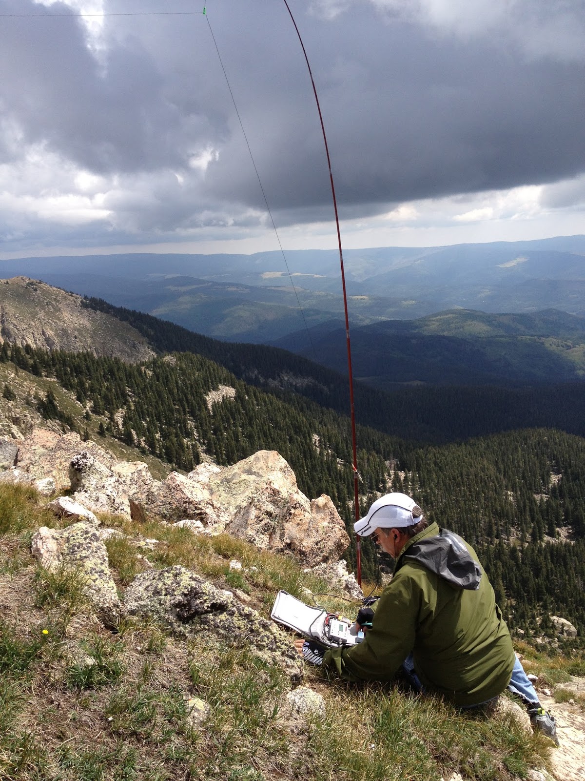
The past Saturday I had a rare weekend with not much on the schedule so I was chasing SOTA summits among other things. It was a fun day on the radio and I worked several Europeans on 12m. Currently the SOTA program has a 12m challenge in place which encourages activity on this band and when open, provides some fairly long haul DX for these QRP summit operations. I wasn't operating QRP, I was using my FT5000 and my Log Periodic Antenna up about 50 ft, however there are always several summit to summit QSO's among the activators that are QRP both ways across the pond. However this wasn't the most fun of the day.
Around 0130z on Saturday evening a SOTA spot came up for VK3ZPF, Peter, on a Mt. St. Phillack in Victoria, Australia on 12m SSB. I swung the beam around, not expecting to hear a peep. I wouldn't be writing the article if that is how it ended;-) I could hear the CQ faintly, but there was deep QSB. Finally on the peak I called and he came right back. We exchanged reports I had him in the log. A few minutes later, Glenn, VK3YY, who was with Peter was calling and I worked him as well. Glenn sent me an email saying that he was using a 40m EFHW antenna through an Elecraft T1 tuner and an FT817. Pretty cool and on SSB as well.
This radio stuff is fun.
A Classic SOTA Hike: Midland Hill (W0/SP-117)
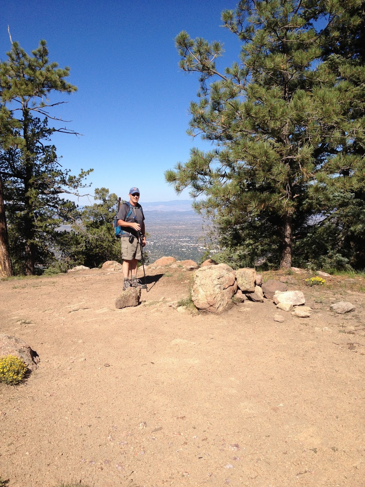
Today, Joyce K0JJW and I decided to hike Midland Hill (W0/SP-117) near Buena Vista, CO (otherwise known as “BV”) and do a SOTA activation on VHF. I call this a “classic SOTA hike” because it is a real hike that requires some exertion, a well-maintained trail to the summit and some great views at the top. By my GPS, it was 2.4 miles one way, with 1600 feet elevation gain.
This hike starts at the trailhead on the east side of BV, where a footbridge crosses the Arkansas River. The SummitPost trail description is very helpful, so be sure to check it out. I checked quite a few topo maps of the area and most of them do not show the trails accurately. I found them more confusing that helpful. I’ve included my GPS track on the map below.
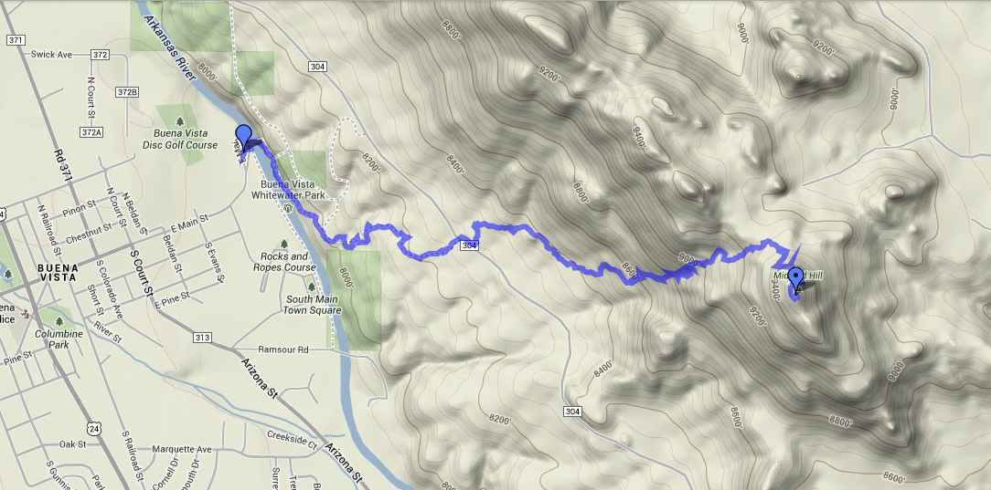
GPS track for Midland Hill
We started at the trailhead, immediately crossing the footbridge to the east side of the river. Then we followed the Midland Bike Trail which parallels the river. Very soon after the bridge, there is a trail leading off to the left (east) uphill that is tempting but we stayed on the main trail that parallels the river. At about 0.5 miles in, we crossed County Road 304 (38.843508 deg N, 106.112297 deg W) onto the clearly marked 6032 trail, which goes up to Midland Hill. Just follow the trail and do not turn onto 6032A trail as it goes off to the left.
If you are pressed for time, you can start the hike where 6032 intersects CR 304, but that only saves 0.5 miles. You’ll miss the bridge and great views of the Arkansas River.
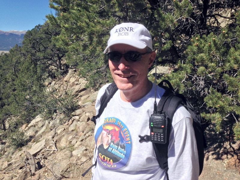
Bob K0NR on the trail
Once we reached the summit, I set up on 146.52 MHz using my VX-8G connected to the 2M Arrow Yagi. Joyce stayed back outside of the activation zone, so I worked her as soon as I made the summit. Then Walt WZ0N came up on frequency and gave me a second contact. I contacted a couple of mobile stations: Ryan KD7OHA on Highway 50 near Texas Creek and Bud NP2CT on Highway 285. Other contacts where with some of the local hams: N0OFQ near Nathrop, Jerry N0VXE and Skip W9GYA near Salida. Not bad for a Monday afternoon in the mountains. Thanks, guys, for the contacts!
Lately, some of the SOTA hikes I’ve done have involved bushwacking up the side of a steep hill to get to the summit. It was great to have a real trail this time. The 1600 vertical feet did get me huffing and puffing but that’s part of the experience. I highly recommend this summit!
73, Bob K0NR
How To Do a SOTA Activation On Pikes Peak
This post was updated on June 4, 2022, after the summit house construction was completed.
Perhaps this should be called The Slacker’s Guide to Activating Pikes Peak since I am going to describe the easy way to do a Summits On The Air (SOTA) activation on America’s Mountain. If you plan to hike up, you have my complete support but this post is not meant for you.

Pikes Peak (W0C/FR-004) is about 10 miles straight west of downtown Colorado Springs. See the Pikes Peak website for useful tourist information. At an elevation of 14,115 feet, the mountain towers over Colorado Springs and the other front-range cities. (You may see the elevation listed as 14,110 but it was revised upward in 2002 by the USGS.) This means that it has an excellent radio horizon to large populated areas. On VHF, it is possible to work stations in Kansas, Nebraska, Wyoming and New Mexico. See VHF Distance From Pikes Peak and Pikes Peak to Mt Sneffels. On HF, you’ll do even better.

Getting There
Access to the summit has three options: hike up, drive up via the Pikes Peak Highway or ride the Pikes Peak Cog Railway. Most people will probably choose the highway since the cog rail only gives you 30 to 40 minutes on the summit. (Normally, you return on the same train that takes you to the top. You can try to schedule two one-way trips but that is a challenge.)
After a few years of turmoil and construction, the summit of Pikes Peak is now back to operating normally but with some changes. The new summit house/visitors center is open and it is a beautiful new facility. The Cog Railway is also operational with brand new equipment. There is a new boardwalk that allows easy strolling on the summit and improved views near the edge of the summit.
Pikes Peak Highway
The highway is at a well-marked exit off Highway 24, west of Colorado Springs. There is a “toll” to use the highway (~$15 per person, check the Pikes Peak Highway website for the latest information and a $2 discount coupon.) Starting in 2022, you must have a reservation (2-hour window) to drive to the summit (roughly Memorial Day to Labor Day). The specifics are likely to change, so be sure to check the Drive Pikes Peak page for the latest updates.
The road is paved all of the way to the top and is usually in good shape. The only caution on driving up is that some people get freaked out by sections of the road that have steep drop-offs without guard rails. It is very safe, but some folks can’t handle it. The main caution driving down is to use low gear and stay off your brakes. There are plenty of signs reminding you to do this and during the summer there is a brake check station at Glen Cove where the rangers check the temperature of your brakes.
It takes about an hour to drive to the summit, assuming you don’t dawdle. It is best to drive up during the morning and avoid the afternoon thunderstorms.
On The Summit
The W0C Association Reference Manual (the SOTA rules for Colorado) used to suggest a “qualifying hike” of 100 vertical feet but this item has been removed from the manual. If you decide to do such a hike, I suggest you proceed down Barr Trail which is the main hiking trail coming up from the east side of the peak. Do not try to walk along the road, as the rangers will stop you. The trail starts on the east side of the summit house (towards Colorado Springs) and is marked with a sign. You have to cross over the cog rail tracks to get to it. (Please try to avoid getting run over by the train as it scares the tourists and makes a mess.)
The summit of Pikes is broad, flat and rocky, so pick out a spot away from the buildings for your SOTA adventure. There are quite a few radio transmitters on the peak so expect some interference. Since this is way above treeline, your antennas will have to be self-supporting. For VHF, giving a call on 146.52 MHz FM will usually get you a few contacts and sometimes a bit of a pileup. Be aware that on top of Pikes you are hearing everyone but they can’t always hear each other. It can get confusing. Another VHF simplex frequency worth trying is 146.58 MHz (The North America Adventure Frequency). On the HF bands, pray for good ionospheric conditions and do your normal SOTA thing.
Your body and your brain will likely be moving a little slower at 14,000 feet due to the lack of oxygen. Don’t be surprised if you have trouble deciphering and logging callsigns. Take it slow and monitor your physical condition on the peak.
Bring warm, layered clothes, even in the summer, since Pikes Peak can have arctic conditions any time of the year. Keep a close eye on the weather since thunderstorms are quite common during the summer months. Lightning is a very real danger, so abandon the peak before the storms arrive.
73, Bob K0NR
Resources
SOTAwatch web site
W0C SOTA Website
Pikes Peak Tourist Information
Pikes Peak (W0C/FR-004) SOTA Page
Pikes Peak Webcams
The post How To Do a SOTA Activation On Pikes Peak appeared first on The KØNR Radio Site.
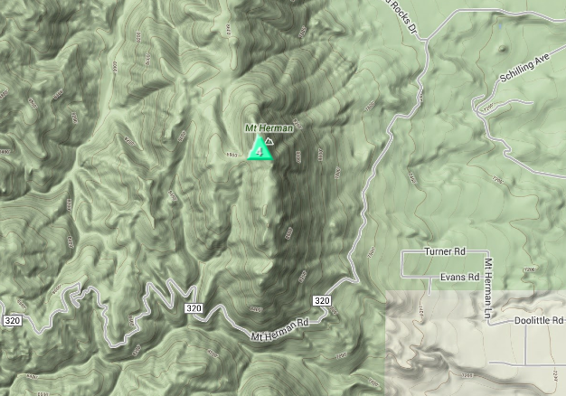
A Soggy Mount Herman SOTA Activation (W0/FR-063)
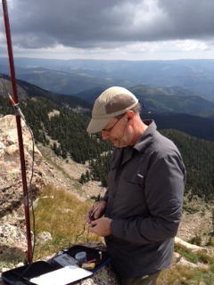
Although I’ve operated a number of VHF contests from the summit of Mount Herman, I had not yet activated it as a Summits On The Air (SOTA) peak. Mount Herman is a 9063 foot mountain just to the west of Monument, Colorado, pretty much in ”my back yard.” Steve WG0AT did the first SOTA activation of Mount Herman, back in May 2010, chronicled here in one of his famous videos. There is a sometimes rough Forest Service Road 320 that leads to the trailhead, then it’s a little more than a one mile hike to the top with 1000 feet of elevation gain. I call it a tourist hike, since it has just enough challenge to make it feel like a climb and there’s a great view at the top. At least on most days.
I was not expecting much of a view today since low rain clouds were dominating the sky. I was just hoping I would not get completely drenched by rain. The weather was definitely marginal but from my house I saw the clouds lift a bit, so I thought it was worth a try. The ARRL September VHF Contest is also this weekend, so it was a great combo opportunity: SOTA + VHF Contest.
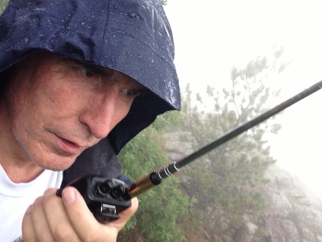
I hopped in the Jeep and quickly made the drive to the trailhead. Then I scooted on up the trail, making it to the summit in about 30 minutes. Just as I reached the summit, the rain really kicked in. I set my gear down under a tree, got out my HT, attached the 1/2-wave antenna and started calling on 147.42 MHz. I wanted to bag my four SOTA qualifying contacts in case the weather turned worse. I quickly worked Frank K0JQZ and Steve WG0AT. Then George AB0YM, operating as a rover in the VHF contest called me from grid DM78, so I worked him as well.
I had my trusty Arrow Yagi antenna with me but I didn’t want to bother with assembling it in the rain. I got out the FT-817, put a vertical antenna on it and called on 144.200 USB. I found stations working the VHF contest and completed QSOs with them: WB0RRU and K3ILC.
The rain intensified so I abandoned the summit and headed back down. All in all, it was not a great hike but I was successful in activating Mount Herman.
73, Bob K0NR
A Little Prevention and a Pound of Cure
Recently, a very active SOTA activator who had probably 80 or 90 summits to his credit suffered a heart attack while on a climb. These events are always a little sobering because we aren't so different in age. It isn't intuitive that an active individual would be a heart attack candidate. The fact is he had 100% blockage in one of his arteries. My son is an MD and explained that the body will build it's own bypass system over time, so 100% blockage means that the main artery was blocked, but there were several smaller bypass blood vessels that were at least transporting some blood, but obviously in the case, not enough.
There were two lessons to learn from this incident. The first in the preventive part. After say, age 50, we should have a full blown physical at least every other year, complete with an EKG that will check you heart capacity and function. If you have to borrow money to pay for the physical, you should do it. A physical is not an expense, but an investment that will yield a nice return in the form of additional years to enjoy all the things you have worked for in your life. We should do some exercise at least 4 times a week, even if it's just walking for 30 minutes. If you aren't currently exercising, get the physical first and if you are exercising don't assume that you don't have issues. The example above should be enough evidence to convince you of that. One health issue associated with ham radio is that we can do it sitting down which isn't necessarily good from a health perspective.
The second lesson from this is the pound of cure. If you are involved in outdoor activities, hiking, biking, etc.. carry a small first aid kit and include aspirin in the kit. This will help to temporarily mitagate heart attack symptoms until help can arrive. Get a book on outdoor first aid and understand what you can do when you are miles away from help and have a medical emergency. There are even several apps available for your smart phone that give solid first aid advice.
The outcome of the incident above was a good as you could hope. His hiking buddy was calm and solicited help from other hikers, one of which had some aspirin in his pack. They had cell service and could call 911 and the victim was flown to a hospital where a stent was put in. (If no phone service, have a 2m rig with the local repeaters in the memory) He is much better and should be able to get back to climbing soon. His recovery is due, in no small part, to the alert reactions of those around him.
So go make that appointment.
Four Days, Four Summits
Day 1 Peak 8409 W5N/PW-027 (8 pts)
We are still setting up house in Santa Fe and so on this Friday morning there were deliveries scheduled for 9:30. So I needed a quick hit summit that I could get on and off of quickly and get back home. Peak 8409 fit the bill. The summit is 11 miles from my house and isn't a particularly difficult summit as you can drive to within a few hundred feet of the summit. So I left the house early and found a pull-out on the road to the summit and scrambled up ~200 feet to my eventual operating position. Quickly the antenna was in place and I was calling CQ within 5 minutes. A chaser pile quickly ensued and in 25 or so minutes of operation I made 23 QSO's. After a few unanswered CQ's, I quickly tore down the station was back home in time to meet the delivery man. Cool, 8 activator points and back home in time to get something done.
Day 2 Atalaya Mountain W5N/PW-023 (8 pts)
Atalaya is not in the easy ascent category. The hike isn't too long, ~5.6 miles round trip depending on where you start (we took Trail #170), but it is relatively steep. I wouldn't call it a hard hike, so moderate is probably the best description. My son Jake, KB5SKN, who flew in the day before, would join me on this one. Jake isn't that active as a ham but when asked if he wanted to operate from the summit, he said he would rather operate than just watch me. So, in addition to my ATS-4, cw only rig, I made Jake carry the FT-817 so he could operate SSB. This is a nice hike and the views of Santa Fe are outstanding. It took us 90 minutes to get to the summit, with Jake having to adjust a little to the altitude, but we make relatively decent time.
Jake was new to mountain portable operation and he was surprised how quickly we were on the air. We set up the EFHW, stringing it in the trees to my carbon fiber collapsible pole. We received good reports, I made 21 QSO's on CW and Jake made 12 on SSB. He was surprised at how effective this antenna was. It was a nice walk down and a good day for father and son.
 |
| KB5SKN Logging His First Activation |
 |
| AD5A on Summit of Atalaya :Mountain |
Sandia Crest is the big mountain that dominates the Albuquerque landscape. I decided to take a chance on a Sunday afternoon activation. Thunderstorms are always an issue in this part of the world, but there is a tram that takes you up the mountain, so I decided to risk it.
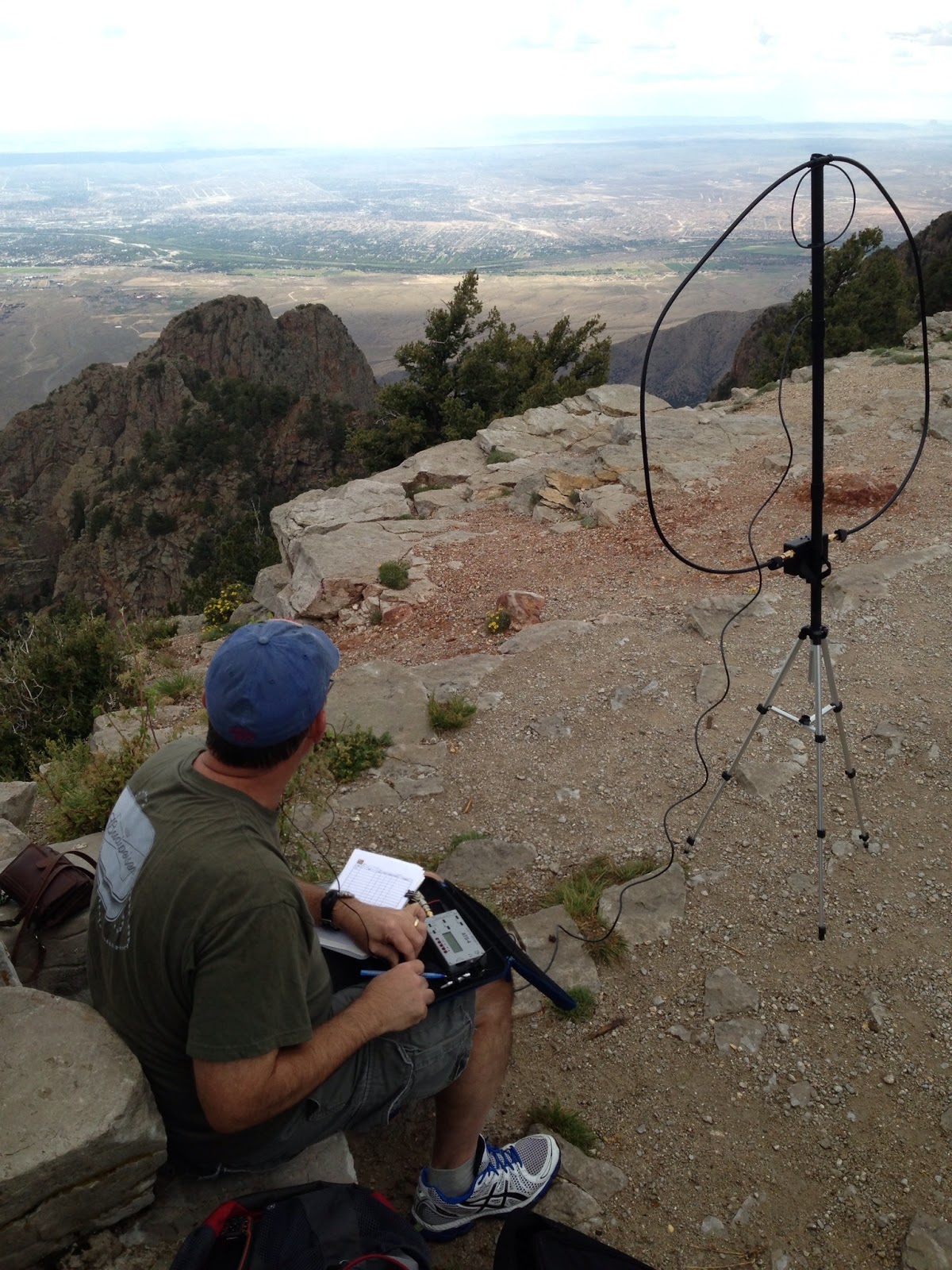
Sure enough when we arrived at the tram there was a light rain on the summit. Actually I thought the tram landing was within the activation zone. When we arrived, in the rain, I realized we need to ascend another 200 feet before I was high enough on the summit. A favorite activation location on this mountain is Kiwanis Cabin; it was a short 1.5 miles away. So my XYL and I set off in the light rain for the cabin. While the rain was light, thunder was echoing through the valley as there were widespread thunderstorms. Upon reaching the cabin, the rain had stopped, so I set up my station. On crowded summits I use the Alexloop antenna. It has a small footprint and actually works pretty well. After tuning it and calling CQ, I didn't get any immediate responses. Little did I know there had been a CME just a few hours before and conditions were not good. Over about a 15 minute time span I made 8 QSO's. Then the wind came up and the thunder got louder, so I shut down. We hiked back to the tram to find a 90 minute wait to go down. This was a holiday weekend after all. So rain, a CME and tram delay turned this into a little more adventurous and time consuming outing than planned, but I made the QSO's to qualify the activation and enjoyed some magnificent views.
 |
| AD5A on Sandia Peak |
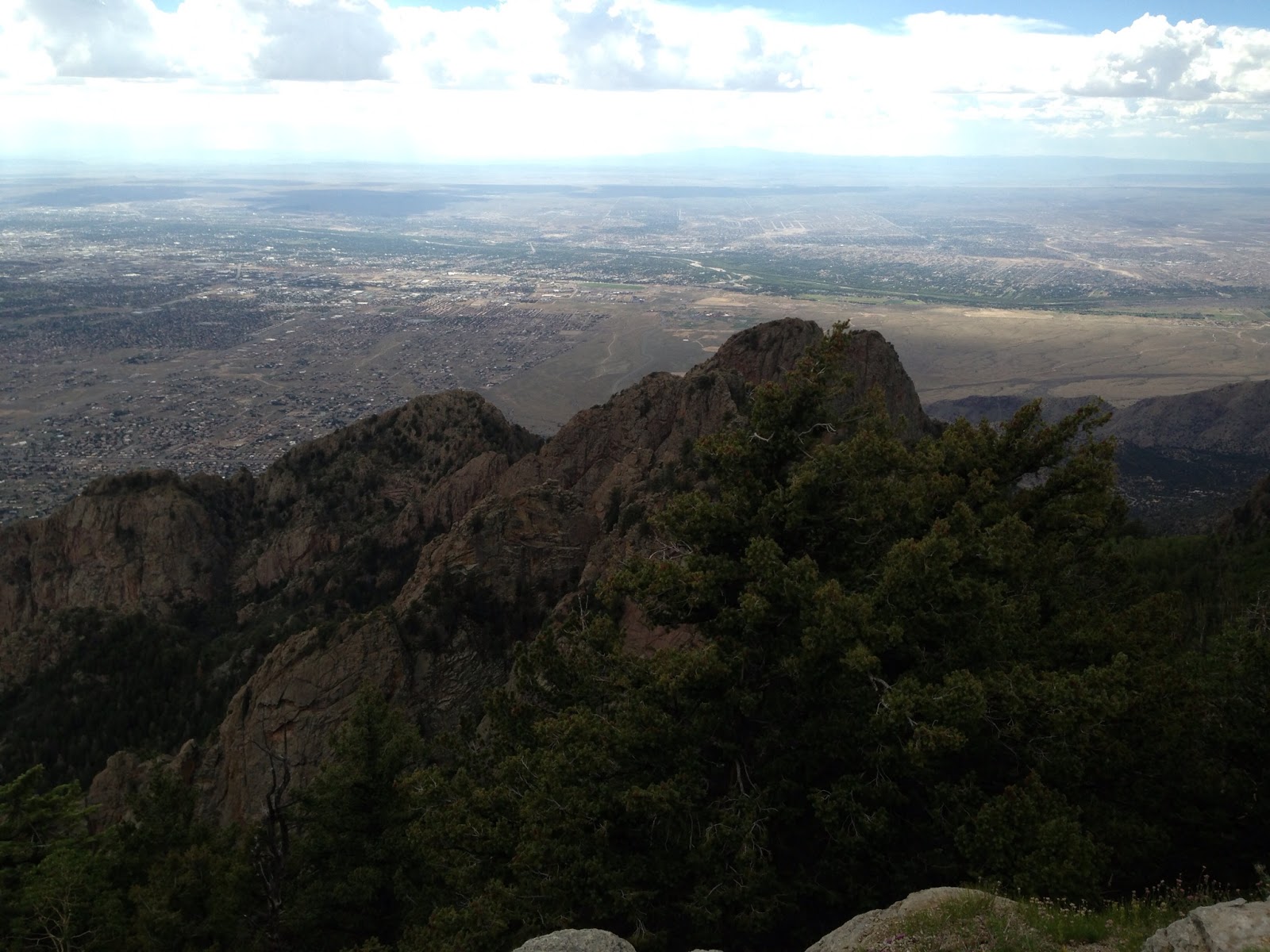 |
| View from Sandia Peak |
Day 4 Santa Fe Baldy W5N/PW-006 (10 pts)
John, K1JD, sent me an email asking if during my stay in Santa Fe I would be interested in doing Santa Fe Baldy, the tallest mountain in the Santa Fe area at 12,622 ft. It is a 10 point summit and I had already done a fourteener this year, (Sherman 14,036), so I knew I could handle the altitude. “Of course” was my response. The kicker on this hike is that it is a 15 mile round-trip. The hike is not 7.5 miles up and then 7.5 miles down, it is a rolling hike for several miles until you get to the trail up to the saddle that leads to the summit. We both knew there were easier 10 pointers around, but activating Santa Fe Baldy is a badge of honor; it looks good on the resume. So as you talk among other activators, you can always ask what their longest hike was and odds are, at 15 miles, not many can best that. So some bragging rights are at risk here and that’s important. We appropriately planned the hike for Labor Day.
The weather forecast wasn’t favorable for a Labor Day activation, 50% chance of rain, which translated during monsoon season in the New Mexico mountains, it’s gonna rain. We toyed with idea of doing it on the Sunday before Labor Day, but my son was in town and I couldn’t get away. So we took our chances on Monday.
 |
| AD5A Operating from Santa Fe Baldy |
 |
| K1JD on Santa Fe Baldy |
The trip down was uneventful, just long. As always a nice walk through the forest is better that most anything else you may want to do to relax, so John and I enjoyed the walk and had several good, long conversations on numerous topics. There was lots of thunder and rain clouds around us, but not a single drop of rain fell on us. It was a grand time. We got back to the truck at 3:23 pm, 8 hrs 11 mins on the trail, including the activation, but 10 points in our pocket.
Spending More Time in a QSO
Lately I have been doing a lot of hit and run contacts – either with DX stations or SOTA Activators. I can copy pretty fast in these quick exchanges. However, I have noticed that my speed has slipped a bit when in a normal QSO.
So today I decided that I would start having at least one QSO that was a bit more of a rag chew each time I operate. Today I had two!
Here is the run down for today (15 meters seemed pretty dead, and so did 17 meters)…
KE7GKM – I heard Bob calling CQ on 20 meters and gave him a call. He was in Boise, ID. He was running a K2 at 5 watts into a dipole. This was a nice 2xQRP QSO.
Then I took a look at SOTA Goat and noticed several activators….
W4EON – Eric was on Mill Mountain, VA – W4V/HB-023 – he had good ears since he gave me a 449 and I gave him a 559 on 20 meters.
WA7JTM – Peter was on Baker Butte, AZ – W7A/AE-035 – RST of 559 both ways.
N7CW – Bud was on West Spruce Mountain, AZ – W7A/AW-202 – it sounded like he was running a nice little pile up! 579 exchanges both ways.
Still had a bit of time, so I tuned down 20 meters and heard….
KF7YHB – Wyatt was calling CQ with a nice clean fist. His QRZ page says he sometimes uses a “cootie key” – I wonder if he was today?? We had a nice long QSO which was really enjoyable – the speed was perfect and Wyatt had a great fist and signal!
On another note, I hope to make some more progress on the Mag Loop antenna this weekend – get it mounted and tuned up and hopefully make a QSO! We are heading to the Kansas State Fair on Sunday to see one of my sons friends and our neice and nephew – so that should be a fun day!


