Posts Tagged ‘SOTA’
 Recent Activations Out West
California
I was in Northern California, of all tough places to be, Napa. While having a look at the nearby summits I discovered that all the nearby summits were 1 or 2 pointers. Should be easy right. Well not so much. One of the inequities of SOTA, albeit well understood, is that elevation is the major determinant of point value, not length of climb or difficulty. Although all of that tends to even out over time if you do enough summits. I used my MTR II configured for 17M, 20M and 30M. I brought my LNR Trail friendly 40/20m antenna and a T1 Elecraft Tuner. The tuner failed, so I could only operate on 20m exclusively.
Mt. Diablo
 |
| View from Scott Hill |
 |
| Scott Hill in the Distance |
Quarry Mountain
This summit, W7U/NU-067, is not the most scenic and the trail winds through a lot of scrub brush. There is a little more cover on top and so some shade to set up the station. It is a 2 mile round trip and is a 6 pointer. It was my second activation on a day that netted 14 points. Below is a short video from the summit.
Lakeland APRS

The picture on the left, from APRS.fi shows the level of coverage by APRS iGates in Wasdale (A lake district valley that is home to Scafell Pike, England’s tallest mountain). You can see that the coverage is fairly limited to heights above about 400m. That really isn’t very good.
I had walked from the road north of the river Irt and up what was a quite steep hill to Whin Rigg. What makes the lack of gates even more disappointing was that there is a clear view of the Isle of Man as well as southern Scotland as you move up the ascent.
So why is it so bad? Well the geography doesn’t help. Like many hilly areas the western lakes is a series of valley that lead out to sea so when you are low there is not much scope for RF to go anywhere. this also explains the patchy mobile phone coverage. Another aspect was the stock antenna on my vx-8. It really isn’t that good compared to other larger aftermarket options.
So what? well first off we hams aren’t the only people to us APRS or a similar protocol. The mountain rescue also use a proprietary system. They must suffer with the same lack of coverage despite a sizeable array at the head of the valley.
So what do other areas use? do they use APRS in hilly areas? are there low cost self powered digipeaters or iGates about? is APRS out-dated now that digital modes are so popular (not here mind you)? I’d like to know simply because I like APRS and think its a under utilised system here in IO84, perhaps elsewhere.
Colorado 14er Event: Mount Antero (W0C/SR-003)
For the 2015 Colorado 14er Event, Joyce K0JJW and I activated Mount Antero (W0C/SR-003) on the 2m and 70 cm bands. Alan NM5S joined us on the summit, operating mostly HF plus some 2m fm.
We took our Jeep Wrangler up the moderate 4WD road and parked at 13,800 feet. This makes for a very manageable hike to the 14,269 foot summit. Of course, you can always choose to start the hike from lower on the mountain, but you’ll end up walking along the road. This web site provides a good overview of the 4WD road. The 14ers.com web site and summitpost.org are additional sources of summit info.
Here’s a short video of our operation on the summit.
Here’s the K0NR log on the 2m band, fm and ssb:
August 2, 2015 K0NR Log, time in UTC
15:09     144MHz     FM     K0JJW
15:13     144MHz     FM     W0CP
15:16     144MHz     FM     KC5JKU     Mt Elbert
15:17     144MHz     FM     KD0WHB     Grays Peak
15:21     144MHz     FM     N0XDW      Pikes Peak
15:37     144MHz     FM     KD5HGD     Mt Elbert
15:42     144MHz     FM     KD0MRC
15:42     144MHz     FM     KE0DMT
15:44     144MHz     FM     NQ0L       Franktown
15:45     144MHz     FM     KE0EUO     Mt Democrat
15:46     144MHz     FM     K7SO       Mt Democrat
15:50     144MHz     SSB    KD0YOB     W0C/PR-005
15:53     144MHz     SSB    W0BV       Buena Vista
15:53     144MHz     SSB    K0YV       Buena Vista
15:57     144MHz     SSB    W0STU      Monument
16:06     144MHz     FM     KD0WHB     Torreys
16:13     144MHz     FM     KI6YMZ     Mt Elbert
16:19     144MHz     FM     KE0EKT     Mt Elbert
16:29     144MHz     FM     WZ0N
16:29     144MHz     FM     KE0DAL
16:31     144MHz     FM     WO9S
16:33     144MHz     FM     K0UO
17:10     144MHz     FM     KD2FHB     Pikes Peak
It was a great day on the mountain with quite a few Summit-to-Summit (S2S) SOTA contacts. See you next year on a Colorado mountaintop!
73, Bob K0NR
The post Colorado 14er Event: Mount Antero (W0C/SR-003) appeared first on The KØNR Radio Site.
2014 September VHF Contest Certificate
The certificate for my entry in the 2014 ARRL September VHF Contest arrived in the mail last week. Given that it has been 11 months after the contest, I had pretty much forgotten about the effort. The ARRL VHF contest certificates look great, even if they do take a while to get issued. It turns out this contest entry was the combination VHF contest plus Summits On The Air (SOTA) activation from Mt Herman that I blogged about.
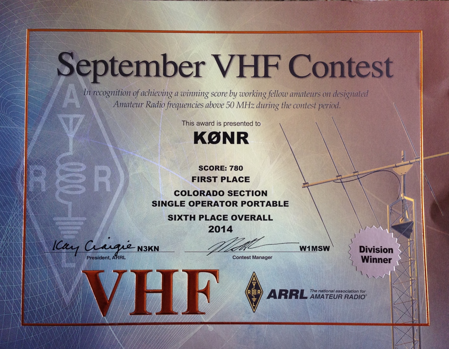 My blog posting said my score was 767 but the actual score was 780. Not a big score by any standard but not bad for ~4 hours of operating on a Saturday afternoon. As I suspected, this sets a new record for the Single Operator Portable category in the Colorado Section. What I did not expect is placing sixth in the overall contest (for my category). For the most part, this was just a really fun SOTA activation that included some VHF contest action.
Summary: The score doesn’t matter; any day having fun with ham radio is a good day.
73, Bob K0NR
The post 2014 September VHF Contest Certificate appeared first on The KØNR Radio Site.
West Buffalo Peak (W0C/SP-018)
Buffalo Peaks are a pair of 13er summits that stick up quite prominently on the west side of South Park. West Buffalo peak is the taller of the pair (13,326 feet) and the SOTA summit (W0C/SP-018). I’ve had my eye on these peaks for a while, wanting to do a SOTA activation. Here’s a winter view of the summits from the south near Trout Creek Pass.
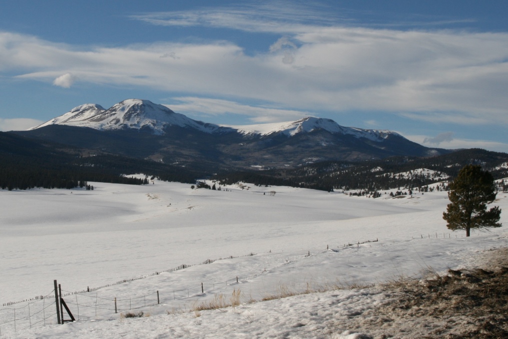
Buffalo Peaks in the Winter
There’s quite a bit of good information on the peaks at SummitPost.org.
Joyce K0JJW and I hiked in from the north, off of Buffalo Peaks Road (FS 431). The trailhead is not marked and is easy to miss but this trip report on the 13ers.com web site is very helpful. Pay special attention to the photo of the trailhead. This trip report describes doing both East and West Buffalo in a bit of a loop. We opted to focus on just West Buffalo, skipping East Buffalo.
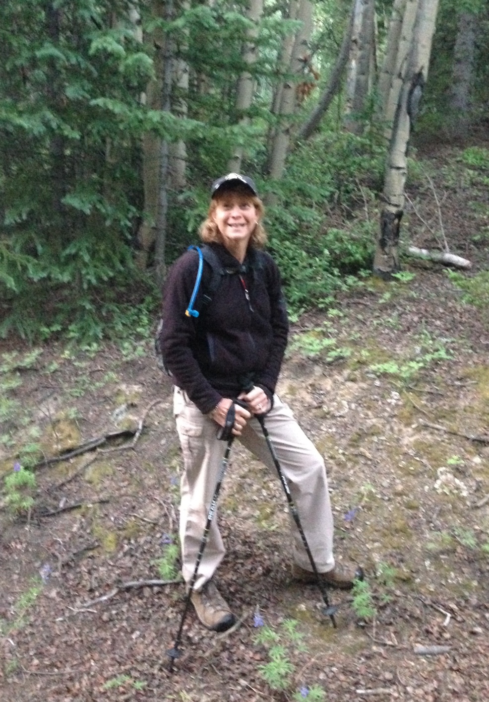
Joyce K0JJW on the trail.
Here’s my favorite hiking partner on the trail near the trailhead. The “trail” is not very well marked, following various old logging roads. We roughly followed the route indicate on 13ers.com. Once we cleared the trees we had a good view of both peaks and aimed for West Buffalo. We did make a critical error by going for the summit too early and got onto some very steep talus. Not fun. So the main route finding advice I am going to provide is make sure you approach the summit from the (more) gentle saddle on the northwest side. I marked this waypoint (N 38.99444, W 106.12866) as a good point to aim for on the way up so that you stay far enough west.
Once on the summit, I worked the following stations on 146.52 MHz: KD0MRC, KJ6NES, AF5KS, W9GYA, KE0DMT, W0BV and K5UK.
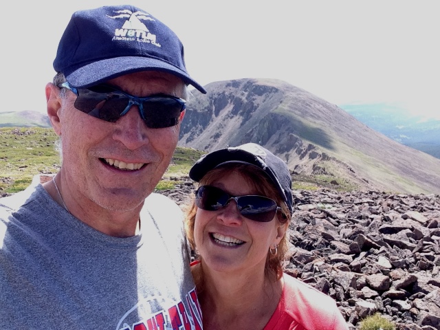
Bob K0NR and Joyce K0JJW on West Buffalo Peak, with East Buffalo Peak in the background.
On the descent we stayed west of the route marked on the 13ers.com trip report with the intent of having an easier route. However, mostly what we did was encounter additional off trail hiking, so that is probably not recommended. It would have been better to just retrace our ascent route. Eventually, we found a different trail that led back to FS 431, popping out about a quarter mile west of where we parked. I had the location of our Jeep marked in the GPS, so it was easy to backtrack to the vehicle.
This was the first SOTA activation for West Buffalo Peak, so it was great to get that in the log. Thanks to everyone that got on the air to work me.
73, Bob K0NR
The post West Buffalo Peak (W0C/SP-018) appeared first on The KØNR Radio Site.
The 10 Essentials for Hiking (and SOTA Activations)
 Most backcountry hikers are familiar with the Ten Essentials that you should take with you whenever you head into the wilderness. Over the past few years, I noticed that I was getting a bit sloppy with regard to what is actually in my pack when I head out on the trail. This hit home one day when my GPS battery went dead. I fumbled around to find my compass which was supposed to be in my pack. Well, it was in my pack, the other one that I left at home.
This caused me to review the list of ten essentials to make sure I had the right stuff in my kit. A search on the internet revealed that the classic list of ten has been modified and augmented by various people to make it better. (Innovation runs rampant on the interwebz, you know.) One of the better resources I found was this page on the REI web site, which explains how the Classic Ten Essentials have been updated to the Ten Essential Systems:
- Navigation (map and compass)
- Sun protection (sunglasses and sunscreen)
- Insulation (extra clothing)
- Illumination (headlamp/flashlight)
- First-aid supplies
- Fire (waterproof matches/lighter/candles)
- Repair kit and tools
- Nutrition (extra food)
- Hydration (extra water)
- Emergency shelter
Read through the REI web page to get the fine points of this system approach. I won’t repeat that information here. They also include a Beyond the Top Ten list which calls out the need for:
Communication device: Two-way radios, a cell phone or a satellite telephone can add a measure of safety in many situations.
Of course, what they really mean is an amateur radio transceiver and antenna but they probably can’t say that in print due to licensing issues. (Not everyone in the backcountry has an FCC ham license. I know, they all should have an amateur license but many don’t…very hard to understand.)
So how are you doing with your Ten Essentials list? Are you consistent in taking along the right stuff in your pack? Any tips to share with hiking hams?
73, Bob K0NR
The post The 10 Essentials for Hiking (and SOTA Activations) appeared first on The KØNR Radio Site.
Summits On The Air at Central States VHF
Recently I had the opportunity to speak about portable, mountaintop VHF operating at the Central States VHF Society Conference in Denver. A key part of my presentation was the Summits On The Air program, portable VHF equipment, VHF contests and other operating events.
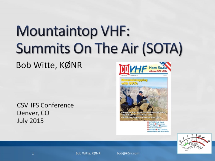 The presentation slides are available here in pdf format. I also submitted a paper on the same topic to the conference a paper on the same topic to the conference proceedings.
73, Bob K0NR
The post Summits On The Air at Central States VHF appeared first on The KØNR Radio Site.


