 |
 Working the Wainwrights
I noticed that when you save a radio coverage image from Radio Mobile, the program also saves a KML file. If you double-click on this it opens Google Earth superimposing the coverage map on the satellite view.
I made a new coverage map without the road map and then opened that in Google Earth. I then opened a Google Earth plugin showing all the Wainwright summits. I could then easily see the predicted radio reception from each of the summits. (Click the image to see it full sized.)
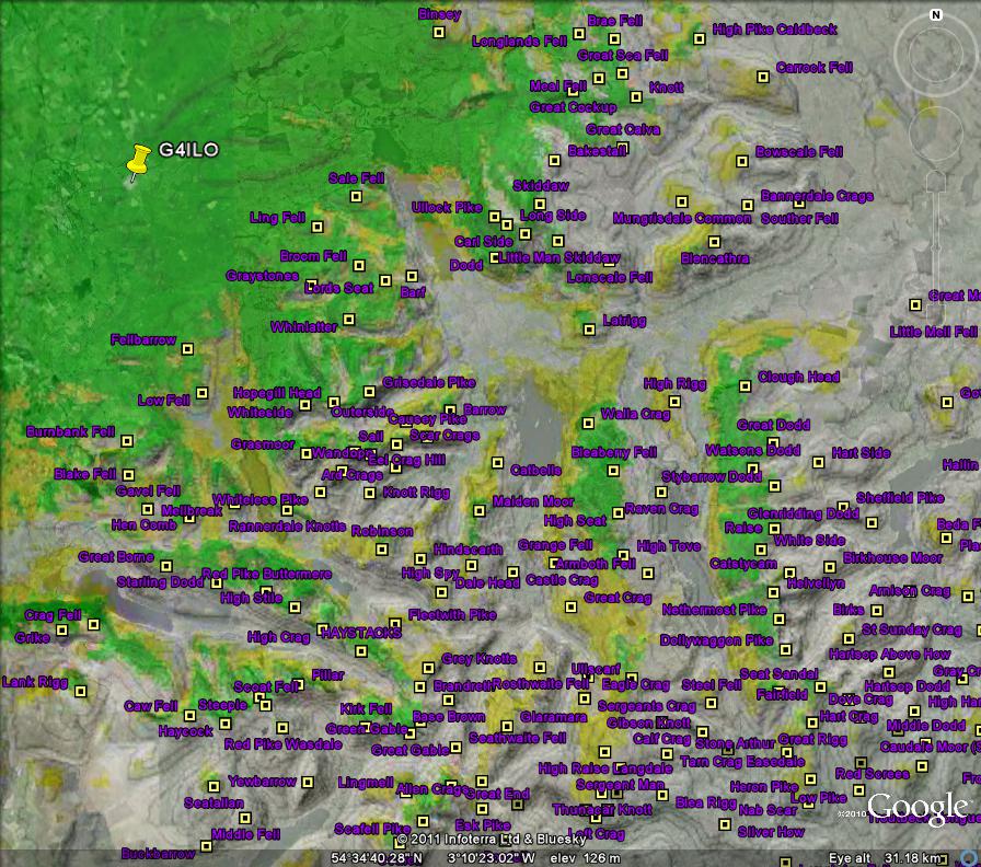
The predictions seem pretty accurate from the summits I have worked (or failed to work) so far.
Please support our generous sponsors who make AmateurRadio.com possible:
 Ham Radio Deluxe |
 W5SWL Electronics |
 Ham Radio Prep |
 KB3IFH QSL Cards  Hip Ham Shirts  HamRadioAuctions HamRadioAuctions Reliance Antennas Reliance Antennas Enigma Shop Enigma Shop |  morseDX  Ni4L Antennas  R&L Electronics R&L Electronics antennas.us antennas.us QRV QRV |
- Matt W1MST, Managing Editor
