Author Archive
 The Rock Mite and It Did
I wrote a short piece a few months back on a 40m RockMite that I bought and I couldn't make a QSO with. I entitled it the "Rock Mite and Then Again It Might Not". The stigma of not making a QSO has bothered me and I was in need of redemption. So as I was perusing EBay the other day and found a very nice 20M RockMite that was up for auction, I couldn't resist. Besides the enclosure matched my paddle. So when it arrived I sat it on the shelf until this evening. My goal was two fold, first make a QSO, but more importantly get 1,000 miles per watt. At 500mw output, I would only need a QSO of 500 miles to make it.
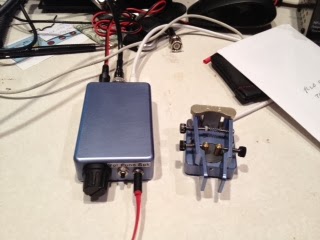
My 20M RockMite That Could
I connected my 10 element log periodic antenna to the radio, plugged in my matching paddle and away I went. I was beaming west and received an answer to my first CQ, but couldn't complete the QSO due to QSB. At least I am getting out!!! Being rock bound can be a little discouraging as I endured a relatively long QSO on my frequency, 14.059, before turning my beam north. Quickly W5BM, Dan, came back to me. We had a nice QSO, I received a 359 report and my next question, what was his QTH? Dan came back, Tulsa, Oklahoma, which is 442 miles from my QTH, drats, a few miles short. I then turned my beam west again and soon, WN7SIU came back to my call giving me a 449 report and quickly signing with me. I asked for his QTH....Sandy, UT. which is 1,300 miles from my QTH in Boerne, TX. 2,600 miles per watt. Alright!!! Mission accomplished.
So the RockMite is in good favor with me again. I like this radio stuff.
APRS On Your Phone
A lot has changed during my ham radio career since I was first licensed in 1989. The logging was manual, you received your DX news via a weekly newsletter that you actually received in the mail and packet was all the rage. Thanks to innovation of the ham radio community, now several technical generations later, we enjoy a very different hobby than we did in those days.
Periodically, I peruse the app store on my iPhone to see what new cool ham radio apps have been developed. I will admit it has been a while since I've done that so this is probably old news to many of you. As I scrolled through the apps I came across an APRS application for the iPhone. APRS (Automatic Packet Reporting System), developed by Bob Bruninga WB4APR, combines packet radio technology with GPS technology to allow you to transmit your coordinates to a digi-peater that then posts your position on the internet. This allows others to know your location for any number of reasons, i.e., to follow progress up a mountain or simply for others to know that you are safe and to follow your progress to your destination. However, previously, to enjoy this functionality required a special radio with the GPS built in or a modification to add GPS functionality to your radio. However, with the apps now available you can accomplish the same thing with your iPhone. Of course you have to have cell service for the system to work and it can use up battery power, but the functionality can now be used without a radio.
So if you are a SOTA activator and have avoided the expense of getting a VHF APRS set-up, you can now accomplish the same thing with your phone. You can avoid battery degradation by only turning your phone on at intervals and allow the system to register your position, then turning it off again.
Very cool.
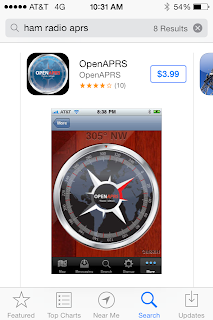
One of the APRS Apps for the iPhone
(I have no commercial interest in this product, nor have I actually used it)
A Little Prevention and a Pound of Cure
Its no secret that the amateur radio population is, on average, a little older than the current population's average age. That is a nice way of saying that we are older. With age many things accrue to us, wisdom, grandchildren, pensions and other good things. However there are some other things we tend to inherit as we get older that aren't so good including a few more health risks. We have a few extra pounds, our cholesterol goes up and we aren't in the same condition as we once were. We all know the story if we are more than 40 years old.
Recently, a very active SOTA activator who had probably 80 or 90 summits to his credit suffered a heart attack while on a climb. These events are always a little sobering because we aren't so different in age. It isn't intuitive that an active individual would be a heart attack candidate. The fact is he had 100% blockage in one of his arteries. My son is an MD and explained that the body will build it's own bypass system over time, so 100% blockage means that the main artery was blocked, but there were several smaller bypass blood vessels that were at least transporting some blood, but obviously in the case, not enough.
There were two lessons to learn from this incident. The first in the preventive part. After say, age 50, we should have a full blown physical at least every other year, complete with an EKG that will check you heart capacity and function. If you have to borrow money to pay for the physical, you should do it. A physical is not an expense, but an investment that will yield a nice return in the form of additional years to enjoy all the things you have worked for in your life. We should do some exercise at least 4 times a week, even if it's just walking for 30 minutes. If you aren't currently exercising, get the physical first and if you are exercising don't assume that you don't have issues. The example above should be enough evidence to convince you of that. One health issue associated with ham radio is that we can do it sitting down which isn't necessarily good from a health perspective.
The second lesson from this is the pound of cure. If you are involved in outdoor activities, hiking, biking, etc.. carry a small first aid kit and include aspirin in the kit. This will help to temporarily mitagate heart attack symptoms until help can arrive. Get a book on outdoor first aid and understand what you can do when you are miles away from help and have a medical emergency. There are even several apps available for your smart phone that give solid first aid advice.
The outcome of the incident above was a good as you could hope. His hiking buddy was calm and solicited help from other hikers, one of which had some aspirin in his pack. They had cell service and could call 911 and the victim was flown to a hospital where a stent was put in. (If no phone service, have a 2m rig with the local repeaters in the memory) He is much better and should be able to get back to climbing soon. His recovery is due, in no small part, to the alert reactions of those around him.
So go make that appointment.
Four Days, Four Summits
I spent a long Labor Day weekend at my new QTH in Santa Fe, New Mexico. From a flatlander's point of view, Santa Fe is SOTA heaven. Lots of nice peaks to climb and now with a place to lay my head, I can go back home and not to a hotel room. From my home QTH in Boerne, TX it is 380 miles to the nearest accessible peak. As I would discover, there is a nice 8 pointer 11 miles from my front door.
Day 1 Peak 8409 W5N/PW-027 (8 pts)
We are still setting up house in Santa Fe and so on this Friday morning there were deliveries scheduled for 9:30. So I needed a quick hit summit that I could get on and off of quickly and get back home. Peak 8409 fit the bill. The summit is 11 miles from my house and isn't a particularly difficult summit as you can drive to within a few hundred feet of the summit. So I left the house early and found a pull-out on the road to the summit and scrambled up ~200 feet to my eventual operating position. Quickly the antenna was in place and I was calling CQ within 5 minutes. A chaser pile quickly ensued and in 25 or so minutes of operation I made 23 QSO's. After a few unanswered CQ's, I quickly tore down the station was back home in time to meet the delivery man. Cool, 8 activator points and back home in time to get something done.
Day 2 Atalaya Mountain W5N/PW-023 (8 pts)
Atalaya is not in the easy ascent category. The hike isn't too long, ~5.6 miles round trip depending on where you start (we took Trail #170), but it is relatively steep. I wouldn't call it a hard hike, so moderate is probably the best description. My son Jake, KB5SKN, who flew in the day before, would join me on this one. Jake isn't that active as a ham but when asked if he wanted to operate from the summit, he said he would rather operate than just watch me. So, in addition to my ATS-4, cw only rig, I made Jake carry the FT-817 so he could operate SSB. This is a nice hike and the views of Santa Fe are outstanding. It took us 90 minutes to get to the summit, with Jake having to adjust a little to the altitude, but we make relatively decent time.
Jake was new to mountain portable operation and he was surprised how quickly we were on the air. We set up the EFHW, stringing it in the trees to my carbon fiber collapsible pole. We received good reports, I made 21 QSO's on CW and Jake made 12 on SSB. He was surprised at how effective this antenna was. It was a nice walk down and a good day for father and son.
Sandia Crest is the big mountain that dominates the Albuquerque landscape. I decided to take a chance on a Sunday afternoon activation. Thunderstorms are always an issue in this part of the world, but there is a tram that takes you up the mountain, so I decided to risk it.
Sure enough when we arrived at the tram there was a light rain on the summit. Actually I thought the tram landing was within the activation zone. When we arrived, in the rain, I realized we need to ascend another 200 feet before I was high enough on the summit. A favorite activation location on this mountain is Kiwanis Cabin; it was a short 1.5 miles away. So my XYL and I set off in the light rain for the cabin. While the rain was light, thunder was echoing through the valley as there were widespread thunderstorms. Upon reaching the cabin, the rain had stopped, so I set up my station. On crowded summits I use the Alexloop antenna. It has a small footprint and actually works pretty well. After tuning it and calling CQ, I didn't get any immediate responses. Little did I know there had been a CME just a few hours before and conditions were not good. Over about a 15 minute time span I made 8 QSO's. Then the wind came up and the thunder got louder, so I shut down. We hiked back to the tram to find a 90 minute wait to go down. This was a holiday weekend after all. So rain, a CME and tram delay turned this into a little more adventurous and time consuming outing than planned, but I made the QSO's to qualify the activation and enjoyed some magnificent views.
Day 4 Santa Fe Baldy W5N/PW-006 (10 pts)
John, K1JD, sent me an email asking if during my stay in Santa Fe I would be interested in doing Santa Fe Baldy, the tallest mountain in the Santa Fe area at 12,622 ft. It is a 10 point summit and I had already done a fourteener this year, (Sherman 14,036), so I knew I could handle the altitude. “Of course” was my response. The kicker on this hike is that it is a 15 mile round-trip. The hike is not 7.5 miles up and then 7.5 miles down, it is a rolling hike for several miles until you get to the trail up to the saddle that leads to the summit. We both knew there were easier 10 pointers around, but activating Santa Fe Baldy is a badge of honor; it looks good on the resume. So as you talk among other activators, you can always ask what their longest hike was and odds are, at 15 miles, not many can best that. So some bragging rights are at risk here and that’s important. We appropriately planned the hike for Labor Day.
The weather forecast wasn’t favorable for a Labor Day activation, 50% chance of rain, which translated during monsoon season in the New Mexico mountains, it’s gonna rain. We toyed with idea of doing it on the Sunday before Labor Day, but my son was in town and I couldn’t get away. So we took our chances on Monday.
The trip down was uneventful, just long. As always a nice walk through the forest is better that most anything else you may want to do to relax, so John and I enjoyed the walk and had several good, long conversations on numerous topics. There was lots of thunder and rain clouds around us, but not a single drop of rain fell on us. It was a grand time. We got back to the truck at 3:23 pm, 8 hrs 11 mins on the trail, including the activation, but 10 points in our pocket.
Day 1 Peak 8409 W5N/PW-027 (8 pts)
We are still setting up house in Santa Fe and so on this Friday morning there were deliveries scheduled for 9:30. So I needed a quick hit summit that I could get on and off of quickly and get back home. Peak 8409 fit the bill. The summit is 11 miles from my house and isn't a particularly difficult summit as you can drive to within a few hundred feet of the summit. So I left the house early and found a pull-out on the road to the summit and scrambled up ~200 feet to my eventual operating position. Quickly the antenna was in place and I was calling CQ within 5 minutes. A chaser pile quickly ensued and in 25 or so minutes of operation I made 23 QSO's. After a few unanswered CQ's, I quickly tore down the station was back home in time to meet the delivery man. Cool, 8 activator points and back home in time to get something done.
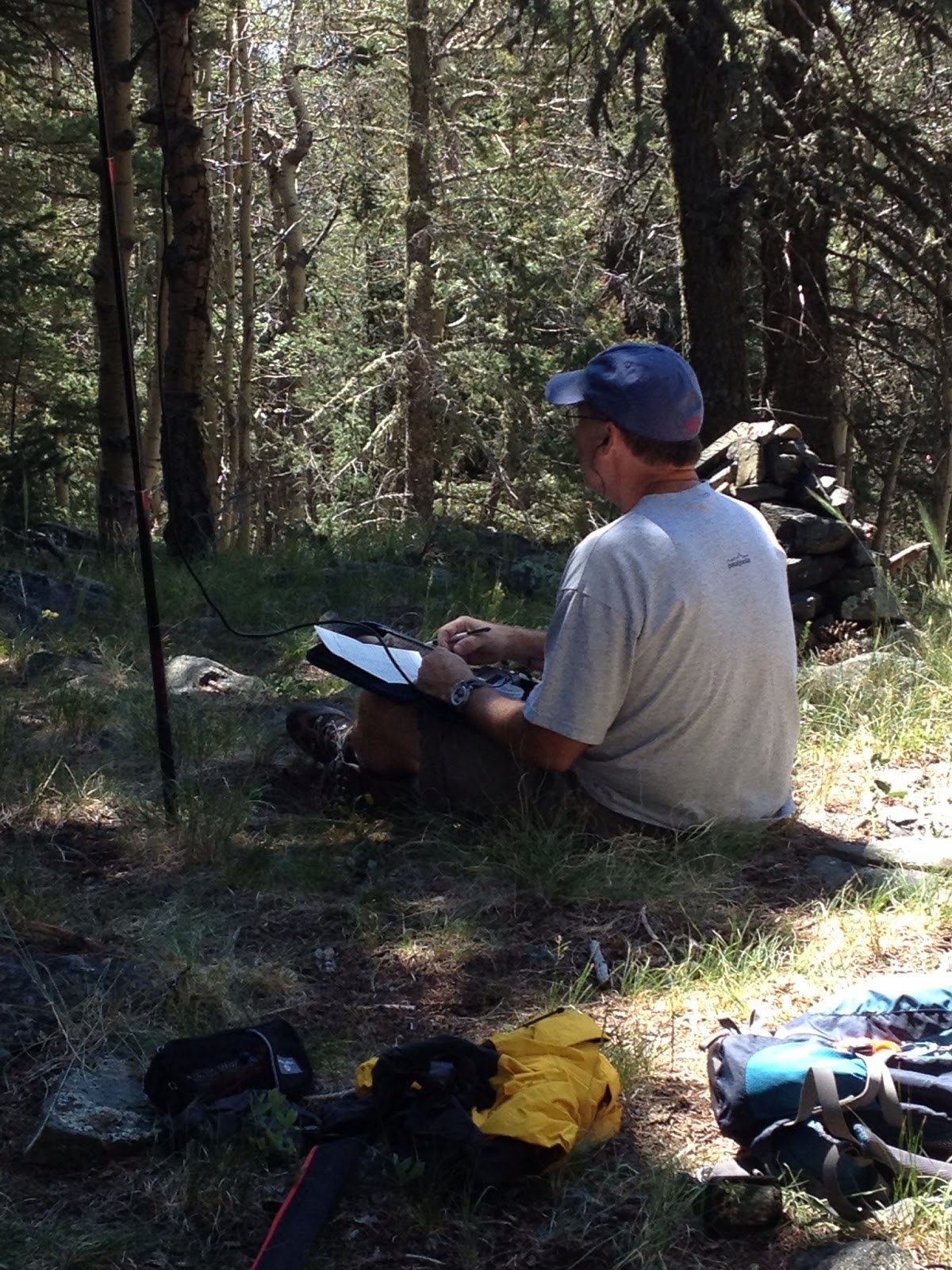
Day 2 Atalaya Mountain W5N/PW-023 (8 pts)
Atalaya is not in the easy ascent category. The hike isn't too long, ~5.6 miles round trip depending on where you start (we took Trail #170), but it is relatively steep. I wouldn't call it a hard hike, so moderate is probably the best description. My son Jake, KB5SKN, who flew in the day before, would join me on this one. Jake isn't that active as a ham but when asked if he wanted to operate from the summit, he said he would rather operate than just watch me. So, in addition to my ATS-4, cw only rig, I made Jake carry the FT-817 so he could operate SSB. This is a nice hike and the views of Santa Fe are outstanding. It took us 90 minutes to get to the summit, with Jake having to adjust a little to the altitude, but we make relatively decent time.
Jake was new to mountain portable operation and he was surprised how quickly we were on the air. We set up the EFHW, stringing it in the trees to my carbon fiber collapsible pole. We received good reports, I made 21 QSO's on CW and Jake made 12 on SSB. He was surprised at how effective this antenna was. It was a nice walk down and a good day for father and son.
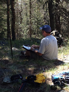
 |
| KB5SKN Logging His First Activation |
 |
| AD5A on Summit of Atalaya :Mountain |
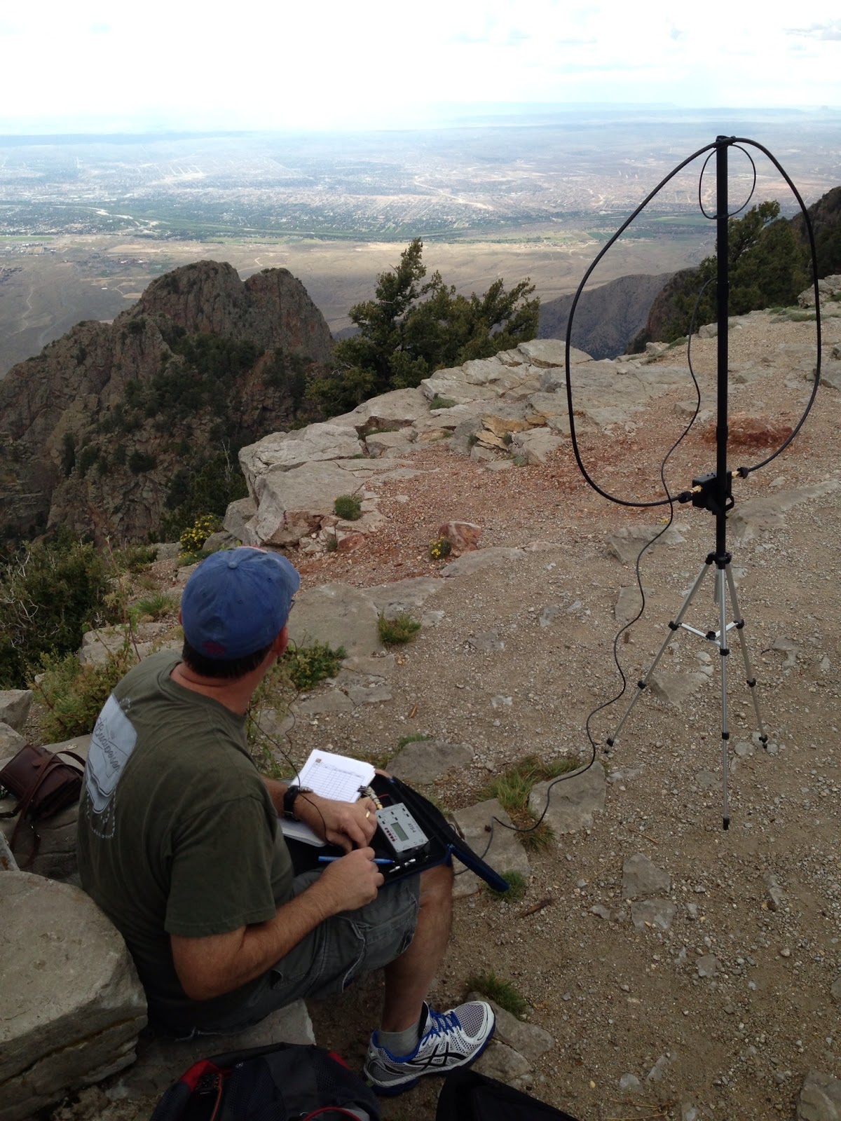
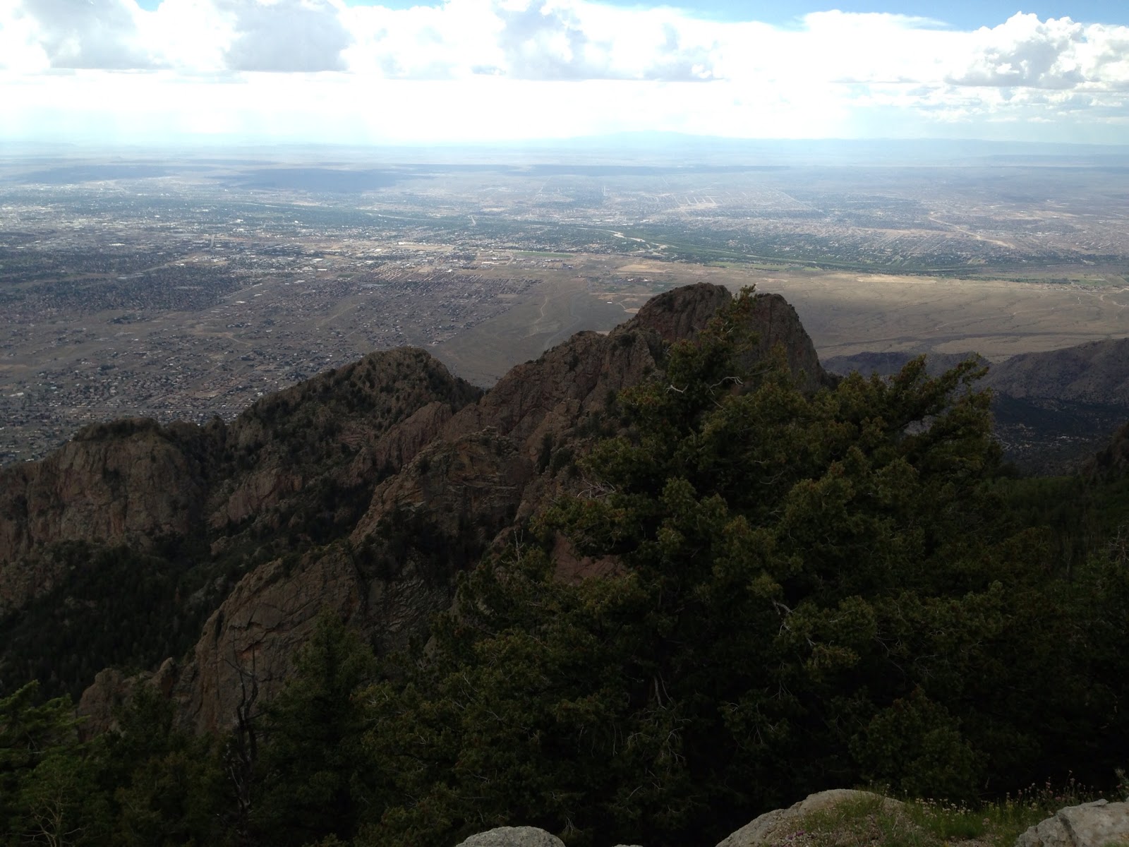
Day 3 Sandia Crest W5N/SI-001 (10 pts)
Sandia Crest is the big mountain that dominates the Albuquerque landscape. I decided to take a chance on a Sunday afternoon activation. Thunderstorms are always an issue in this part of the world, but there is a tram that takes you up the mountain, so I decided to risk it.
Sure enough when we arrived at the tram there was a light rain on the summit. Actually I thought the tram landing was within the activation zone. When we arrived, in the rain, I realized we need to ascend another 200 feet before I was high enough on the summit. A favorite activation location on this mountain is Kiwanis Cabin; it was a short 1.5 miles away. So my XYL and I set off in the light rain for the cabin. While the rain was light, thunder was echoing through the valley as there were widespread thunderstorms. Upon reaching the cabin, the rain had stopped, so I set up my station. On crowded summits I use the Alexloop antenna. It has a small footprint and actually works pretty well. After tuning it and calling CQ, I didn't get any immediate responses. Little did I know there had been a CME just a few hours before and conditions were not good. Over about a 15 minute time span I made 8 QSO's. Then the wind came up and the thunder got louder, so I shut down. We hiked back to the tram to find a 90 minute wait to go down. This was a holiday weekend after all. So rain, a CME and tram delay turned this into a little more adventurous and time consuming outing than planned, but I made the QSO's to qualify the activation and enjoyed some magnificent views.
 |
| AD5A on Sandia Peak |
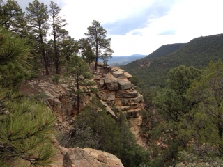
 |
| View from Sandia Peak |
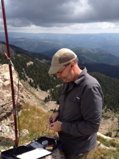
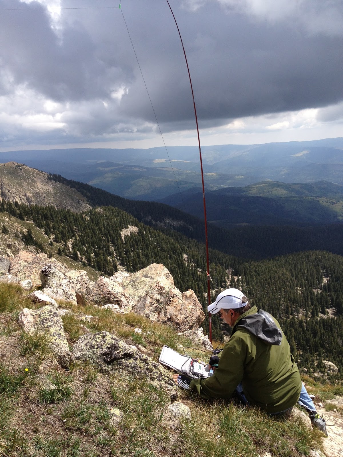
Day 4 Santa Fe Baldy W5N/PW-006 (10 pts)
John, K1JD, sent me an email asking if during my stay in Santa Fe I would be interested in doing Santa Fe Baldy, the tallest mountain in the Santa Fe area at 12,622 ft. It is a 10 point summit and I had already done a fourteener this year, (Sherman 14,036), so I knew I could handle the altitude. “Of course” was my response. The kicker on this hike is that it is a 15 mile round-trip. The hike is not 7.5 miles up and then 7.5 miles down, it is a rolling hike for several miles until you get to the trail up to the saddle that leads to the summit. We both knew there were easier 10 pointers around, but activating Santa Fe Baldy is a badge of honor; it looks good on the resume. So as you talk among other activators, you can always ask what their longest hike was and odds are, at 15 miles, not many can best that. So some bragging rights are at risk here and that’s important. We appropriately planned the hike for Labor Day.
The weather forecast wasn’t favorable for a Labor Day activation, 50% chance of rain, which translated during monsoon season in the New Mexico mountains, it’s gonna rain. We toyed with idea of doing it on the Sunday before Labor Day, but my son was in town and I couldn’t get away. So we took our chances on Monday.
We met at 6:20 am local time and headed for the Trailhead near the ski resort outside of Santa Fe. The day dawned with a partly cloudy sky, not a particularly good sign. We were on the trail at 7:12 am. The trail is a widely used trail, especially at the lower elevations. The trail took us through the forest, across streams and up and down inclines of varying difficulty, however, no one part of the hike is tough. It’s just long. To make a long hike story short, we summited around 11:10, so four hours up the mountain.
We decided, in the interest of time since clouds were building, we would only erect one antenna and take turns operating. After setting up the pole, my job, John deployed the wire. I quickly turn on my 2m radio to hear Alan, NM5S, calling John. I answered and had my first QSO. Alan had camped at Spirit Lake overnight and was checking on us. After we signed, Fred, WS0TA, called. He was on Elk Mountain, another 10 pointer across the valley as were NM5SW and K5RHD. The local S2S’s were in the bag. Of course John worked these guys as well.
John started on HF to mixed results and after knocking off a half dozen or so QSO’s passed the antenna to me. Over the next 6 minutes I managed 9 more QSO’s on 20m before John took another run. The clouds were building, we were 7.5 miles from the truck; it was time to go.
 |
| AD5A Operating from Santa Fe Baldy |
 |
| K1JD on Santa Fe Baldy |
The trip down was uneventful, just long. As always a nice walk through the forest is better that most anything else you may want to do to relax, so John and I enjoyed the walk and had several good, long conversations on numerous topics. There was lots of thunder and rain clouds around us, but not a single drop of rain fell on us. It was a grand time. We got back to the truck at 3:23 pm, 8 hrs 11 mins on the trail, including the activation, but 10 points in our pocket.
This was a great trip, four days, four summits and 36 points. I can’t wait to do it again.
SOTA Activity Weekend, September 7th and 8th
North America SOTA Activity Weekend is a casual event involving tiny battery-powered radios on mountain summits. It is not a contest but is intended to introduce "Summits on the Air" to newcomers with home stations who try to work summit operators during one or two days. There are no rules regarding power levels, modes or number of bands worked, but please be courteous when more than one station is trying to talk to a SOTA operator on a summit. The SOTA operators have just climbed mountains as high as 14,000 feet; they use low power; and they don't receive on split frequencies. Check SOTAWATCH.org to spot who is on which mountain. Summits are numbered, and you can hover your cursor over the number to see the name and point value for each summit. Expect the website to show activity near 7.032, 7.185, 10.110, 14.342, 18.095, 18.155, 21.350, 24.905, 24.955, 28.420, 146.52, 446.00, and 61 Khz up from the bottom of 20, 15 and 10 meters CW. Don't be deceived by the QRP power levels, these guys have some nice antenna supports.
Participants are invited to collect points toward certificates and trophies offered by the eleven-year-old international SOTA group (SOTA.org.UK). As we learned in past years, this is a barrel of fun for both hill climbers and home operators. See you then.
The folks at NA-SOTA.org
Participants are invited to collect points toward certificates and trophies offered by the eleven-year-old international SOTA group (SOTA.org.UK). As we learned in past years, this is a barrel of fun for both hill climbers and home operators. See you then.
The folks at NA-SOTA.org
Busy Days, Fun Days, Two Summits in New Mexico
It have been a very busy couple of weeks. For the two or three of you that follow my blog, you have probably noticed the recent silent period. Worry not, I haven't been slacking on radio adventure. As some of you may have noticed, I have been activating a few summits around New Mexico. Well my wife an I have looking for a vacation home in Santa Fe. We weren't in any hurry and wanted to find just the right spot. Well, we found it and spent last week buying it and furnishing it. It is in a non-ham friendly neighborhood, but that makes for more of a challenge. My plan is to do most of my radioing outside anyway. There are summits galore. While I was there tending to moving-in activities I did find time to activate a couple of summits. Below are some brief summaries.
Glorieta Mesa W5N/PW-032 August 16, 2013
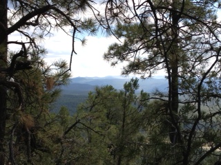
This was my first solo summit. I've done summits with other activators and my wife often does the hike with me, however this time I was on my own. Glorieta Mesa is an 8 point summit whose elevation is just over 8,000 ft. Finding the route required a little research but the SOTA website is very valuable in finding routes if previous activators have uploaded their activation notes. Such was the case here and I was able to get two sets of coordinates, the first directed me where to park and the second pinpointed the previous operating location of another activator. Given those two points the hike was fairly straight forward. Only about 300 feet elevation gain over 1.5 mile climb isn't too bad.
I used my GPS unit with it's TOPO map to navigate to the activation zone. There is no trail per se on this climb. I would classify it as a minor bushwhack. While there are no trails the forest is very walk-able with a few brushy areas that you have to walk through, but not bad.
There were some very nice views on the way to the top as evidenced by the picture to the left.
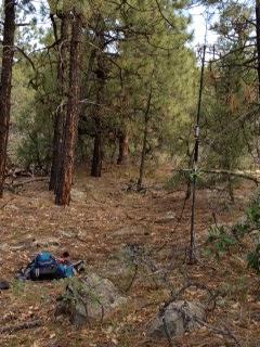
Once on the top I used my ATS-4 and my modified Buddi-Stick vertical. Conditions were decent and after couple of CQ's I had a nice SOTA Chaser pile-up. I managed to work 18 stations in a 20 minute span working stations Coast to Coast.
A Chaser pile-up is the ultimate QRP thrill in my opinion. You are operating a station that you carried up the hill on your back, using a portable antenna and other stations are actually chasing you. The signals were loud and I was getting some 569 and 579 reports.
Glorieta Mesa W5N/PW-032 August 16, 2013
This was my first solo summit. I've done summits with other activators and my wife often does the hike with me, however this time I was on my own. Glorieta Mesa is an 8 point summit whose elevation is just over 8,000 ft. Finding the route required a little research but the SOTA website is very valuable in finding routes if previous activators have uploaded their activation notes. Such was the case here and I was able to get two sets of coordinates, the first directed me where to park and the second pinpointed the previous operating location of another activator. Given those two points the hike was fairly straight forward. Only about 300 feet elevation gain over 1.5 mile climb isn't too bad.
I used my GPS unit with it's TOPO map to navigate to the activation zone. There is no trail per se on this climb. I would classify it as a minor bushwhack. While there are no trails the forest is very walk-able with a few brushy areas that you have to walk through, but not bad.
 |
| On The Way Up |
Once on the top I used my ATS-4 and my modified Buddi-Stick vertical. Conditions were decent and after couple of CQ's I had a nice SOTA Chaser pile-up. I managed to work 18 stations in a 20 minute span working stations Coast to Coast.
A Chaser pile-up is the ultimate QRP thrill in my opinion. You are operating a station that you carried up the hill on your back, using a portable antenna and other stations are actually chasing you. The signals were loud and I was getting some 569 and 579 reports.
View from the Top
Operating Position
I was behind schedule, so I called it quits after about 25 minutes on the air. It was a satisfying trip down the Mesa, mission accomplished. Exercise, portable QRP, Chaser pile-up and 8 Activator points.
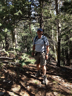
Thompson Peak W5N/PW-013 August 17th, 2013
Thompson Peak is a 10 point peak with an elevation at 10,554 ft. To get to the trail head you have to travel a 4WD road for ~15 miles. Once at the trail head the hike is fairly straight forward. The trail is easy to follow. There are some ups and downs on the hike before you get to the summit so its's not just an straight up and straight down hike. The trail is a little over 1.5 miles to the summit with a net 700 ft. climb, but because of the up and down nature of the trail the gross elevation gain might be twice as much.
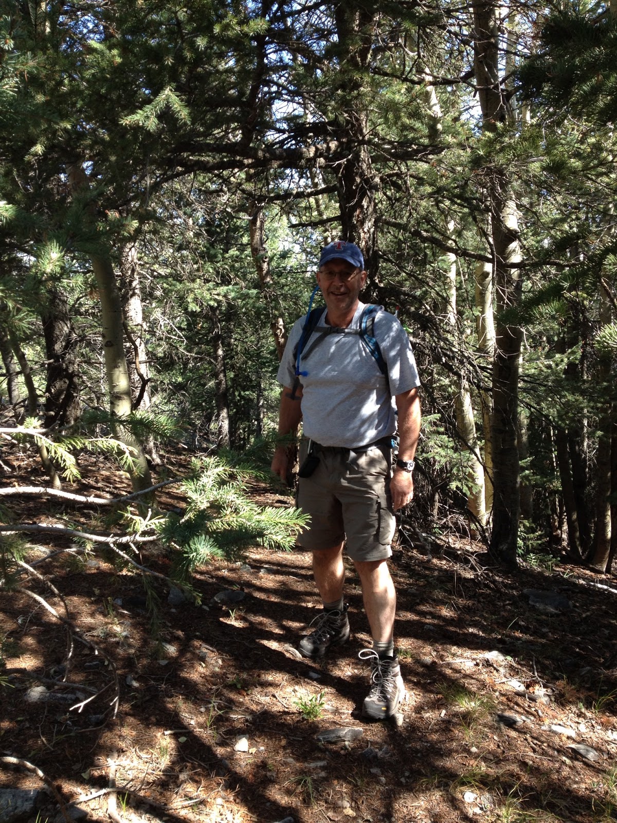
AD5A on the Trail
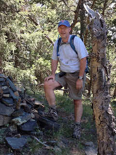
My old friend and ex-ham Jeff accompanied me on this hike. A nice hike in the forest with an old friend is lots of fun. We enjoyed the hike and before we new it we were on the summit.
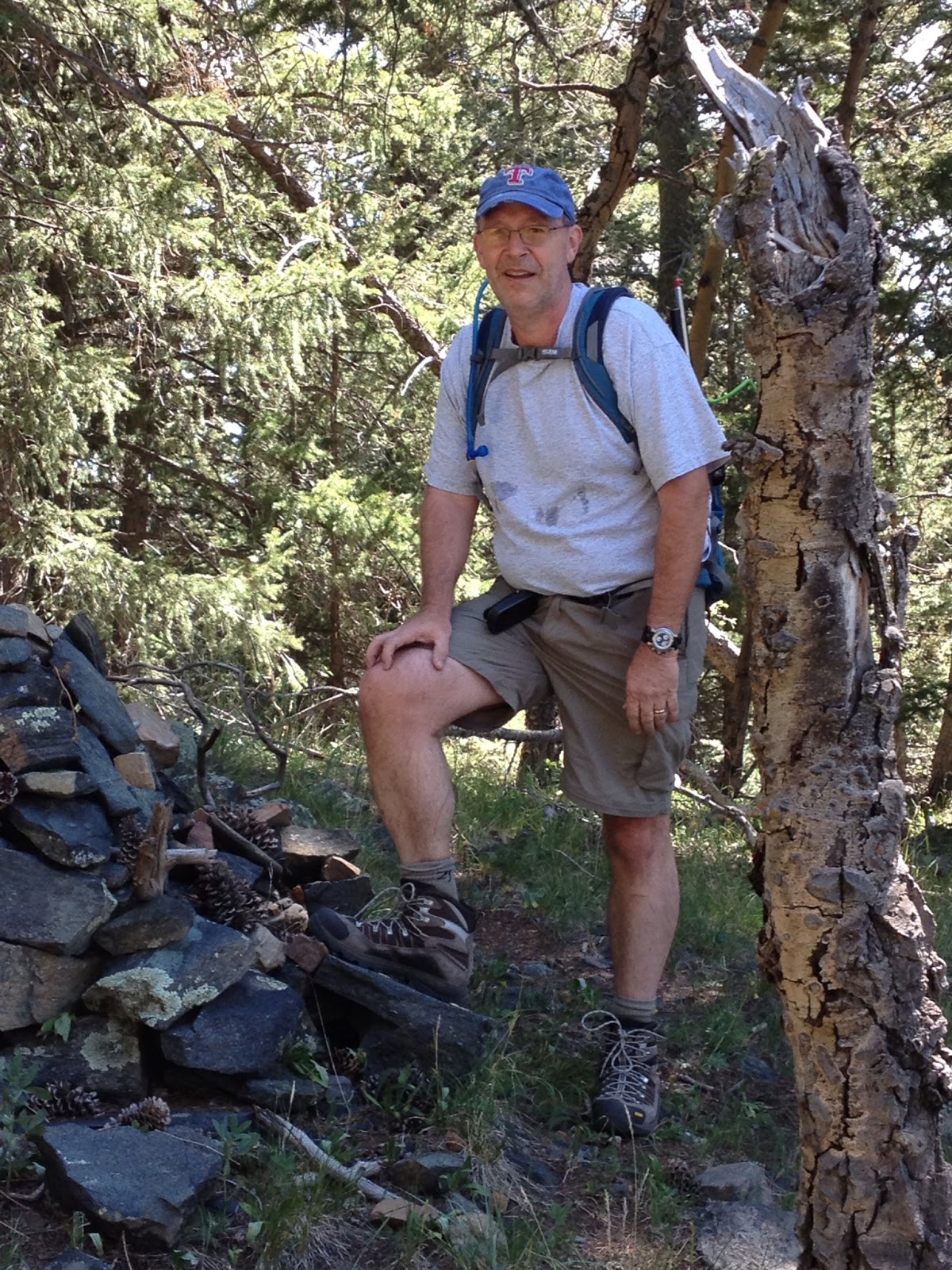
Summit Cairn
I used my trail friendly 10m/20m/40m/ EFHW antenna. I used my 21 foot collapsible carbon fiber pole to put the end of the wire over the highest branch I could reach and then used the pole as a support for the other end of the antenna. In no time I had a loud pile-up. There was some QSB as K index was 4, but I made 21 QSO's in ~30 minutes, all on 20 meters. I called CQ on 40m, but no joy there.
Operating from Thompson Peak
After several unanswered CQs, it was time to go. After packing up the station we headed down the hill, another mission completed and 10 more activator points on the scoreboard.
The nice thing about these two activations was that after I got down, I was able to go to my new home in Santa Fe rather than a hotel room. That was a first as well. My home QTH is 380 miles from the closest 10 pointer, so travelling is a must if you are to activate summits.
So, look for a few more New Mexico summits from me.
Do QRP’ers Have an Identitiy Crisis?
So I was browsing the QRP Blogs today and I read about the most recent QRP contest. It occurred to me that maybe QRPer's have self esteem issues. Two of the activities that seem to attract a lot of QRP'ers are, "The Flight of the Bumblebees" and "The Skeeter Hunt". So, as I contemplated the deeper meaning, both the bumblebee and the skeeter are annonying creatures that bite you and yes, even carry disease. People actually spray chemicals on themselves to keep bees and skeeters away. Now I ask you as a fellow QRP'er; is this really who we are? Skeeters and bees, should these be the mascots of QRPdom? We should rather associate ourselves with the sly, skilled animals of the forests that we are, those that through their guile and agility are able to strike quickly and capture their prey. Why can't we have, "The Flight of the Eagles" or "The King of the Jungle Hunt". These symbols, or mascots if you will, would invoke a much stronger sense of purpose and pride, we can hold our heads high and make cool T-Shirts, while demonstrating to the world that indeed QRP'ers are a force to be reckoned with. We could say, "come join us in our hunt for the Lions this weekend", instead of "hey, wanna go skeeter hunting?". Anyway, just some thoughts, skeeters and bees or Eagles and Lions.


