 |
 Autumn tropo
On the first day of autumn, we were treated to some nice VHF/UHF tropo. I was alerted to it on Twitter, by Rob, MW0DNK saying that he was going portable and then later on, saying that he had worked some nice DX from Anglesey on 144/432MHz.
Driving home from the station, on 145.650, when GB3WH was not transmitting, I heard a French repeater in Limoges, JN05. Not bad, considering I was only using the Moonraker MD-7400 antenna in 1/4 wave configuration.
Once I was home, I had a quick look on 432MHz and heard John G3WZT calling CQ on CW on 432.200. To my surprise, I was able to hear DL5MAE come back to him. I waited for the QSO to finish and then called DL5MAE a couple of khz higher than their QSO frequency. Often this doesn’t work, but this time it did! I was thrilled to work Wolfgang, who was one of my 144MHz meteor scatter pals back in the 1980s – a nice distance to JN58.
Other stations popped up on 432Mhz during the evening, a couple of DLs, LX1DB, who I didn’t manage to work and French station in JN27. Closer to home I worked F5MFO in JN19, also on CW.
I’m not on 144MHz CW.SSB currently, but I listened on FM, where there were lots of French voices and some repeaters from interesting locations coming through. Listening on 145.725, there was a particularly loud signal. I was just scanning the French repeater list to see what it was likely to be, when it IDed on CW; HB9G!
OK! I waited for the QSO to finish, turned my CTCSS off, so as to try and avoid bringing closer repeaters and called F6BPZ. I think Jean was surprised to be called by a G station and I was surprised that he heard me! We had a pleasant, brief QSO, before the repeater dived in fading, though it came up again later.
Although this morning dawned foggy and there is some good enhancement on UK signals, I’ve not heard anything more distant so far.
Tim Kirby, G4VXE, is a regular contributor to AmateurRadio.com and writes from Oxfordshire, England. Contact him at [email protected].
This.
This is how we need to talk up amateur radio.
Anthony, K3NG, is a regular contributor to AmateurRadio.com.
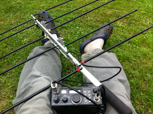
QRP: More fun than a barrel of microphones
This is an article I wrote for LIMARC here on Long Island, and also posted at my blog Fofio!. Some of it is targeted to beginners in the hobby, so I apologize for the elementary nature of some of it. Many of the kit references can also be found at my list of radio-related kits RadioKitGuide.com
 kit from EA3GCY") though, is how well you can do with some inexpensive equipment, and a simple antenna.
though, is how well you can do with some inexpensive equipment, and a simple antenna.Most of my portable setup is relatively Read the rest of this post
Neil Goldstein, W2NDG, is a regular contributor to AmateurRadio.com and writes from New York, USA. Contact him at [email protected].
Nissequogue River State Park
I’ve been to this creepy state park several times since moving to Long Island. Why creepy? Mostly the abandoned buildings from the previous tenant on

Nissequogue River State Park
this property; The Kings Park Psychiatric Center. So, crumbling scary buildings, and a great view of the Nissequogue River Inlet? Is there a better place for a Sunday afternoon QRP outing? I think not!
While I was here last time, I spotted a great spot for a QRP setup. At the top of the long hill, and past the courtyards is a nice grassy area that terminates at a fence at the top of a Read the rest of this post
Neil Goldstein, W2NDG, is a regular contributor to AmateurRadio.com and writes from New York, USA. Contact him at [email protected].
How To Do a SOTA Activation On Pikes Peak
This post was updated on June 4, 2022, after the summit house construction was completed.
Perhaps this should be called The Slacker’s Guide to Activating Pikes Peak since I am going to describe the easy way to do a Summits On The Air (SOTA) activation on America’s Mountain. If you plan to hike up, you have my complete support but this post is not meant for you.

Pikes Peak (W0C/FR-004) is about 10 miles straight west of downtown Colorado Springs. See the Pikes Peak website for useful tourist information. At an elevation of 14,115 feet, the mountain towers over Colorado Springs and the other front-range cities. (You may see the elevation listed as 14,110 but it was revised upward in 2002 by the USGS.) This means that it has an excellent radio horizon to large populated areas. On VHF, it is possible to work stations in Kansas, Nebraska, Wyoming and New Mexico. See VHF Distance From Pikes Peak and Pikes Peak to Mt Sneffels. On HF, you’ll do even better.

Getting There
Access to the summit has three options: hike up, drive up via the Pikes Peak Highway or ride the Pikes Peak Cog Railway. Most people will probably choose the highway since the cog rail only gives you 30 to 40 minutes on the summit. (Normally, you return on the same train that takes you to the top. You can try to schedule two one-way trips but that is a challenge.)
After a few years of turmoil and construction, the summit of Pikes Peak is now back to operating normally but with some changes. The new summit house/visitors center is open and it is a beautiful new facility. The Cog Railway is also operational with brand new equipment. There is a new boardwalk that allows easy strolling on the summit and improved views near the edge of the summit.
Pikes Peak Highway
The highway is at a well-marked exit off Highway 24, west of Colorado Springs. There is a “toll” to use the highway (~$15 per person, check the Pikes Peak Highway website for the latest information and a $2 discount coupon.) Starting in 2022, you must have a reservation (2-hour window) to drive to the summit (roughly Memorial Day to Labor Day). The specifics are likely to change, so be sure to check the Drive Pikes Peak page for the latest updates.
The road is paved all of the way to the top and is usually in good shape. The only caution on driving up is that some people get freaked out by sections of the road that have steep drop-offs without guard rails. It is very safe, but some folks can’t handle it. The main caution driving down is to use low gear and stay off your brakes. There are plenty of signs reminding you to do this and during the summer there is a brake check station at Glen Cove where the rangers check the temperature of your brakes.
It takes about an hour to drive to the summit, assuming you don’t dawdle. It is best to drive up during the morning and avoid the afternoon thunderstorms.
On The Summit
The W0C Association Reference Manual (the SOTA rules for Colorado) used to suggest a “qualifying hike” of 100 vertical feet but this item has been removed from the manual. If you decide to do such a hike, I suggest you proceed down Barr Trail which is the main hiking trail coming up from the east side of the peak. Do not try to walk along the road, as the rangers will stop you. The trail starts on the east side of the summit house (towards Colorado Springs) and is marked with a sign. You have to cross over the cog rail tracks to get to it. (Please try to avoid getting run over by the train as it scares the tourists and makes a mess.)
The summit of Pikes is broad, flat and rocky, so pick out a spot away from the buildings for your SOTA adventure. There are quite a few radio transmitters on the peak so expect some interference. Since this is way above treeline, your antennas will have to be self-supporting. For VHF, giving a call on 146.52 MHz FM will usually get you a few contacts and sometimes a bit of a pileup. Be aware that on top of Pikes you are hearing everyone but they can’t always hear each other. It can get confusing. Another VHF simplex frequency worth trying is 146.58 MHz (The North America Adventure Frequency). On the HF bands, pray for good ionospheric conditions and do your normal SOTA thing.
Your body and your brain will likely be moving a little slower at 14,000 feet due to the lack of oxygen. Don’t be surprised if you have trouble deciphering and logging callsigns. Take it slow and monitor your physical condition on the peak.
Bring warm, layered clothes, even in the summer, since Pikes Peak can have arctic conditions any time of the year. Keep a close eye on the weather since thunderstorms are quite common during the summer months. Lightning is a very real danger, so abandon the peak before the storms arrive.
73, Bob K0NR
Resources
SOTAwatch web site
W0C SOTA Website
Pikes Peak Tourist Information
Pikes Peak (W0C/FR-004) SOTA Page
Pikes Peak Webcams
The post How To Do a SOTA Activation On Pikes Peak appeared first on The KØNR Radio Site.
Bob Witte, KØNR, is a regular contributor to AmateurRadio.com and writes from Colorado, USA. Contact him at [email protected].
Quiet satellite weekend
With the weather being a little better today, in between the chores, I put the Elk log periodic yagi together. SO-50 had just finished its’ last pass for about 13 hours, so I decided to get the FT790 out and have a listen for FO-29.
There was a nice overhead pass, so I had a listen around. Signals were pretty good and I heard IZ8IBC, UR3CTB, SP6ASD, SQ9MEH, ON2VHF, EA7AHG, 9A5YY and others. A next pass was much closer to the horizon and the best DX at the start of the pass was UA9CS on CW with a few other closer stations about.
Keen to be QRV on the satellite. I was thinking that over the winter, I might try some ‘mobile’ with the FT847 and the Elk antenna from a decent spot. Should work fine!
Tim Kirby, G4VXE, is a regular contributor to AmateurRadio.com and writes from Oxfordshire, England. Contact him at [email protected].
Updating the DSTAR Raspberry Pi – dealing with a missing libwiringpi.so
Over the summer, having been busy with 50 and 70MHz, I’ve had very few DSTAR QSOs, other than a quick chat with MM6KSJ the other day. I decided that I should make sure it was all working today.
I fired the Raspberry Pi/DVAP up and was pleased to find that all was ok. Since it was a few months since I updated the G4KLX DVAPNode and ircDDBGateway software. I thought I would get that done.
I ran the klxupdate utilities for both repeater and gateway software and then when I rebooted, I found thaqt although the ircDDBGateway software started, the DVAPNode software didn’t! First of all, I couldn’t see why, but then I tried
sudo dvapnode
which returned a error message saying that libwiringpi.so could not be found
Initially, I thought perhaps I just needed to upgrade the OS, so tried the standard
sudo apt-get update
sudo apt-get upgrade
The upgrade took around an hour, but after that was completed, I tried to start dvapnode – still the same error!
Whilst the Pi was upgrading, I had plenty of time to research the issue a little more and found a page which described installing the WiringPi library
This was the solution! Following this, the DVAPNode software started just fine.
To my amusement, when the software started up, REF001C was very busy with a DSTAR contest!
Tim Kirby, G4VXE, is a regular contributor to AmateurRadio.com and writes from Oxfordshire, England. Contact him at [email protected].
 Ham Radio Deluxe |
 W5SWL Electronics |
 Ham Radio Prep |
 KB3IFH QSL Cards  Hip Ham Shirts  HamRadioAuctions HamRadioAuctions Reliance Antennas Reliance Antennas Enigma Shop Enigma Shop |  morseDX  Ni4L Antennas  R&L Electronics R&L Electronics antennas.us antennas.us QRV QRV |
- Matt W1MST, Managing Editor
