Posts Tagged ‘Portable’
 Portable Ops in Comfort
 |
| Working my rolling shack portable station from air-con comfort |

 |
| Early try with a military fiberglass pole mast |
 |
| Now I use a Flagpole Buddy with a 30 foot telescoping mast |
 |
| Gone RF fishing with a 30 foot pole and a big sinker. |
 |
| Palm Radio Single Paddle |
 |
| On the Eagle the Palm Radio Single magnetically attaches to the side |
 |
| Note the power and antenna connections under the table |
Do You Travel? Don’t Forget Your Ham Gear! – ETH087

In this episode of the Everything Ham Radio Podcast, we talk with Vance Martin, N3VEM, about how he takes his Ham Radio Equipment with him when he goes on business trips. If you travel at all, you know the boringness of sitting in a hotel room after working all day, right? Maybe it is a new city, or maybe you have to be up early and don’t want to “go out” and be out late so you are able to function the next day.
So why not take your ham radio equipment with you while you travel and use that down time to make some contacts? This can also give you a chance to get out of your shack and get some fresh air and make some contacts to boot.
Vance and I talk about everything from what he does before he leaves, to what to do at the airport to how he operates while he has down time while traveling. Check out the show notes and listen to the episode by following the link below:
Arduino Projects for Amateur Radio with Glen Popiel – ETH072

Do you want to get back to the original roots of Amateur Radio? Maybe you are a new ham and you have a DIY side? Maybe you just want to try something new? There are so many things that you can do with an Arduino that cost only $4 or so! Anything from a morse code keyer to a 40m QRP CW Radio and a whole lot in between. You can even do things with an Arduino that has nothing to do with amateur radio but you will find a use for.
In this episode with talk with Glen Popiel, KW5GP the author of the ARRL published books, Arduino for Ham Radio and his new book that just came out, More Arduino for Ham Radio. He is also the author of the ham mesh networking book, High Speed Multimedia for Amateur Radio.
We had a great conversation and it made me literally go to the ARRL website and buy his new Arduino book while we were recording! Check out the show notes of this episode to listen and to get more information about what we talked about. There are also links to his books that you can go to to buy one for yourself.
First SOTA activation – Normanby Top G/TW-005

After last weekends disappointment I had purchased a new Baofeng UV-82L dual band for the princely sum of £27 from eBay to replace the suspect UV-5R. It certainly seems more sensitive when receiving and the transmit audio is loud and clear.
With the 'flower-pot' antenna in the rucksack I spent the walk monitoring the local repeaters (and could hear the regular idents) as well as the calling channels. I was putting out the odd call (with little success) when we stopped to allow the wife to search for the geocaches.
 |
| One man and his dogs |
I had been spurned on to have a go at an activation after watching a video of Michael Sansom's (G0POT) presentation on the SOTA scheme for the Chertsey Radio Club. The video is available online here and Michael has written an excellent companion introduction to SOTA on his website http://peanutpower.co.uk/sota
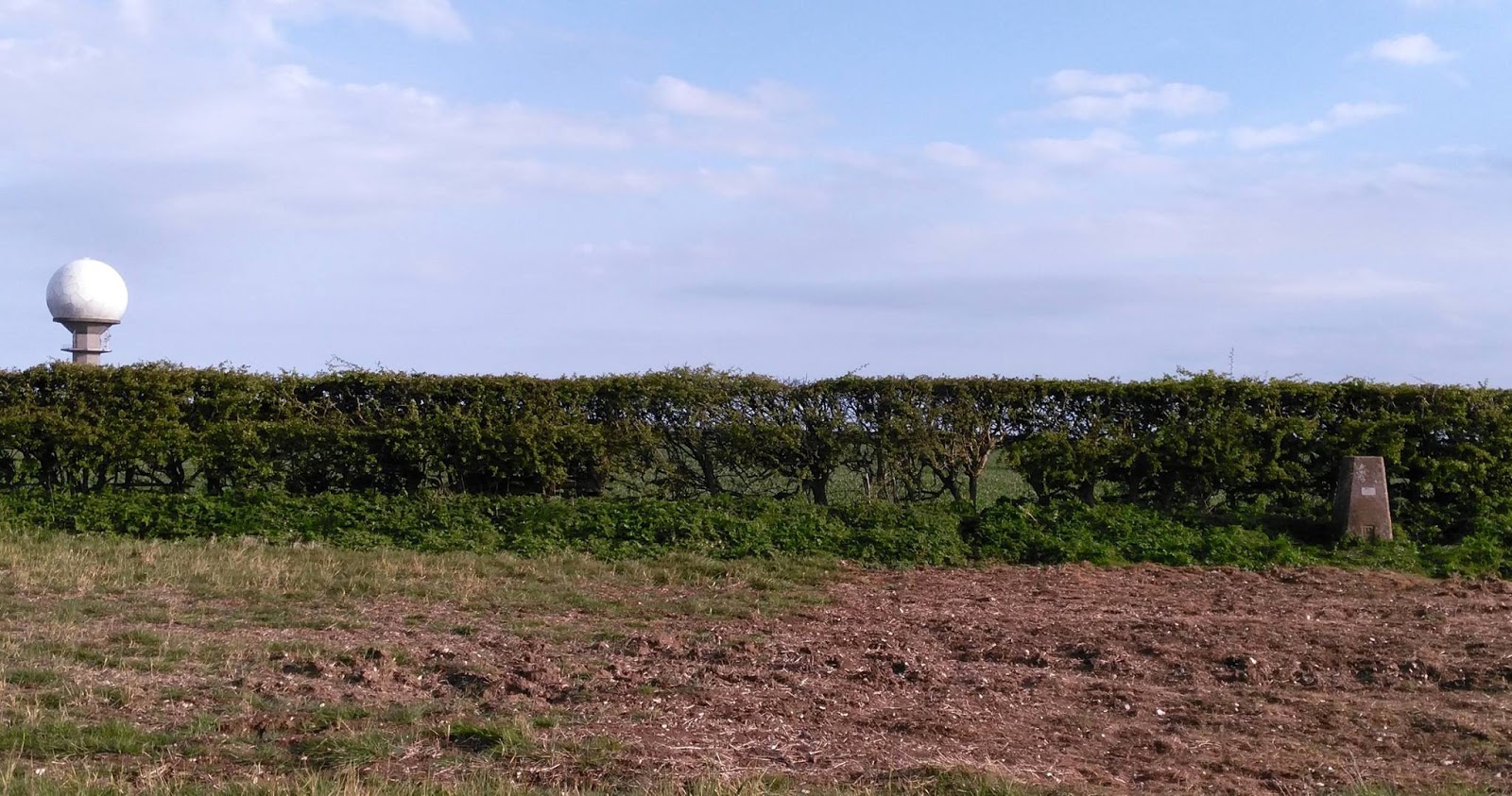
 |
| View across to radar station on Normanby Top |
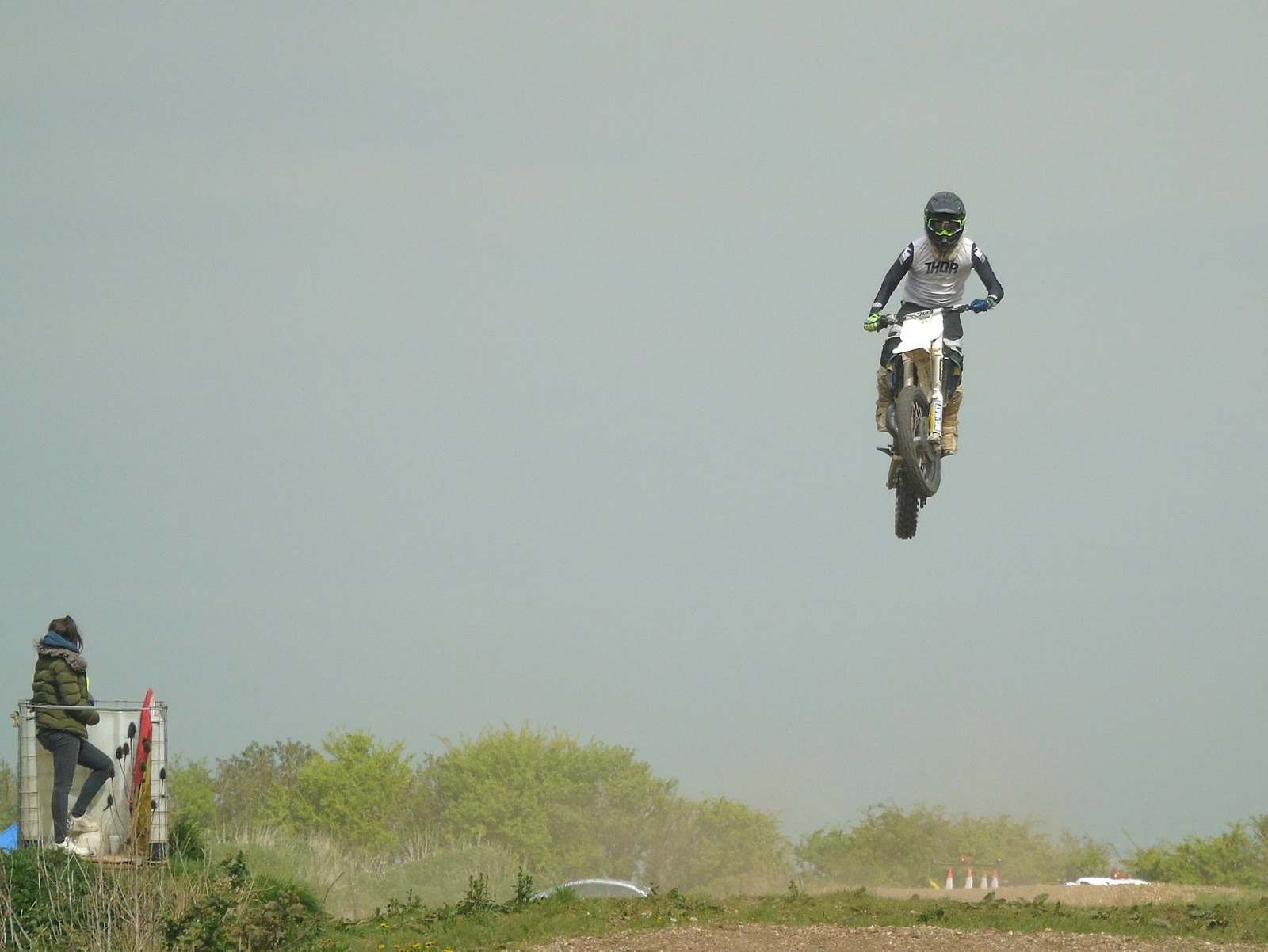 |
| Saw some spectacular jumping skills |
 |
| Section of the 1:25000 Ordnance Survey Map |
To the South of the summit is a road with an air-traffic control radar station. We parked up near this impressive structure to have some very late lunch (time had flown by)
 |
| Radar Station on Normanby Top |
I had a friendly chat with him and he was fully aware of what I was doing and had no issues having met other activators in the past. He also gave me permission to walk across his land up to the trig-point if I wanted to. As I've mentioned it isn't on a public right of way but said he is more than happy for people to go to the trig-point providing they ask at the farm before hand and take home all their rubbish, unfortunately he has some recent problems with inconsiderate litterers.
I decided to decamped and following his instructions to a gap in the fence and set off to the trig-point which was a little bit further away and a little steeper than I thought, but it didn't help I was carrying a half made up antenna, poles and a bag full of kit and my not inconsiderate bulk! Anyway I got there but due to us running already behind schedule and my change of location it was getting late in the day and was nearly 5pm.
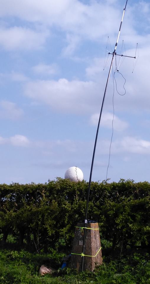
 |
| Trig-point and radar station behind |
I had taken my Yaesu FT-857D, two 7Ahr SLA batteries, fibreglass pole, antennas for 20m/40m HF, 2m SSB and 2m/70cm FM. Yes I'd travelled light! Having some lovely clear views all around I decided to try some 2m 'line of sight' contacts.
I put up the Sandpiper Delta Beam for SSB (horizontal) and my 'flower-pot' dual band for FM (vertical) on a fishing pole. The wind had started to pick up and I'd not got any proper bungee cords (doh!) so I lashed it up using guy ropes around the pillar.
 | |
| It was straighter than this before I went to take photo |
 |
| View North (Humber to the top left) |
I really enjoyed myself but wished I'd allowed myself more time, this was in part because it was a late decision in the week to tack the 'summit' on the end of a day out walking and changing my mind to actually go to the summit given the chance but it was nice to do that for my first SOTA but I really need to get the hang of travelling light.
 |
| Back down and met by the wife who wanted her shopping bag back |
"Geocaching is like a high tech Easter egg hunt. People hide caches – waterproof containers containing a logbook and maybe some little trinkets – and then post the GPS coordinates to a Web site like geocaching.com. Others will search the site for caches in an area of interest, then use their own GPS (and intuition and woodcraft skills) to try to find them. Anyone who finds a cache signs the logbook, may take one of the trinkets and/or leave a new one, then goes back to the Web site and reports that they found that cache. There’s quite a community of geocachers, and it’s been going on for over a decade."
First SOTA activation – Normanby Top G/TW-005
After last weekends disappointment I had purchased a new Baofeng UV-82L dual band for the princely sum of £27 from eBay to replace the suspect UV-5R. It certainly seems more sensitive when receiving and the transmit audio is loud and clear.
With the 'flower-pot' antenna in the rucksack I spent the walk monitoring the local repeaters (and could hear the regular idents) as well as the calling channels. I was putting out the odd call (with little success) when we stopped to allow the wife to search for the geocaches.
|
| One man and his dogs |
I had been spurned on to have a go at an activation after watching a video of Michael Sansom's (G0POT) presentation on the SOTA scheme for the Chertsey Radio Club. The video is available online here and Michael has written an excellent companion introduction to SOTA on his website http://peanutpower.co.uk/sota
|
| View across to radar station on Normanby Top |
|
| Saw some spectacular jumping skills |
|
| Section of the 1:25000 Ordnance Survey Map |
To the South of the summit is a road with an air-traffic control radar station. We parked up near this impressive structure to have some very late lunch (time had flown by)
|
| Radar Station on Normanby Top |
I had a friendly chat with him and he was fully aware of what I was doing and had no issues having met other activators in the past. He also gave me permission to walk across his land up to the trig-point if I wanted to. As I've mentioned it isn't on a public right of way but said he is more than happy for people to go to the trig-point providing they ask at the farm before hand and take home all their rubbish, unfortunately he has some recent problems with inconsiderate litterers.
I decided to decamped and following his instructions to a gap in the fence and set off to the trig-point which was a little bit further away and a little steeper than I thought, but it didn't help I was carrying a half made up antenna, poles and a bag full of kit and my not inconsiderate bulk! Anyway I got there but due to us running already behind schedule and my change of location it was getting late in the day and was nearly 5pm.
|
| Trig-point and radar station behind |
I had taken my Yaesu FT-857D, two 7Ahr SLA batteries, fibreglass pole, antennas for 20m/40m HF, 2m SSB and 2m/70cm FM. Yes I'd travelled light! Having some lovely clear views all around I decided to try some 2m 'line of sight' contacts.
I put up the Sandpiper Delta Beam for SSB (horizontal) and my 'flower-pot' dual band for FM (vertical) on a fishing pole. The wind had started to pick up and I'd not got any proper bungee cords (doh!) so I lashed it up using guy ropes around the pillar.
| |
| It was straighter than this before I went to take photo |
|
| View North (Humber to the top left) |
I really enjoyed myself but wished I'd allowed myself more time, this was in part because it was a late decision in the week to tack the 'summit' on the end of a day out walking and changing my mind to actually go to the summit given the chance but it was nice to do that for my first SOTA but I really need to get the hang of travelling light.
|
| Back down and met by the wife who wanted her shopping bag back |
"Geocaching is like a high tech Easter egg hunt. People hide caches – waterproof containers containing a logbook and maybe some little trinkets – and then post the GPS coordinates to a Web site like geocaching.com. Others will search the site for caches in an area of interest, then use their own GPS (and intuition and woodcraft skills) to try to find them. Anyone who finds a cache signs the logbook, may take one of the trinkets and/or leave a new one, then goes back to the Web site and reports that they found that cache. There’s quite a community of geocachers, and it’s been going on for over a decade."
Out portable on the Lincolnshire Wolds
Following a recent presentation at the South Kesteven ARS by David Gordon G6ENN where he talked about his successful portable operating I was encouraged to constructed a simple dual band 'flower pot' antenna (design from VK2ZOI) using some RG58 coax and 25mm conduit.
 | |
| Completed 2m/70cm Flower Pot |
My previous attempts at portable operating have largely involved HF and slightly heavy equipment (my Yaesu FT-857D and Sealed Lead Acid batteries) but I decided this time to try VHF/UHF as we were going to one of the highest spots in the area. This allowed me to travel light just taking along a Baofeng UV-5R and the antenna sticking out of the rucksack.
 |
| Just setting off with Boris & Eddie |
Parking up in Donington on Bain we had a short 4 mile circular walk planned allowing the wife to collect a dozen geocaches along the way with a short detour at the top to visit RAF Stenigot. The walk climbs to the top of a hill, but it isn't a long ascent by any means or overly strenuous. The view back included the impressive Belmont Transmission Tower (just visible over my shoulder in the picture above) which before it was shortened in 2010 was reputably the tallest structure of its type in the world.
 | |
| Belmont Transmission Tower |
The Lincolnshire Wolds is the highest area on the East of England between Yorkshire and Kent and so there are many structures that take advantage of the elevation. In addition to Belmont we could see the Radar station at Wolds Top/Normanby Hill and Lincoln Cathedral in the distance, but we were interested in what was in front of us the remains of RAF Stenigot.
 | ||
| The tower at RAF Steingot, clearly visible as we climbed |
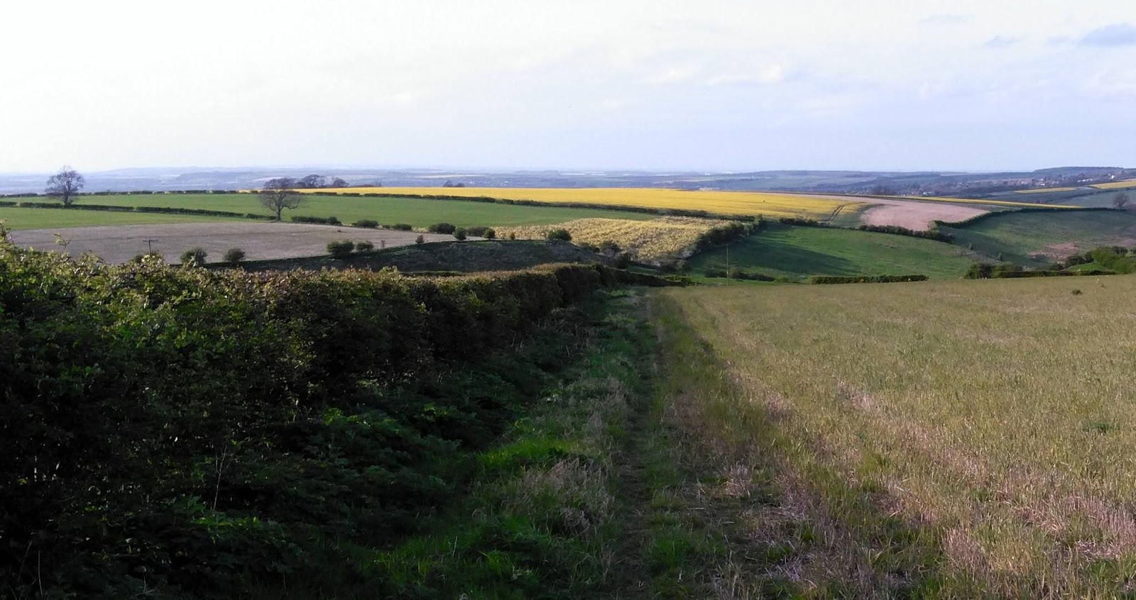
 | |
| View back |
After the Second World War, the site was retained and in 1959 it was upgraded to a communications relay site as part of the NATO ACE High system, which involved adding four tropospheric scatter dishes. The site was decommissioned in the late 1980s and was mostly demolished by 1996 but the toppled dishes remain.
 |
| View of RAF Stenigot |
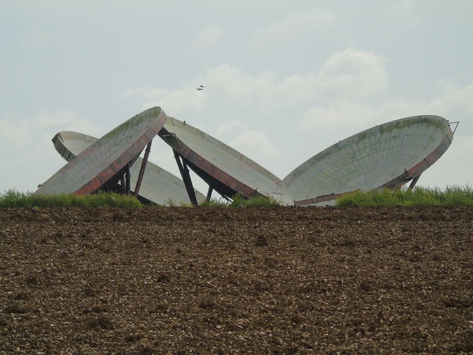 | |
| The dishes as seen from the footpath |
 |
| At the gate (locked) to the site |
 |
| View looking towards the radar tower |
 |
| Yours truly |
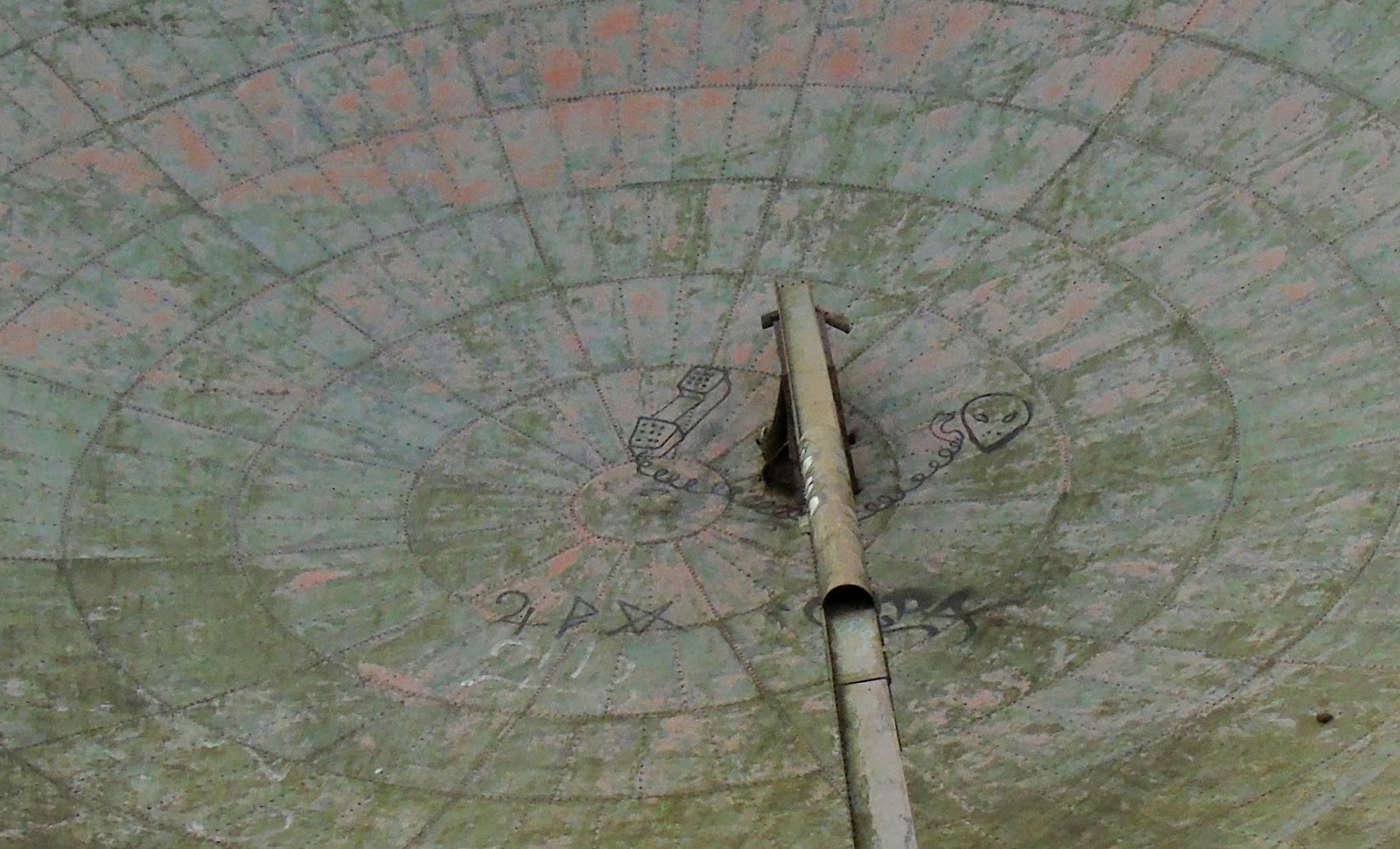 |
| ET Phone Home! |
 |
| CQ CQ M0NRD/P |
 |
| The Chain Home Radar tower |
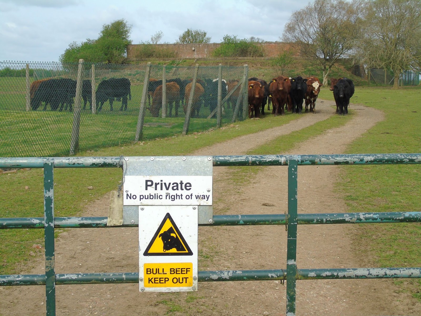 | |
| The "Heavy Mob" Security Patrol |
What's more you aren't far from the Lincolnshire Coast, so after our walk we went to Mablethorpe for the afternoon and fish and chips which were well received.
 |
| Eddie enjoying his fish and chips |
Out portable on the Lincolnshire Wolds
Following a recent presentation at the South Kesteven ARS by David Gordon G6ENN where he talked about his successful portable operating I was encouraged to constructed a simple dual band 'flower pot' antenna (design from VK2ZOI) using some RG58 coax and 25mm conduit.
| |
| Completed 2m/70cm Flower Pot |
My previous attempts at portable operating have largely involved HF and slightly heavy equipment (my Yaesu FT-857D and Sealed Lead Acid batteries) but I decided this time to try VHF/UHF as we were going to one of the highest spots in the area. This allowed me to travel light just taking along a Baofeng UV-5R and the antenna sticking out of the rucksack.
|
| Just setting off with Boris & Eddie |
Parking up in Donington on Bain we had a short 4 mile circular walk planned allowing the wife to collect a dozen geocaches along the way with a short detour at the top to visit RAF Stenigot. The walk climbs to the top of a hill, but it isn't a long ascent by any means or overly strenuous. The view back included the impressive Belmont Transmission Tower (just visible over my shoulder in the picture above) which before it was shortened in 2010 was reputably the tallest structure of its type in the world.
| |
| Belmont Transmission Tower |
The Lincolnshire Wolds is the highest area on the East of England between Yorkshire and Kent and so there are many structures that take advantage of the elevation. In addition to Belmont we could see the Radar station at Wolds Top/Normanby Hill and Lincoln Cathedral in the distance, but we were interested in what was in front of us the remains of RAF Stenigot.
| ||
| The tower at RAF Steingot, clearly visible as we climbed |
| |
| View back |
After the Second World War, the site was retained and in 1959 it was upgraded to a communications relay site as part of the NATO ACE High system, which involved adding four tropospheric scatter dishes. The site was decommissioned in the late 1980s and was mostly demolished by 1996 but the toppled dishes remain.
|
| View of RAF Stenigot |
| |
| The dishes as seen from the footpath |
|
| At the gate (locked) to the site |
|
| View looking towards the radar tower |
|
| Yours truly |
|
| ET Phone Home! |
|
| CQ CQ M0NRD/P |
|
| The Chain Home Radar tower |
| |
| The "Heavy Mob" Security Patrol |
What's more you aren't far from the Lincolnshire Coast, so after our walk we went to Mablethorpe for the afternoon and fish and chips which were well received.
|
| Eddie enjoying his fish and chips |